Category: BoulderCAST Daily (Page 52 of 465)

This page contains an index of our BoulderCAST Daily forecast updates. If you are NOT a Premium member, you will only see a tiny sample of this content below. Subscribe to BoulderCAST Premium to gain access to all of our daily forecasts which get published every morning.

Premium This Weekend in Colorado Weather: A few more stormy days ahead of a beautiful Sunday and Labor Day

The latest drought map dropped this morning, and it’s not great news for Colorado. Over half the state is officially in drought, and nearly two-thirds are at least abnormally dry. Boulder and Denver Counties have slipped back into Stage 1 Moderate Drought territory. The silver lining? We’ve finally seen some rain this week. Most areas picked up between 0.25" and …

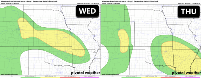
Premium BoulderCAST Daily – Wed 08/27/25 | Gloomy, damp, and stormy weather holds firm through tomorrow

Astubborn monsoonal flow continues to pump moisture into the West, keeping things unsettled across Boulder, Denver, and much of Colorado. With deep atmospheric moisture and embedded lift from the jet stream and passing shortwaves, expect scattered to widespread showers and storms to stick around for the next 48 hours. GOES-East satellite imagery overnight showed thick cloud cover blanketing the state …

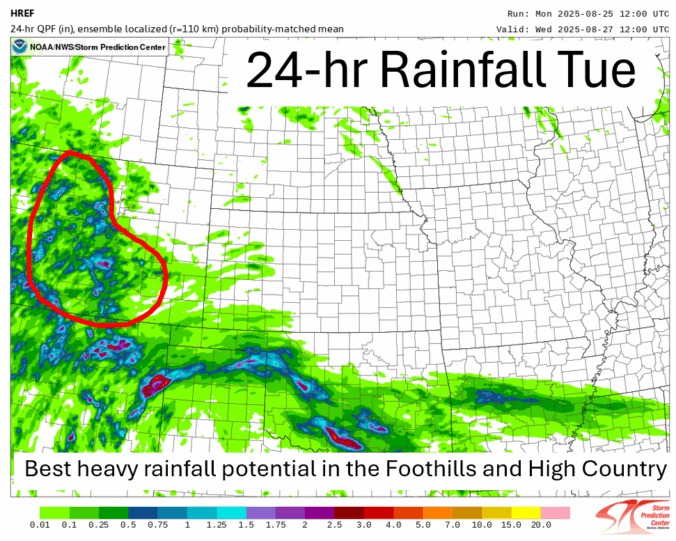
Premium BoulderCAST Daily – Tue 08/26/25 | Heavy rainfall in the cards again but the greatest risk is south/west of Denver

Anorthwest to southeast oriented boundary at the low to mid-levels will be situated over the state this afternoon. The boundary will allow moisture and lift to fuel scattered to numerous showers and storms over the higher terrain and Foothills, and isolated to scattered activity on the Plains this afternoon. Much of the area remains in a Marginal risk of excessive …

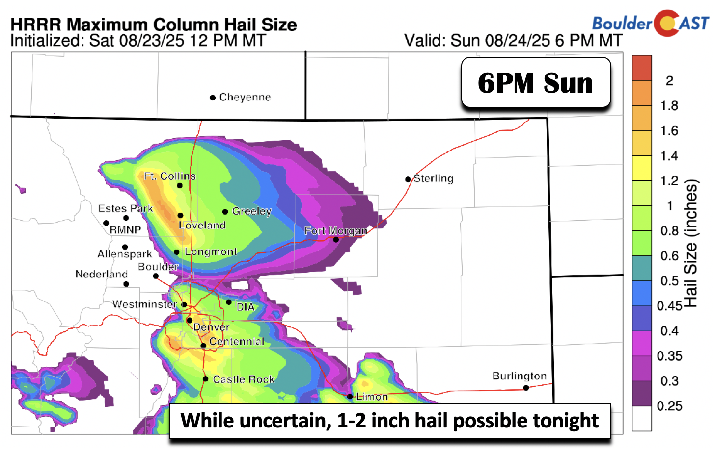
Premium BoulderCAST Daily – Sun 08/24/25 | Chance of Severe Storms This Evening

Astrong mid-level disturbance will track through this evening in the northwest flow aloft to favor the development of scattered severe thunderstorms. Shear and instability (below) will be more than sufficient, with surface flow out of the northeast with an approaching cold front and the mid-level flow around 30-40 mph. This flow will favor the development of storms capable of damaging …

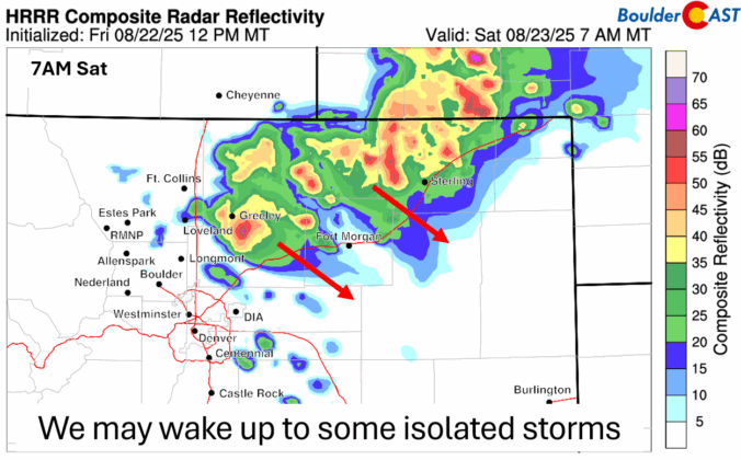
Premium BoulderCAST Daily – Sat 08/23/25 | Staying cool with two chances for showers

Apossible sunrise surprise area of isolated to scattered showers or storms may move just along and east of the Denver Metro area this morning. Guidance is depicting a potential weak disturbance aloft that may track from Wyoming into eastern Colorado this morning. Whether or not it materializes, there will be the chance of a few showers into mid-morning, as well …

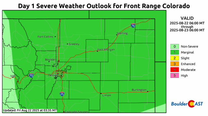
Premium BoulderCAST Daily – Fri 08/22/25 | The start of a cool and wet stretch

Deep moisture is in place today and tonight ahead of a cold front slated to move through sometime this evening. Moisture values, measured by precipitable water, are forecast to be between 1 and 1.3 inches, which is well above normal for late August in Colorado. That deep moisture will be realized as showers and storms develop to our northwest tied …

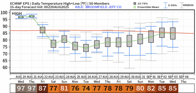
Premium BoulderCAST Daily – Wed 08/20/25 | Two more hot days, but there are hints of autumn in the extended

It’s another scorcher on tap today across the state as the Four Corners high keeps its grip locked in through Thursday. That ridge is doing what it does best—suppressing vertical motion and drying out the atmosphere. So for the Front Range, rain chances are basically nonexistent. The good news? Winds are staying tame under this setup, which will help keep …

« Older posts Newer posts »