


The pattern shift is here, but don’t get your hopes up just yet. Two Pacific storms are lined up to hit the West Coast this week. California is about to get buried, with feet of snow in the Sierra and inches of rain in the lowlands. For the Boulder-Denver area, the story is more complicated. Both storms track too far north to give us meaningful precipitation, but they still bring a few impacts: a mountain wave windstorm in the Foothills on Wednesday, a Denver Cyclone on Thursday, and a slim chance of the season’s first flakes on Friday night. We cover what to expect, why last week’s 1-2 foot snow forecasts in your weather app vanished, and why you should keep any expectations for that first accumulating snow very, very low.
This week’s highlights include:
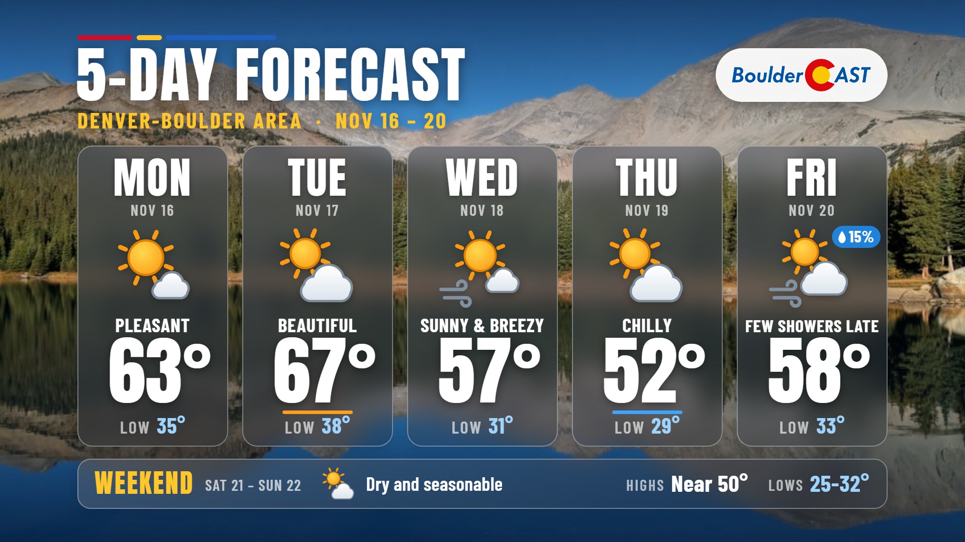
- ☀️ Warm, Sunny Start: Monday and Tuesday are the nicest days of the week, with highs in the 60s and light winds before a pair of storms move in.
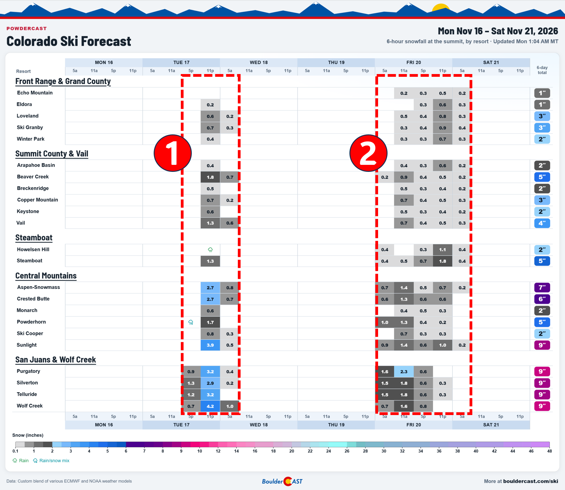
- 🏔️ Mountain Snow, Round One: The first storm favors the San Juans with 3-7″ Tuesday into Tuesday night. Other ranges see a dusting to 3″.
- 💨 Foothills Windstorm Wednesday: The first strong mountain wave event of the season is possible above 7,000-7,500 ft in Boulder and Larimer Counties late Tuesday night through Wednesday morning. Lower elevations should stay just a little breezy.
- 🌀 Denver Cyclone Thursday: Expect a sharp temperature split, from the lower 50s near Boulder to the lower 60s southeast of Denver.
- 🌨️ Low Odds of First Flakes: The second storm brings mountain snow Friday into Saturday. Plains chances are limited to spotty showers and maybe a few flakes Friday night. The odds of accumulating snow are close to zero as a new record late first snow becomes within reach.
- 🌤️ Quiet Weekend: A brief ridge brings dry weather and 50s. The next storm early next week currently looks too far south.

- Daily Forecast Updates Our forecast discussion every morning, delivered to your inbox.
- All Our Model Data Every one of our Colorado-centric, high-resolution weather model graphics. Seriously, every one!
- Ski & Hiking Forecasts 6-day forecasts for every Colorado ski resort and 120+ hiking trails, including every 14er.
- Smoke Forecasts Wildfire smoke concentration predictions up to 72 hours into the future.
- Exclusive Content Weekend outlooks every Thursday, bonus storm updates, historical data and much more.
- No Advertisements Enjoy ad-free viewing across the entire site.
T
he pattern shift we’ve been talking about across the western U.S. is well underway early Monday. Widespread rain is falling across the Bay Area and heavy snow is falling in the Sierra as the first of two storms lined up for the week approaches the California coast. A strong plume of subtropical moisture is feeding this system, with deep southwesterly flow pointed straight at Northern California.
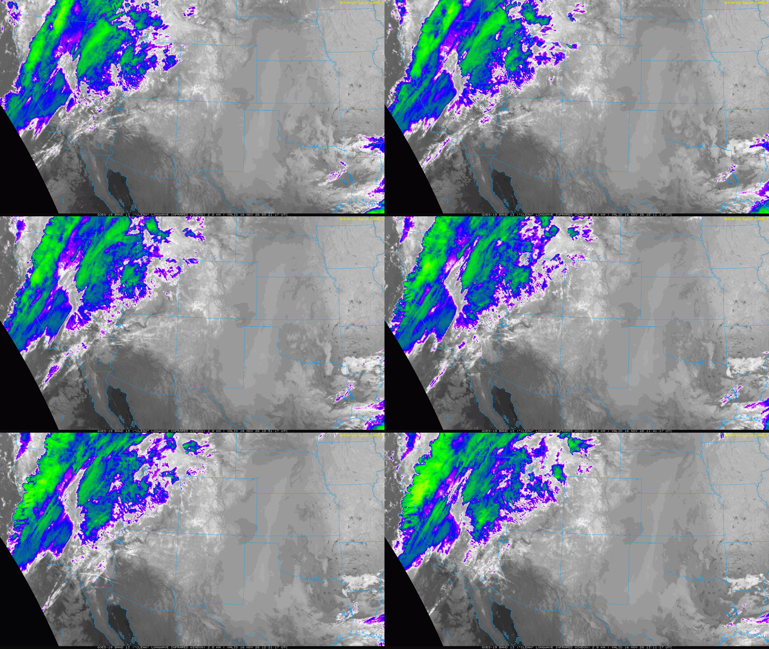
Further east, GOES-East shows quiet conditions across Colorado with mostly clear skies. The exception is some fog over the eastern part of the state, trapped under a shallow radiation inversion overnight. In the animation below you can see a pocket of fog north and east of Denver. Most of the immediate Metro area avoided the low clouds early Monday and instead had a frost or freeze.
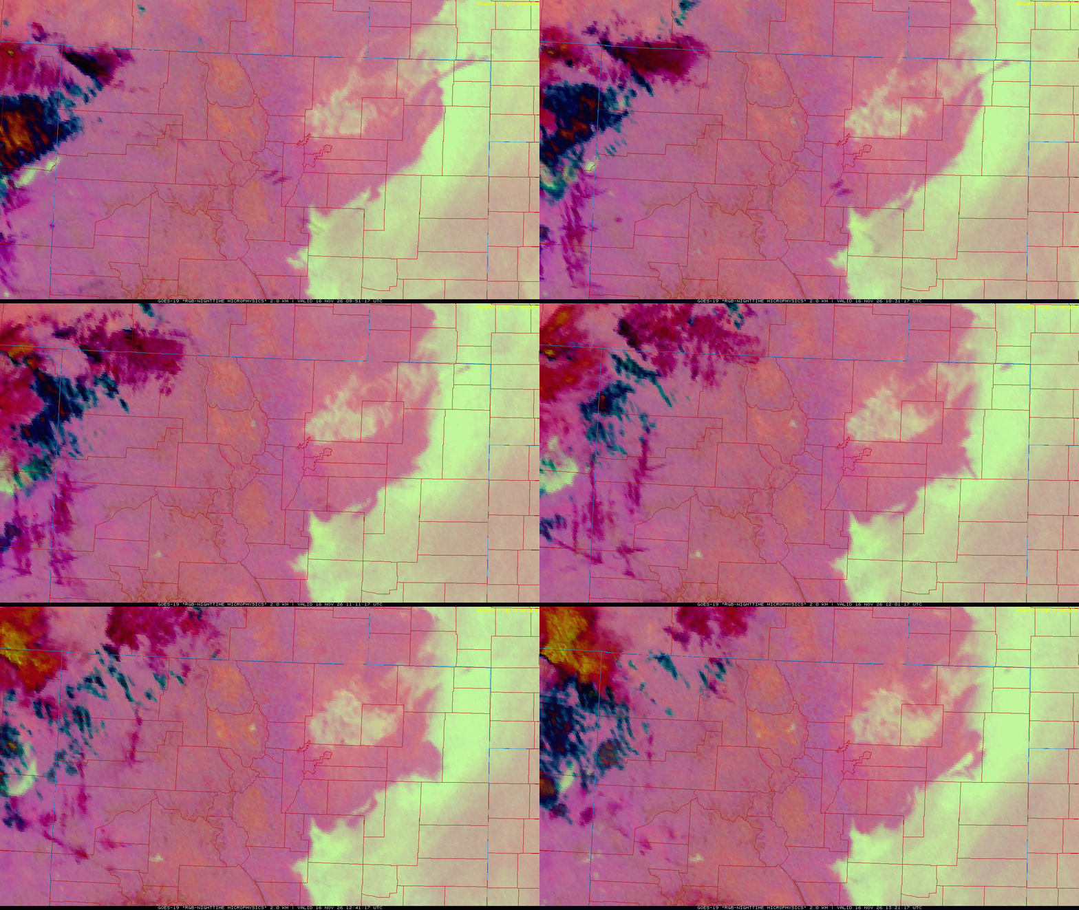
The first system comes ashore Monday evening and night, and a second follows close behind on Wednesday.
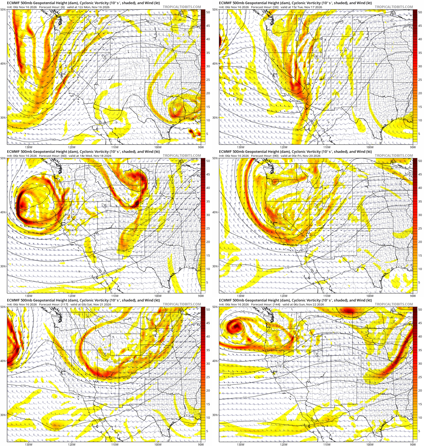
The first storm will keep its energy well northwest of the Front Range. The shortwave trough will track across Salt Lake City, through Wyoming and into the Dakotas. The Colorado mountains will see a round of generally light snow. The San Juans are favored because they’ll get a brief period of moist southwest flow, the same moisture plume hitting San Francisco right now. The southwest-facing terrain there is ideally oriented to wring out orographic snow in that flow. Expect 3 to 7 inches of snow in southwest Colorado Tuesday into Tuesday night, with lighter totals across the rest of the state’s ranges (dusting to 3 inches).
The second storm is a bit stronger but takes a very similar path. It will cross northern California into the Great Basin, then skirt northern Colorado as an open wave rather than a closed low. It will move more slowly than the first system, which could allow higher snow totals in the central and northern mountains. The Front Range will probably get largely missed again. Timing, amounts and snow levels for this late-week storm are still uncertain, especially snow levels, which will drop as colder air arrives behind the wave. In general, most ranges should see a couple of inches, with higher totals possible depending on the exact track.
Why Your Weather App Showed 1-2 Feet of Snow for Denver This Week
A few model runs last week showed this second storm closing off into a strong cutoff low over the central Rockies. That would have changed everything. A closed low would have slowed down, pulled in more moisture, and, most importantly for the Denver Metro area, set up easterly upslope flow along the Front Range. Upslope flow is the setup behind almost every big Boulder-Denver snowstorm.
Automated weather apps pick up raw output from individual model runs with no meteorologist checking it. They quickly started showing 1 to 2 feet of snow for Denver, even though that outcome was very uncertain at the time. We got a lot of questions about it and eventually posted the warning below on social media. Since then, guidance has steadily moved toward a weaker, faster-moving open wave and away from the closed-low outcome. This is a good reminder of why single deterministic model runs five or more days out shouldn’t be taken literally.
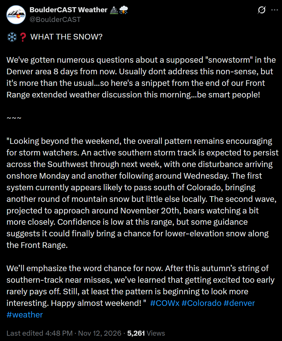
Please follow us here and on your favorite social platform for reliable, no-nonsense Colorado weather updates.
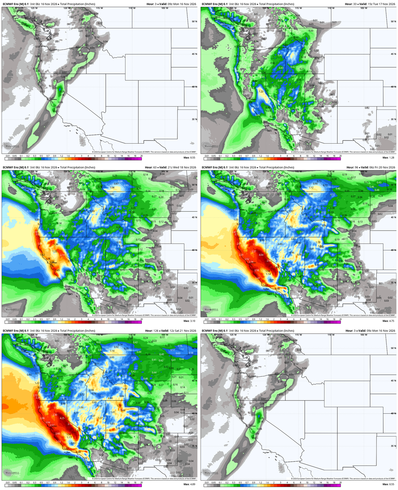
California will get hammered by this series of storms, with the stronger second storm doing most of the heavy lifting. Feet of snow are forecast around Lake Tahoe, and 1 to 4 inches of rain are expected at lower elevations. Some of that moisture will spread inland across the Intermountain West during the week, but most of it stays north and west of the Front Range. The Boulder-Denver area is once again stuck in the rain shadow and on the wrong side of the storm track. Precipitation will be limited again this week, but each storm will still bring some impacts.
Pleasant Monday & Tuesday
Before either storm arrives, the early part of the week will be the warmest and sunniest stretch along the Front Range. We’ll sit under mild southwesterly flow ahead of the approaching trough. Monday’s highs will reach the low to middle 60s, and Tuesday warms to the mid to upper 60s with light winds. For mid-November, it doesn’t get much nicer. Yes, we’re in extreme drought, but that shouldn’t stop you from enjoying the weather Mother Nature keeps handing us.
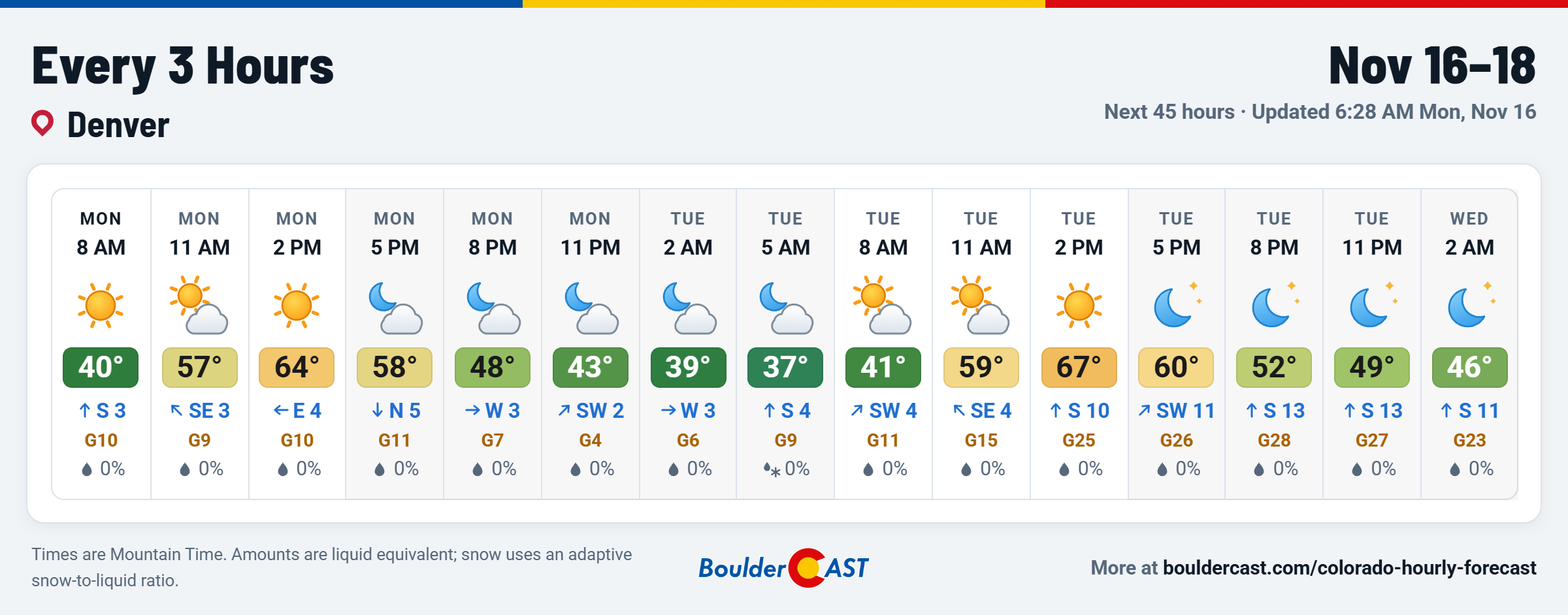
Tuesday night will bring very little snow to the Front Range mountains. The focus stays on the San Juans, as mentioned above.
Downslope Windstorm Wednesday, Likely Confined to the Foothills
As the first storm moves out through Wyoming early Wednesday, 50+ MPH cross-barrier winds from the west-southwest will move across the Divide. Several factors favor a classic mountain wave setup:
- Strong cross-barrier flow at and just above ridgetop level, roughly perpendicular to the Front Range
- A stable layer near mountaintop level, which channels that momentum down the lee slopes instead of letting it pass overhead
- Strong subsidence behind the departing shortwave, which strengthens the stable layer and helps push air downslope
Together, these ingredients will likely produce the first strong mountain wave windstorm of the season for the northern Front Range Foothills of Boulder and Larimer Counties. Some aspect of these winds could reach lower elevations in the usual favored corridors, such as canyon mouths and along the base of the Foothills. Right now, though, this doesn’t look like a significant wind event for the city of Boulder, and definitely not for Denver. The damaging winds, with gusts of 50 to 75 MPH, should stay above roughly 7,000 to 7,500 feet, which suggests the wave won’t fully break down to the plains.
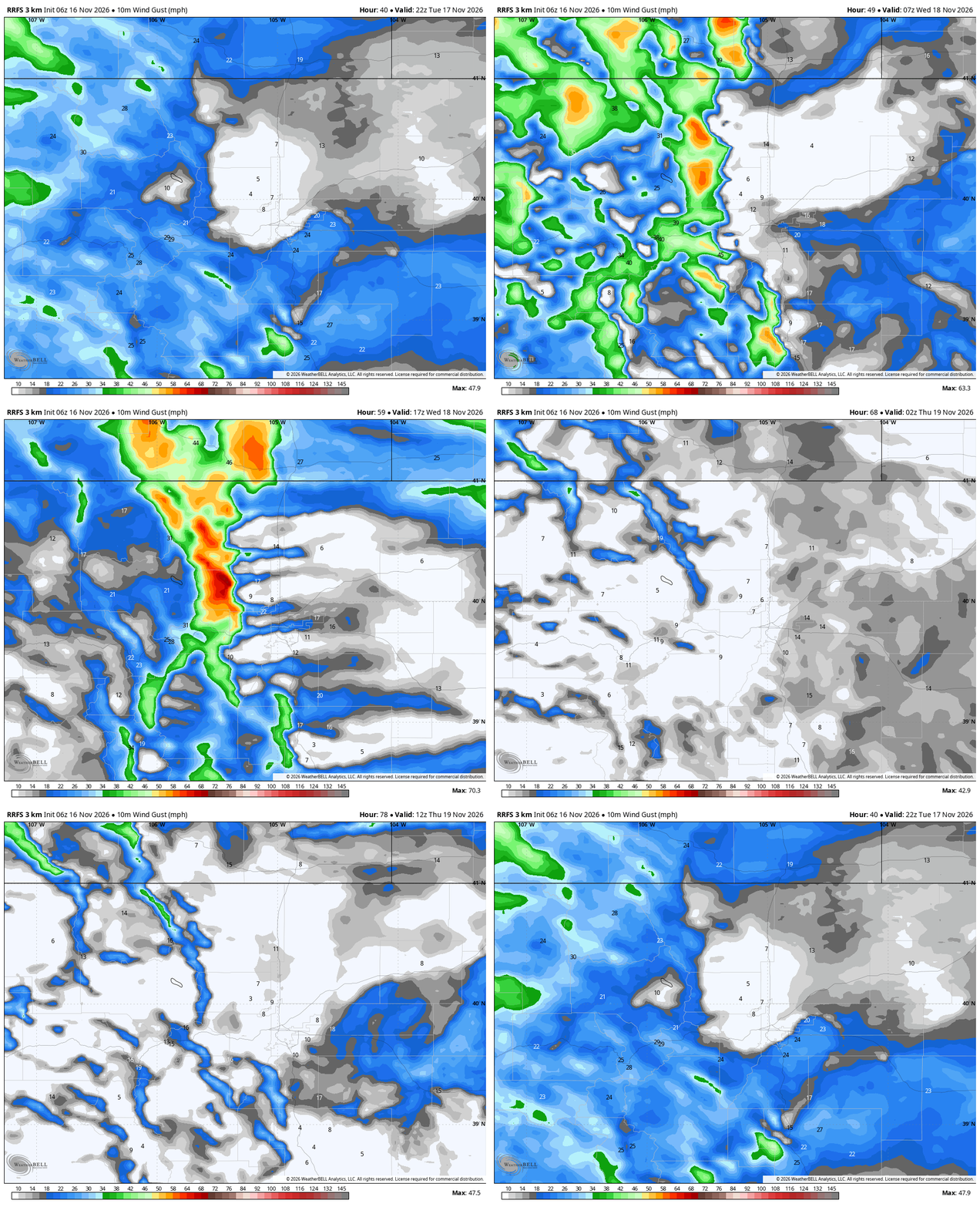
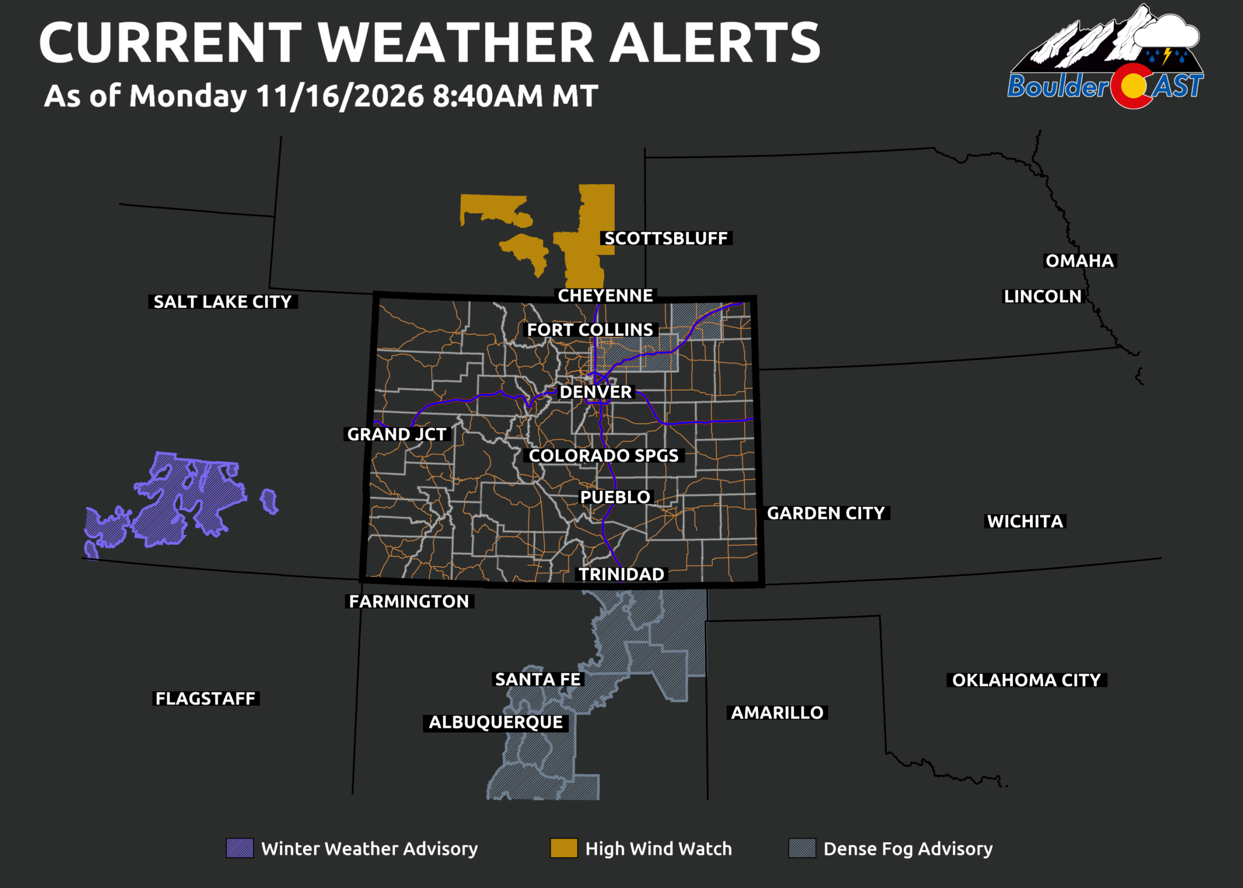
This event is only now coming into range of the high-resolution guidance, so the forecast is still changing. Small differences in the height and strength of the stable layer can decide whether the intense winds come down a bit lower or not. The strongest winds are possible from after midnight Tuesday night through late morning Wednesday. High Wind Watches are in effect across Wyoming for the same setup. These may get extended south into Larimer or Boulder Counties in time, though winds may not be strong enough to meet our local High Wind criteria.
At lower elevations, expect periods of breezy weather with highs in the mid to upper 50s. Keep an eye on the forecast. Stronger winds reaching the plains aren’t completely ruled out, even though they look unlikely right now.
Thursday: Dry with a Denver Cyclone
Thursday looks like the coolest day of the week, with more clouds and a possible Denver Cyclone setup. This low-level circulation forms when south-southeasterly surface flow interacts with the Palmer Divide and the Front Range terrain. When it sets up, the Boulder side of the circulation usually turns cooler and cloudier under northerly or northeasterly flow. Areas south and east of Denver stay in the warm sector, with more sun and breezy southerly winds.
Expect a big temperature split across the Metro area: lower 50s around Boulder to lower 60s around Parker.
Friday: Second Storm Brings Mountains Snow, Slight Chance of Showers to the Plains
The late-week storm is still somewhat uncertain, but the details won’t matter much for the Boulder-Denver corridor. Most models show the open wave crossing northern Colorado in two weak pieces of energy:
- Friday afternoon and evening: The first piece could produce a few spotty rain showers in our area. Light orographic snow will continue in the mountains through much of Friday into early Saturday.
- Friday night into Saturday morning: The second piece may bring a cold front and just enough lift to produce a few snowflakes as cooler air moves in behind it.
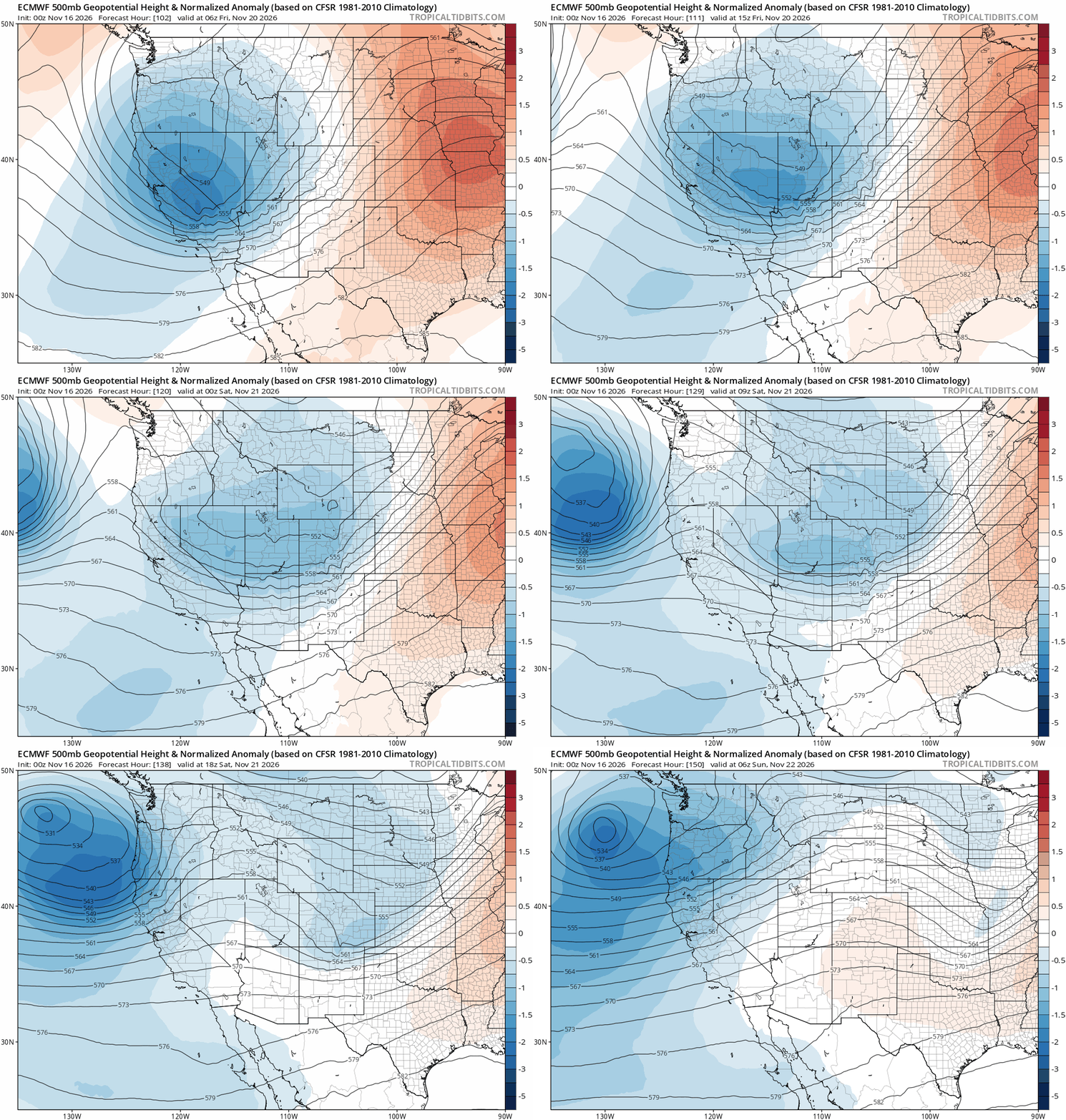
Before the few showers arrive, Friday’s daytime looks fairly nice, with highs back in the upper 50s under increasing clouds.
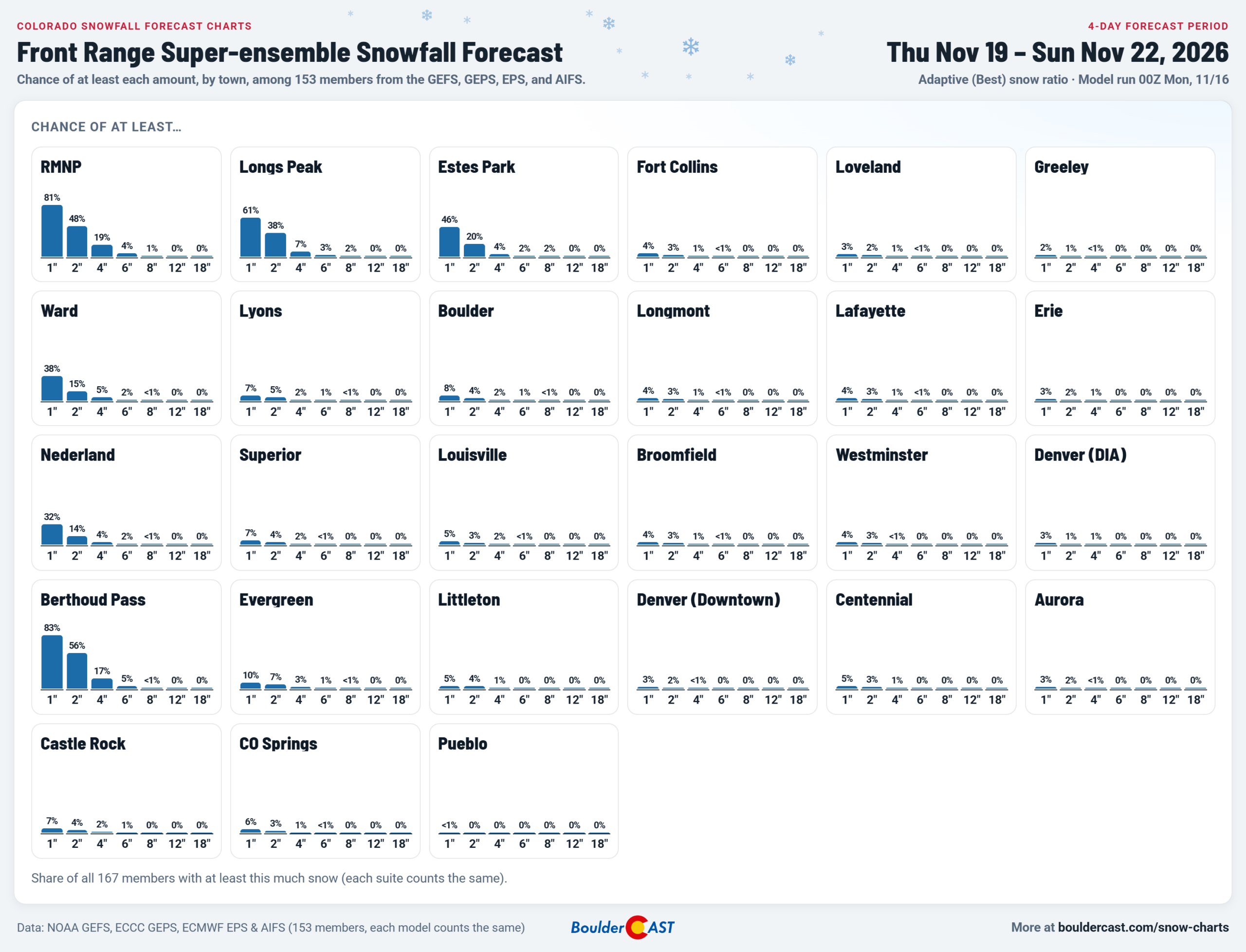
If you’re hoping for the first accumulating snow of the season, keep your expectations very low. The most likely outcome is a few scattered raindrops followed by a slight chance of a few flakes Friday night as colder air filters in. The chance of any snow at all is already low. The chance of accumulating snow is nearly zero. Check our Snowfall Probabilities page to see how embarrassingly low the chances are in your exact location.

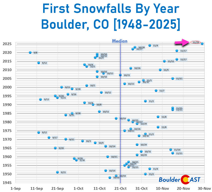
For context, Boulder’s first snow usually arrives in mid to late October. The longer this snowless streak lasts, the closer we get to the record for the latest first measurable snow, which currently stands as November 29th set just last year.
Weekend Turns Quiet
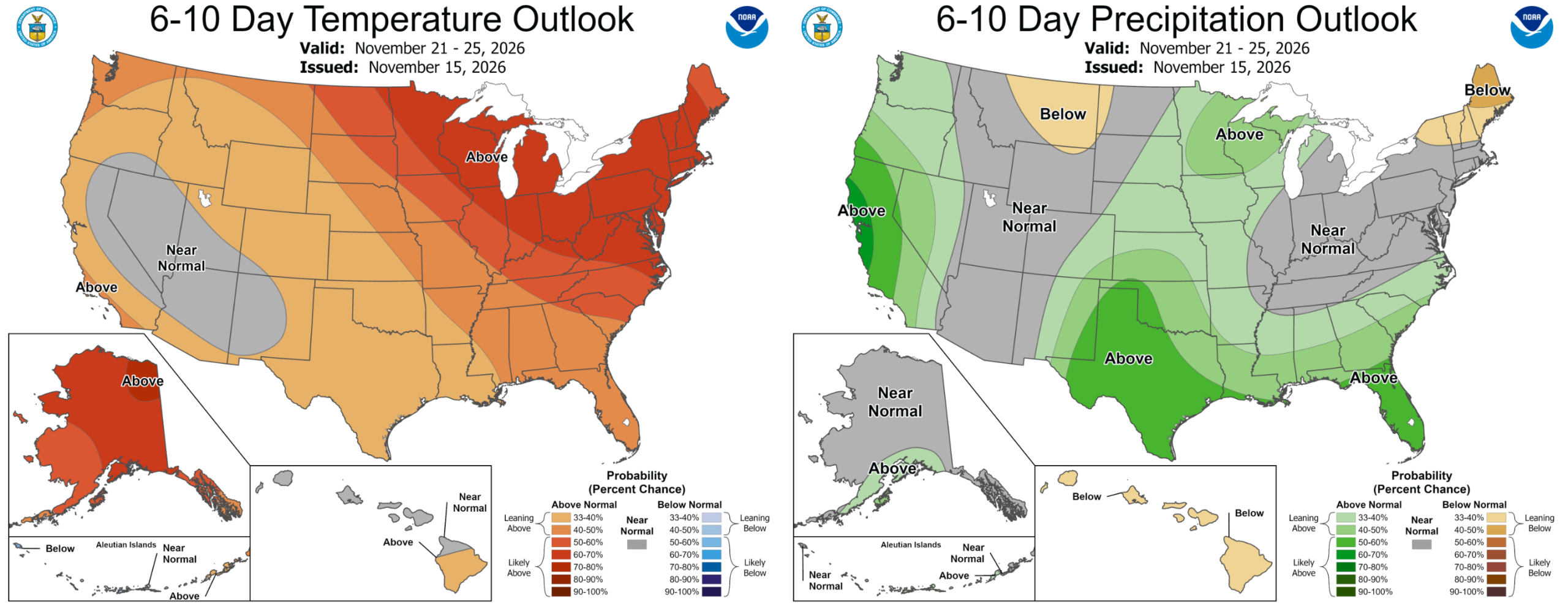
Snow will wind down in the mountains Saturday morning. After that, a weak shortwave ridge builds briefly over the central Rockies and brings quiet weather for the weekend. Temperatures will reach the 50s both days. Another storm shows up early next week, but for now it favors a southern track that would again leave the northern Front Range on the outside looking in. We’ll keep watching it. Have a great autumn week…the holidays are approaching quickly!
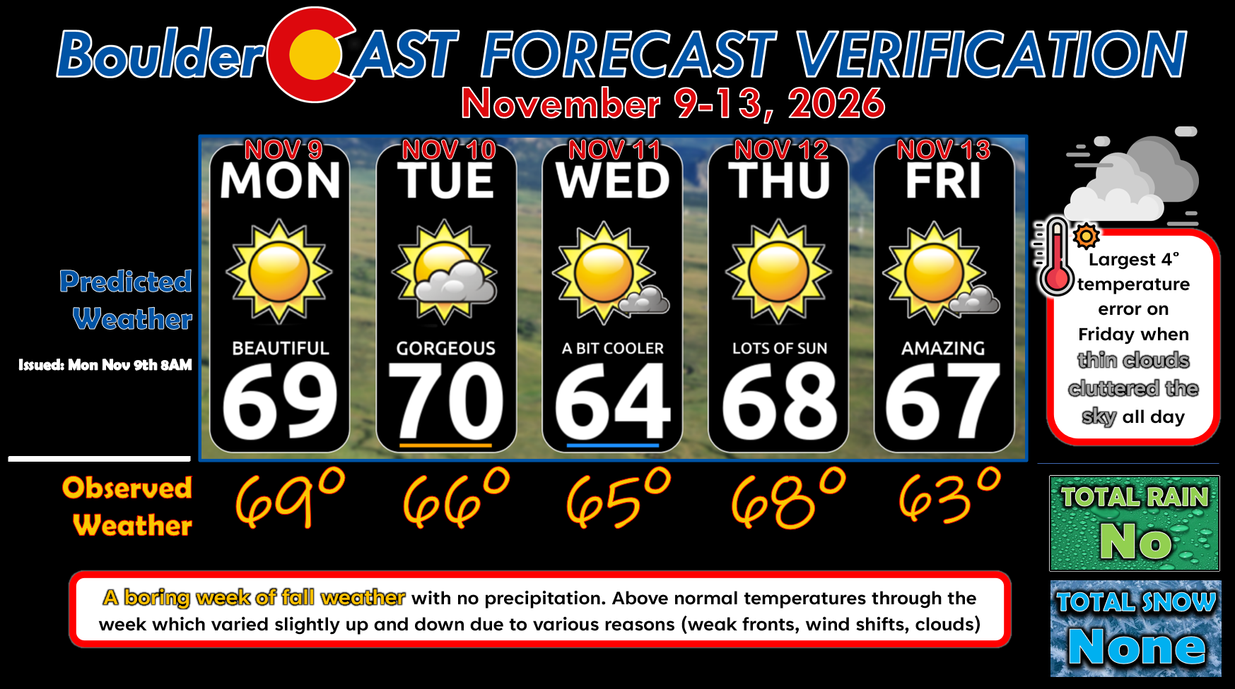
Forecast Verification: November 9-13, 2026 (Last Week)
- 🌡️ 9° of total temperature error through the week, largest at 4° on Friday when some thin high clouds made for a slightly cooler day.
- 🌵 No precipitation at all this week
- ↕️ Temperatures above normal every day with minor fluctuations up and down due to weak fronts, clouds and wind shifts.
- Daily Forecast Updates Our forecast discussion every morning, delivered to your inbox.
- All Our Model Data Every one of our Colorado-centric, high-resolution weather model graphics. Seriously, every one!
- Ski & Hiking Forecasts 6-day forecasts for every Colorado ski resort and 120+ hiking trails, including every 14er.
- Smoke Forecasts Wildfire smoke concentration predictions up to 72 hours into the future.
- Exclusive Content Weekend outlooks every Thursday, bonus storm updates, historical data and much more.
- No Advertisements Enjoy ad-free viewing across the entire site.
Enjoy our content? Give it a share!



Sigh. Last winter appears stuck on repeat. No snow; plenty of wind. Surprised there’s not a red flag out for Wednesday given how dry we are.