Category: BoulderCAST Daily (Page 50 of 465)

This page contains an index of our BoulderCAST Daily forecast updates. If you are NOT a Premium member, you will only see a tiny sample of this content below. Subscribe to BoulderCAST Premium to gain access to all of our daily forecasts which get published every morning.

Premium BoulderCAST Daily – Sun 09/14/25 | Showers ending this afternoon…

Showers will be around this morning as an area of low pressure slowly makes its way into the Dakotas this afternoon. Expect a sort of wet and cloudy morning, but that won't last all day. In fact, as the system tracks northeast and out of the area, downslope flow will ensue and favor a drying out of the atmosphere. That …

Premium BoulderCAST Daily – Sat 09/13/25 | Severe Risk Today Mainly Along/East of I-25

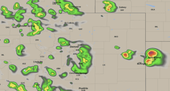
As expected, the Storm Prediction Center has expanded the Marginal Severe Risk today to include areas mainly along and east of I-25. This is shown below, which includes much of eastern Colorado. We'll get into the specifics here shortly as a vigorous upper-trough aids a surface low development over eastern Coloardo. The low will track into South Dakota by Sunday …

Premium BoulderCAST Daily – Fri 09/12/25 | Storm chances into Saturday, with highest chances on the Plains tomorrow

Avigorous upper trough will send several waves of energy across Colorado these next few days, sparring scattered to numerous showers and storms over the higher terrain of western and southwestern Colorado, as well as isolated to scattered activity on the Plains. The expected total precipitation through tonight is shown below from the HRRR, which shows a wide swath of one …

Premium This Weekend in Colorado Weather: Trending somewhat cooler and wetter as a Pacific trough clips Colorado — and yes there will be Mountain snow!

It's a beautiful morning out there in the Front Range, with crystal blue, smoke free skies and mild temperatures in the lower 60s to start.   That upper-level Pacific trough we’ve been tracking all week is still hanging out to our west this morning, parked over northern California and the Great Basin. It’s helping funnel a moist southwesterly flow into …

Premium BoulderCAST Daily – Wed 09/10/25 | Isolated thundershowers with gusty winds after 2PM as temperatures push towards 90°

Colorado’s weather is in a bit of a holding pattern as we cruise toward the weekend. Right now, a ridge of high pressure is parked over the western Great Plains, keeping us locked into a southwest flow aloft. That setup sticks around through Friday, meaning warm late-summer conditions will dominate the forecast for a few more days. Expect highs in …

Premium BoulderCAST Daily – Tue 09/09/25 | Middle 80s with widely scattered late-day storms as smoke remains well north

The big story this week is a slow-moving ridge of high pressure that's keeping things warm and dry across Colorado—at least through Thursday. Right now, that ridge is parked just west of Boulder, and it's funneling in mostly westerly winds over the state, which you can spot in the latest water vapor animation from GOES-East below: As the ridge gradually …

Premium BoulderCAST Daily – Sun 09/07/25 | Smoke retreats slowly northeast today

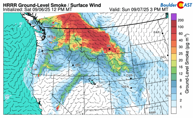
The haze and smoky skies will reduce somewhat today as the flow helps push the denser smoke particles to the north and east. The smoke at low-levels (below) will drift into Wyoming and Nebraska and the northern Great Plains by this evening. Expect to still see some haze around, but it should be better than our Saturday. Temperatures will rise …

« Older posts Newer posts »