
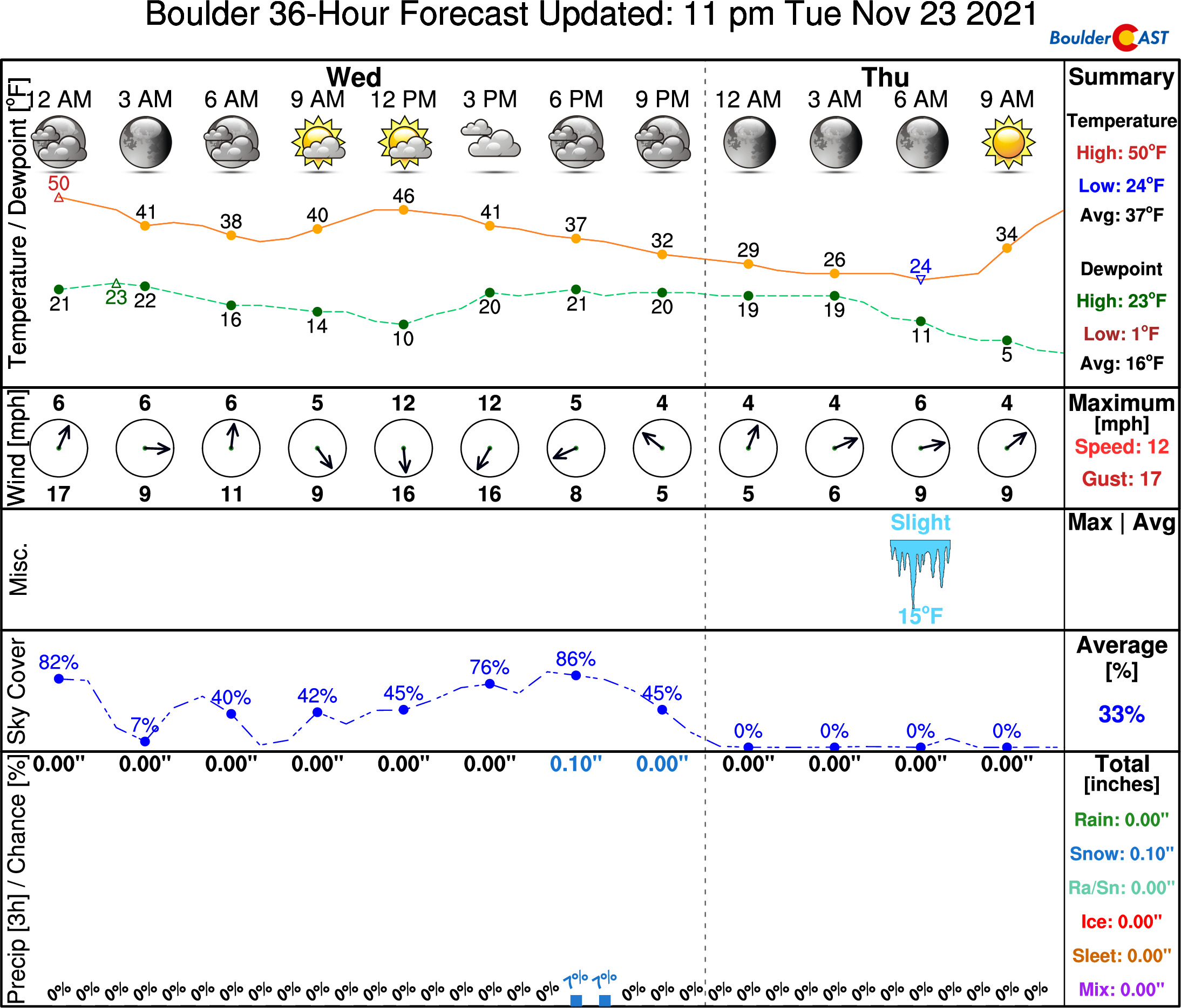
⦁❶⦁ A cold front has moved through overnight with highs today below normal in the 40’s
⦁❷⦁ Spotty rain/snow showers developing late this afternoon into the evening
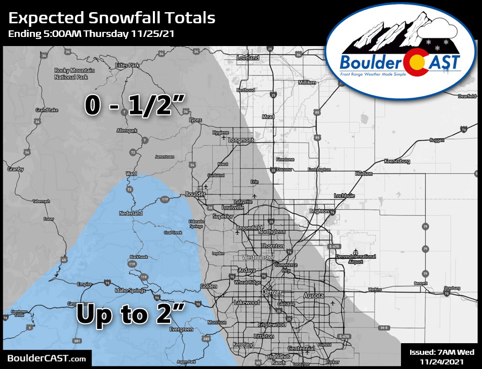
⦁❸⦁ Light accumulations possible mainly in the Foothills and Palmer Divide
⦁❹⦁ Dry and seasonal for Thanksgiving Day with highs in the 50’s
Do you want the latest BoulderCAST Daily forecast discussion delivered to your inbox every single morning? If so, join BoulderCAST Premium where we talk Boulder and Denver weather every single day.

Detailed Forecast Discussion:
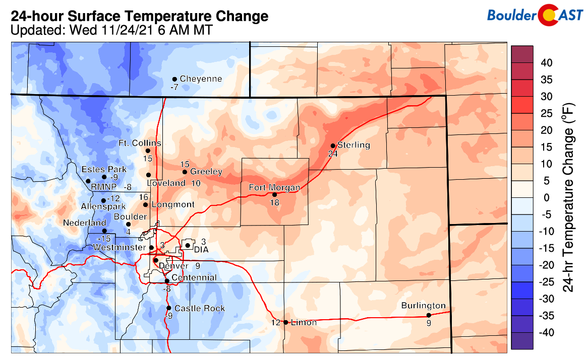
Acold front dropped across the area earlier this morning as a trough continues to push through the Rockies. Ironically most of us are actually slightly warmer at this hour compared to yesterday since there was a stronger inversion yesterday that was quite chilly.
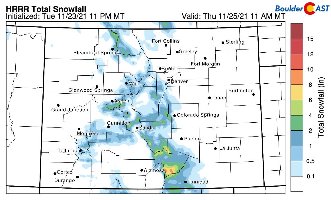
The warm flow of yesterday will be replaced by much colder temperatures behind this front, with scant moisture and northwest flow helping to spawn a few snow showers in the Mountains today. A few inches are possible in the southern ranges of the state, but just a trace to 2″ in the central and northern Mountains.
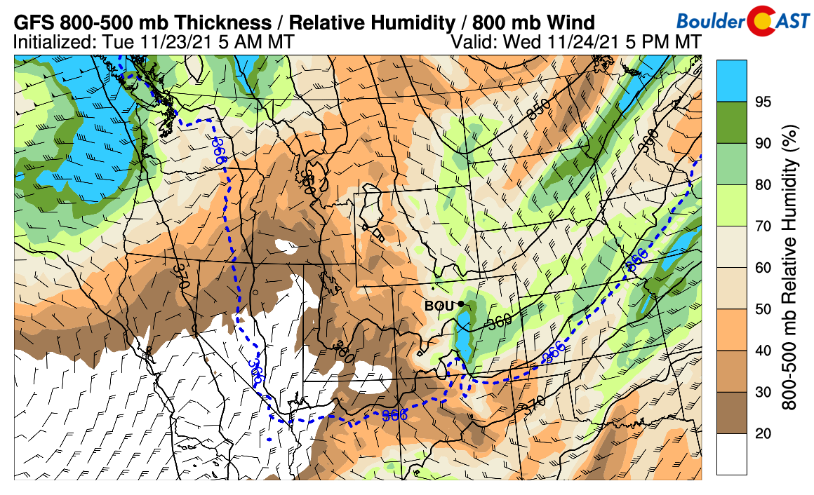
East of the terrain, precipitation will be very limited across eastern Colorado, mainly confined to a few light sprinkles or snow showers over southwestern portions of the Denver Metro this afternoon and evening as a period of northeasterly upslope ensues. As you can see in the humidity and low-level wind forecast map below for this evening, the only real upslope will be south of Boulder into New Mexico.
Here is a look at the HRRR model simulated precipitation radar forecast for today. Look for a slight chance of a mix of rain and snow this afternoon transitioning to light snow this evening. The focus, as mentioned, will be west and southwest of Denver.

Accumulation potential is up to 2″ in the Foothills and Palmer Divide, with a dusting or less elsewhere. Highs will be in the 40’s falling into the 30’s by early evening. Snow will end quickly well before midnight this evening with skies clearing thereafter.
By tomorrow, the trough will have pushed east into the Midwest leaving dry northwest flow in its wake. For the Thanksgiving holiday, things will be quiet across the Front Range with near normal temperatures in the middle 50’s under sunny skies with light winds.
Remember, our daily forecasts are Premium content. Periodically, we open this forecast up to all of our readers. Today is one of those days!
Help support our team of Front Range weather bloggers by joining BoulderCAST Premium. We talk Boulder and Denver weather every single day. Sign up now to get access to our daily forecast discussions each morning, complete six-day skiing and hiking forecasts powered by machine learning, first-class access to all our Colorado-centric high-resolution weather graphics, bonus storm updates and much more! Or not, we just appreciate your readership!


You must be logged in to post a comment.