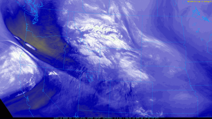
The polar jet stream took a major dive this week rolling out the red carpet for a series of storm systems that brought record-setting cold as well as significant late-season snow to the Front Range. We take a look at the snowfall totals, new cold and snow records, and look ahead to a stretch of warmer temperatures.
Author: BoulderCAST Team (Page 35 of 48)
This post had major contributions from at least two members of our team. The more meteorologists the better, right?
As if we haven’t had our fill of winter already this week, another potent storm system will bring more accumulating snow to the Boulder and Denver area Wednesday night and into Thursday. This approaching storm isn’t as cold as the one earlier this week, but does have more moisture to work with and a very efficient mechanism to produce moderate to heavy snow. As a result, many locations will likely see more snow in the next 36 hours than what fell on Easter Sunday and Monday combined! Read on for a discussion of the incoming winter wonderland and a look at our snowfall forecast map.
PREMIUM STORM UPDATE (7:00 AM Thu 04/16/20): Heavy snow has fallen as expected overnight from Boulder to Fort Collins. We take a look at the latest model runs and discuss for the forecast for the second half of the snowstorm that will linger into Thursday evening. Click HERE to read.
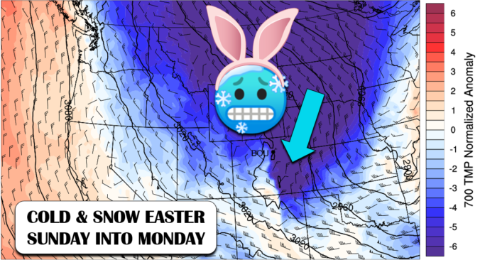
A winter storm is coming to Front Range Colorado just in time for Easter Sunday with temperatures expected to fall nearly 50°F in the next 18 hours. Accompanying the fierce drop in temperatures will be an extended period of snowfall from Sunday morning into Monday. Let’s take a look at forecast snowfall amounts and just how cold temperatures will get in the coming days.
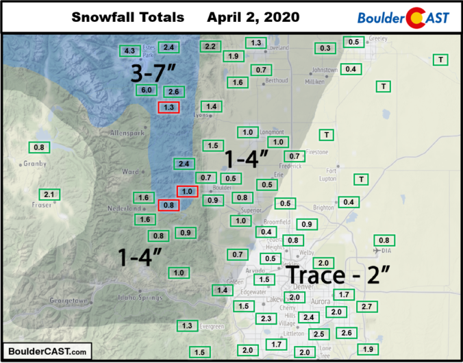
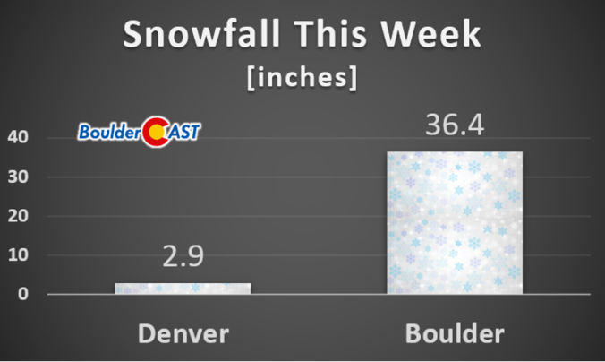
A review of the snow totals from Thursday, April 2 2020 across the Denver Metro area.

It’s hard to believe that it has been five full-years since we began the BoulderCAST journey. We’ve come a long way since, transitioning from an idea envisioned by a few CU-Boulder grad students and alumni…to becoming a leader in Boulder and Denver weather that members of our community depend on today. While an anniversary is a great time to reflect on what we have accomplished already, we’re also looking ahead to the future.
.
Please celebrate with us: Use the promo code FIVE to save 30% on an annual membership to BoulderCAST. This special sale ends Monday April 20th at 11:59 PM Mountain Time.
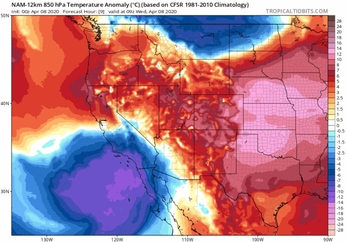
Don’t be fooled by the warm temperatures Wednesday afternoon! A rapid transition back to winter-like conditions will begin Wednesday evening capped off with another round of light snow following on Thursday. In this forecast update, we discuss the BIG changes that will bring the coldest airmass since mid-February into the Denver Metro area and the expected snowfall amounts for the region.
PREMIUM STORM UPDATE (8:00 AM Thu 04/02/20): We do a quick check on how the overall forecast looks this morning as freezing drizzle falls across the area and bitter cold temperatures settled into the Front Range. Click HERE to read.

Live View of Boulder

Current Conditions

Live Radar

Recent Premium Posts

BoulderCAST Daily – Thu 06/25/26 | On-and-Off Showers and Storms with a Lower Severe Threat
🌩️ Severe setup today but overall threat is much lower than past few …
BoulderCAST Daily – Wed 06/24/26 | Another Day of Severe Weather
🌩️ Severe setup once again today with the threat of very large hail …
BoulderCAST Daily – Tue 06/23/26 | High‑End Hail Threat Targets the Denver Area, with the Risk Lingering into the Overnight
🌩️ Severe setup persists with upslope + strong westerlies aloft + copious moisture/instability …
3-Day Forecast

Trending Content

© 2026 Front Range Weather, LLC