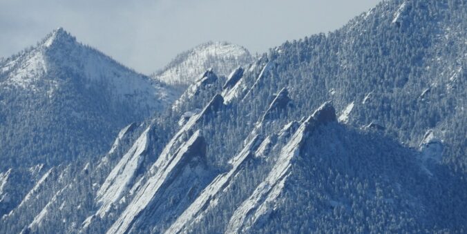
It’s been another day stuck in the Arctic airmass, but at least we’ve got a little sun this afternoon. The slow-moving storm responsible for this extreme cold and snow will finally begin to push eastward tonight through Thursday. This will dump another round of light snow upon us before things dry out and temperatures start to climb back towards normal in the coming days. We discuss how much snow has fallen so far and what is still to come this evening. Plus a look at when we will get back above freezing
Author: BoulderCAST Team (Page 21 of 45)
This post had major contributions from at least two members of our team. The more meteorologists the better, right?
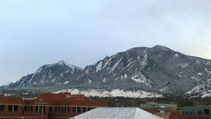
The Arctic chill is REAL this morning as temperatures hover around zero degrees with wind chills much colder than that! We provide an update on the blast of winter currently engulfing the Front Range, including a review of the snowfall totals so far, the expected record cold temperatures to be challenged in the coming days, and a look at how much snow is still to come.
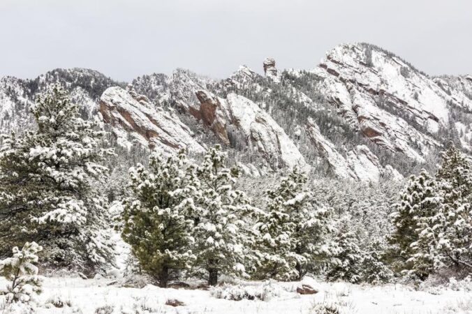
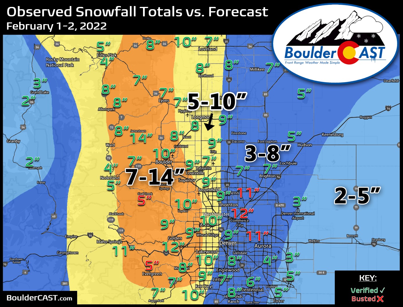
The incredibly snowy start to 2022 continued with yet another snowstorm across the Front Range last evening. The storm played out as we expected with up to 10″ of snow falling in some locations. Let’s take a look at both the storm and seasonal snowfall totals and the current status of the drought. We also peek ahead to the next Arctic blast targeting Colorado early next week.
After several mild and beautiful February days, winter is entering right back into the forecast. The first southern-track storm of the season will aid in producing a smattering of wintry weather on Wednesday including much colder temperatures, patchy freezing drizzle and several inches of accumulating snow. Let’s take a look at the atmospheric setup, timing of the first flakes, potential commute impacts, and our snowfall forecast map.
Premium Storm Update (2/16/22 7:00AM): Overnight model runs have increased our confidence that higher-end snow totals will occur with this system. Thus we are bumping up snow amounts a tad across the area. We discuss the latest from six different models and the updated timeline for snow beginning Wednesday afternoon. READ HERE

The tide may finally be starting to turn with the ongoing drought it seems. January 2022 was one of Boulder’s snowiest with two and a half feet of snowfall reported during the month. It was also the first month to conclude with colder than normal temperatures since May of last year. Here’s a quick and colorful graphical recap of our weather during January and how it relates to climatology.

It’s already been Boulder’s snowiest January since 2014, but we’ll add to it on Thursday with another round of light snow moving into the area. We discuss the setup, timing, commute impacts and the expected snowfall amounts for the Front Range.
Premium Storm Update (1/27/22 6:00AM): We do a final check of the latest model runs which have all come into excellent agreement as snow begins to fall across the northern Front Range. We also discuss why some models were coming in lower yesterday. READ HERE
Moderate to heavy snow arrived to the Denver Metro area right on-schedule Tuesday making for a messy morning commute. While most of us received our allocated amount of snowfall, localized ridiculous totals were observed in far eastern Colorado on Tuesday — up to 30″ in some cases near the Kansas border. This region was expecting much less snow than this which created a dangerous situation for livestock and on the roadways. We review the storm totals and discuss why this historic snow fell in that region.

Live View of Boulder

Current Conditions

Live Radar

Recent Premium Posts

BoulderCAST Daily – Tue 01/13/26 | A thick blanket of high clouds won’t stop us from reaching the 60s again
☁️ Thick cloud deck overhead — Moisture streaming in aloft brings widespread mid‑ …
BoulderCAST Daily – Sun 01/11/26 | A mild Sunday with readings reaching the 50s
🌤️ Mild & Melty Sunday: Light winds and patchy clouds, with lingering snowpack …
BoulderCAST Daily – Sat 01/10/26| Widespread sunshine and moderating temperatures this weekend as our recent snow melts off
🌤️ Calm Saturday: Winter storm systems have departed the state, leaving behind a …
3-Day Forecast

Trending Content

© 2026 Front Range Weather, LLC
You must be logged in to post a comment.