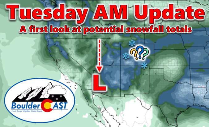
A high-impact, major El Niño snowstorm is about to unfold across the entire Front Range from late Wednesday into Friday. While we were a bit cautious of the eccentric model output over the last several days, all systems appear to be go for a significant, long-lasting dumping of heavy wet snow in the Denver Metro and nearby terrain. While there is still quite a range in the potential outcomes, we’ve seen enough to increase expected snowfall amounts across the board (again!). Read on as we sift through the latest model data and discuss the updated storm timeline and expected snowfall amounts. This one’s going to be a doozy!
Premium Storm Update (3/13/2024 8:00AM): The overarching forecast remains on-track as of Wednesday morning as a significant and highly impactful snowstorm bears down on the Front Range. Travel will become extremely difficult (and in some areas of the Foothills, impossible) Wednesday night into Thursday night, with some power outages expected. We wade through a wide gamut of the most recent model data, with trends suggesting a boom scenario is more likely than a bust. We also give our final thoughts on the impressive winter storm about to slam the Denver Metro area. READ HERE
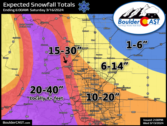
Update (3/13/2024 3:00PM): The BOOM scenario has grown more favor with our team! As models continuing to trend upward on snow amounts, we’ve bumped up our official forecast totals a bit more. We’ve adjusted this entire post to be up to date with the latest information, including all graphics and discussion. BIG snow inbound! Be safe!