Author: Ben Castellani (Page 81 of 301)
Ben grew up in southwestern Pennsylvania and holds both a bachelor's and a master's degree in Meteorology, the latter being from CU Boulder. His hometown received nearly three feet of snow from the Storm of the Century back in March of 1993, sparking his initial interest in impactful weather. Ben currently works on remote sensing and data analysis software at NV5 Geospatial Software in Boulder.

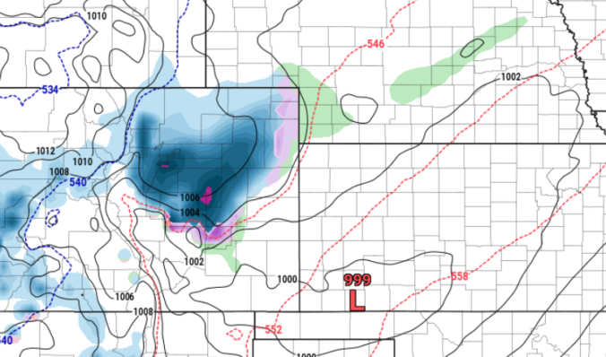
Happy Wednesday! Ingredients are already starting to come together for a quick shot of precipitation this evening with rain changing to heavy wet snow across the entire area. Forecasting Front Range snow isn’t always as easy as we may make it look and tonight’s forecast is a prime example with uncertainty still remaining rather high. Models have been very inconsistent with this wintry system thus far, but the overall recent trend has been towards more snow for everyone. We discuss the latest developments on the storm and the expected snowfall totals across the Boulder-Denver area. Unfortunately the timing of everything will have implications on the Wednesday evening commute.
Premium Storm Update (12/28/22 3:00PM): Things are coming together nicely across the central Rockies and the ongoing forecast for rain changing to snow this evening remains on-track. Recent model runs continue to advertise copious moisture dumping on the Front Range tonight, greater than 0.5″ in many areas, and thus we’re expecting almost everyone will pick up several inches of wet snow from this storm. Read on for the latest timing on the change-over from rain to snow and an updated look at snowfall totals, including which spots could have a chance at double digit snow amounts! READ HERE
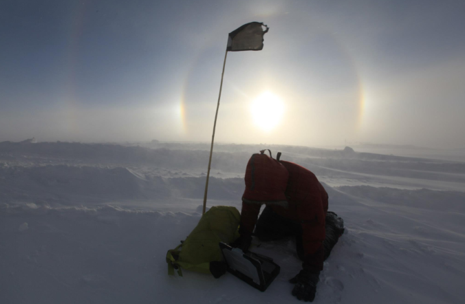
Last week’s highly-anomalous Arctic blast delivered the goods in terms of record cold and a decent snowfall across the Front Range. We discuss a few different aspects of this particular Arctic outbreak which make it stand out against Boulder’s 122 year historical record.

The highly-anticipated Arctic blast delivered the goods over the last 18 hours — taking us from near 50 degrees into the negative teens rapidly with a blanket of snow also falling across the entire area. Let’s take a look at the regional snowfall totals.
⦁❶⦁ Today will be a day to remember in Colorado weather — one that should be worthy of telling the grandkids about someday!
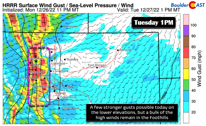
⦁❷⦁ Warm and windy conditions will exist ahead of the front with elevated fire danger — highs in the upper 40s
⦁❸⦁ The Arctic front remains on-track to bring an incredible temperature change between 4 and 6PM with snow beginning an hour or two afterwards
⦁❹⦁ Heaviest snow will fall during the evening hours, but lighter snow lingers into the overnight — 2 to 7″ expected across the Front Range
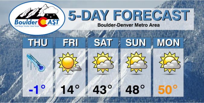
⦁❺⦁ Temperatures go negative before midnight and likely stay below zero until Friday morning with wind chills ranging from -15 to -30°F much of the time

Live View of Boulder

Current Conditions

Live Radar

Recent Premium Posts

BoulderCAST Daily – Tue 04/28/26 | Staying cool with a couple showers, the late-week storm is still the main event despite trending south
🌧️ Morning wave = main show, with light rain showers and Foothills wet …
BoulderCAST Daily – Sun 04/26/26 | Showers and some storms later today and this evening
🌧️ A wet afternoon and early evening, with showers and a few rumbles …
BoulderCAST Daily – Sat 04/25/26 | Cooler today and wet Sunday into early next week
🌧️ A wet latter part of the weekend, with showers and a few …
3-Day Forecast

Trending Content

© 2026 Front Range Weather, LLC