
The highly-anticipated Arctic blast delivered the goods over the last 18 hours — taking us from near 50 degrees into the negative teens rapidly with a blanket of snow also falling across the entire area. Let’s take a look at the regional snowfall totals.
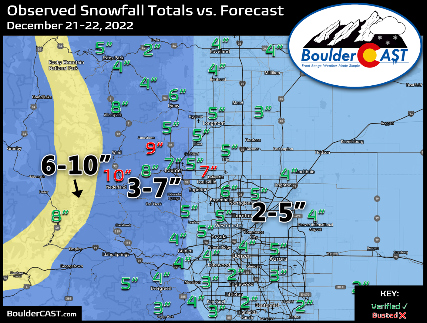
Shown below is our snowfall forecast map issued Monday evening with actual storm totals overlaid. Green values indicate that our forecast verified to within one inch of the observed snowfall total. Red numbers did not. Overall, we had excellent forecast verification across the region with just a few trouble spots in Boulder County that overperformed under persistent heavy jet-forced snow bands. Denver officially reported 3.9″ of snow at DIA, while Boulder recorded 6.2″ officially.


You must be logged in to post a comment.