Wednesday sure will be an appropriate first day of winter across the Front Range — the coldest airmass in more than a decade will flood our area! After a warm and windy afternoon of elevated fire danger, the well-advertised Arctic front will blow through by early evening accompanied by tumbling temperatures and pockets of heavy snow. We discuss a few small changes to the forecast including why we are bumping up the expected snowfall totals a tad across the area. Let’s talk bitter cold and white stuff!
At a Glance:
- Mild and windy with elevated fire danger Wednesday afternoon
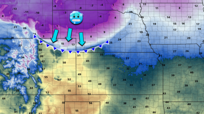
- The Arctic front arrives a bit ahead of expectations between 3PM and 6PM Wednesday across the Metro area
- Temperatures will drop rapidly with the front and then steadily fall below zero by midnight and towards -10°F by sunrise Thursday with dangerous wind chills
- Pockets of heavy snow may overlap with the Wednesday PM commute, then light snow lingers into late Wednesday night
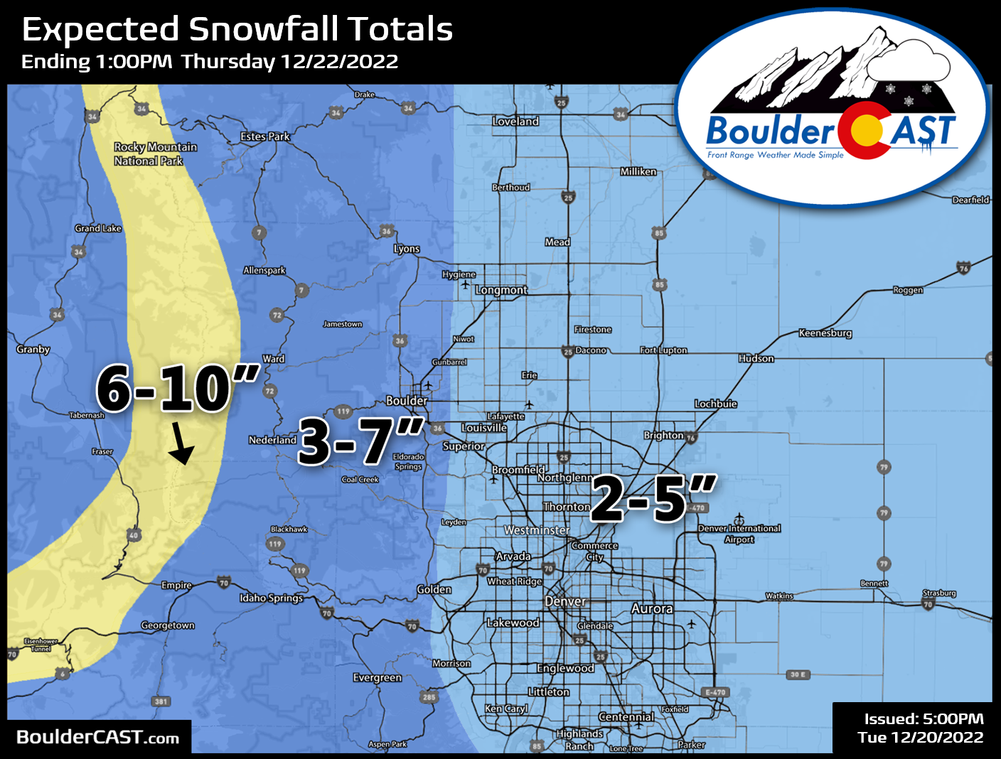
- We’ve increased snowfall totals a tad: 2-5″ expected in Denver area and 3-7″ in Boulder and the Foothills
- Temperatures stay below zero through Friday morning
B
uckle up, folks! Mother Nature is about to unleash one of the coldest Arctic airmasses to reach the Front Range in at least a decade if not longer! We’re back with another forecast update as there’s been two noteworthy changes to the situation since we released our last general post Monday morning. Let’s get into it!
The front is showing up a tad sooner
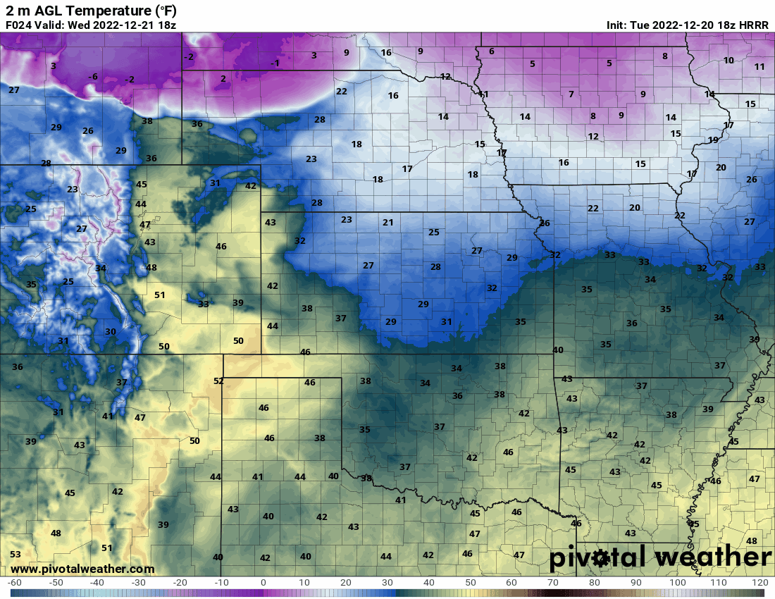
Models are usually initially too sluggish with intense Arctic fronts and this one is shaping up to be no exception. Recent model runs have been pushing the much anticipated dense Arctic air into our neck of the woods a little faster — likely now arriving into the Denver Metro area between 3PM and 6PM on Wednesday. This front will be no joke — temperatures may drop as much as 35 degrees in less than one hour (from the 40s into the teens), with temperatures continuing to plummet slowly but steadily through the evening and overnight. Our entire area will get below zero before midnight most likely, with most of us nestling around -10 to -15°F by sunrise on Thursday — and that’s without consideration of the winds!
This earlier arrival of the bitter cold air does ramp up the slew of impacts during the Wednesday evening commute. Not only will temperatures be plummeting as folks are driving home, heavy bands of snowfall developing just behind the cold front will probably overlap at least somewhat with the commute as well making for one heck of a mess Wednesday evening with travel conditions deteriorating. Keep this new frontal timing in mind — the earlier you can be off the roads and warm at home the better!
Heavy bursts of snow are still on the table AND we’re upping snow totals slightly
The second major change is our increased confidence in slightly higher snowfall totals overall. The global (mid-range) models have ramped up the intensity of the precipitation following the frontal passage and they now match closely with the short-range models which are just starting to come in to view. Our early prediction that moderate to heavy snowfall would accompany this Arctic blast appears as likely as ever now, as confirmed by the latest HRRR model-simulated radar animation below.
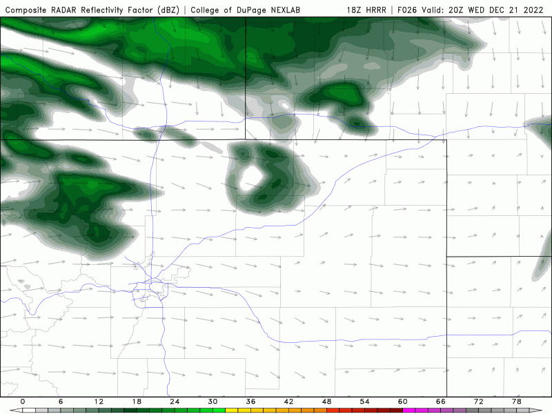
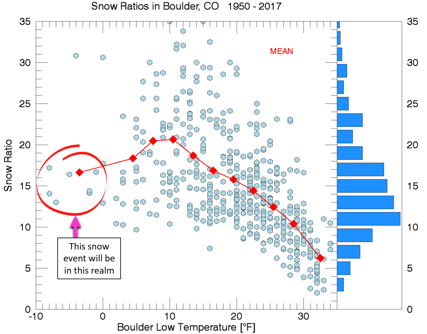
Strong lift associated with the front plowing through and the overhead jet stream will be teaming up to fire-off these moderate to heavy snow bands Wednesday evening. The snow bands look to trail the front by an hour or two, which may be just enough time to limit the overlap of strong north winds and heavy snow (i.e. snow squalls), but we won’t rule out some areas of blowing snow and reduced visibility near and just after rush hour. There will be just a couple hours in the evening where snowfall rates could be impressive — 1 to 2″ per hour. After those amazing moments of more intense snow with big fluffy ratios at the onset, even more frigid air will filter in through the late evening and tank our snow ratios as overall snowfall intensity declines. While we are usually rooting for colder temperatures to produce fluffier snow, on rare occasions it can become too cold and snow ratios reverse and drop back down as shown in the graphic below. Basically with temperatures tumbling below zero during the overnight period, snow ratios are likely to land lower than you might expect — our guess is around ~15:1 for the entire snow event — the average of fluffy snow turning to denser snow during the course of the evening.
We still do expect at least light snow to fall well into the overnight and perhaps even into early Thursday morning, especially south and west of Denver where shallow upslope will linger, providing just enough forcing to coax-out a few ice crystals from the bone-dry Arctic air.
We expect this to be a 0.15″ to 0.5″ precipitation event for the Front Range, with the highest moisture totals in the Foothills of Boulder County and the Mountains. The GFS and Euro models are in fairly decent agreement with the general magnitude of the event, with some spatial differences as always:
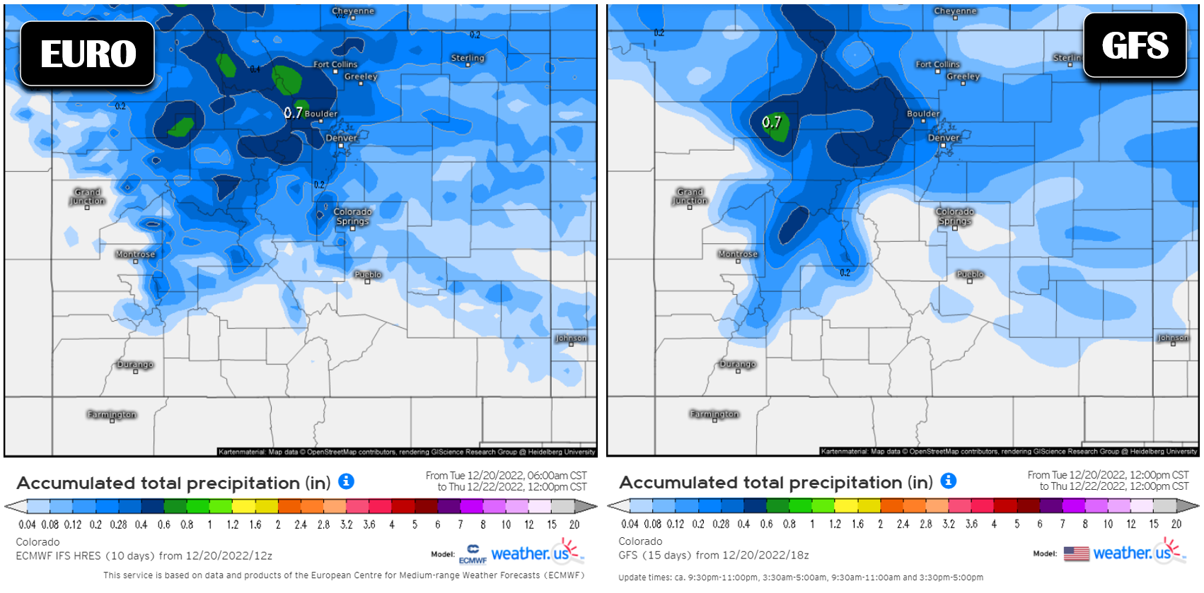
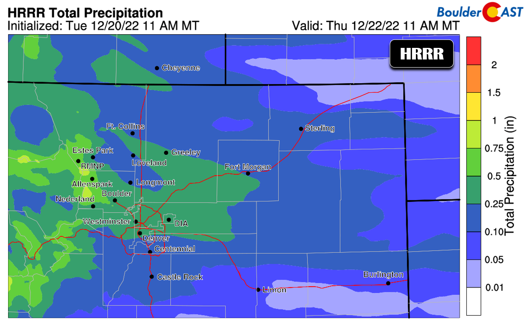
The HRRR model, which we count on to have a better grasp on the intensity and location of the beefier bands of snow, is indicating essentially the same thing, albeit with slightly more moisture dumping regionwide.
Putting everything together, our latest snowfall forecast map is shown below. Overall our confidence in these amounts is on the higher end, though with the wildcard of short-lived byut intense snow raking across the area, there’s probably going to be some booms and busts!
Our latest Snowfall Probabilities jive nicely with our expectations as well — it may surprise you, but it doesn’t always work out that way! Most locations around the Metro area have an almost sure-bet for 2″, whereas usual places like Boulder are showing higher odds of 4″ or more.

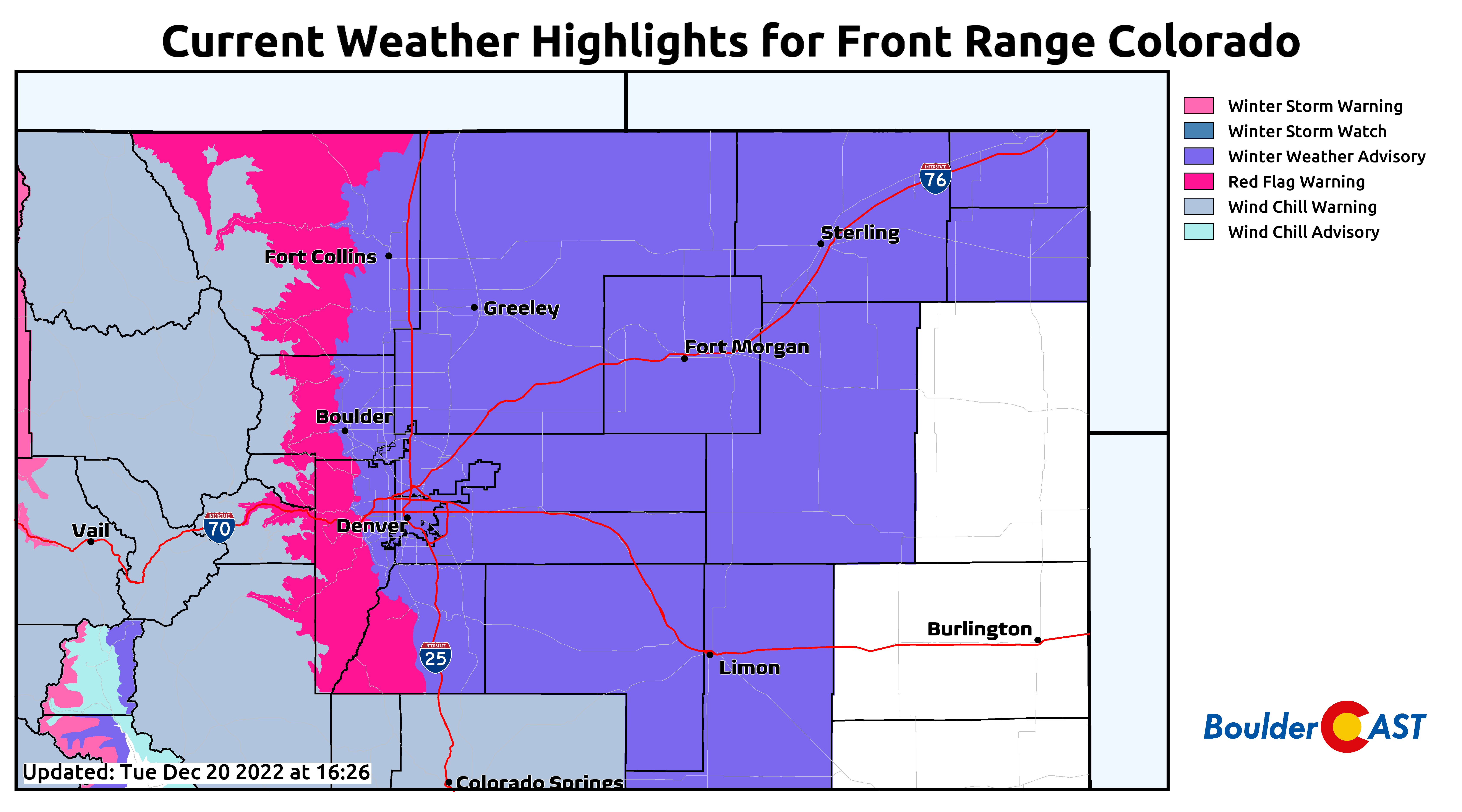
Winter Weather Advisories are in effect for the lower elevations, mainly due to the quick hit of moderate snow which will be brushing up against rush hour and that threat of snow squall conditions mixed in.
Fire danger on Wednesday
Winds will be whipping in the Foothills Tuesday night, but that wind will eventually come crashing down across the lower elevations by Wednesday morning or early afternoon. Winds will be gusting 30 to 45 MPH much of the day up until the moment the Arctic front arrives. As you can see in the graphic above, Red Flag Warnings are in effect for the Foothills which will be very blustery with somewhat dry air and fuels. We already saw what similar conditions did on Monday with the Sunshine Wildland Fire just west of Boulder!
Don’t underestimate the extreme cold
Wind chills are expected to bottom out on Thursday between -20°F and -35°F in our area. Areas further north and east on the Plains and along the Wyoming Border will be at risk of -50°F wind chills on Thursday. This is a dangerous situation indeed! If it’s any consolation, models have been trending slightly warmer overall for our area, taking this from possibly the coldest event all-time in our area, to one that is just really cold but still quite rare! The probability of experiencing a -40°F or colder wind chill has declined for Denver — that’s good news. It’s now only a around 20% chance according to ensemble data shown below. Oh, and there is essentially no chance that Boulder sees wind chills below -40°F! Winning?

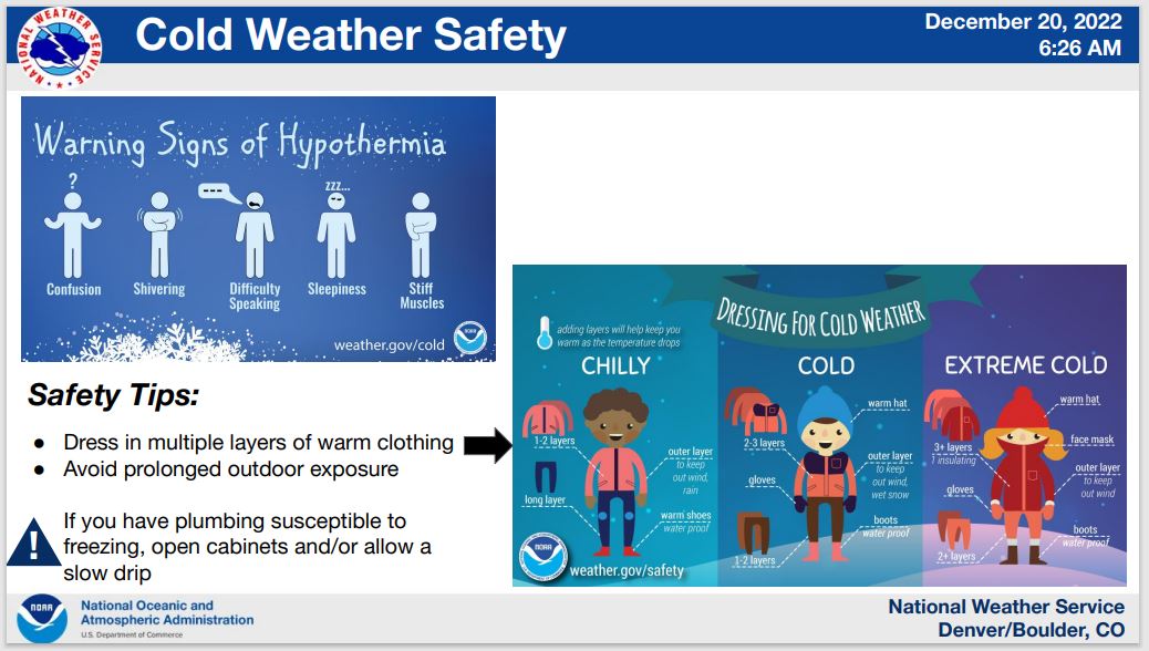
The National Weather Service put out this great graphic regarding cold weather safety and we’re happy to pass it along. Frostbite and hypothermia are the main things to watch out for in yourself and those around you.
For those of you thinking about heading to the Mountains to avoid the cold (yes, that is sometimes a good option in shallow Arctic outbreaks), don’t even bother. Though temperatures will be a tad warmer up there, if you factor in the stronger winds it will be just as dangerously cold in the High Country!
Check back for updates as this unbelievably cold airmass settles in across Colorado and much of the nation. Stay safe, stay toasty, and enjoy winter’s “warm” welcome!

Get BoulderCAST updates delivered to your inbox:
Enjoy our content? Give it a share!


You must be logged in to post a comment.