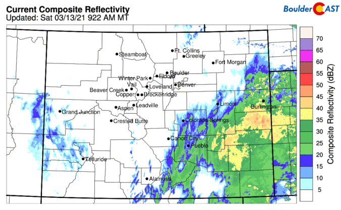
We provide a quick update on the situation this morning as Mother Nature is about to unleash on the Front Range! The potential for a bust has decreased and snowfall amounts have trended up overnight in the models. Let’s run through the latest.
Author: Ben Castellani (Page 130 of 301)
Ben grew up in southwestern Pennsylvania and holds both a bachelor's and a master's degree in Meteorology, the latter being from CU Boulder. His hometown received nearly three feet of snow from the Storm of the Century back in March of 1993, sparking his initial interest in impactful weather. Ben currently works on remote sensing and data analysis software at NV5 Geospatial Software in Boulder.

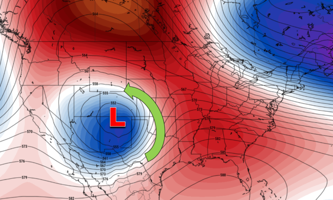

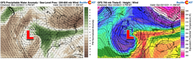
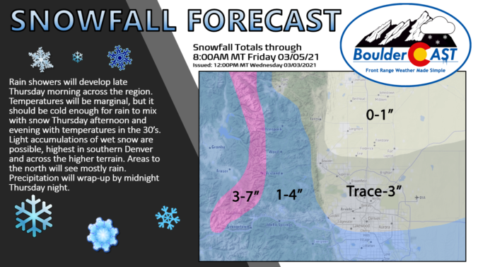
The secret is out it seems! By now you’ve heard that a major winter storm is heading towards the Front Range. Some weather models are predicting that historic snowfall totals will blanket the area by the end of the upcoming weekend. While forecast confidence is growing, our storm system is still offshore and the main event is still several days away from Colorado. We discuss the latest on the storm, provide details on how the models are trending, and give our (super early) preliminary snowfall forecast.
UPDATE (Wed 3/10/21 7:00AM): The recent rounds of model updates continue to support heavy snow this weekend across the Front Range, however there are a few concerns we have as the storm approaches. We discuss this and more in Wednesday morning’s Premium weather discussion, found HERE.

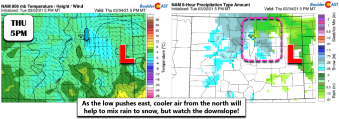
The week ahead will certainly be a wild one! There will be warm temperatures to begin on Monday and Tuesday, but we’ll be trending colder and unsettled thereafter. This transition is just the tip of the iceberg, though, with a potentially massive winter storm gearing up for the weekend ahead. Let’s talk about this roller-coaster of weather knocking on our door.

Live View of Boulder

Current Conditions

Live Radar

Recent Premium Posts

BoulderCAST Daily – Fri 05/01/26 | Warming up this weekend
🌡️ Warming up this weekend, from the upper 50s-60 today to the upper …
BoulderCAST Daily – Tue 04/28/26 | Staying cool with a couple showers, the late-week storm is still the main event despite trending south
🌧️ Morning wave = main show, with light rain showers and Foothills wet …
BoulderCAST Daily – Sun 04/26/26 | Showers and some storms later today and this evening
🌧️ A wet afternoon and early evening, with showers and a few rumbles …
3-Day Forecast

Trending Content

© 2026 Front Range Weather, LLC