
The week ahead will certainly be a wild one! There will be warm temperatures to begin on Monday and Tuesday, but we’ll be trending colder and unsettled thereafter. This transition is just the tip of the iceberg, though, with a potentially massive winter storm gearing up for the weekend ahead. Let’s talk about this roller-coaster of weather knocking on our door.
This week’s highlights include:
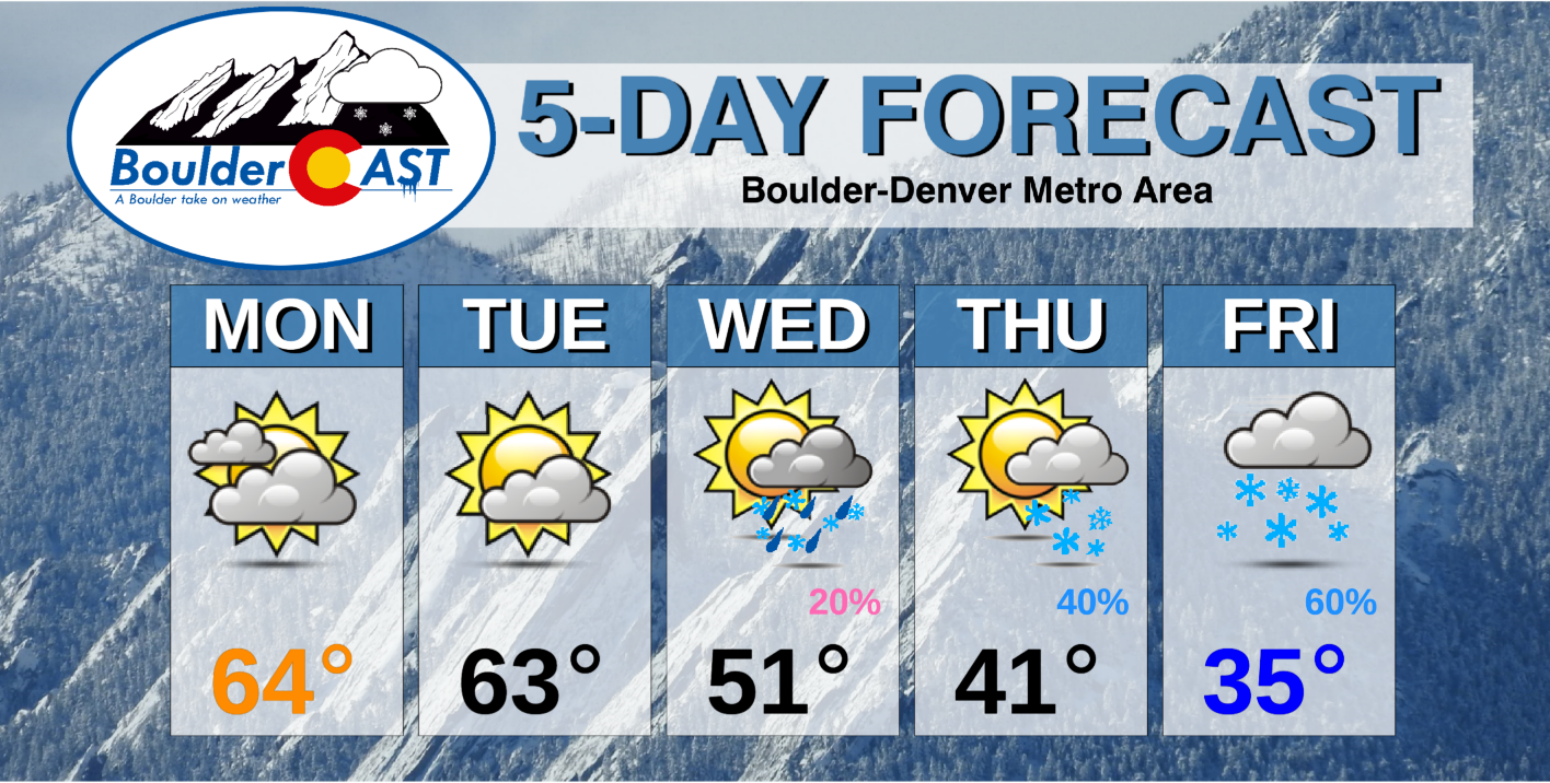
- A beautiful, spring-like start to the week will ensue with highs in the 60’s
- Temperatures begin to trend downward Wednesday and beyond, with rain and snow chances each day
- A huge cut-off storm will impact the area over the weekend, with major winter weather implications likely for the Front Range
- Weekend snow totals could be absolutely massive in eastern Colorado, though this far out we must continue to monitor model trends
DISCLAIMER: This weekly outlook forecast is created Monday morning and covers the entire upcoming week. Accuracy will decrease as the week progresses as this post is NOT updated. To receive daily updated forecasts from our team, subscribe to BoulderCAST Premium.

A gorgeous start to the week
This week will begin right where the weekend left off, with absolutely gorgeous weather across the Front Range. A large ridge of high pressure sits in control across nearly the entire continental United States, as seen below.
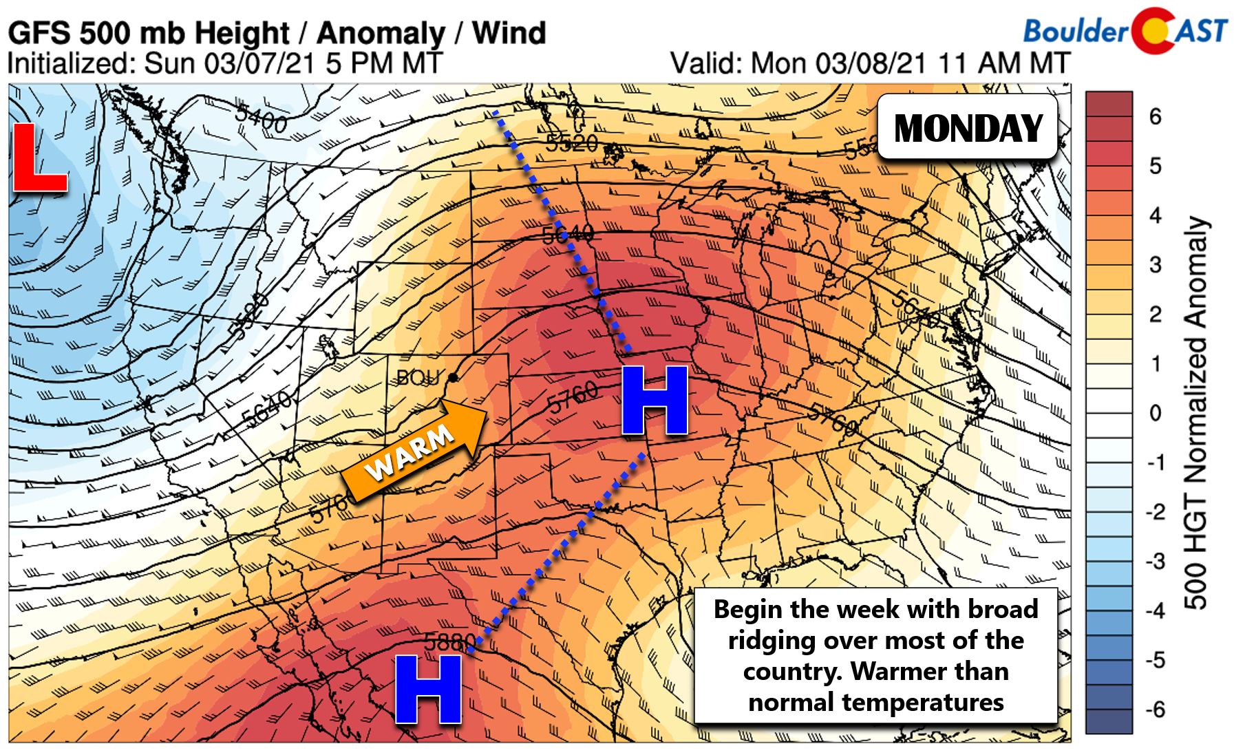
The deep pipeline of southwesterly flow has allowed for lots of high cirrus clouds the last few days thanks to elevated moisture influx, as well as warm temperatures approaching 70 degrees in the Denver Metro area. This trend will continue with highs in the 60’s both Monday and Tuesday.
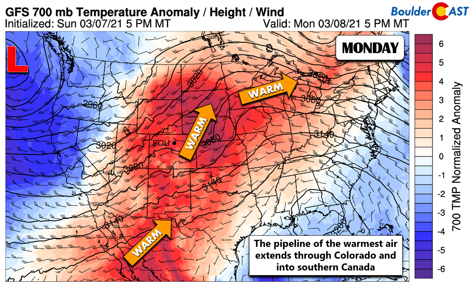
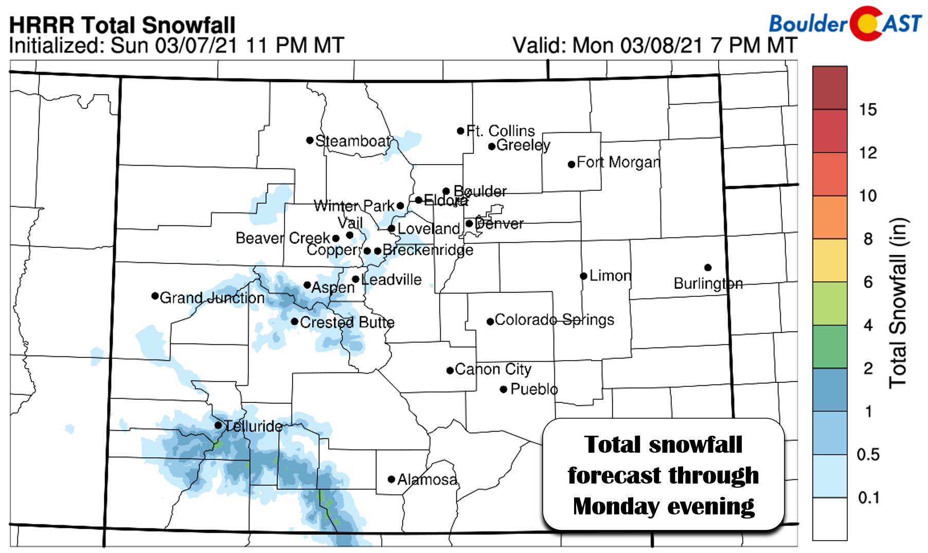
There is a weak shortwave embedded in the southwest flow passing across Colorado on Monday. It’s such a warm, weak, and quick-moving piece of energy that we’re only expecting spotty rain/snow showers in the Mountains, with little to no accumulation at all as the atmosphere is quite dry. There could be a dusting on the highest peaks this morning and afternoon, though (see below).
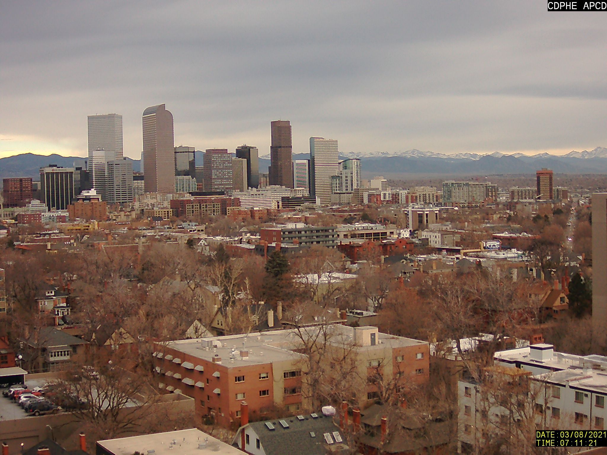
The main impact across the lower elevations from this system on Monday will be mid and upper-level clouds early in the day. This uptick in sky cover is the main reason we are forecasting cooler temperatures on Monday compared to Sunday. The view from Denver on this Monday morning is very gloomy, but this will slowly change through the day with clouds decreasing.
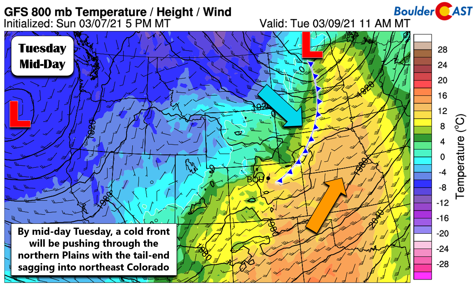
By Tuesday, the ridge axis will shift east taking the warmest of the air with it as well. We’ll start to see cooler air filter into northeast Colorado as the tail-end of a cold front clips the area (shown below). After a very mild morning on Tuesday, the initial surge of cooler air should arrive sometime around mid-day or early afternoon. This will put a lid on the warming and cause slightly falling temperatures through the rest of the day. The early day high temperature on Tuesday will be in the low to middle 60’s with bouts of sunshine.
Beyond Tuesday, our attention must shift focus to the offshore storm system we have yet to mention, but conveniently have labeled in many of the graphical forecasts above…
Things could get VERY interesting later in the week!
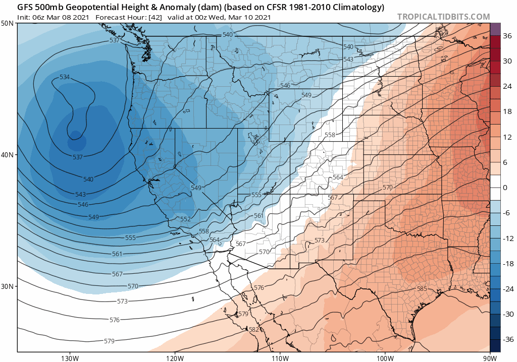
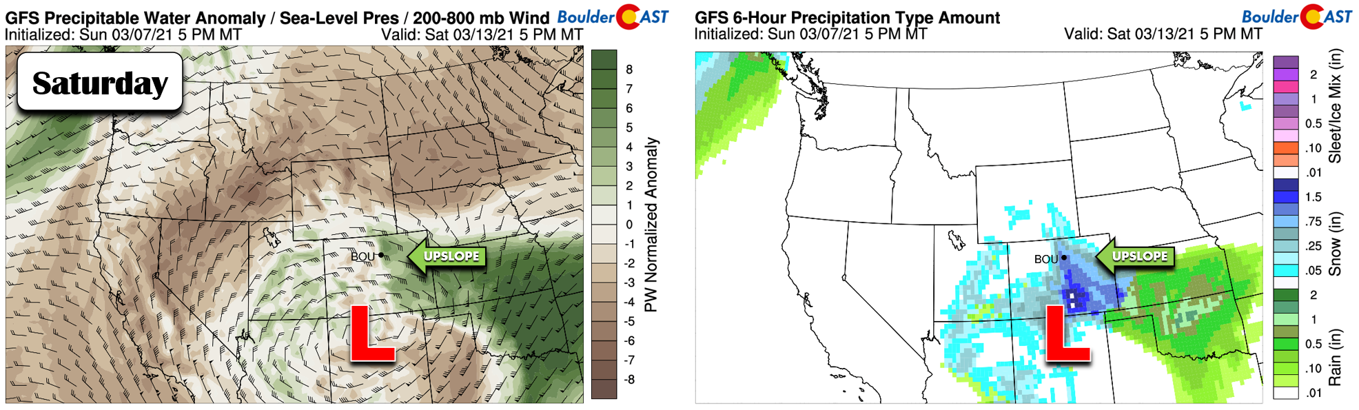
While meteorological winter ended with the turn of the calendar over to March, technically we still have a few weeks left until the Equinox and thus official winter rages on across Colorado! Our first real warm stretch of weather in 2021 gets cut short on Wednesday with the arrival of our next stronger storm system from the Pacific Northwest. A mash-up of unsettled weather is headed to the entire western United States later this week into the upcoming weekend. The GFS 500mb height anomaly animation below shows the broad cut-off low diving southward through California and eventually landing in northern New Mexico by the weekend. This would be a very lucrative position for a major Front Range snowstorm, should it verify.
Even though weather models tend to struggle immensely with pinpointing the track of cut-off systems this far out, we are seeing some ensemble agreement between the GFS and European models. Both ensemble suites put a very strong mid-level low somewhere in northern New Mexico by Saturday. The exact track may end up not being that important since the breadth of the storm is so large. That is, anywhere it goes should produce a period of moist upslope east of the Continental Divide and as a result, heavy snow.
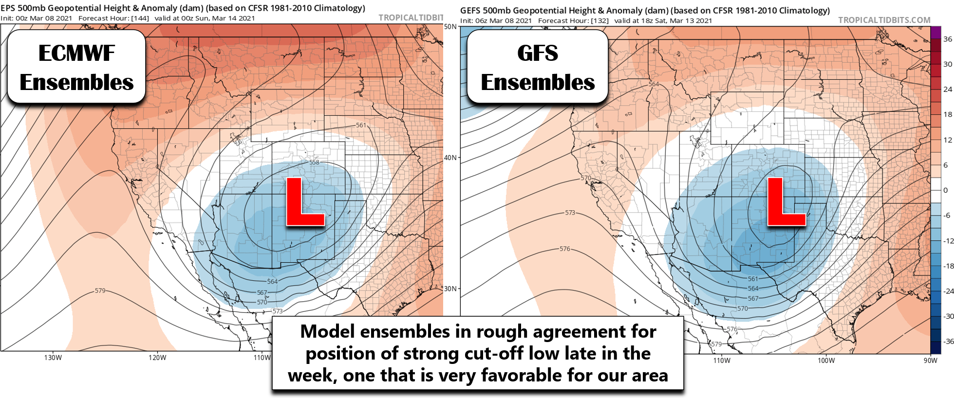
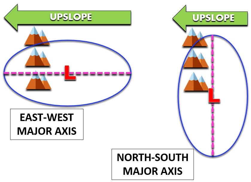
The ECMWF forecast scenario has the potential to be very devastating for the Front Range due to the long fetch of moist upslope resulting from the counter-clockwise flow. A simplified diagram comparing an east-west major axis orientation to a north-south axis orientation is shown below. Can you see how the Euro forecast matches up with the left diagram, while the GFS is closer to the right diagram?
We’re not going to greatly focus on the finer details of this monster storm yet. It definitely has the potential to produce significant snow totals up and down all of eastern Colorado, but specifics and amounts clearly can’t be nailed down this far out. Despite a partially confirmed track, the speed of which this storm moves across Colorado is up in the air right now, and this facet will be critical. If it comes through slower, we could see epic moisture drop across the region as a prolonged period of moist and deep upslope hammers against the terrain.
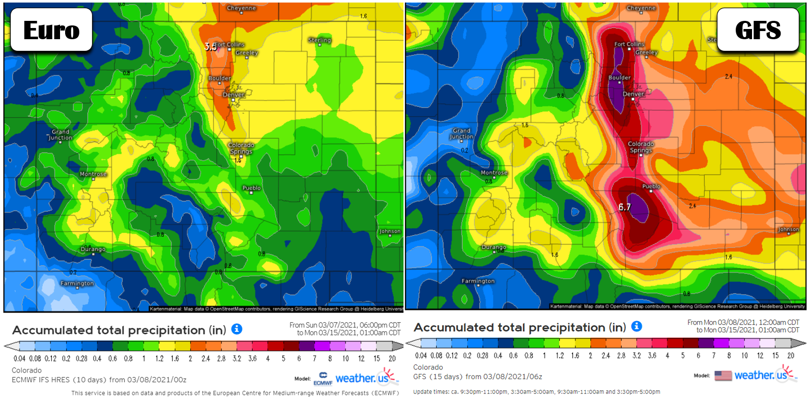
Some ensemble runs and even the operational models are showing anywhere from 1″ up to 7″ of liquid (yes 7 inches!) with this system. The GFS, shown below on the right, has a cool 4 to 8 FEET of snow dumping in the Denver-Boulder area by the end of the weekend. The Euro on the left has half this amount, but that’s still 2 to 4 FEET!
The main wintry event looks to be Friday night into Sunday if things go as planned. However, there will be several days of winter weather beforehand that will offer just a taste of what could arrive over the upcoming weekend. Expect tumbling temperatures beginning on Wednesday and continuing into the weekend. Highs Wednesday will be in the lower 50’s, with lower 40’s Thursday and 30’s on Friday. Each day will offer a chance of spotty precipitation in the Metro area, starting as a rain/snow mix Wednesday, with only snow thereafter. The preliminary waves will offer anywhere from a trace to a couple of inches of snow each day, but there is a lot of variation right now on who sees what. Nonetheless, expect unsettled conditions Wednesday through Friday with cooler temperatures. Friday night into Sunday could be VERY snowy, but much can change between now and then as we hammer out the details on the track of the storm, the timing, and exactly how slow it will move through. Stay tuned and make sure you are subscribed for the latest as things are looking interesting for the weekend! Also keep an eye on our SnowTracker page for the latest model snowfall data.
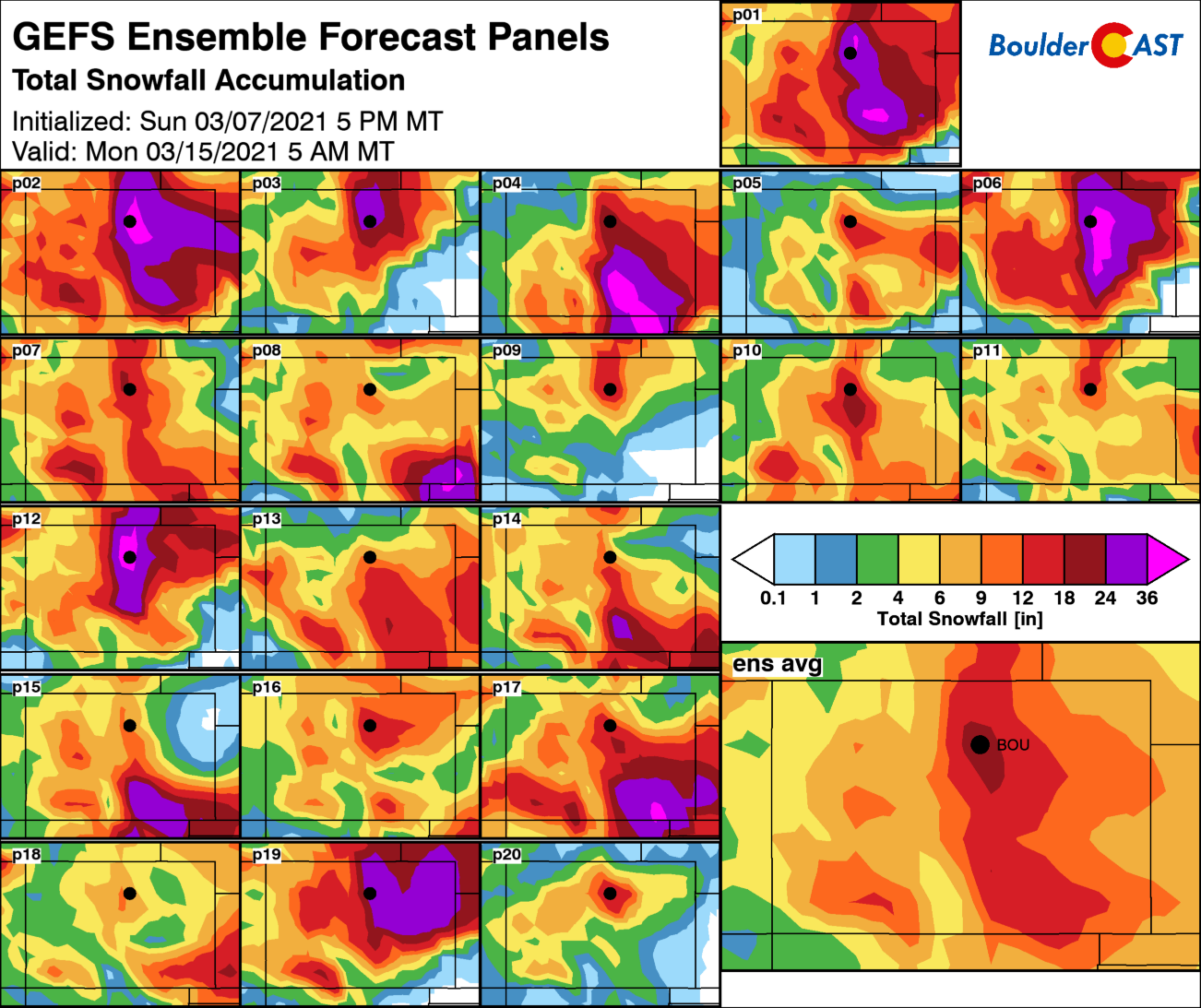
GFS ensemble total snowfall forecast through the weekend. Each of the 20 small panels represent an individual member run of the model. The large panel is the average of all runs.
Forecast Specifics:
Monday: Mostly cloudy early with some sun taking over later in the day. Highs in the lower to middle 60’s on the Plains, with upper 40’s in the Foothills.
Tuesday: Partly sunny and pleasant early with elevated fire danger. Highs in the lower to middle 60’s, but falling slightly through the afternoon into the 50’s behind a cool front.
Wednesday: Cooler and partly cloudy with a slight chance of rain/snow showers during the late-day. Highs near 50 on the Plains and in the upper 30’s in the Foothills.
Thursday: Partly cloudy with a chance of late-day snow showers. Highs around 40 degrees on the Plains with upper 20’s in the Foothills. Light accumulations possible.
Friday: Overcast and cold with light snow likely. Highs in the middle 30’s on the Plains and middle 20’s in the Foothills. Lights accumulations possible. More widespread and significant snow may develop Friday night.
The Weekend: Keep an eye on the forecast as a major winter storm is shaping up for eastern Colorado over the weekend, with widespread moderate to heavy snow expected Friday night into Sunday. Snowfall totals are uncertain right now, but plan for a very impactful winter storm with potentially 12″ or more in the Denver Metro area.
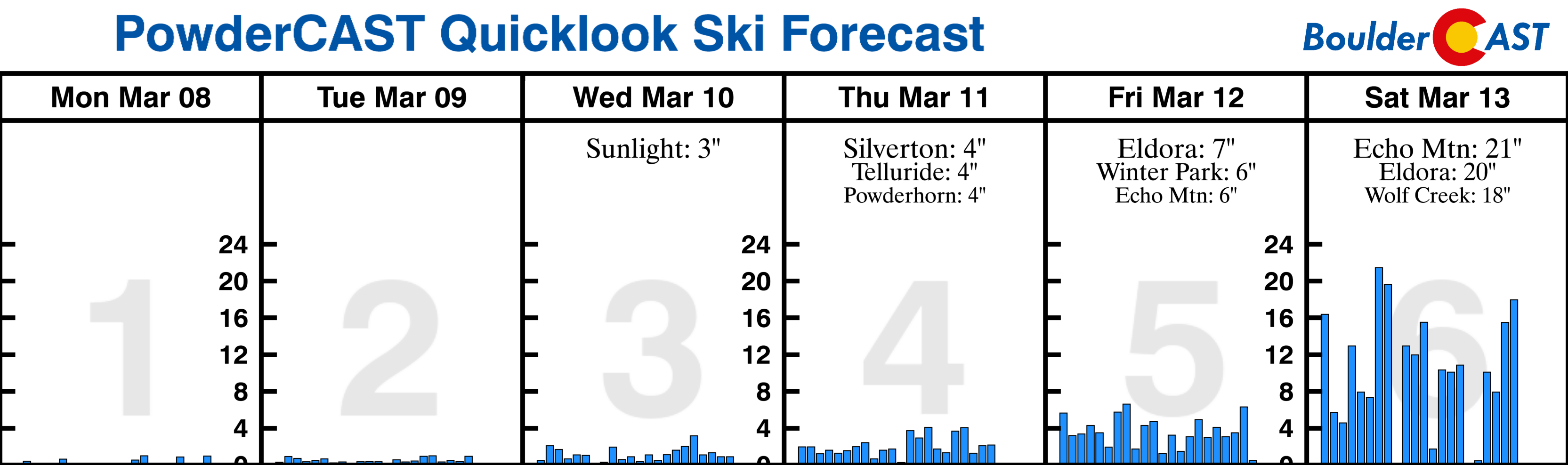
Mountains: A slight chance of rain/snow in the Mountains will take shape Monday morning and afternoon. It will be dry Tuesday, but snow returns Tuesday night and continues off and on the rest of the week as a large-scale trough develops across the western United States. Snow totals will be modest most days, but ultimately could add up to somewhat impressive totals by the end of the weekend. Due to the easterly upslope nature of the major storm gearing up for the weekend, Eldora could pick up the most snow, perhaps several feet.
Help support BoulderCAST and save 25% with promo code HEAVYSNOW
Help support our team of Front Range weather bloggers by joining BoulderCAST Premium. We talk Boulder and Denver weather every single day. Sign up now to get access to our daily forecast discussions each morning, complete six-day skiing and hiking forecasts powered by machine learning, first-class access to all our Colorado-centric high-resolution weather graphics, bonus storm updates and much more! Or not, we just appreciate your readership!

.
Spread the word, share the BoulderCAST forecast!
.


You must be logged in to post a comment.