Author: Ben Castellani (Page 129 of 301)
Ben grew up in southwestern Pennsylvania and holds both a bachelor's and a master's degree in Meteorology, the latter being from CU Boulder. His hometown received nearly three feet of snow from the Storm of the Century back in March of 1993, sparking his initial interest in impactful weather. Ben currently works on remote sensing and data analysis software at NV5 Geospatial Software in Boulder.

As widespread light snow fizzles out Monday morning, we look ahead to an overall unsettled week filled with additional chances for rain and accumulating snow. Our focus in the near-term aims at the potential for convective snow showers Tuesday and Tuesday night. Beyond that, rain/snow will stick with us through the end of the week with temperatures remaining below normal.
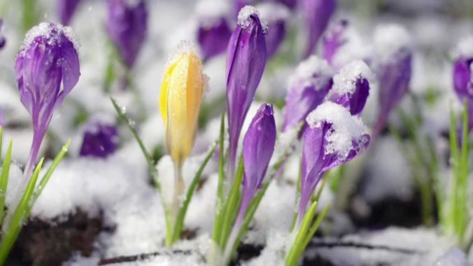
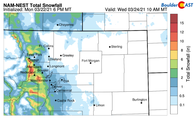
Happy first day of spring, everyone! Alright, now that we got that out of the way….let’s talk about the winter weather that is headed to the Front Range Sunday evening into Monday. A relatively quick moving but vigorous storm system will slide across the Rockies bringing more wet snow to the area. Let’s take a look at the timing and projected snow totals.


Live View of Boulder

Current Conditions

Live Radar

Recent Premium Posts

BoulderCAST Daily – Fri 05/01/26 | Warming up this weekend
🌡️ Warming up this weekend, from the upper 50s-60 today to the upper …
BoulderCAST Daily – Tue 04/28/26 | Staying cool with a couple showers, the late-week storm is still the main event despite trending south
🌧️ Morning wave = main show, with light rain showers and Foothills wet …
BoulderCAST Daily – Sun 04/26/26 | Showers and some storms later today and this evening
🌧️ A wet afternoon and early evening, with showers and a few rumbles …
3-Day Forecast

Trending Content

© 2026 Front Range Weather, LLC