Author: Ben Castellani (Page 128 of 301)
Ben grew up in southwestern Pennsylvania and holds both a bachelor's and a master's degree in Meteorology, the latter being from CU Boulder. His hometown received nearly three feet of snow from the Storm of the Century back in March of 1993, sparking his initial interest in impactful weather. Ben currently works on remote sensing and data analysis software at NV5 Geospatial Software in Boulder.
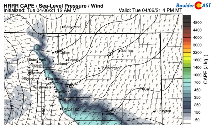
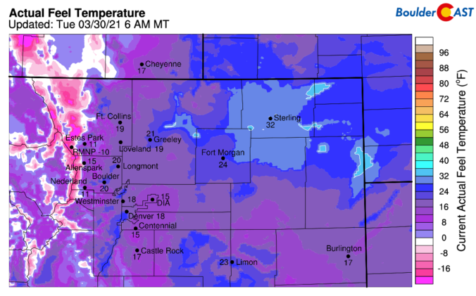
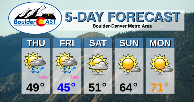
The week begins right where the weekend left off with record warm temperatures on-tap for Monday. However, change will come quickly Tuesday with much colder temperatures, rain changing to snow, and even a little thunder thrown into the mix. The back-half of the week will be quiet, mild and sunny with this trend flowing right into the upcoming weekend. Read on for our complete outlook of the week ahead.
Our weather will be incredible over the next few days with the warmest stretch thus far in 2021 persisting across the Front Range. After the multi-day threat of record high temperatures, we will see a cooldown next week.


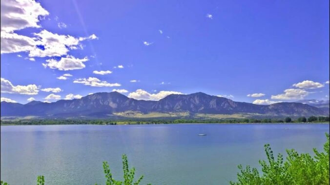
Live View of Boulder

Current Conditions

Live Radar

Recent Premium Posts

BoulderCAST Daily – Fri 05/01/26 | Warming up this weekend
🌡️ Warming up this weekend, from the upper 50s-60 today to the upper …
BoulderCAST Daily – Tue 04/28/26 | Staying cool with a couple showers, the late-week storm is still the main event despite trending south
🌧️ Morning wave = main show, with light rain showers and Foothills wet …
BoulderCAST Daily – Sun 04/26/26 | Showers and some storms later today and this evening
🌧️ A wet afternoon and early evening, with showers and a few rumbles …
3-Day Forecast

Trending Content

© 2026 Front Range Weather, LLC