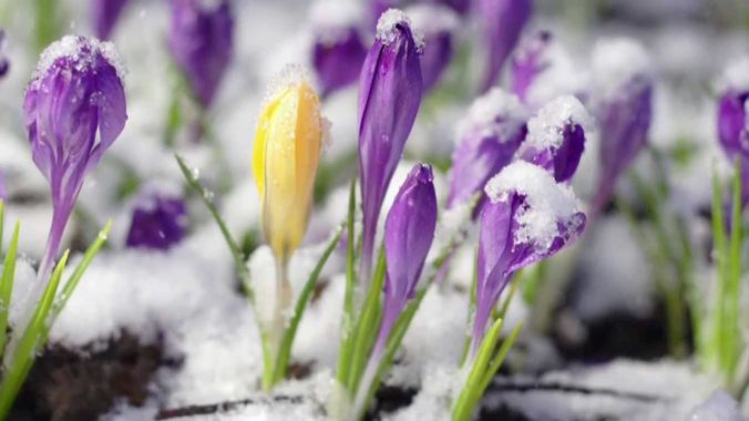
Happy first day of spring, everyone! Alright, now that we got that out of the way….let’s talk about the winter weather that is headed to the Front Range Sunday evening into Monday. A relatively quick moving but vigorous storm system will slide across the Rockies bringing more wet snow to the area. Let’s take a look at the timing and projected snow totals.
At a Glance:
- A relatively quick moving trough will pass across the Rockies Sunday into Monday brining a return of winter weather to the Front Range
- Spotty rain Sunday afternoon will change to widespread snow by early Sunday evening and continue into mid-day Monday
- Warm air and warm ground temperatures will cause lots of melting with this system on the Plains, but healthy snow accumulations in the Foothills
- Amounts up to 8″ of wet snow across the Plains and up to 12″ in the Foothills is expected, highest south
Help support our team of Front Range weather bloggers by joining BoulderCAST Premium. We talk Boulder and Denver weather every single day. Sign up now to get access to our daily forecast discussions each morning, complete six-day skiing and hiking forecasts powered by machine learning, first-class access to all our Colorado-centric high-resolution weather graphics, bonus storm updates and much more! Or not, we just appreciate your readership!

Another snowy Sunday!
We hope you’ve been enjoying the pleasant weather the last few days, though your exact location will determine how nice it actually has been. Low-lying areas with deep snowpack have been stuck under an atmospheric inversion on both Friday and Saturday leading to chilly temperatures only in the 40’s and 50’s. However, areas that eroded the inversion saw 60’s and even some 70’s Saturday afternoon. The image below shows just how well those cooler temperatures matched up with the lingering snowpack on satellite imagery across northeast Colorado Friday afternoon.
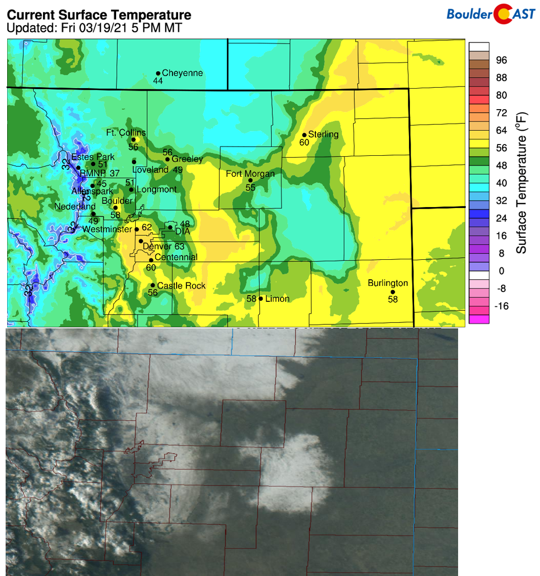
Very poor air quality has been observed in the areas under the inversion, while elsewhere it has been almost pristine, like in southern Denver. The air in the northern Front Range has been particularly disgusting the last few days. At our station in north Boulder, we’ve measured PM2.5 Air Quality Indices above 150 much of the day Friday and Saturday. Yuck! The good news is that cleaner air is on the horizon. The bad news is that it will be accompanied by much colder temperatures and snow! Goodbye spring!
You can tell which spots busted the inversion over the snowpack this afternoon. It's close to 60°F in those locations… Oh, and it's actually safe to breathe there, too.
Boulder Air Quality:https://t.co/5TRScpdzWg
Regional Air Quality: https://t.co/TFdRFX3rwq#COwx #PM25 pic.twitter.com/9cVsi3EpJ6— BoulderCAST Weather (@BoulderCAST) March 19, 2021
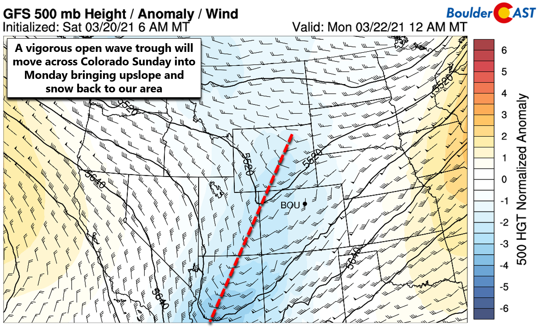
Our next major trough will dig across the Rockies on Sunday bringing with it another round of precipitation to the Front Range. The forecast position of the trough at midnight Sunday night is shown below. Unlike our major winter storm last week, this trough is an open wave (the opposite of a cut-off low) and will be fairly quick-moving. It won’t have a lot of time to put down much snow, but it will certainly try its best!
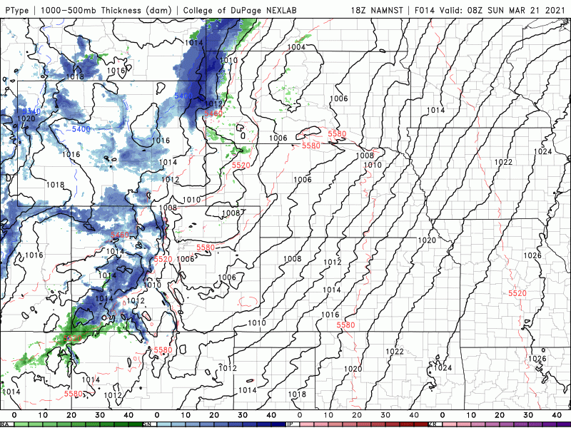
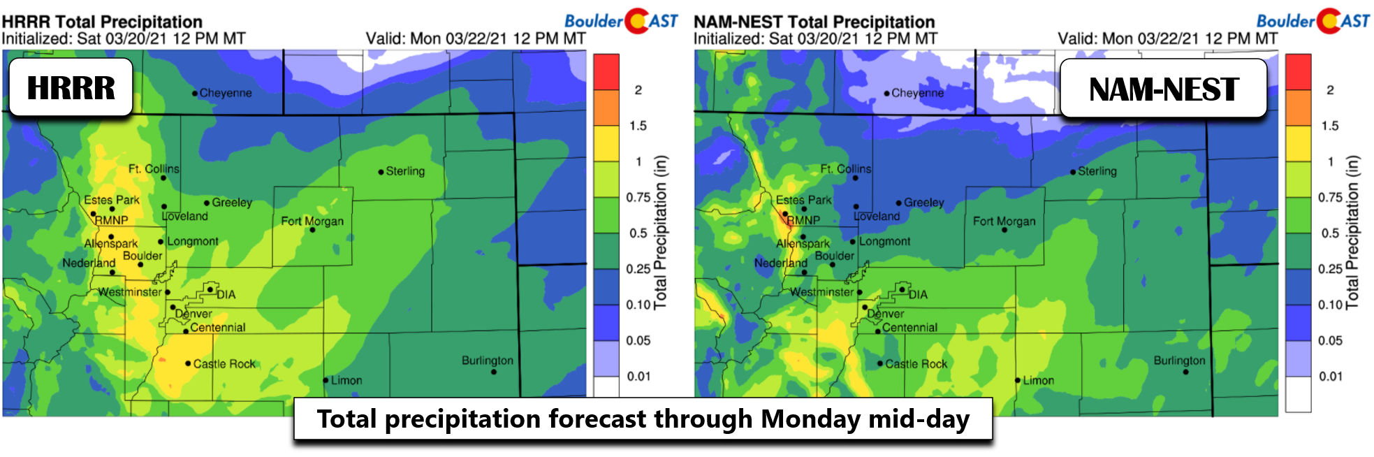
Nonetheless, we are expecting a period of about 18 hours where upslope and large-scale lift from the trough will combine to produce wet snow across the Front Range. The precipitation forecast animation below is from the high-resolution NAM model. The snow will develop late Sunday and linger into Monday across our area. The resulting surface low then pulls eastward Monday night taking the rain and snow with it into the upper Midwest.
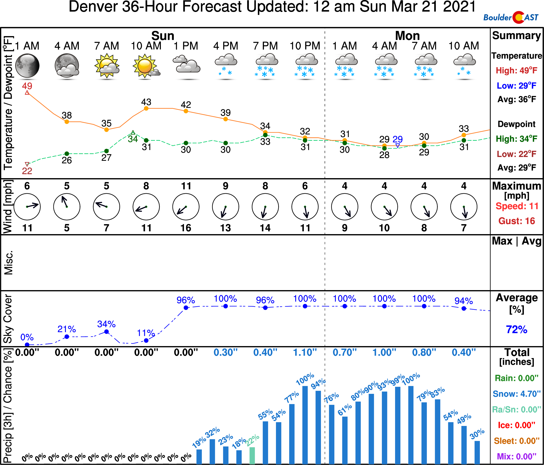
Highs on Sunday will be some 30 degrees cooler in the upper 30’s to middle 40’s in the Denver Metro area. Not ideal for the first full day of spring, but what can you do? Snow will spread into the Mountains by morning and then eastward across the Plains by late afternoon and evening as upslope flow begins to intensify east of the Continental Divide. Very early on Sunday afternoon it will be too warm and many areas below 6000 feet will begin as rain. However, we do expect a rather rapid change-over to snow to occur across the lower elevations with just about everyone seeing all white stuff after 6PM or 7PM Sunday (if not earlier).
For precipitation amounts, we’re looking at anywhere from 0.3″ in the drier European solution, to 0.5″ in GFS solution (below left), to upwards of an inch in the NAM solution (below right).
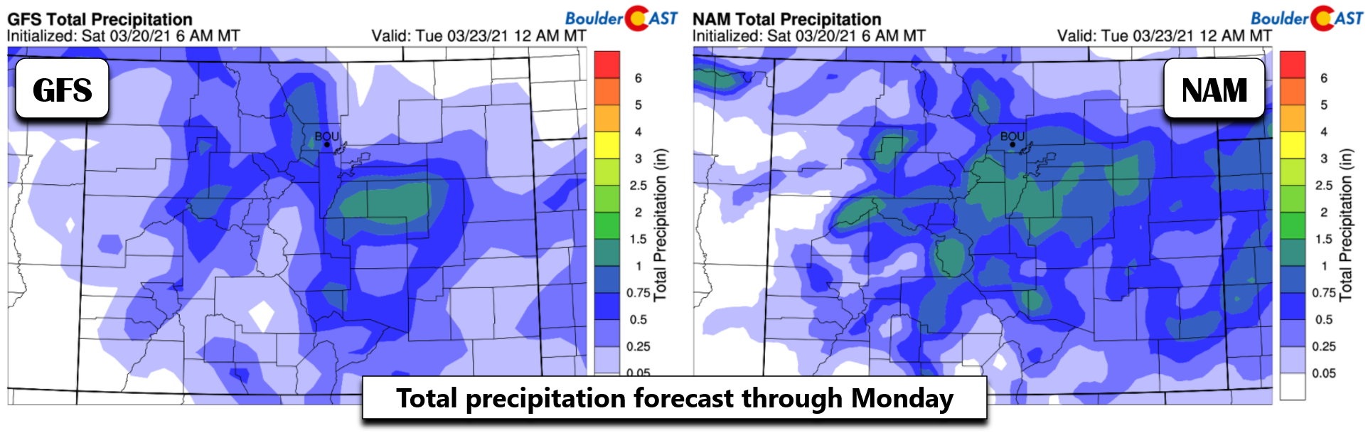
Right now the higher-resolution models are trending towards the upper half of that range…more like 0.5″ to 1.0″ across the area.
We also see decent ensemble support for this same amount of moisture — a half inch up to one inch— though we do still note considerable spread in the ensemble members for Denver, shown below.
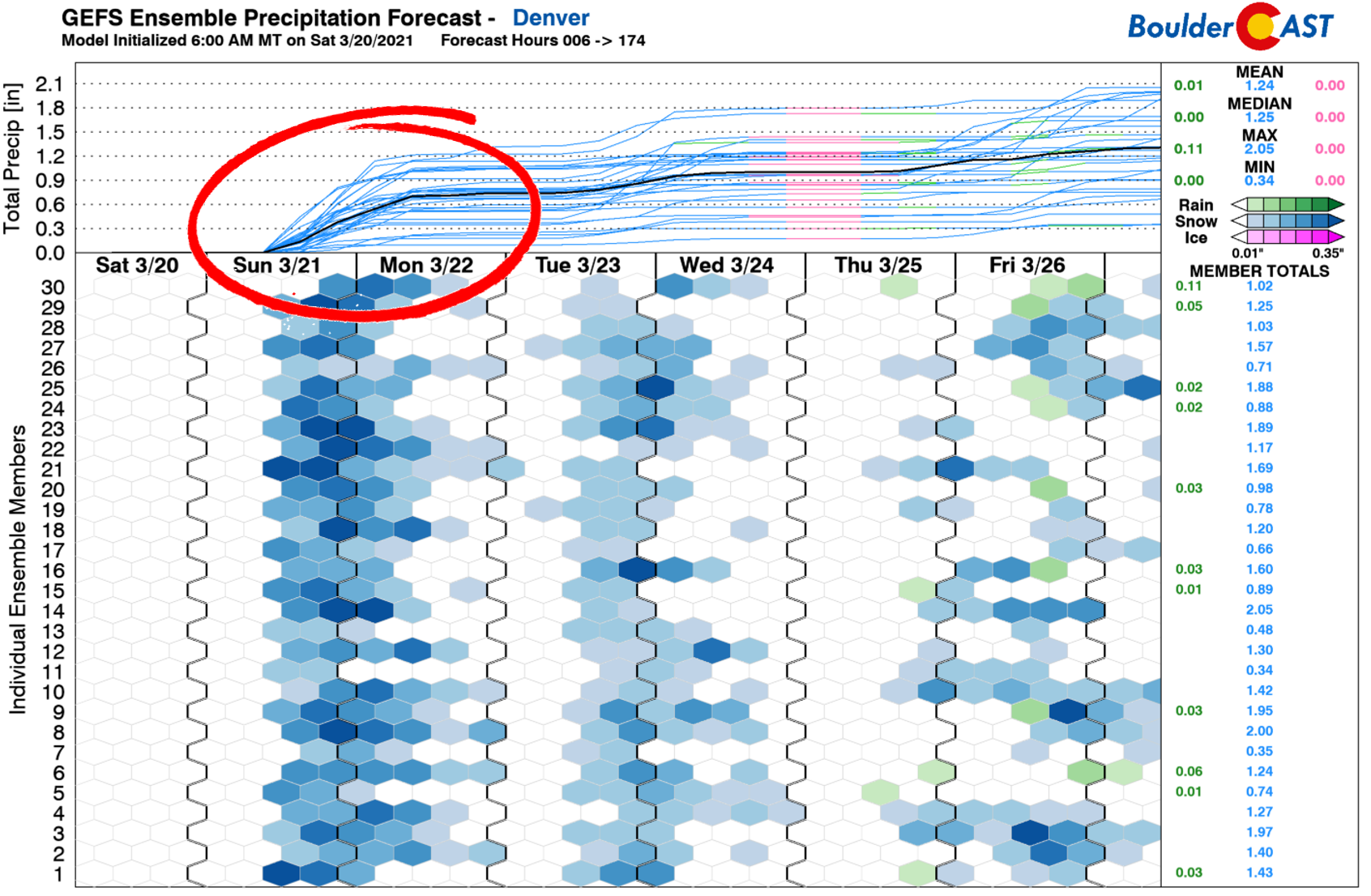
All in all, we’re fairly confident in the amount of moisture that will fall with this system, 0.4 – 1.0″ of liquid. The upslope will be persistent for about 18 hours. There could be a few pockets of heavier snow Sunday evening when the best forcing will be overhead, but everything will translate into a lighter snowfall event late Sunday night into Monday morning. The jet stream won’t be a factor as it lines up just a shade too far south and is in fact rather weak, so we shouldn’t have to worry about heavy jet-forced snow bands throwing a wrench into the forecast.
The big question though will be snowfall amounts, mainly due to temperatures. Even though we are expecting most of this event to be snow, there will be a brief period of rain near the onset and even when it does change to snow, it will be falling onto a very warm ground. Thus, there will be a lot of melting during this event. The evening and overnight timing of the snow will help things along, though. As of writing Saturday evening, the National Weather Service has issued a Winter Storm Watch for areas below 6000 feet elevation, predicting 4 to 12″ of snow will be possible from Boulder to Denver. This isn’t a terrible range considering the uncertainty, but it’s a little high in our opinion. It’s likely that half of whatever falls will melt and will largely be confined to grassy surfaces. Most likely we’ll see that Winter Storm Watch get replaced with a “downgraded” Winter Weather Advisory sometime early Sunday.
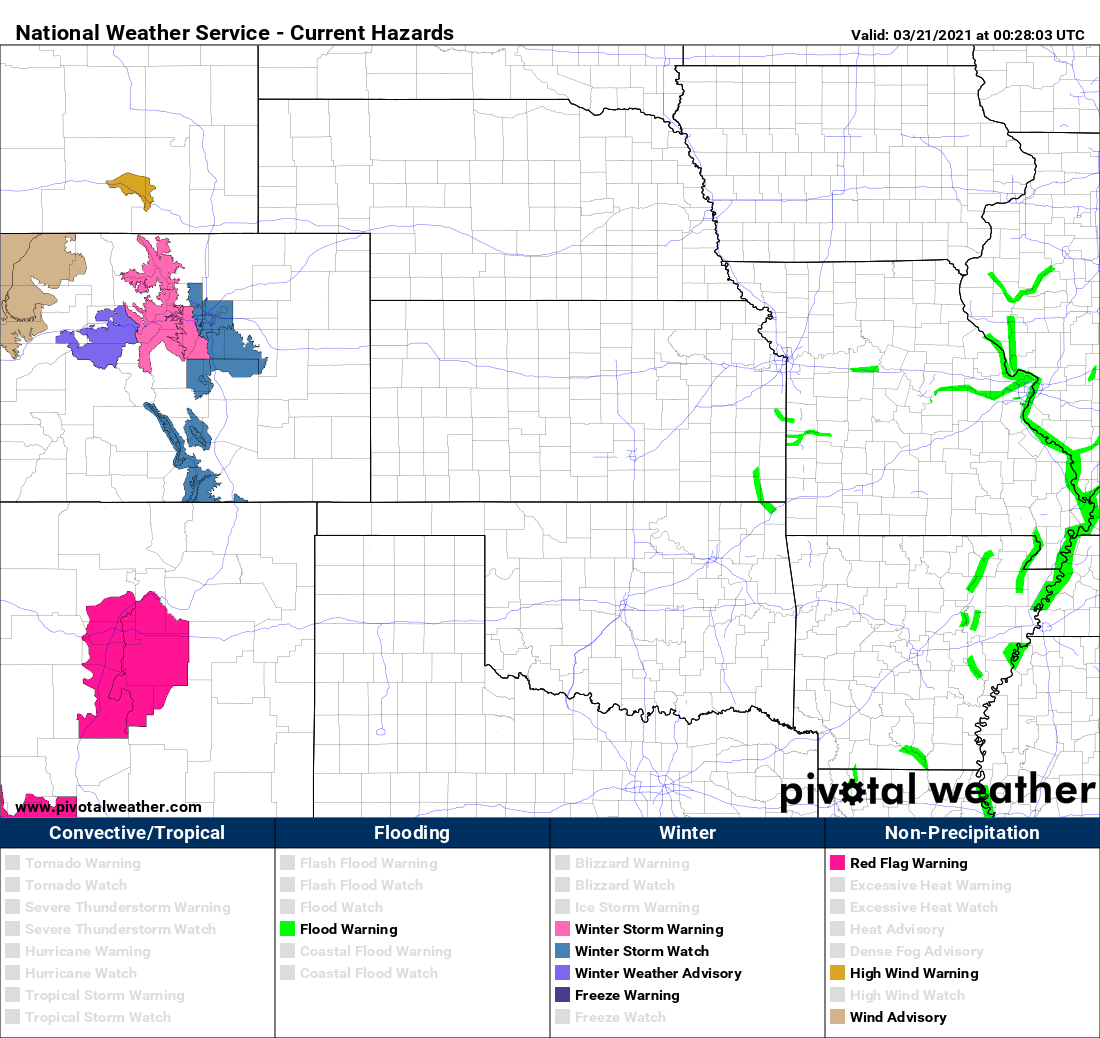
Weather highlights in effect as of 7PM Saturday March 20, 2021.
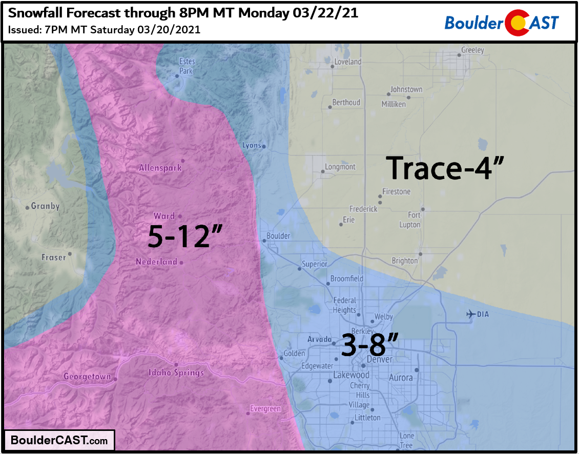
Given everything we are seeing, our snowfall forecast map for the event is shown below. This covers all snow falling through Monday evening.
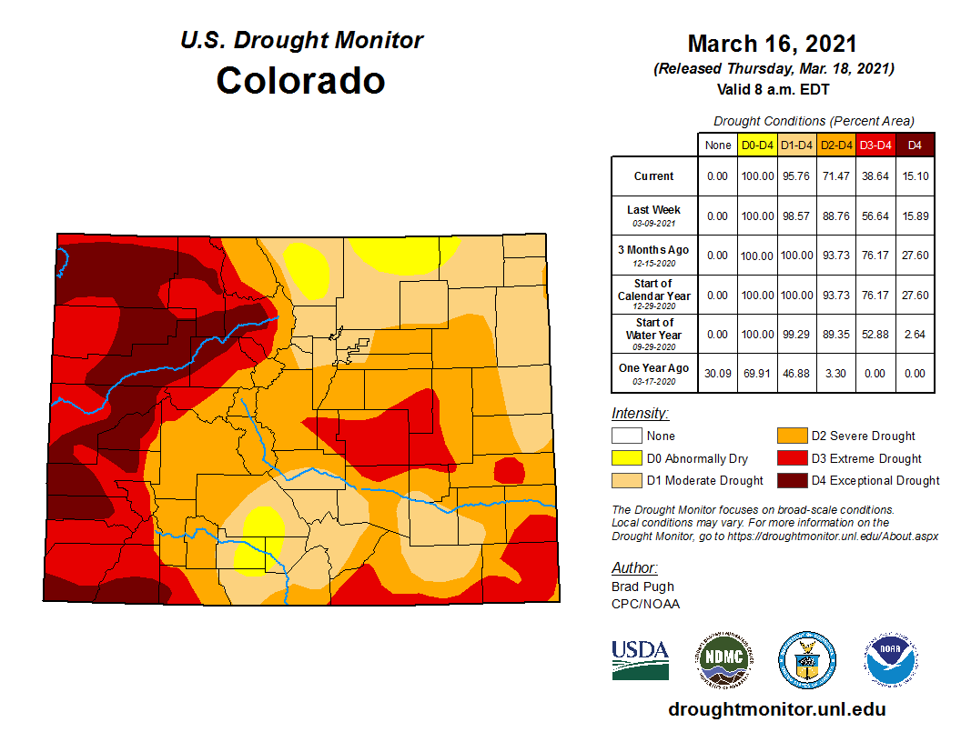
The timeline right now is for a much cooler day Sunday. Expect morning sunshine, but increasing clouds with spotty afternoon rain showers transitioning to widespread snowfall by mid-evening. Snow could be heavy at times Sunday evening. Light snow will then persist through Sunday night and linger into late Monday morning or early afternoon before shutting off. Roadways shouldn’t be too bad considering how warm it has been the last few days, but watch out if traveling in the Mountains, Foothills, or up and over the Palmer Divide. The big storm last week did help curb the drought in our immediate area, but not so much for Colorado as a whole. This smaller snowstorm on the horizon will bring a few more reinforcements to that cause.
Be sure to check back tomorrow as we may adjust our snowfall forecast map Sunday morning if newer model runs reveal any surprises. If you don’t heard from us again, have a great rest of the weekend!
Subscribe to get notified instantly when our forecast updates go live:
We respect your privacy. You can unsubscribe at any time.
Help support BoulderCAST
Help support our team of Front Range weather bloggers by joining BoulderCAST Premium. We talk Boulder and Denver weather every single day. Sign up now to get access to our daily forecast discussions each morning, complete six-day skiing and hiking forecasts powered by machine learning, first-class access to all our Colorado-centric high-resolution weather graphics, bonus storm updates and much more! Or not, we just appreciate your readership!
Share the best forecast:
.


You must be logged in to post a comment.