Author: Ben Castellani (Page 109 of 301)
Ben grew up in southwestern Pennsylvania and holds both a bachelor's and a master's degree in Meteorology, the latter being from CU Boulder. His hometown received nearly three feet of snow from the Storm of the Century back in March of 1993, sparking his initial interest in impactful weather. Ben currently works on remote sensing and data analysis software at NV5 Geospatial Software in Boulder.
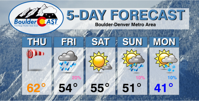

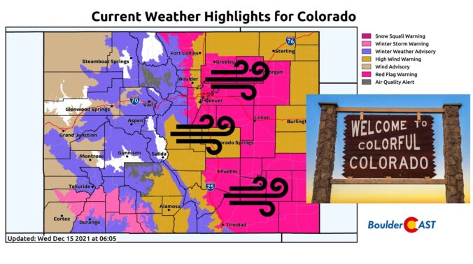
Things are about to start rocking and rolling across the Front Range as a potent storm system rapidly races across Colorado early this morning. Here’s the latest update on the timing of everything, where the snow squall is headed, potential snow amounts, and the all-important wind speed outlook.
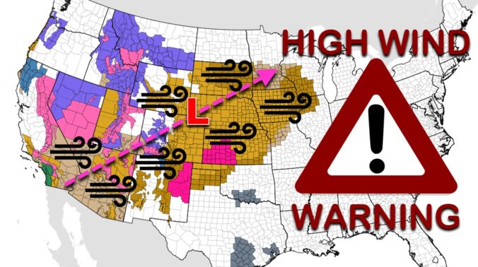
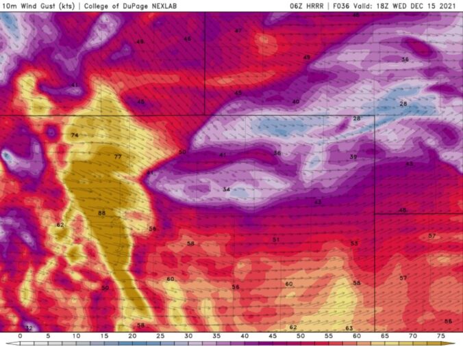
Batten down the hatches! A significant and potentially historic wind event is about to unfold across the Front Range on Wednesday with gusts reaching up to 100 MPH. A band of heavy snow will also race across the state during the morning hours creating dangerous travel, especially in the Mountains. Let’s review the setup, the timing of the snow and strongest winds, and the potential snow amounts and impacts across the area.

Live View of Boulder

Current Conditions

Live Radar

Recent Premium Posts

BoulderCAST Daily – Tue 04/28/26 | Staying cool with a couple showers, the late-week storm is still the main event despite trending south
🌧️ Morning wave = main show, with light rain showers and Foothills wet …
BoulderCAST Daily – Sun 04/26/26 | Showers and some storms later today and this evening
🌧️ A wet afternoon and early evening, with showers and a few rumbles …
BoulderCAST Daily – Sat 04/25/26 | Cooler today and wet Sunday into early next week
🌧️ A wet latter part of the weekend, with showers and a few …
3-Day Forecast

Trending Content

© 2026 Front Range Weather, LLC