Author: Ben Castellani (Page 108 of 358)

Ben grew up in southwestern Pennsylvania and holds both a bachelor's and a master's degree in Meteorology, the latter being from CU Boulder. His hometown received nearly three feet of snow from the Storm of the Century back in March of 1993, sparking his initial interest in impactful weather. Ben currently works on remote sensing and data analysis software at NV5 Geospatial Software in Boulder.
This Week in Colorado Weather: December 19, 2022

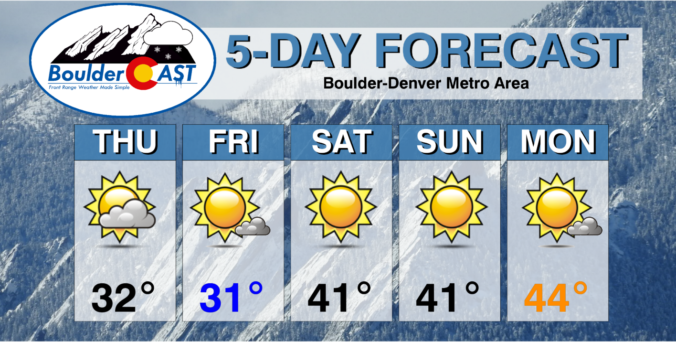
A doozy of a forecast will unfold this week as extremely cold Arctic air overtakes the Front Range late on Wednesday accompanied by a quick shot of fluffy snowfall. However, the main story will be the bitter cold with wind chills dropping to dangerous levels for an extended period. This may be the coldest air to reach our area in decades. We discuss the timing of the powerful front, just how cold it will get and give our early thoughts on potential snowfall accumulations.

Continue reading

Colorado Weekend Weather Outlook: December 15, 2022

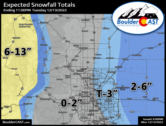
Here's a quick look at the final snowfall totals, or lack thereof in many cases, from the event earlier this week. The western Metro area got completely skunked from this storm, though that was always our main expectation. Totals of 2 to 5" were common east of Denver, including out near DIA. The departed low pressure system from earlier in …

BoulderCAST Daily – Wed 12/14/22 | Chilly & breezy with overcast skies, difficult travel remains out east due to blowing snow

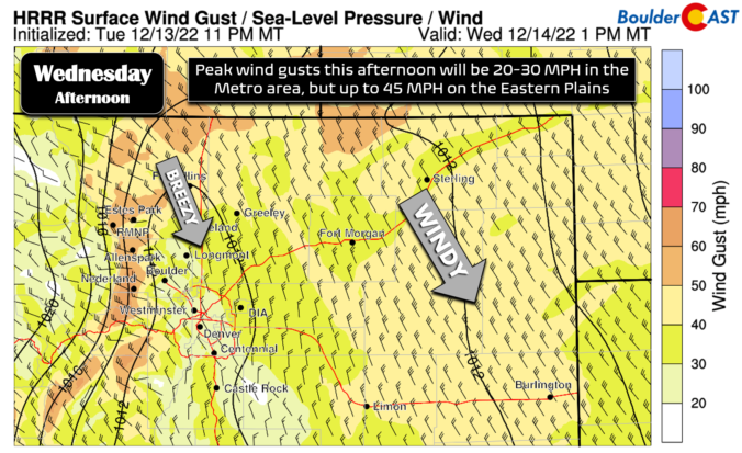
The excitement in weather this week is largely over following the departure of the powerful winter storm system into the Great Plains. However, the storm's large sphere of influence will continue to keep clouds, occasional flurries, cold temperatures, and breezy conditions over eastern Colorado through the day as the system slowly pulls away. Radar this morning is picking up some …

Premium Storm Update – Tue 12/13/22 7:00AM | A cold & gloomy day around Boulder, but blizzard conditions further east

TPREMIUM STORM UPDATE: 7:00 AM Tuesday December 13th he powerful low pressure developed right on-schedule overnight across southeast Colorado and has drifted into east-central Colorado as of early this morning. It is still in the process of coming together overall, wrapping in more moisture from the east. The storm looks fairly impressive from space, even over the Front Range where …

Colorado Weekend Weather Outlook: December 8, 2022

Snow continues in the Mountains this morning with tricky travel likely through the early afternoon in many areas as the final hurrah of this week's main trough pushes across the state. There's even a little snow shower activity spreading eastward across the Plains around Fort Collins and Greeley. This batch of showers will continue to spread east putting down a …

BoulderCAST Daily – Wed 12/07/22 | Mild and quiet today but the winds will be whipping on Thursday

The mid-level closed low pressure has moved very little since yesterday. It is now located just east of Los Angeles this morning in California. The GOES-East water vapor animation below clearly shows the influx of moisture continuing to push into western Colorado out ahead of this system thanks to persistent southwest flow. Models are in good agreement that this storm …

BoulderCAST Daily – Tue 12/06/22 | Pleasant across the lower elevations as snow continues in the Mountains

We expected a few jet-forced snow bands to roll off the higher terrain overnight across far northern Colorado and that was the case. Places like Loveland and Fort Collins should be waking up to a dusting to 1" of snow, with a bit more than that in the nearby Foothills. We saw a few sporadic flurries in Boulder on our …

« Older posts Newer posts »