Author: Ben Castellani (Page 110 of 358)

Ben grew up in southwestern Pennsylvania and holds both a bachelor's and a master's degree in Meteorology, the latter being from CU Boulder. His hometown received nearly three feet of snow from the Storm of the Century back in March of 1993, sparking his initial interest in impactful weather. Ben currently works on remote sensing and data analysis software at NV5 Geospatial Software in Boulder.
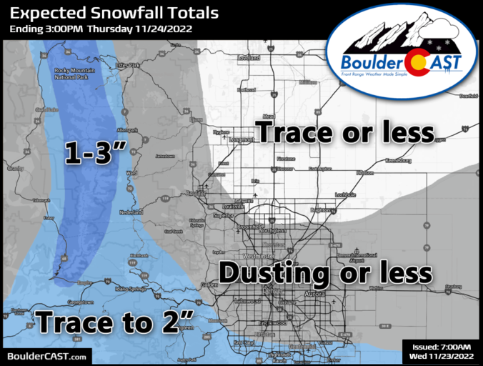
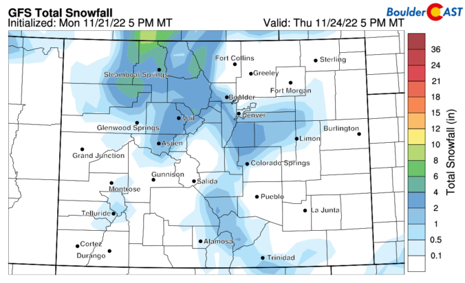
BoulderCAST Daily – Wed 11/23/22 | Light snow develops late tonight, mainly south of Denver

An overall pleasant day is expected on Wednesday as Colorado resides in pre-frontal downslope throughout the depth of the atmosphere. Wave clouds will be on the increase through the day, but winds will be light. High temperatures will reach the upper 40s --- a perfect day for holiday travel. Whether it be by plane or car you should be in …

BoulderCAST Daily – Tue 11/22/22 | Continued seasonal, but snow chances have increased for early Thursday

Quiet weather will continue across the state of Colorado today as unperturbed zonal flow remains over the Intermountain West. Partly cloudy skies and highs around 50 degrees are expected both today and tomorrow. Throughout the day the next shortwave system will come ashore into the Pacific Northwest reaching Colorado by Wednesday afternoon and night. As we touched on in our …

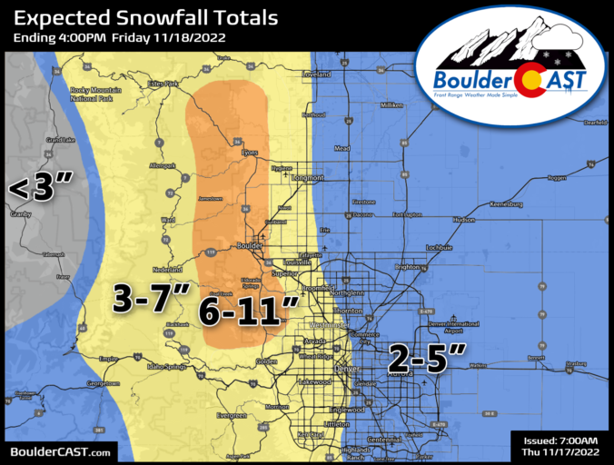
Storm Recap: Long-duration light snowfall led to nearly a foot of fluff along the base of the Foothills

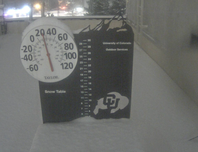
Snow began earlier that expected Thursday morning making for three consecutive tricky commutes across the Denver Metro area. Light snow continued almost continuously for 24 hours leading to a slow but steady accumulation reaching several inches of snow across the Front Range, with up to a foot in some upslope-favored locations. Let’s take a look at the snow totals and the beautiful weather that lies ahead for the weekend.
Continue reading

Premium Storm Update – Thu 11/17/22 7:00AM | Arctic blast on-track with up to a foot of fluffy snow possible in the Boulder area

OPREMIUM STORM UPDATE: 7:00 AM Thursday November 17th ur winter storm continues to rapidly approach the Front Range from the north, though calling it a true "storm system" doesn't quite feel right with this one. As we discussed yesterday, this particular snow event is not being directly forced much by low pressure or significant shortwave energy. A big chunk of …

BoulderCAST Daily – Tue 11/15/22 | Light snow dissipates this morning, but round #2 is taking shape for Thursday

Happy snowy Tuesday morning! It's a bit of an unexpected winter wonderland out there right now as a few small-scale waves of snow showers impacted the Front Range overnight. After we posted our weekly outlook on Monday (which actually gets written on Sunday), high-resolution models started to hint that accumulating snow was of greater probability for the area --- something …

Colorado Weekend Weather Outlook: November 10, 2022

The potent winter storm continues is trek across the northern Rockies this morning. A look at GOES-East water vapor imagery over the last 12 hours shows just how big of a miss this storm was for Colorado. There was a brief band of heavy snow which pushed across the High Country yesterday, but it completely dissipated before reaching Denver thanks …

BoulderCAST Daily – Wed 11/09/22 | Highly variable temperatures today, Mountain snow squalls, & the prolonged cold weather begins

The forecast has shifted a tad since yesterday --- with the storm system out West is progressing across the Rockies quicker than models were showing and even further northward. This is bringing everything together sooner with lesser overall impacts expected across the state of Colorado now. The storm is now going to move from northern California into eastern Montana over …

« Older posts Newer posts »