Author: Ben Castellani (Page 102 of 301)
Ben grew up in southwestern Pennsylvania and holds both a bachelor's and a master's degree in Meteorology, the latter being from CU Boulder. His hometown received nearly three feet of snow from the Storm of the Century back in March of 1993, sparking his initial interest in impactful weather. Ben currently works on remote sensing and data analysis software at NV5 Geospatial Software in Boulder.
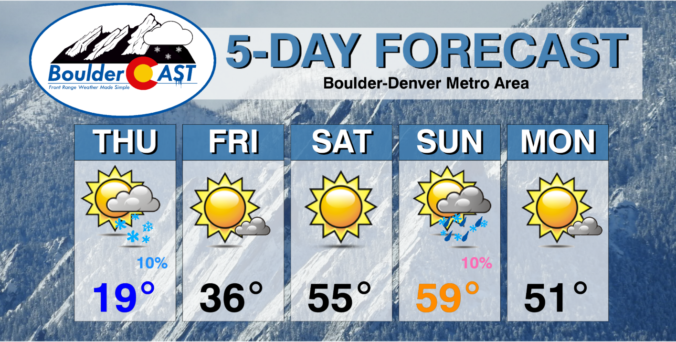
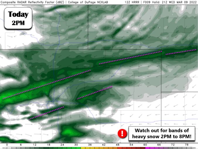
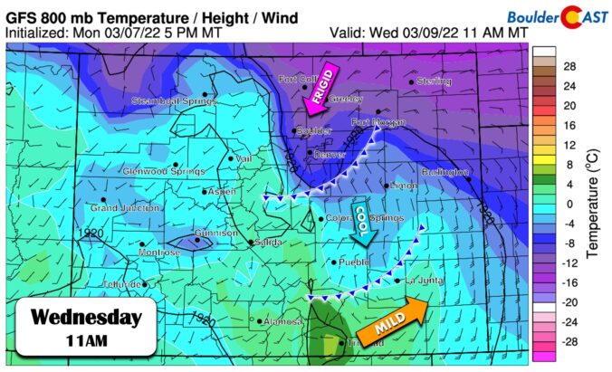
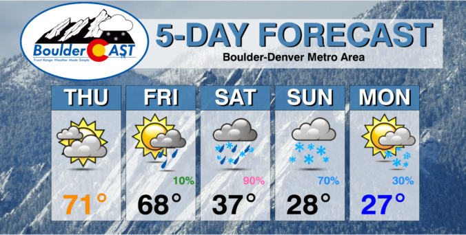
After a very cold and wintry weekend, the week ahead will be…well, unfortunately more of the same. We will enjoy a little bit of sunshine Monday and Tuesday, but yet another Arctic blast will arrive Wednesday to keep things cold and/or snowy for the rest of week. We discuss the expected timing of the Arctic front, potential fluffy snowfall amounts, and just how cold it will get later this week.
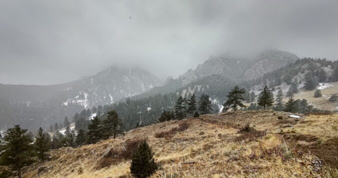
Light snow and at times freezing drizzle have been falling in Boulder most of the day today, but it hasn’t amounted to much yet in terms of accumulation as snowfall rates have not been enough to counteract the increasingly strong early March sun! The lack of accumulation will change on Sunday as colder air and more substantial upslope arrive. Let’s talk temperatures, timing and those snowfall amounts expected through Monday.
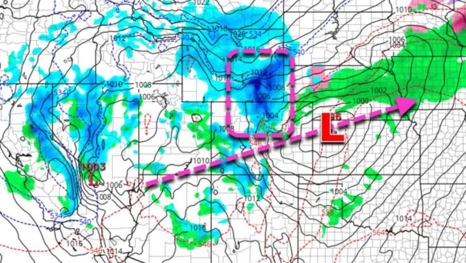
It may have seemed like spring was here to stay the way this week has played out so far — but alas, winter is gearing up again just in time for the weekend. We’ve got two different storm systems to discuss with you this evening. The first will offer a slight chance of thunderstorms Friday evening followed by a threat of heavy convective snow early Saturday morning. The second system will bring sub-freezing temperatures and lighter upslope snow to the entire area on Sunday. Let’s take a look.

Live View of Boulder

Current Conditions

Live Radar

Recent Premium Posts

BoulderCAST Daily – Tue 04/28/26 | Staying cool with a couple showers, the late-week storm is still the main event despite trending south
🌧️ Morning wave = main show, with light rain showers and Foothills wet …
BoulderCAST Daily – Sun 04/26/26 | Showers and some storms later today and this evening
🌧️ A wet afternoon and early evening, with showers and a few rumbles …
BoulderCAST Daily – Sat 04/25/26 | Cooler today and wet Sunday into early next week
🌧️ A wet latter part of the weekend, with showers and a few …
3-Day Forecast

Trending Content

© 2026 Front Range Weather, LLC