Author: Ben Castellani (Page 101 of 301)
Ben grew up in southwestern Pennsylvania and holds both a bachelor's and a master's degree in Meteorology, the latter being from CU Boulder. His hometown received nearly three feet of snow from the Storm of the Century back in March of 1993, sparking his initial interest in impactful weather. Ben currently works on remote sensing and data analysis software at NV5 Geospatial Software in Boulder.
A strong cut-off low pressure system will slowly pass by south of Colorado early in the week leading to below normal temperatures, gusty winds and at times light snow for the area. Little to no accumulation is expected across the lower elevations though. Things turn sunny and warmer Wednesday and beyond, with the upcoming weekend looking particularly stunning. Read on for our complete outlook of the week ahead.
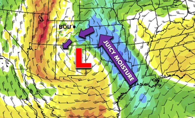
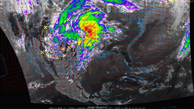
For several days now we have anxiously been looking forward to a big cut-off pressure system forecasted to impact the southern Rockies on Monday. While we’re confident that heavy snow will indeed dump on eastern Colorado, we unfortunately don’t believe that will be across the Front Range. Let’s take a look at the evolving forecast and why this storm will most likely be a swing and a miss for the Denver area.


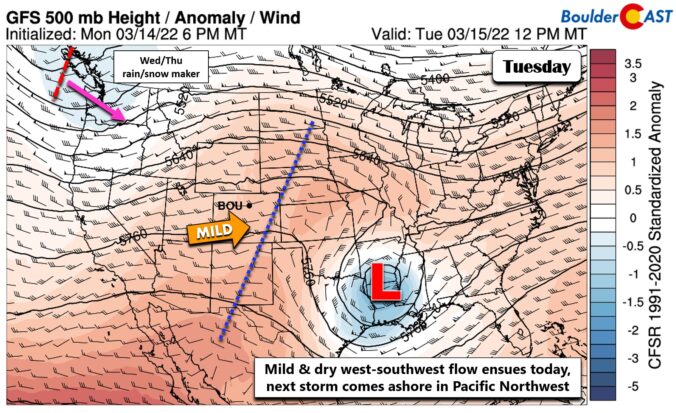
Another Wednesday, another winter storm is going to hit the Front Range! A Pacific trough will impact the area Wednesday into Thursday bringing a return of the white stuff to the Boulder-Denver Metro. Unlike the last handful of snowstorms, this one will have just enough cold air to turn rain over to snow across the entire area. Snowfall amounts remain somewhat uncertain, but most of us should expect at least a couple inches of slushy snow by midday Thursday, with much more in the higher terrain. Let’s take a look at our first “warm” winter storm of the season!

Live View of Boulder

Current Conditions

Live Radar

Recent Premium Posts

BoulderCAST Daily – Tue 04/28/26 | Staying cool with a couple showers, the late-week storm is still the main event despite trending south
🌧️ Morning wave = main show, with light rain showers and Foothills wet …
BoulderCAST Daily – Sun 04/26/26 | Showers and some storms later today and this evening
🌧️ A wet afternoon and early evening, with showers and a few rumbles …
BoulderCAST Daily – Sat 04/25/26 | Cooler today and wet Sunday into early next week
🌧️ A wet latter part of the weekend, with showers and a few …
3-Day Forecast

Trending Content

© 2026 Front Range Weather, LLC
You must be logged in to post a comment.