Author: Ben Castellani (Page 100 of 301)
Ben grew up in southwestern Pennsylvania and holds both a bachelor's and a master's degree in Meteorology, the latter being from CU Boulder. His hometown received nearly three feet of snow from the Storm of the Century back in March of 1993, sparking his initial interest in impactful weather. Ben currently works on remote sensing and data analysis software at NV5 Geospatial Software in Boulder.
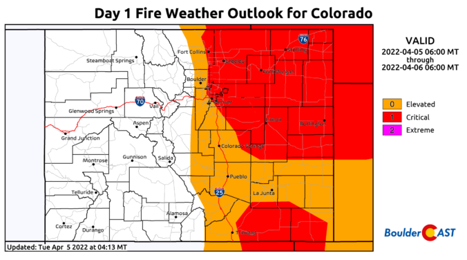
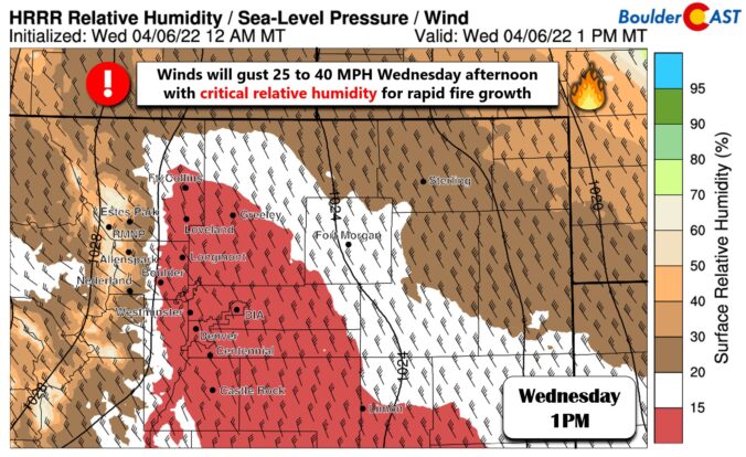
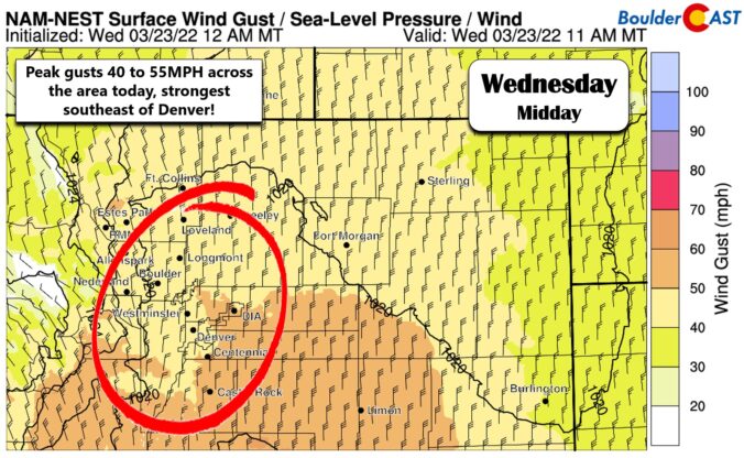
A strong low pressure system passing to our north will wrap in a potent jet stream to northern Colorado in the coming days. This will result in a period of Mountain snow, but to the east several days of strong downslope winds and high fire danger for the lower elevations. Read on for all the details of the weather week ahead.


⦁❶⦁ A wet storm system will spread rain, thunder and eventually some snow across the area today into tonight
⦁❷⦁ After highs in the 50s, a strong cold front blows through by early evening with tumbling temperatures and blustery northeast winds to 40 MPH
⦁❸⦁ Rain will change to snow during the mid to late evening, with that transition happening earlier in the Foothills and Palmer Divide
⦁❹⦁ Generally less than 1″ of accumulation is expected across the lower elevations, but several inches in the higher terrain

Live View of Boulder

Current Conditions

Live Radar

Recent Premium Posts

BoulderCAST Daily – Tue 04/28/26 | Staying cool with a couple showers, the late-week storm is still the main event despite trending south
🌧️ Morning wave = main show, with light rain showers and Foothills wet …
BoulderCAST Daily – Sun 04/26/26 | Showers and some storms later today and this evening
🌧️ A wet afternoon and early evening, with showers and a few rumbles …
BoulderCAST Daily – Sat 04/25/26 | Cooler today and wet Sunday into early next week
🌧️ A wet latter part of the weekend, with showers and a few …
3-Day Forecast

Trending Content

© 2026 Front Range Weather, LLC