Colorado has been stuck in a dry, windy southwest‑flow pattern all week that has led to more than 130,000 acres of forest and shrubland burning across the state in nearly a dozen large fires. Now, as we head into the holiday weekend, the pattern finally shows some give: winds ease, temperatures climb, and a slow return of low‑level moisture should allow a few storms to sneak back into the Front Range. It’s not a full reset — meaningful rainfall will still be hard to come by for now — but the atmosphere is nudging Colorado toward a more familiar early‑July rhythm just in time for the Fourth. We break down how this evolving setup will shape the weekend’s weather, fire danger, and your outdoor plans.
What You Need to Know
- 🌬️ Persistent southwest flow continues through Friday, driven by a blocking heat dome in the East and a West Coast trough keeping things dry (and windy in the Mountains).
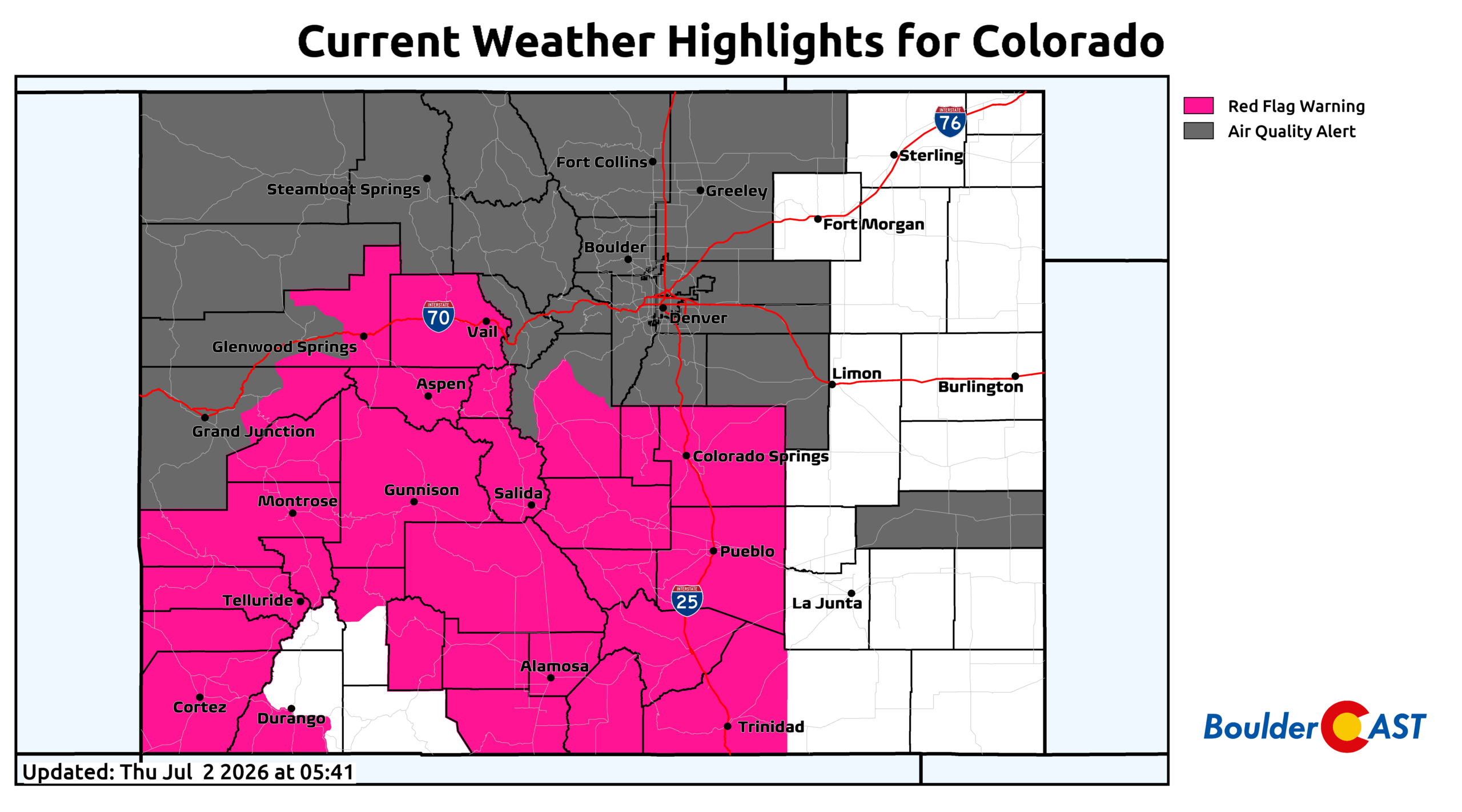
- 🔥 Now at 7+ days of Red Flag conditions across western/southern Colorado with large active fires; smoke remains entrenched along the Front Range.
- 🔄 Pattern shift this weekend as the heat dome breaks down and a long‑wave ridge expands, bringing slightly hotter, more typical July temperatures.
- 💧 Moisture slowly returns, with low‑level easterly flow Saturday and a possible small boost from Tropical Storm Douglas early next week.
- 🌩️ Storm chances increase this weekend but stay fairly spotty; Boulder–Denver will see limited coverage while areas east of I‑25 may see stronger storms.
- 🎆 Fire restrictions in Boulder County (Stage 2 Foothills, Stage 1 Plains); fireworks prohibited county‑wide amid ongoing drought and high fire danger.
- 😶🌫️ Smoke persists through at least Saturday morning as the Front Range remains downstream of major fires in UT, AZ and CO.
- ⚡ Dry lightning remains a threat, especially in the higher terrain — one such strike presumably sparked a small fire west of Boulder Wednesday night.

Go Premium, get all the perks.
Daily Forecast Updates
Get our daily forecast discussion every morning delivered to your inbox.
All Our Model Data
Access to all our Colorado-centric high-resolution weather model graphics. Seriously — every one!
Ski & Hiking Forecasts
6-day forecasts for all the Colorado ski resorts, plus more than 120 hiking trails, including every 14er.
Smoke Forecasts
Wildfire smoke concentration predictions up to 72 hours into the future.
Exclusive Content
Weekend outlooks every Thursday, bonus storm updates, historical data and much more!
No Advertisements
Enjoy ad-free viewing on the entire site.
Stubborn Southwest Flow Keeps Fire Weather Locked In a Bit Longer
Persistent southwest flow will continue to dominate Colorado through the end of the work week, a pattern we’ve been stuck in for nearly seven days now. A blocking heat dome over the eastern United States has kept a quasi‑stationary trough pinned along the West Coast, maintaining a strong mid‑level pressure gradient across the Four Corners. In between these features, unusually strong, bone‑dry mid‑level winds have funneled into the region — a setup responsible for more than a week of Red Flag Warnings across western and southern Colorado where multiple large, active wildfires continue to burn.
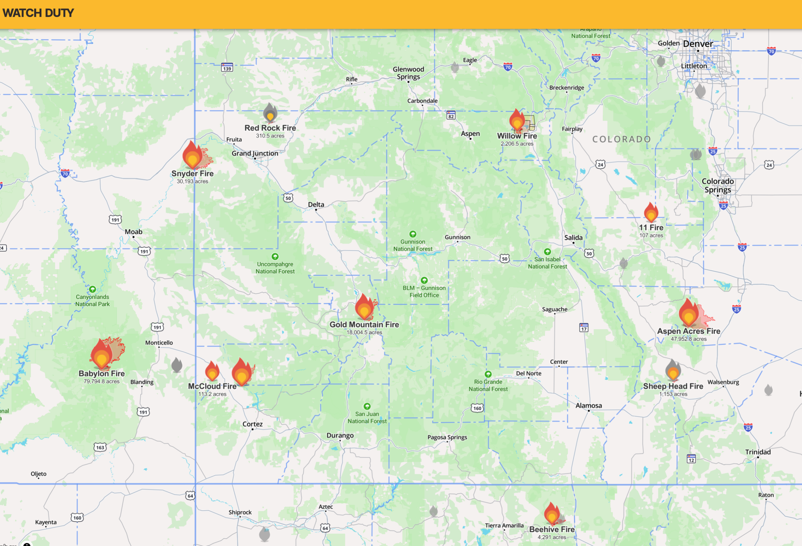
Active fires burning across Colorado | WatchDuty
A persistent heat dome in the East paired with a trough in the West has kept a continuous pipeline of dry mid‑level air aimed directly at the Four Corners.
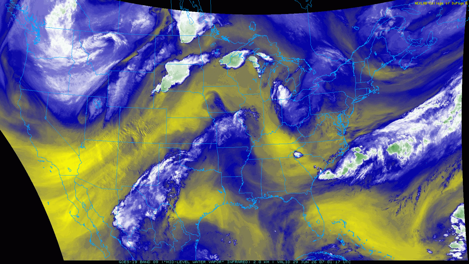
GOES-East mid-level water vapor animation Monday June 29-Thursday July 2nd. Heat dome in the eastern US with trough in the West has persisted all week long. Notice the continual pipeline of dry mid-level air flowing into the Four Corners.
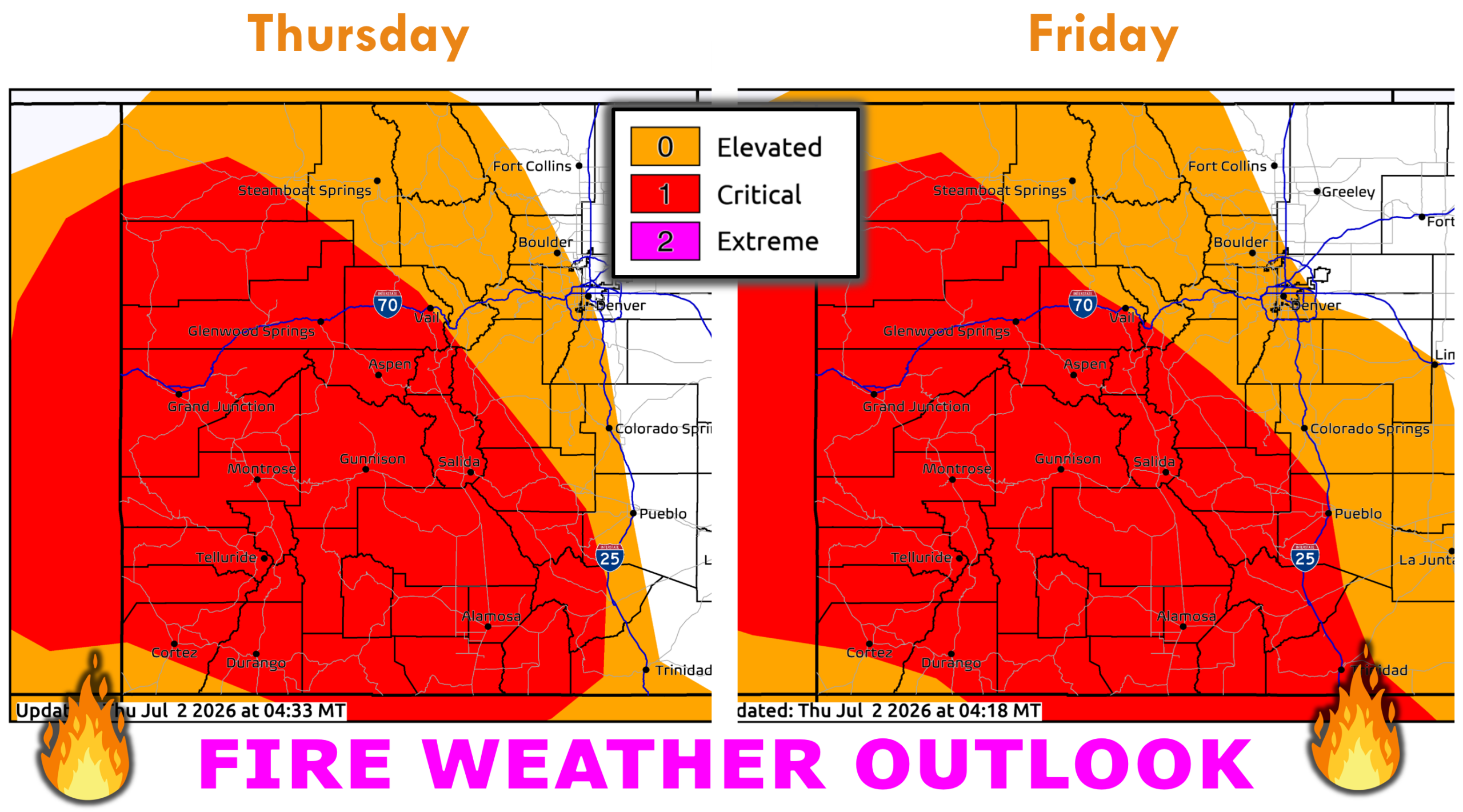
Red Flag Warnings remain in place Thursday and Friday for the same areas before the pattern finally begins to shift.
Pattern Evolution: Heat Dome Breaks, Ridge Expands, Moisture Slowly Returns
Model guidance continues to show the East Coast heat dome weakening this weekend, fading Saturday and largely gone by Sunday. The western trough also erodes, allowing a broad long‑wave ridge to expand across much of the Lower 48. We’ve been warm along the Front Range, sure, but not seasonally hot under the current trough. That changes gradually this weekend as true summer heat returns early next week.
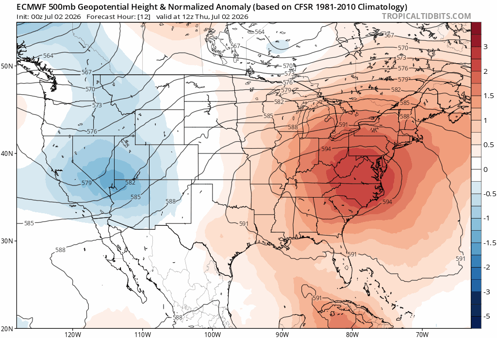
Euro 500mb height anomaly forecast animation Thursday through Monday. The eastern US heat dome breaks down with slow ridging building nationwide, including into Colorado over the weekend.
At the same time, low‑level moisture will begin to recover, though meaningful shower and storm coverage may lag until late weekend or early next week.
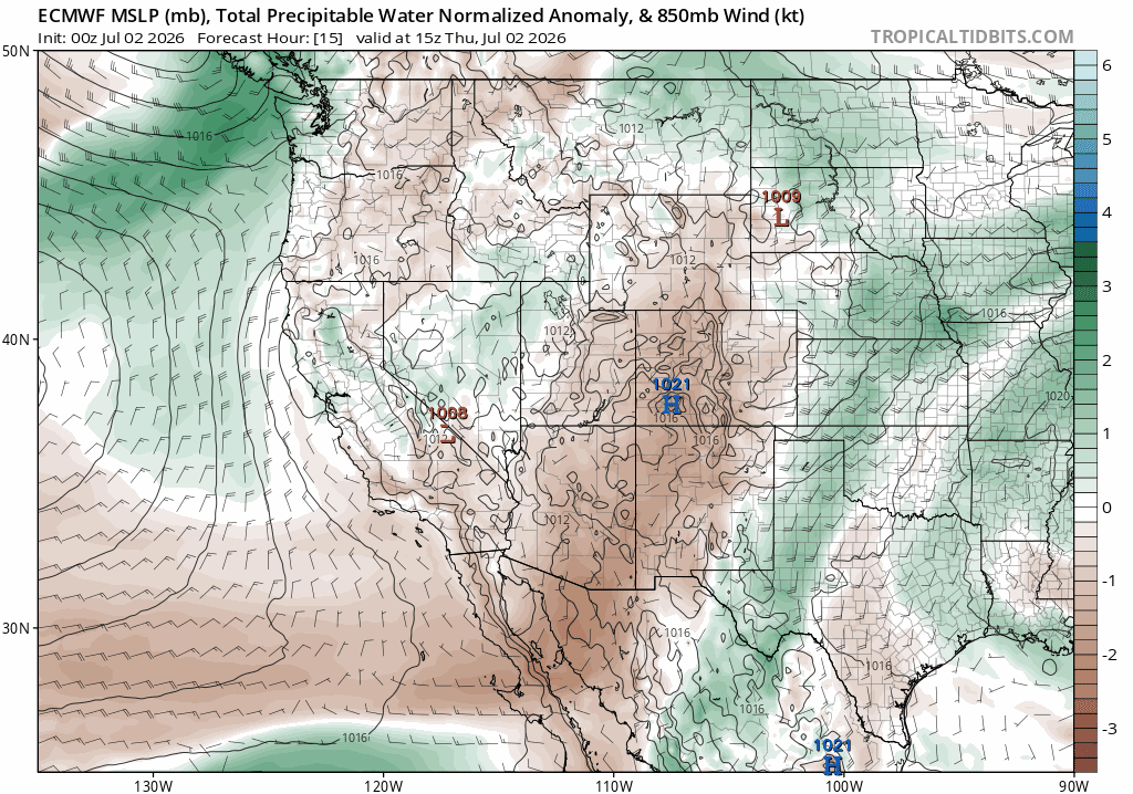
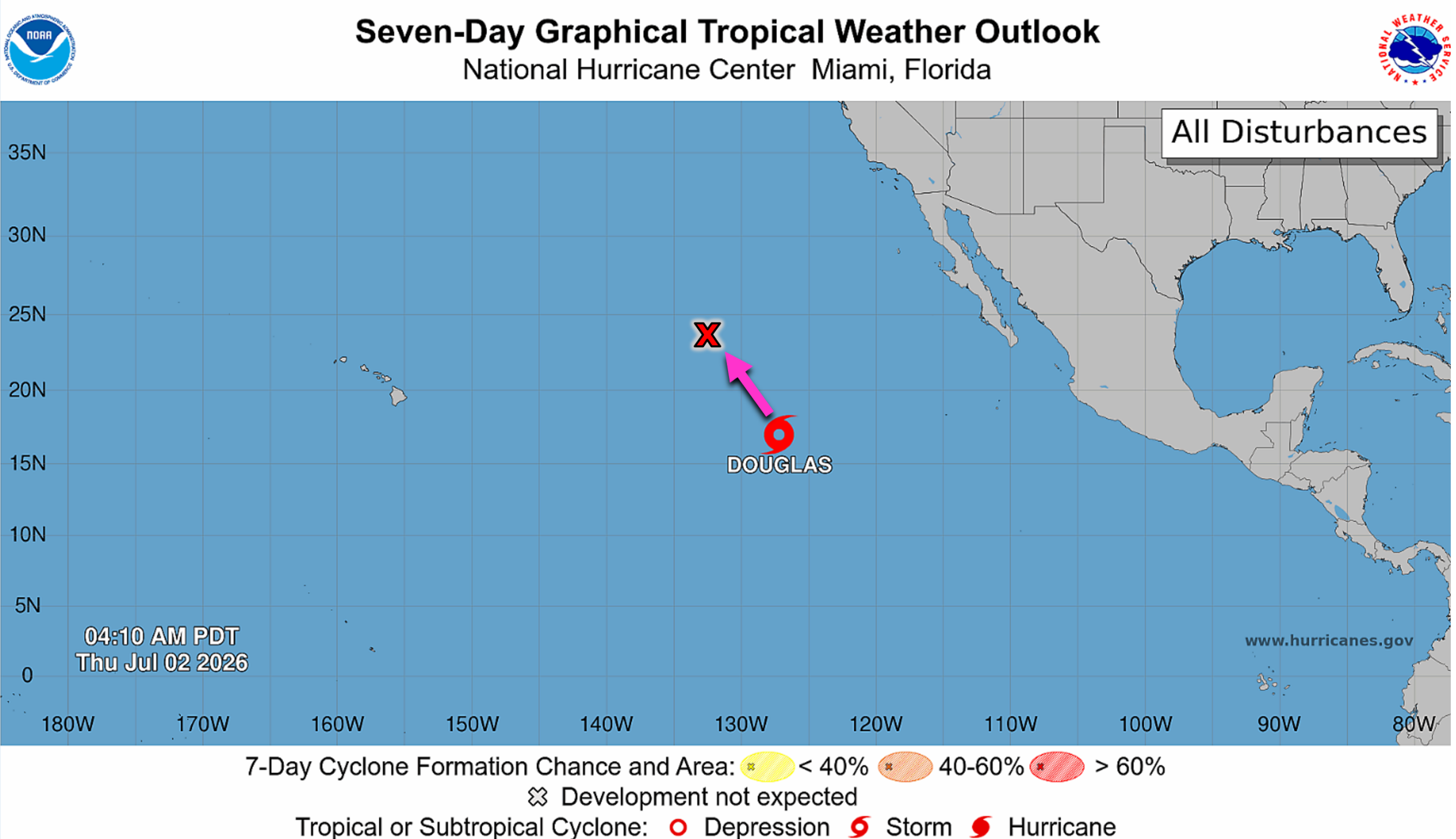
A subtle tropical moisture tap may assist this process. Tropical Storm Douglas, currently far out over the eastern Pacific, is weak and not a direct player — but some ensemble members show a offshoot plume of enhanced precipitable water lifting into the Southwest. Even a small bump could help; Boulder and Denver haven’t recorded measurable precipitation in about a week now.
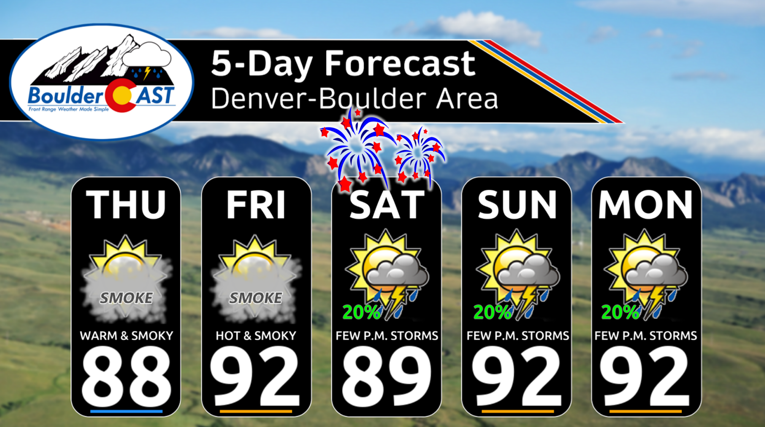
Thursday & Friday: Warm, Dry, and Fire‑Prone — With Smoke
A nocturnal outflow boundary from storms in Larimer/Weld County pushed into the Denver Metro late Wednesday, producing low stratus along the Foothills early Thursday (white clouds spawning below). Expect rapid mixing as southwest flow re‑asserts itself.
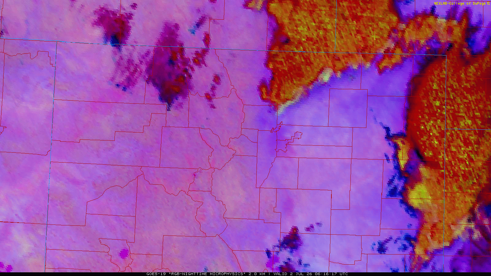
Nocturnal imagery showing an outflow boundary from storms to the north forming low clouds in Boulder County late Wednesday night into Thursday morning.
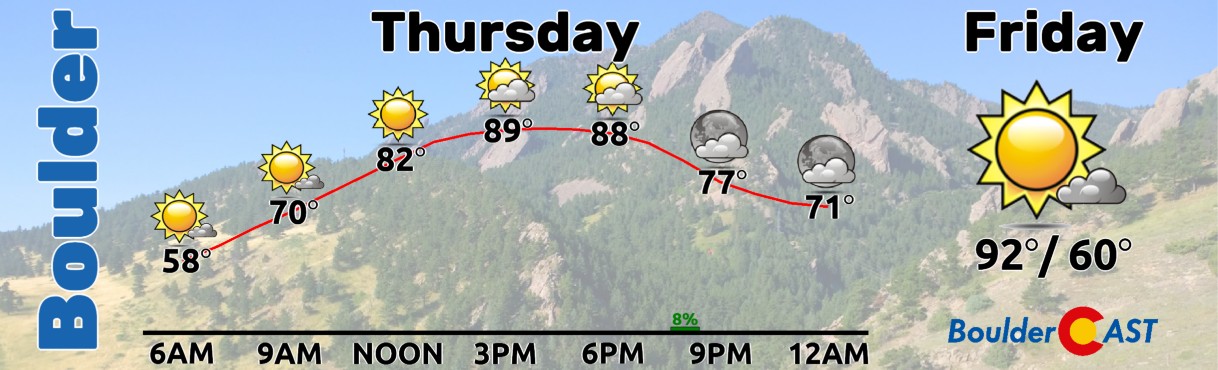
The week will end largely quiet:
- Morning low clouds Thursday, then sunshine, then partly cloudy by afternoon.
- A few “ominous” clouds again, but mostly virga with gusts up to 30 MPH favored.
- Highs: upper 80s to near 90° Thursday.
- Friday: low 90s, similar pattern with a couple evening virga showers.
Through (at least) Saturday morning, the Front Range will remain downstream of major active wildfires in Utah, Arizona, and Colorado’s higher terrain.
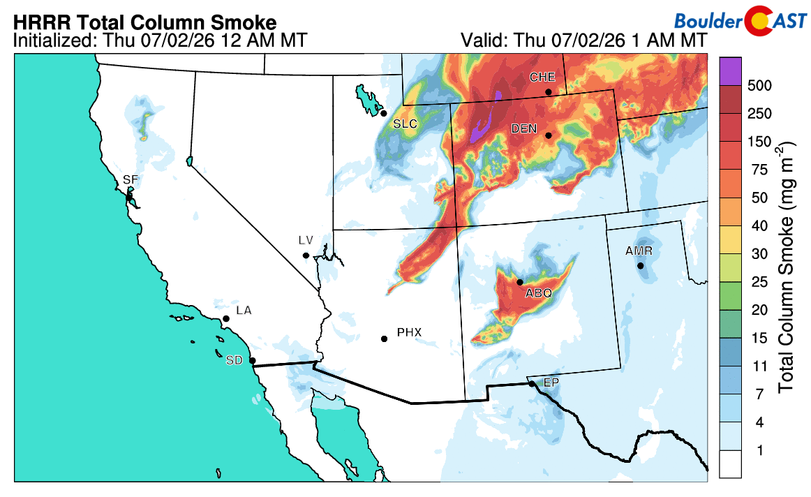
Fire weather conditions are expected to improve somewhat over the weekend with lesser winds, but for at least the next couple of days, smoke will remain thick in our skies and, at times, our lungs.
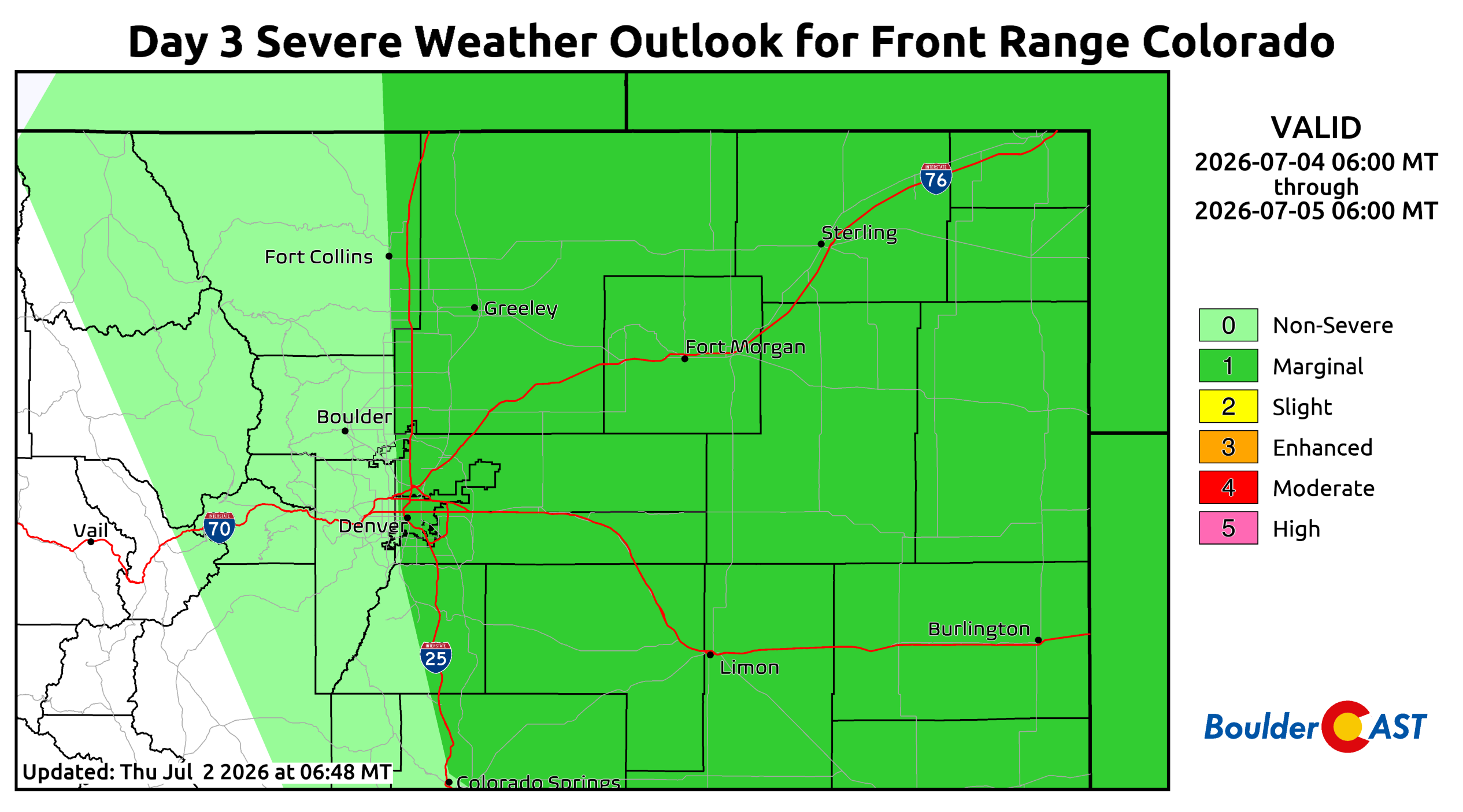
Fourth of July Weekend: Storms Return, But Still Limited Moisture
Despite lingering mid‑level dryness, low‑level easterly moisture begins to creep back into the Metro on Saturday, supporting a modest return of showers and thunderstorms.
Coverage in Boulder and Denver looks isolated to widely scattered, so most outdoor plans — including evening fireworks displays — should be fine. East of Denver, storms may become severe, with a Marginal Risk of hail/wind per the Storm Prediction Center. Highs will reach near 90° on Saturday with a 10–20% late‑day storm chance, wrapping up near sunset.
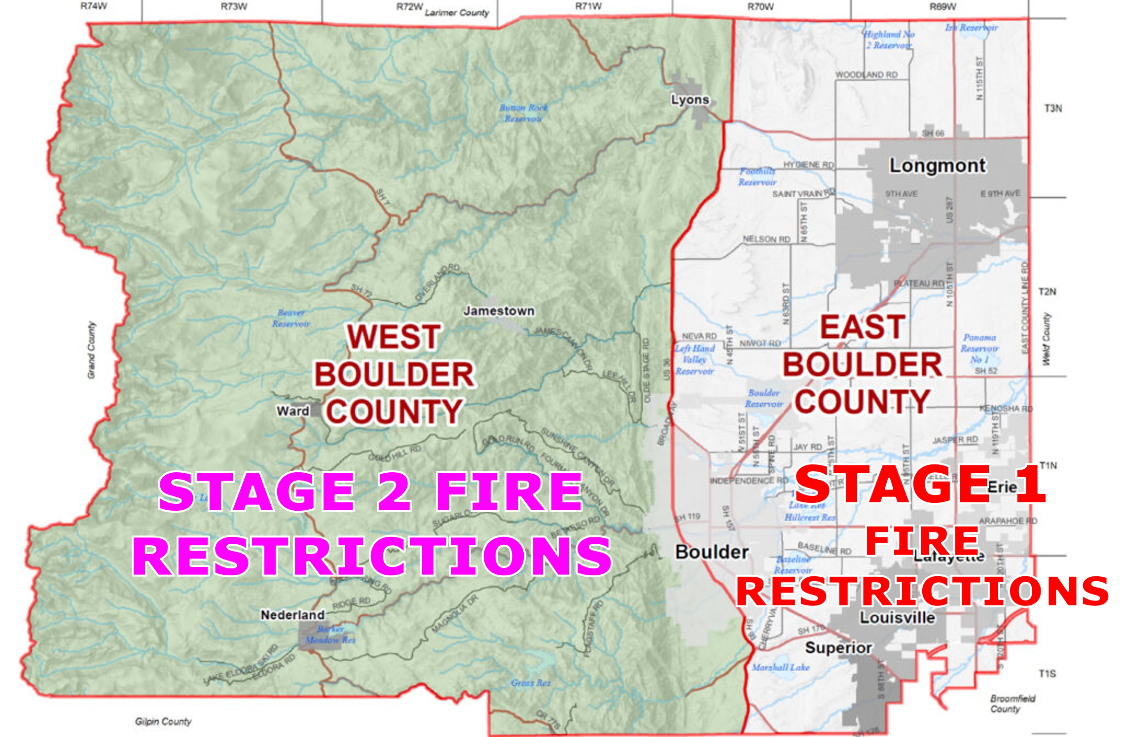
Please be aware the Boulder County has enacted Stage 2 (Foothills) and Stage 1 (Plains) fire restrictions. Use, sale, and possession of fireworks are prohibited county‑wide. You can read more about these restrictions on the County website. Other counties may have similar rules. Given the ongoing drought and active fires, avoiding fireworks entirely is the safest choice.
Sunday & Monday: More Typical Summer Pattern, Still Spotty Rain
By Sunday, deeper moisture — potentially aided by Douglas — begins to work into Colorado from the southwest. This will support a more typical July pattern: widely scattered late‑day storms rolling off the higher terrain into the Metro area. Highs will remain hot in the lower 90s Sunday and Monday.
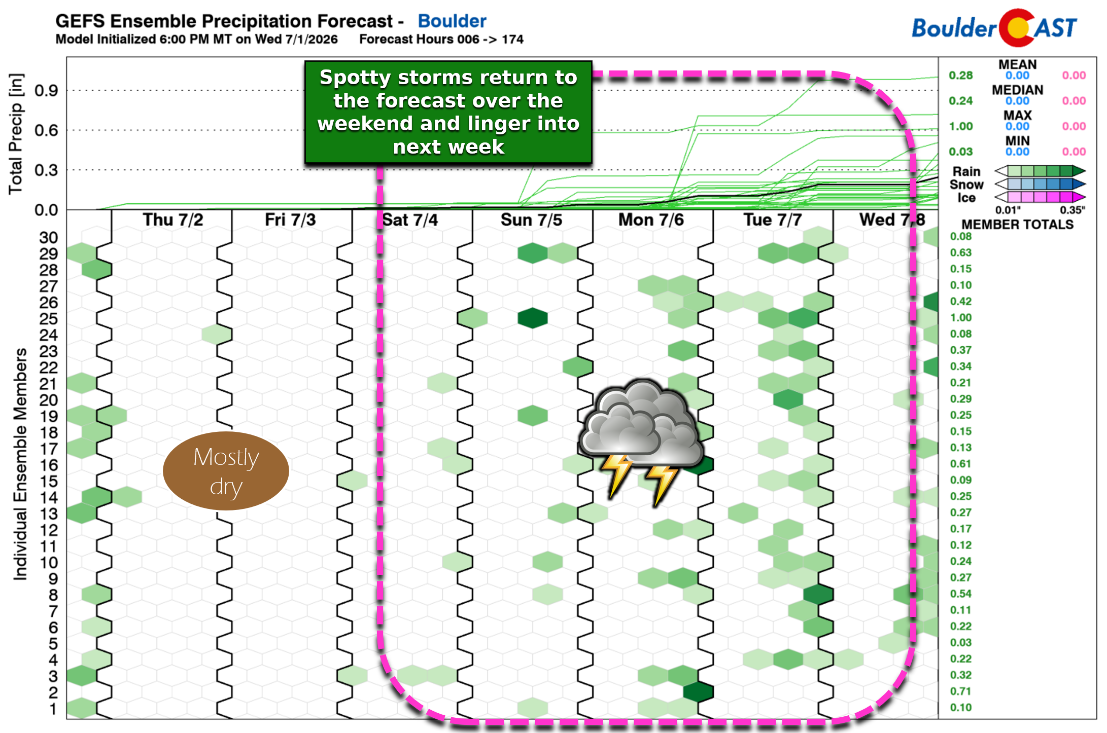
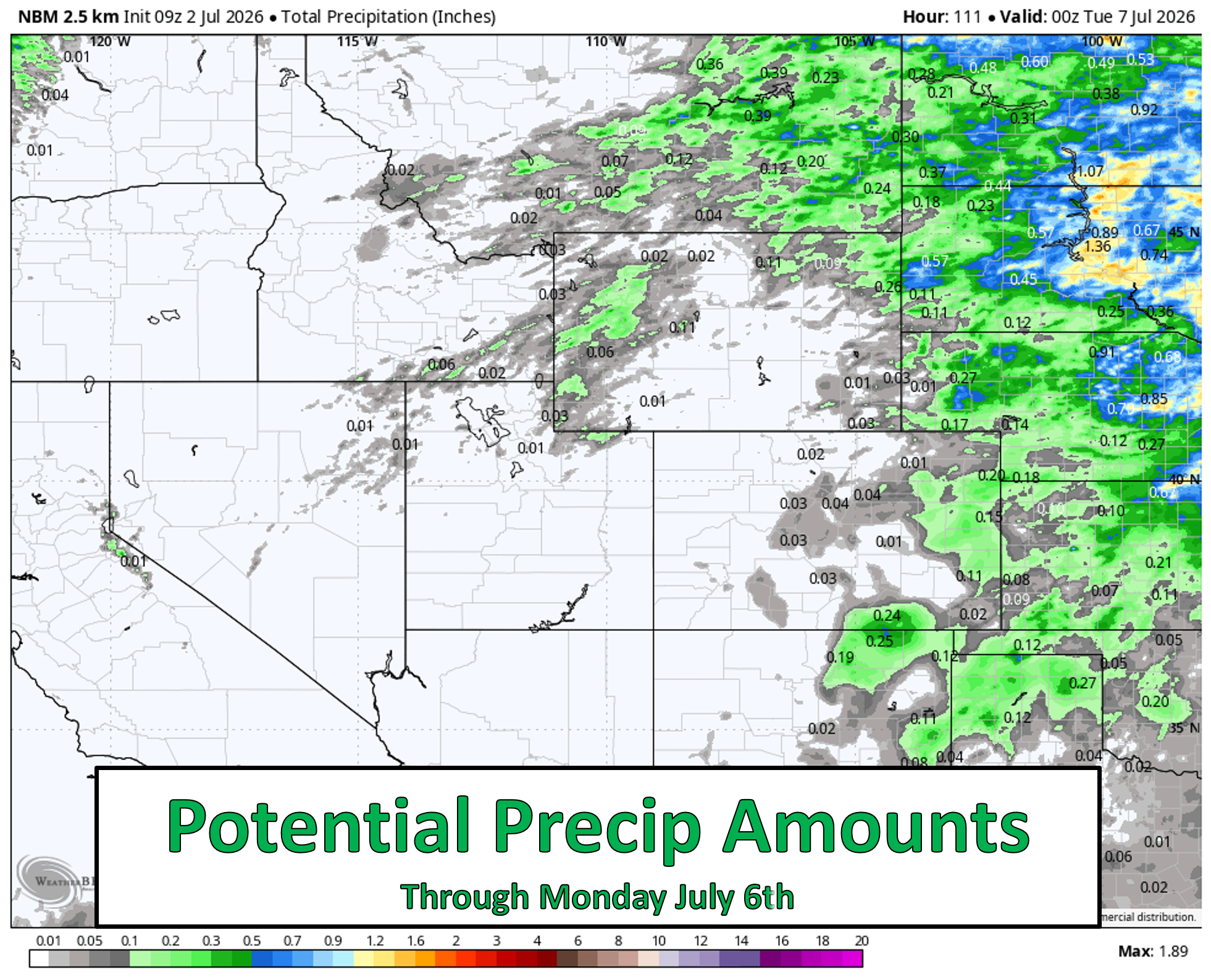
Despite the uptick in storms, rainfall totals will likely remain low. Most areas could stay under 0.1″, with only isolated pockets doing better. Storms will still be moisture‑starved, and dry or mostly dry lightning remains a concern in the higher terrain.
We saw this firsthand just last night when a dry lightning strike from a largely rain‑free nocturnal storm presumably ignited a small fire in Fourmile Canyon west of Boulder. The goods news is atmospheric conditions are not favorable for spread and this fire should be extinguished quickly Thursday morning.
Moisture deficits will continue to grow while drought intensifies across the Intermountain West and Four Corners. The European ensemble forecast below shows the expected cumulative precipitation anomaly over the next 10 days. Lots of brown across Colorado, especially in the Front Range Mountains and Foothills.
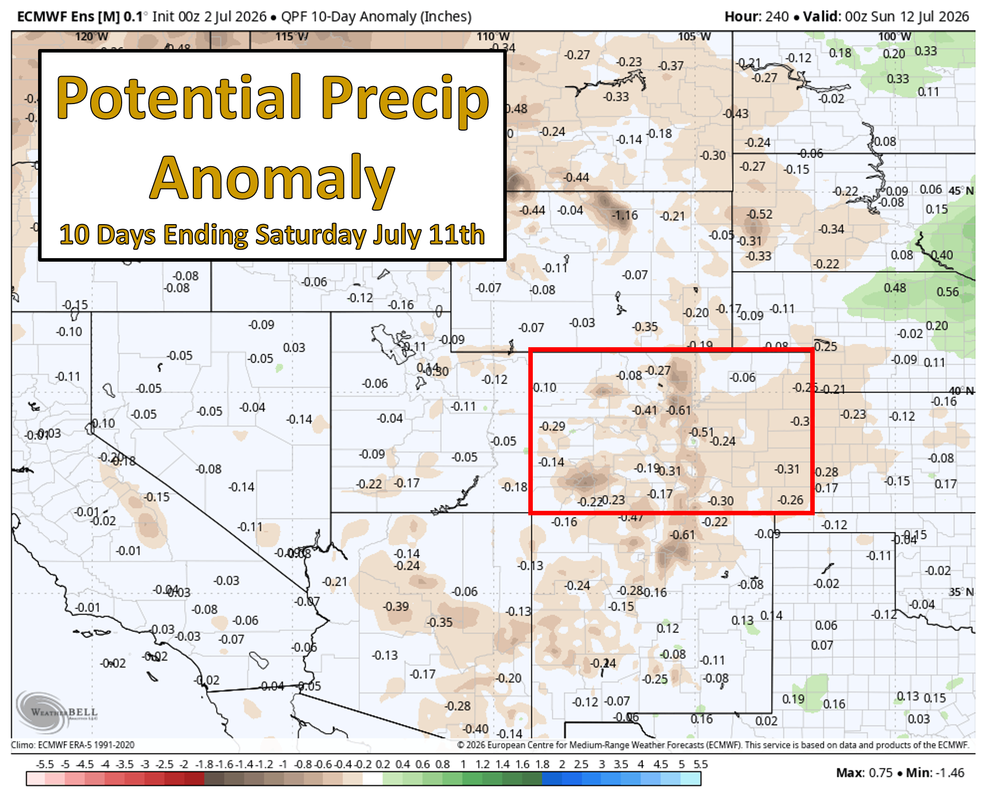
We still eagerly await the arrival of the summer monsoon to bring us more meaningful moisture, but it’s running well behind schedule. However, our confidence is starting to increase that the monsoon tap will begin to flow into the Southwest U.S. around the middle of the month.
Bottom Line
The broader takeaway is that Colorado is finally pivoting out of the entrenched southwest‑flow and fire weather regime that has dominated for more than a week. As the heat dome breaks down in the East and the western trough erodes, the Front Range will transition toward a more typical early‑July pattern: hotter temperatures, gradually lessening winds, and a slow but steady return of low‑level moisture capable of supporting a few storms.
Even so, meaningful rainfall looks limited, and the fire weather backdrop doesn’t disappear — it simply becomes less extreme. Smoke will linger, dry lightning remains a concern in the high terrain, and drought continues to amplify local vulnerability.
As we move through the holiday weekend and into next week, expect a familiar midsummer rhythm: hot afternoons, isolated storms drifting off the Mountains, and occasional pockets of better moisture depending on how much the Southwest tap — possibly aided by Tropical Storm Douglas — materializes.
In short, the pattern is improving, which is good, but it’s not fixed. Stay aware of fire restrictions, keep an eye on smoke levels, and enjoy the long, holiday weekend!
P.S. Don’t be the one to start our next wildfire!
Spread the word, share our crazy Colorado weather:
Go Premium, get all the perks.
Daily Forecast Updates
Get our daily forecast discussion every morning delivered to your inbox.
All Our Model Data
Access to all our Colorado-centric high-resolution weather model graphics. Seriously — every one!
Ski & Hiking Forecasts
6-day forecasts for all the Colorado ski resorts, plus more than 120 hiking trails, including every 14er.
Smoke Forecasts
Wildfire smoke concentration predictions up to 72 hours into the future.
Exclusive Content
Weekend outlooks every Thursday, bonus storm updates, historical data and much more!
No Advertisements
Enjoy ad-free viewing on the entire site.


Leave a Reply
You must be logged in to post a comment.