This brief lull in the action Wednesday morning won’t last long as the pattern is set to turn unsettled again in a hurry. A pair of poorly aligned disturbances is gearing up to bring the Front Range a long‑overdue dose of moisture — along with snow in the higher terrain. While the bullseye of heaviest precipitation is frustratingly expected to be south of our area again, a slew of marginal ingredients are coming together for what should be our most meaningful storm in months. We break down what to expect as we head into a soggy, colder, and in some cases, snowier end to the week.
What You Need to Know
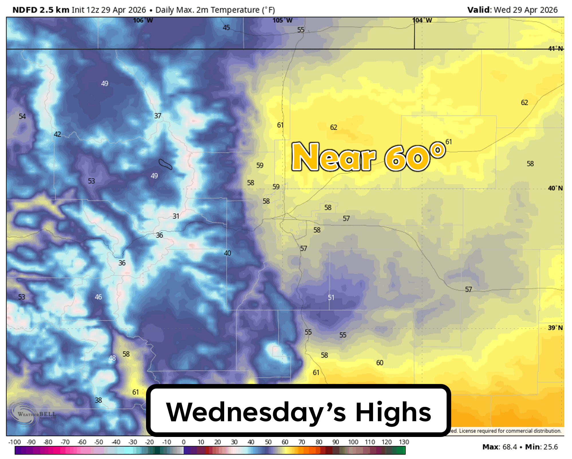
🌤️ Wednesday warms to near 60° with spotty showers, plus a low chance of thunder mainly south/east of Denver.
🌧️ Thursday is the main event: a long‑duration of weak ingredients bring widespread rain to the Denver Metro area from Thursday morning into Thursday night.
❄️ Foothills & Mountains see accumulating snow, several inches above 7500 feet and up to ~10″ along the Divide.
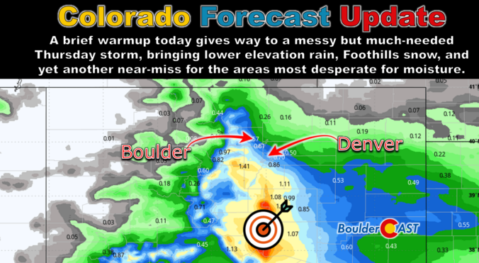
📉 Moisture bullseye stays south again, leaving Boulder and Denver in the 0.20–0.60″ range while southeast Colorado scores the bigger soaking.
🌵 Drought context: Not a game‑changer, but still should be one of our more meaningful moisture events in months — a needed slowdown to the ongoing intensifying drought.

Go Premium, get all the perks.
Daily Forecast Updates
Get our daily forecast discussion every morning delivered to your inbox.
All Our Model Data
Access to all our Colorado-centric high-resolution weather model graphics. Seriously — every one!
Ski & Hiking Forecasts
6-day forecasts for all the Colorado ski resorts, plus more than 120 hiking trails, including every 14er.
Smoke Forecasts
Wildfire smoke concentration predictions up to 72 hours into the future.
Exclusive Content
Weekend outlooks every Thursday, bonus storm updates, historical data and much more!
No Advertisements
Enjoy ad-free viewing on the entire site.
Wednesday: Warmest day of the week with spotty showers
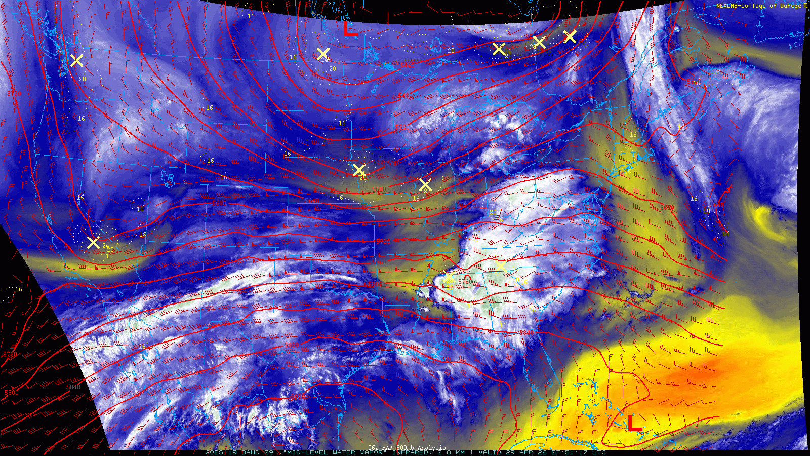
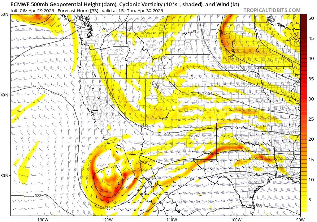
Broad but disorganized troughing remains sprawled across the western United States as of Wednesday morning, keeping the larger‑scale pattern unsettled. Mid‑level moisture continues streaming into the Four Corners, and several embedded shortwaves are rotating through in that flow. One of those disturbances — currently near Las Vegas and visible in the water vapor loop below — will swing across the Front Range this afternoon, perfectly timed to spark another round of isolated to scattered showers and a few thunderstorms.
Before that wave arrives, the first half of the day looks decent. Partly sunny skies and modest warming will push highs toward 60°, likely making today the warmest of the work week.
High‑resolution guidance shows convection initiating early this afternoon south of Denver, with some of that activity drifting north through the late afternoon and evening. This will not be a washout — far from it — but a broad 30-40% chance of showers exists from midday through midnight. Instability remains meager for most of the Denver Metro area, with CAPE values above 300 J/kg confined mainly to the Palmer Divide and areas east of Denver. That’s where a few rumbles of thunder are most likely. Light rain chances will fizzle around midnight as the shortwave exits into the Great Plains.
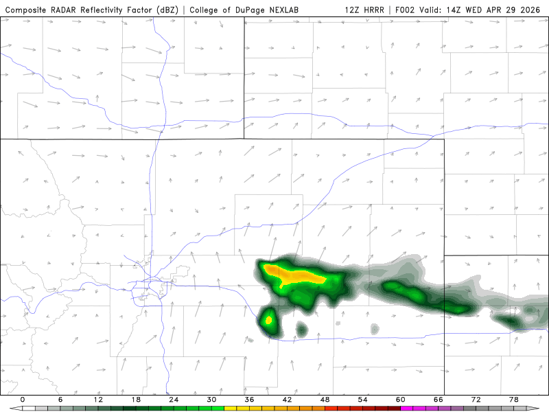
Simulated radar animation for Wednesday from the HRRR model. Widely scattered storms expected during the afternoon/evening, most numerous south/east of Denver.
Thursday: Widespread rain down low, accumulating snow in the Foothills
Thursday continues to stand out as the most impactful day of the week for the Front Range — and likely our best shot in months at a meaningful, slow‑burn moisture event. Even within 24 hours, forecast confidence hasn’t improved much thanks to a complicated late‑week setup involving two or three shortwaves trying (but mostly failing) to phase over the Four Corners.
The players:
- A chilly northern‑stream wave (or pair of waves) dropping south out of Canada into western Colorado and the Great Basin
- A moisture‑rich closed low lifting east‑northeast from Baja California into southern New Mexico, arriving a bit later than ideal
Neither system takes a classic Front Range‑friendly track, and neither is particularly strong. Instead, the key ingredient is duration: roughly 24 hours of weak but persistent forcing combined with modest moisture and deepening upslope from Thursday morning through Friday morning.
By midday Thursday, 10–20 MPH east‑northeasterly upslope develops up to 10,000 feet and persists for 12+ hours — a solid signal we love to see!
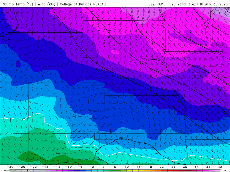
RAP 700mb temp/wind forecast animation for Thursday into Thursday night
At the same time the upslope is underway, weak forcing from the northern stream wave will be over the Front Range area alongside anomalous moisture, with this moisture pooling towards the terrain during the event. However, as we see in the animation below, the Denver area will be on the far northern fringe of the juice, with the tongue of above normal moisture just barely reaching into Boulder and maybe Fort Collins. Just north of us, very dry is noted along the Wyoming Border. The best moisture availability will be across southern Colorado and New Mexico for this event, tied to the warmer and wetter low pressure sliding in from Mexico.
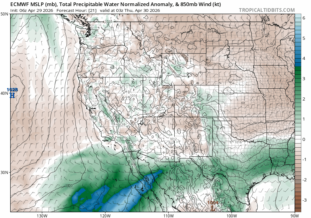
Model spread remains wide regarding how far north the precipitation shield will extend. The European model keeps the bulk of the QPF from Boulder County southward. Other guidance is more generous, pushing moisture farther into the Foothills and even parts of Larimer County — likely too optimistic given the overall setup and recent southward shift in the modeling.
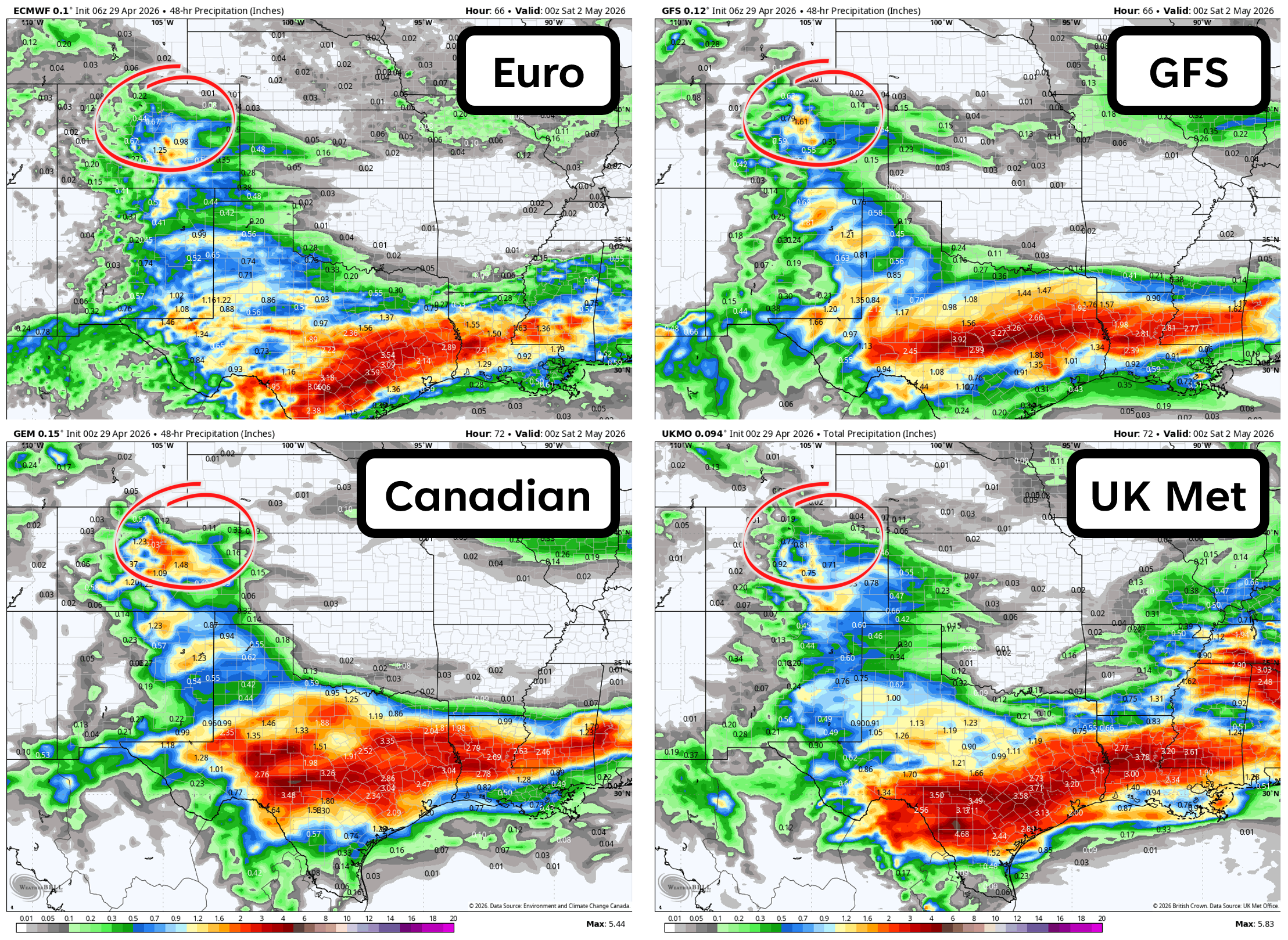
That southward drift in the guidance is hard to ignore. Colorado Springs is locked into a spring soaker, but Denver and Boulder will be fighting to reach 0.20–0.60″ of precipitation. Farther north into Weld and Larimer Counties, totals will end up lower still.
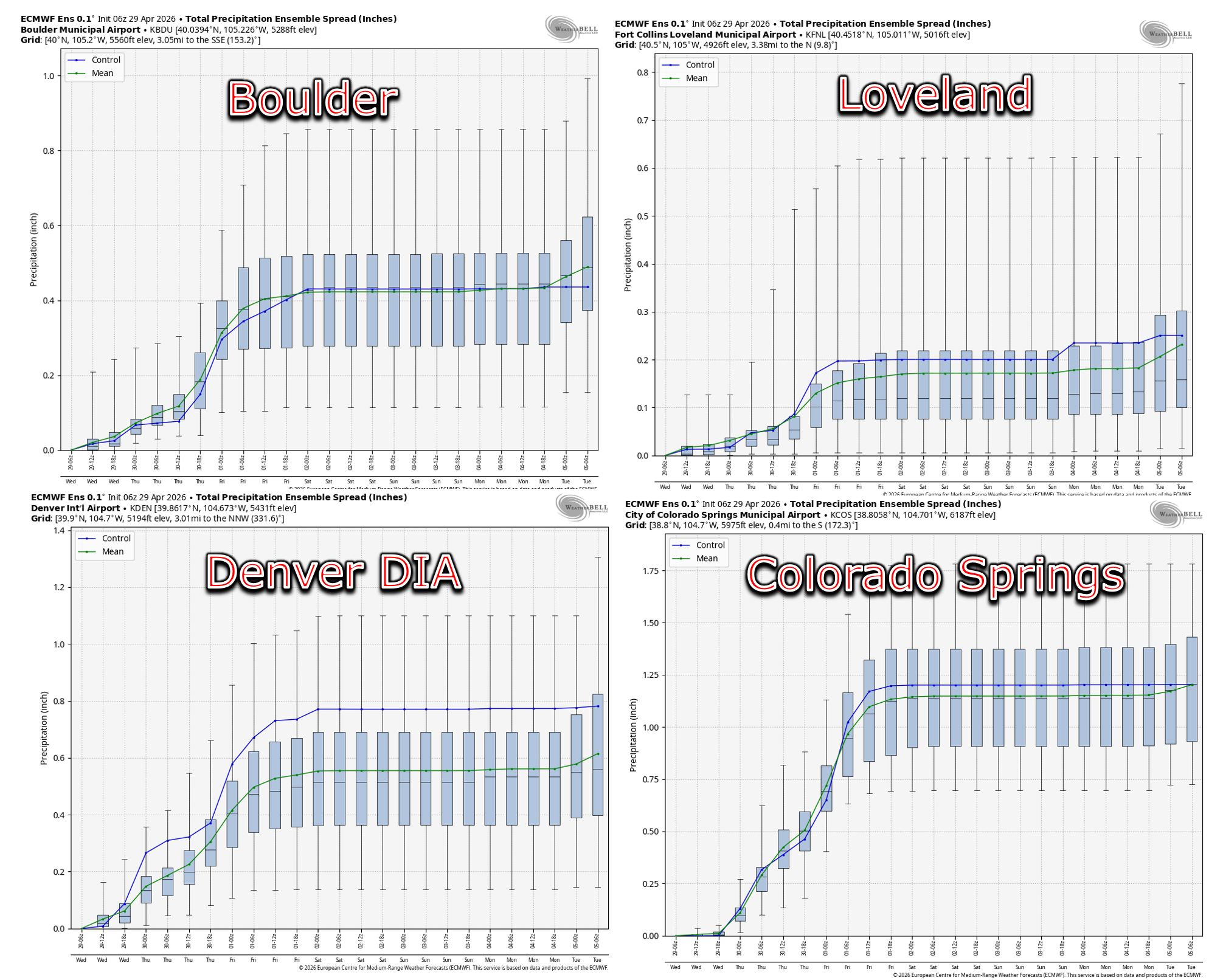
Blended guidance aligns with this idea: the bullseye misses us again — a familiar theme over the last six months.
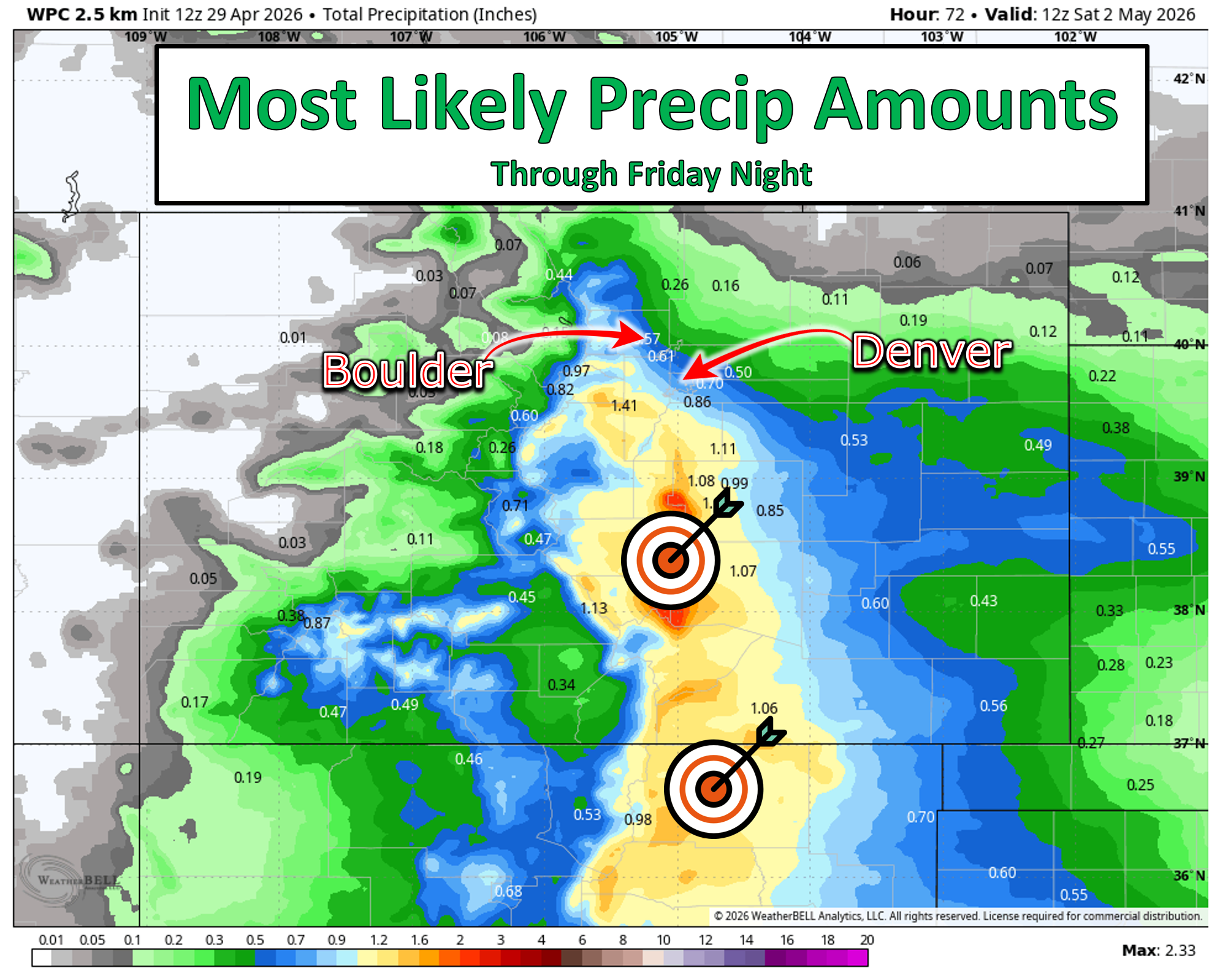
It’s hard to complain, though, as southern Colorado needs the moisture almost as much as we do.

Snowy in the Mountains and Foothills
Temperatures will be cold enough for snow in the Foothills and Mountains from this event. Snow levels hover near 7,500 feet Thursday but may dip to ~6,500 feet Thursday evening and night. Convective bursts could briefly drag flakes even lower, making a few wet snowflakes in Boulder or Denver not entirely out of the question. With surface temps in the upper 30s to mid‑40s, though, accumulation is not expected at lower elevations.
Above 7500 feet, several inches of wet snow are likely. Our snowfall forecast map below highlights the greatest totals along the Continental Divide from Rocky Mountain National Park to the Eisenhower Tunnel, where up to 10 inches may fall — enough for intermittent travel impacts Thursday evening into Friday morning especially. The Foothills west of Boulder could see a few inches as well, with the highest totals above 8,000 feet along the Peak‑to‑Peak corridor south toward I‑70.
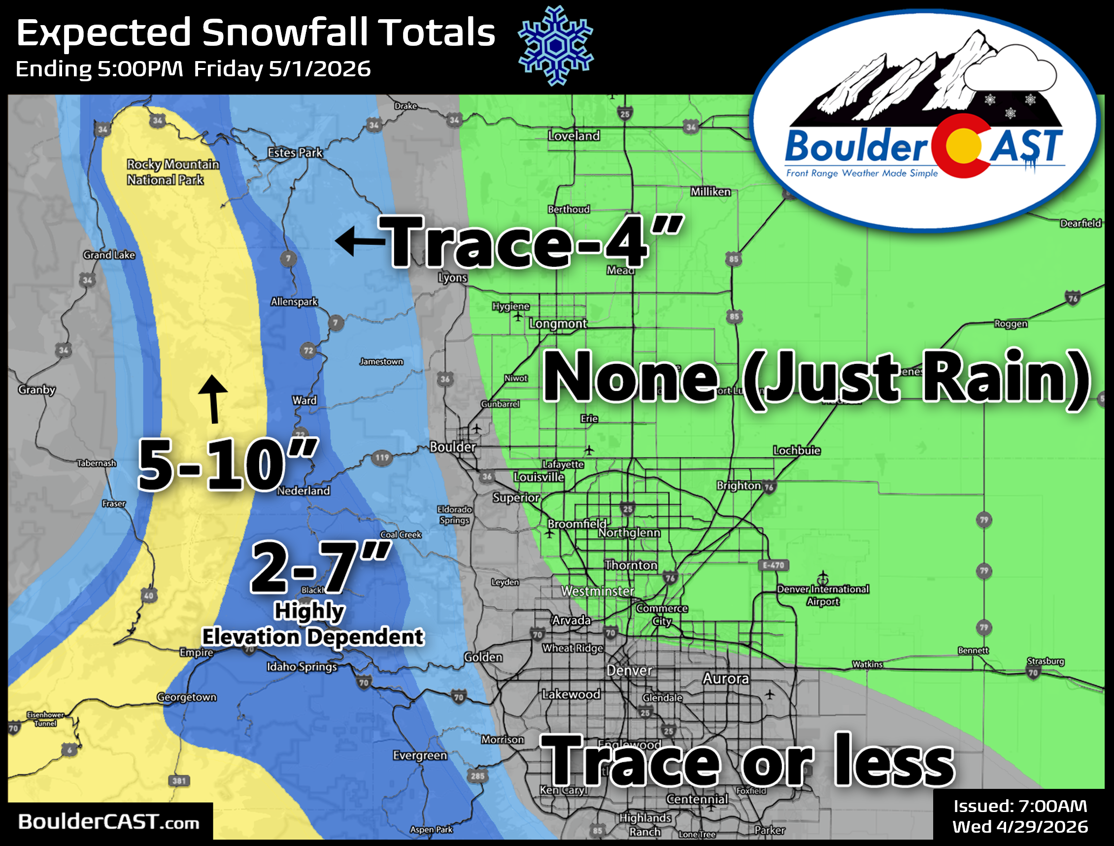
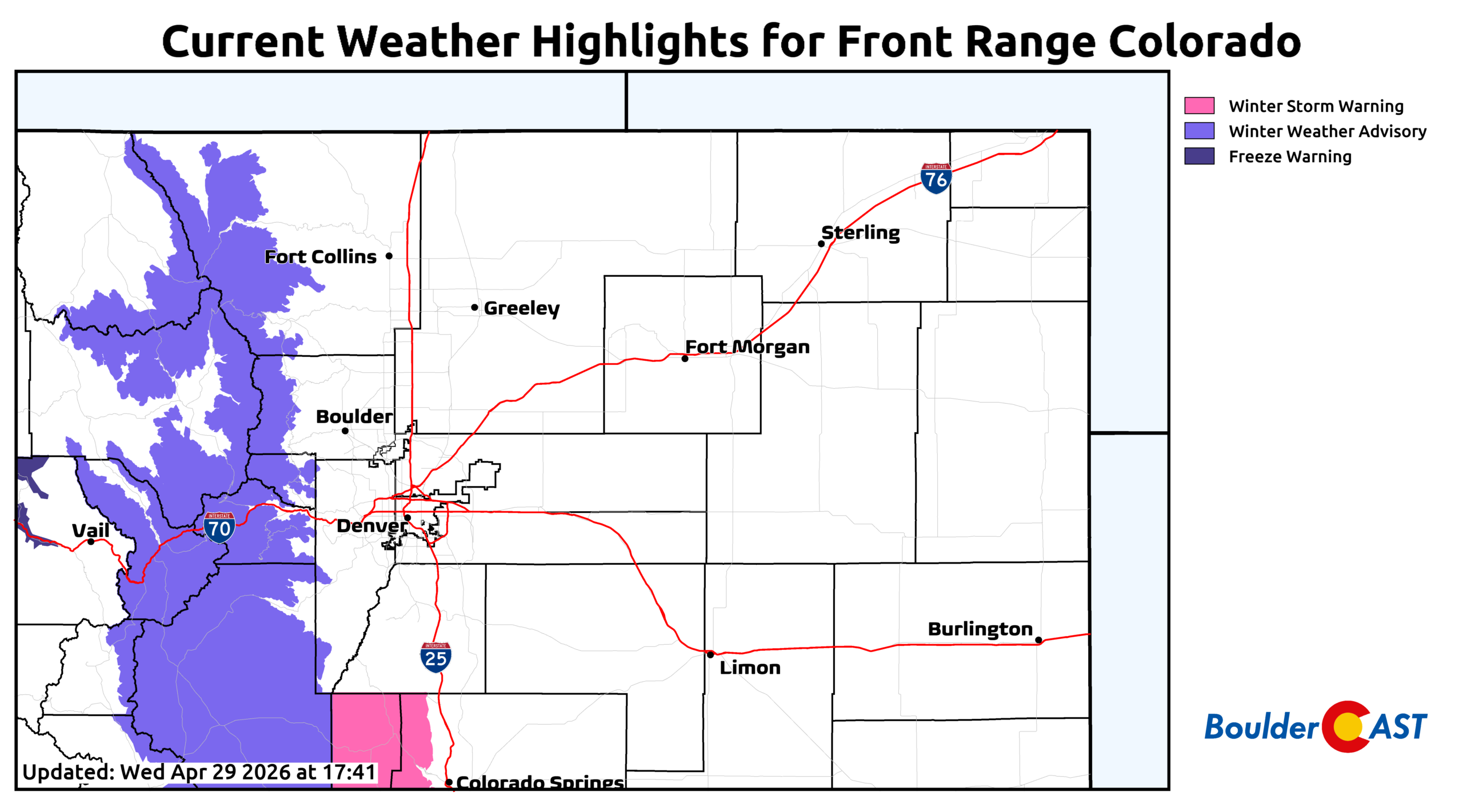
Winter Weather Advisories go into effect for areas above 9,000 feet from 6AM Thursday through 6AM Friday. These areas could see slushy or snow-covered roadways at times Thursday but more likely Thursday evening and night if snow sticks around.
Looking ahead, Friday will remain chilly in the 50s but with clearing skies through the day and largely dry weather. The upcoming weekend will be lovely with highs returning above normal in the upper 60s to lower 70s and more sunshine than we’ve seen all week.
Bottom Line
- Wednesday brings our warmest temps of the week near 60° with only spotty, low‑end showers and a couple rumbles of thunder mainly south/east of Denver.
- Thursday is the Main Event: a long‑duration, weakly forced system delivers 12+ hours of upslope, steady light rain for most of the Metro area, and accumulating snow above ~7500 ft in the Foothills and Mountains.
- Moisture placement remains uncertain, but the latest trends keep the heaviest precip south of Boulder and Denver, with our area likely landing in the 0.20–0.60″ range — less north, more south.
- High Country Snow: several inches above 7500 feet, up to 10″ along the Divide, with travel impacts Thursday evening into Friday morning.
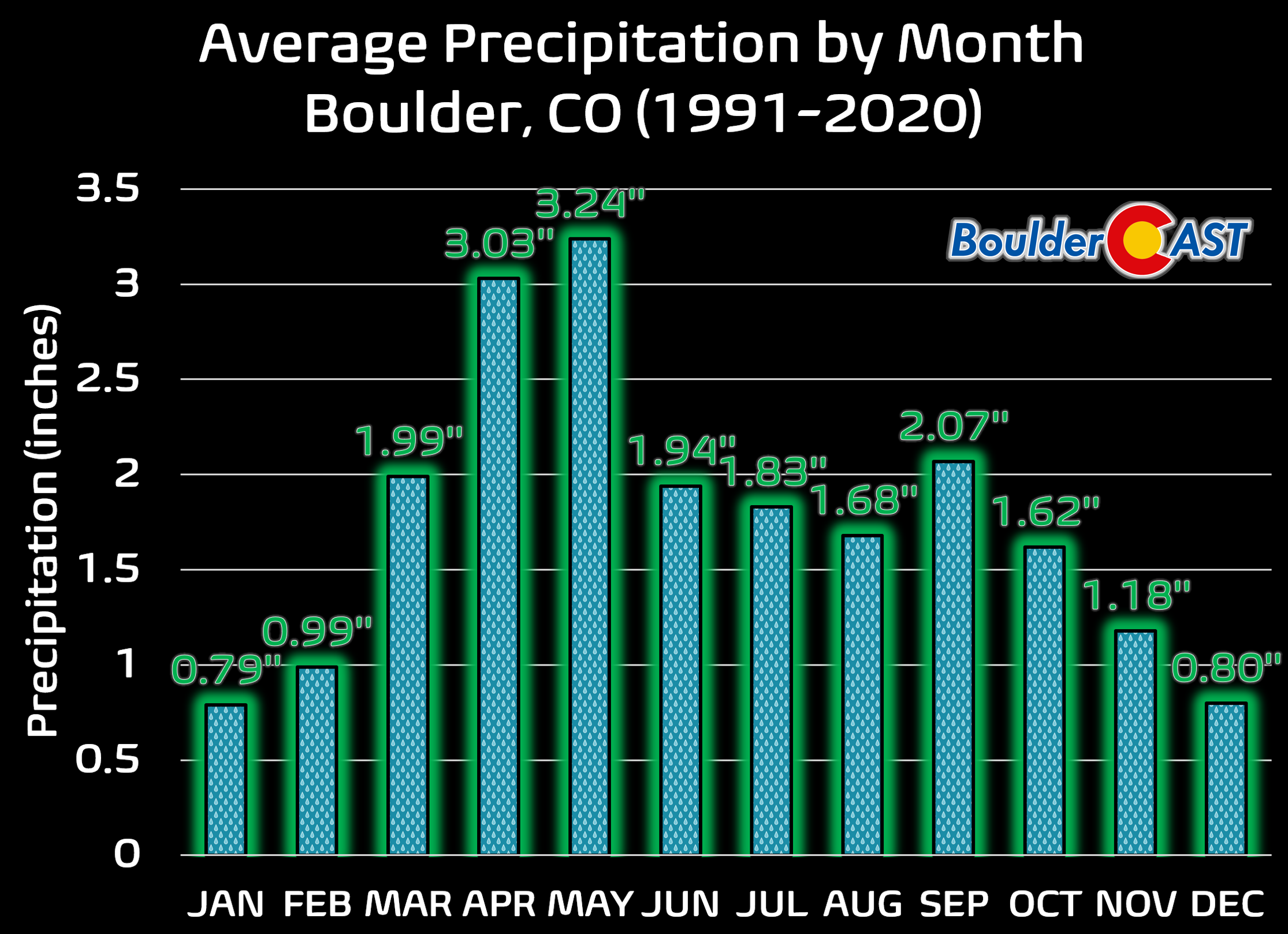
- Drought Buster This Ain’t: Even if the bullseye misses us again, this is still one of the more meaningful precipitation events we’ve seen in months. It won’t fix the Front Range’s entrenched moisture deficit — especially after a winter that repeatedly underperformed — but it will at least help to slow drought intensification heading into May which is historically our wettest month. Southern Colorado gets the goods!
Spread the word, share our crazy Colorado weather:
Go Premium, get all the perks.
Daily Forecast Updates
Get our daily forecast discussion every morning delivered to your inbox.
All Our Model Data
Access to all our Colorado-centric high-resolution weather model graphics. Seriously — every one!
Ski & Hiking Forecasts
6-day forecasts for all the Colorado ski resorts, plus more than 120 hiking trails, including every 14er.
Smoke Forecasts
Wildfire smoke concentration predictions up to 72 hours into the future.
Exclusive Content
Weekend outlooks every Thursday, bonus storm updates, historical data and much more!
No Advertisements
Enjoy ad-free viewing on the entire site.


You must be logged in to post a comment.