
A tandem of low pressure systems — one warm and moisture‑rich, the other colder and more dynamic — teamed up just enough to deliver a surprisingly efficient burst of snowfall across the Front Range to end the week. We break down how this two‑part event unfolded, why the timing mattered so much, and where our forecast over‑ and under‑performed.
ur late‑week snowstorm arrived in two distinct acts, each driven by its own piece of atmospheric energy sliding across the southern Rockies — and neither particularly interested in phasing cleanly with the other. The opening act featured a warm, moisture‑laden low lifting out of Baja California Thursday morning into the afternoon. This system delivered a long stretch of wet, low‑intensity snowfall across the Metro area, the kind that coats everything in a slush but struggles to accumulate meaningfully. Most locations picked up under an inch of goop from this first wave. Act two was the colder, more dynamically impressive system. It dove out of the Pacific Northwest late Thursday, sharpening into a classic Four Corners low by early Friday. This was the piece of the puzzle with better upslope potential — and the one we were watching most closely.
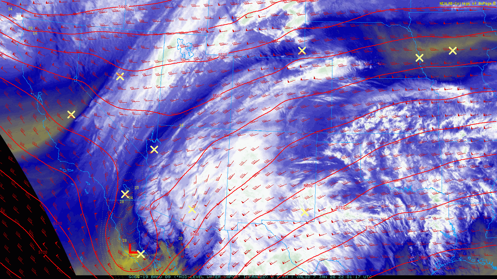
From the start, the biggest wildcard of the entire event was how efficiently these two disturbances might “hand off” forcing. The warm, juicy Baja system was exiting just as the colder, more upslope‑friendly wave arrived. That imperfect timing left a narrow window for enhanced lift, but the atmosphere made the most of it. The well‑advertised surge of upslope Thursday night ignited several intense, slow‑moving snow bands, some producing snowfall rates near or exceeding 1 inch per hour. These bands ultimately nudged parts of the Boulder–Denver corridor toward the upper edge — and in a few cases slightly beyond — our forecast ranges.
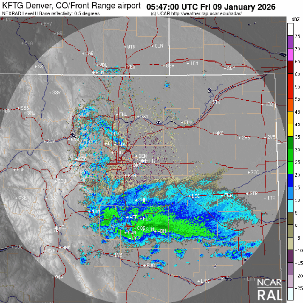
Radar imagery from roughly 11 PM Thursday through 8 AM Friday tells the story clearly: once the upslope arrived, banded snowfall blossomed and drifted south and southwest through the overnight hours, laying down a surprisingly efficient accumulation swath west of Interstate 25.
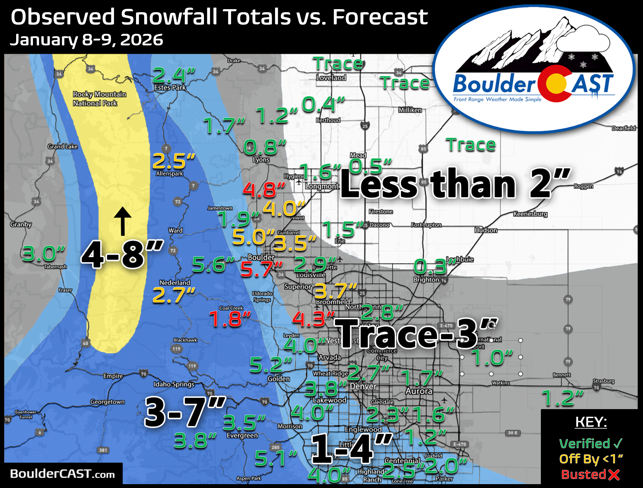
Our snowfall forecast map issued Thursday morning is shown below with storm totals overlaid. Green values indicate our forecast verified, Yellow values mean the observed total was just outside our forecast, while Red was a busted forecast (more than 1″ off). Overall, verification was solid. Boulder County, however, proved tricky — the city over‑performed with “booming” totals, while the Foothills came in a bit under expectations.
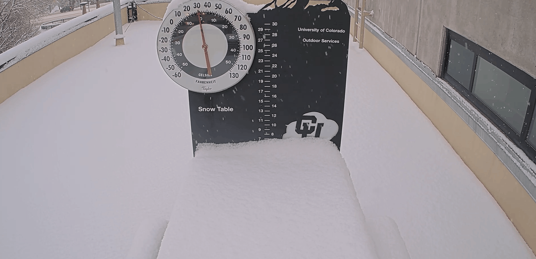
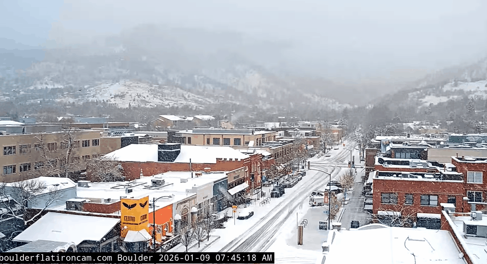
As of this writing, with a few stray flakes still fluttering around, Boulder has officially recorded 5.4″ from the two‑part event (about 1″ from wave one and over 4″ from wave two). Meanwhile, Denver (DIA) checked in with 1.0″ as of midnight, with the second wave largely bypassing the airport. See the CoCoRaHS page for a closer look at snow reports in your specific neighborhood.
You can find a recap of all the winter storms so far in the 2025-2026 snow season HERE.
Moisture totals (rain + melted snow) came in respectable, but still lower than the early model projections. Totals ranged from less than 0.1″ (north/east) to around 0.4″ in/near Boulder.

Moisture total (melted snow water) from this event
This is a welcome shot of moisture for the region. It’s nowhere near enough to erase our ongoing drought, of course, but for what is typically our driest month of the year, it’s a solid contribution to the ledger.

Melting ahead this weekend
For the rest of Friday, lingering snow will taper off through the morning quickly, giving way to gradually increasing sunshine by afternoon.

Looking ahead, a ridge builds over Colorado this weekend, bringing a quick warm‑up under sunny skies and light winds. Our next chance for precipitation — assuming we see anything at all — doesn’t arrive until the middle of next week. Until then, enjoy a bright, quiet weekend and the satisfying slow‑motion melt of our fresh snowpack.

Spread the word, share our crazy Colorado weather:

Go Premium, get all the perks.
Daily Forecast Updates
Get our daily forecast discussion every morning delivered to your inbox.
All Our Model Data
Access to all our Colorado-centric high-resolution weather model graphics. Seriously — every one!
Ski & Hiking Forecasts
6-day forecasts for all the Colorado ski resorts, plus more than 120 hiking trails, including every 14er.
Smoke Forecasts
Wildfire smoke concentration predictions up to 72 hours into the future.
Exclusive Content
Weekend outlooks every Thursday, bonus storm updates, historical data and much more!
No Advertisements
Enjoy ad-free viewing on the entire site.


You must be logged in to post a comment.