The week ahead will feature persistent northwest flow across the northern Rockies which will keep things sunny, mostly dry and generally mild for us in the Front Range. Overall temperatures will be up and down with the only chance of rain for the week coming late in the day Tuesday. There’s no snow in the pipeline either, but frost will be possible Thursday morning especially in outlying areas. Read on for our complete outlook of the weather week ahead.
This week’s highlights include:
- Northwest flow will dominate our weather throughout the week and likely much of next week as well
- This will translate into mostly dry conditions with near normal temperatures but with frequent weak cold fronts and brief warm-ups
- The first front arrives Tuesday evening offering up what will be our only chance of rain for the week, then another front on Wednesday
- Keep an eye on Thursday morning for potential frost in outlying areas!
- Friday will be gorgeous and warm — close to 80 degrees
- Another series of cold fronts arrive for the weekend with temperatures temporarily cooling off a tad — frost/freeze potential returns
DISCLAIMER: This weekly outlook forecast is created Monday morning and covers the entire upcoming week. Accuracy will decrease as the week progresses as this post is NOT updated. To receive daily updated forecasts from our team, among many other perks, subscribe to BoulderCAST Premium.
A mostly dry week stuck in northwest flow
Those hoping for a shift to colder and more typical weather for mid-October will find little to cheer about in this week’s forecast. Last week we mentioned (on Twitter) a few distant hints of snowflakes in the extended outlook. While a strong storm system is indeed going to drop out of Canada this week, it will track too far north and east to bring any major impacts to northeast Colorado. Models have continued to trend this system even further away from our area over this past weekend. Sorry snow-lovers!
❄️ Starting to see some blue bars appearing in our Snowfall Probabilities mid to late next week! Just something to keep an eye on for now… 👀 https://t.co/uQNnjZw7vG #COwx #DEnver #Boulder pic.twitter.com/5k8zTCnKoG
— BoulderCAST Weather (@BoulderCAST) October 5, 2022
We begin the week under a familiar northwest flow pattern, the same setup which has largely existed for the entire month of October thus far across the northern Rockies. In fact, northwest flow will dominate our weather here in Colorado through this week and likely much of next week as well. For those new to the game, northwest flow will generally translate to mostly dry conditions with near to slightly below normal temperatures in the Front Range. However, northwest flow also leaves our area susceptible to backdoor cold fronts arriving from the Great Plains, something we saw last week and will stumble upon again in the coming days. Let’s get to it!
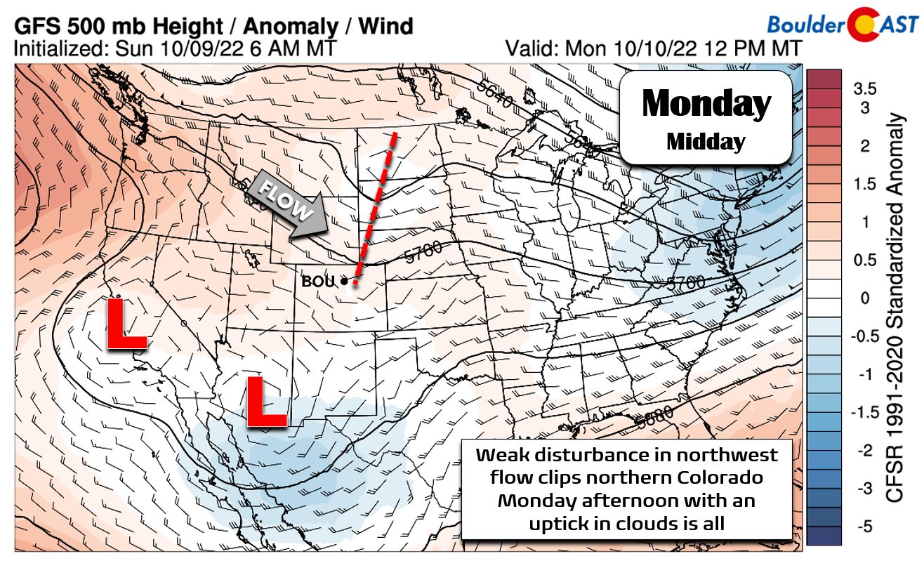
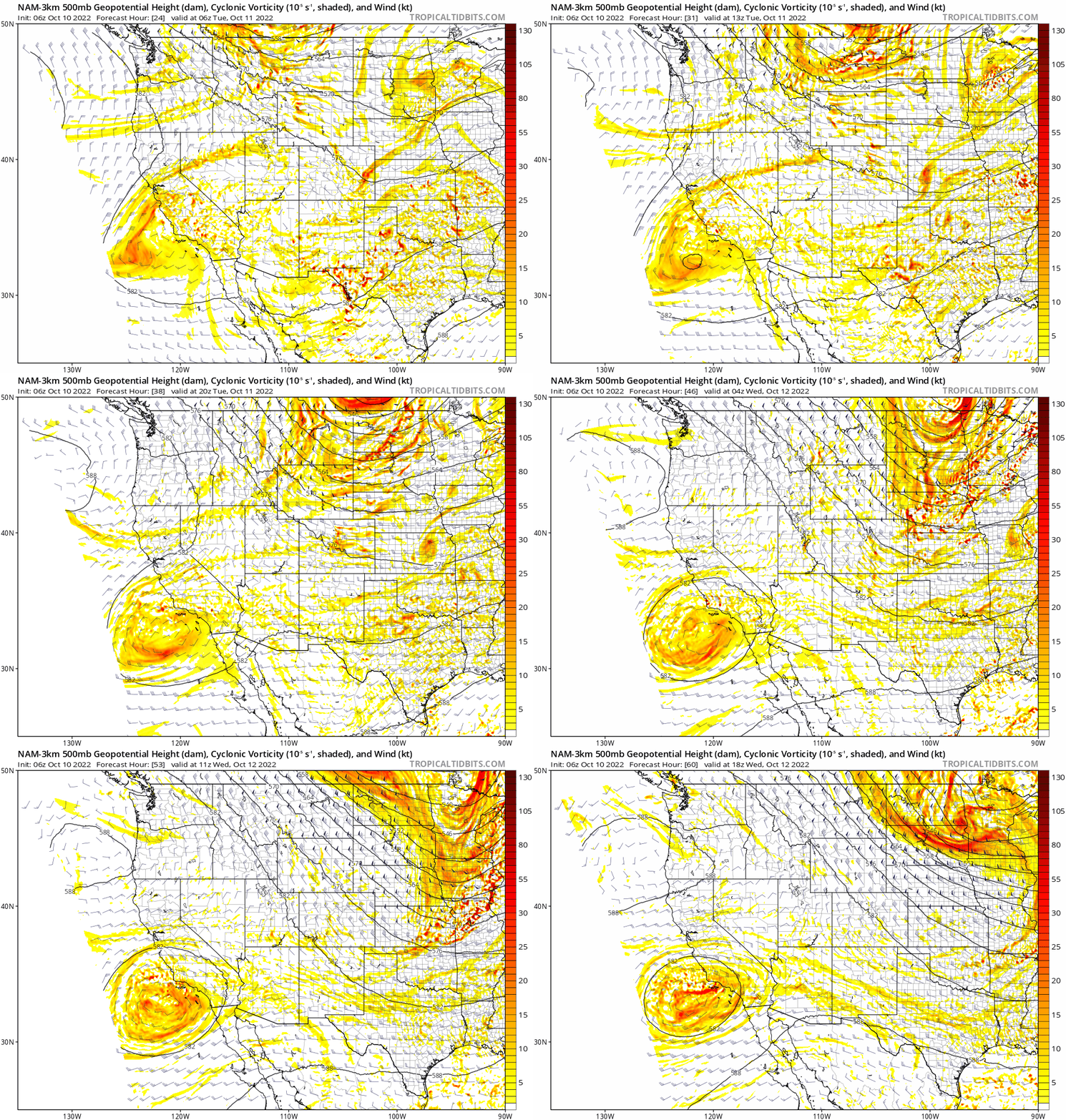
The situation on Monday has only the faintest of shortwave disturbances clipping northern Colorado — this too is a feature in the northwest flow. It will come and go without much action for us. Monday will begin with full sun and turn partly cloudy quickly through the afternoon as the trough moves through. Temperatures will reach the middle 70s — a few degrees above normal for this time of year.
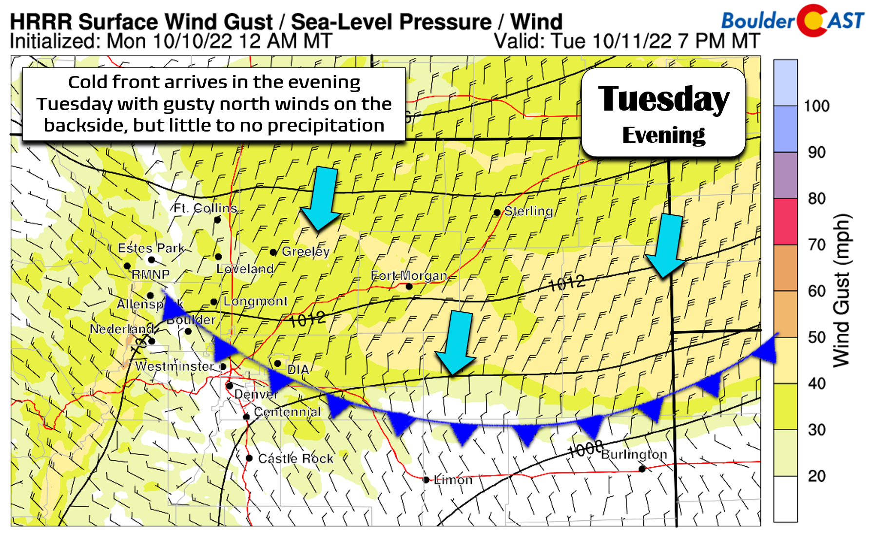
Tuesday will be a relatively quiet day as well, though things will be transitioning as the aforementioned potent storm dives out of western Canada into the Dakotas. The very tailend of this system will clip Colorado with an associated backdoor cold front reaching the Front Range around sunset Tuesday evening.
Before this though, Tuesday will be another definitively mild day with temperatures in the middle 70s under clouds and sun. It will be breezy at times in the afternoon with low humidities as well, raising the dial on fire danger somewhat. No Red Flag Warnings are expected, though. Northwest winds will gust 15 to 30 MPH during the day, highest east of Denver and north along the Wyoming Border area. Winds turn northerly behind the evening front and may gust in excess of 40 MPH east of Denver.
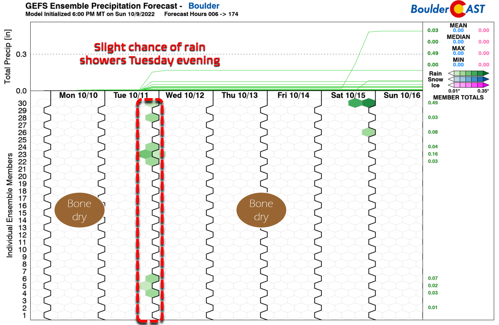
As the front moves through Tuesday evening around sunset, there will be a chance of isolated to widely scattered rain showers across the area. However, we are not expecting much at all given the dry lower atmosphere — especially since models have been taking this system and its energy further east. Expect about a 10-20% chance of rain Tuesday late afternoon into the middle evening. Remember, that means most of us will remain dry. The way the forecast is shaping up, this will unfortunately be our only chance of precipitation for the week…
Despite the frontal passage, Wednesday could easily climb close to 70 degrees again by late afternoon with full sunshine — the cooler airmass barely reaches the Front Range. There will be a secondary slightly stronger (but still dry) cold front dropping southward during the day. It will bring an uptick in north winds but not much else. Temperatures will fall behind this front somewhat back into the 60s for highs on Thursday. We will have to watch Thursday morning in particular for a chance of frost in the Boulder-Denver Metro, especially in outlying areas, as temperatures drop well into the 30s over most of the lower elevations. Downtown Denver and Boulder proper probably dodge the frost, but do keep an eye on Thursday morning for your gardens and potted plants!
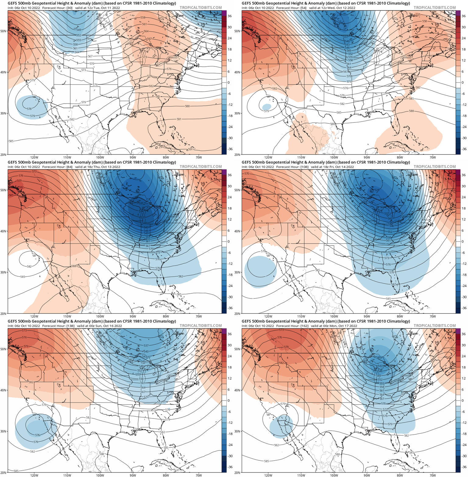
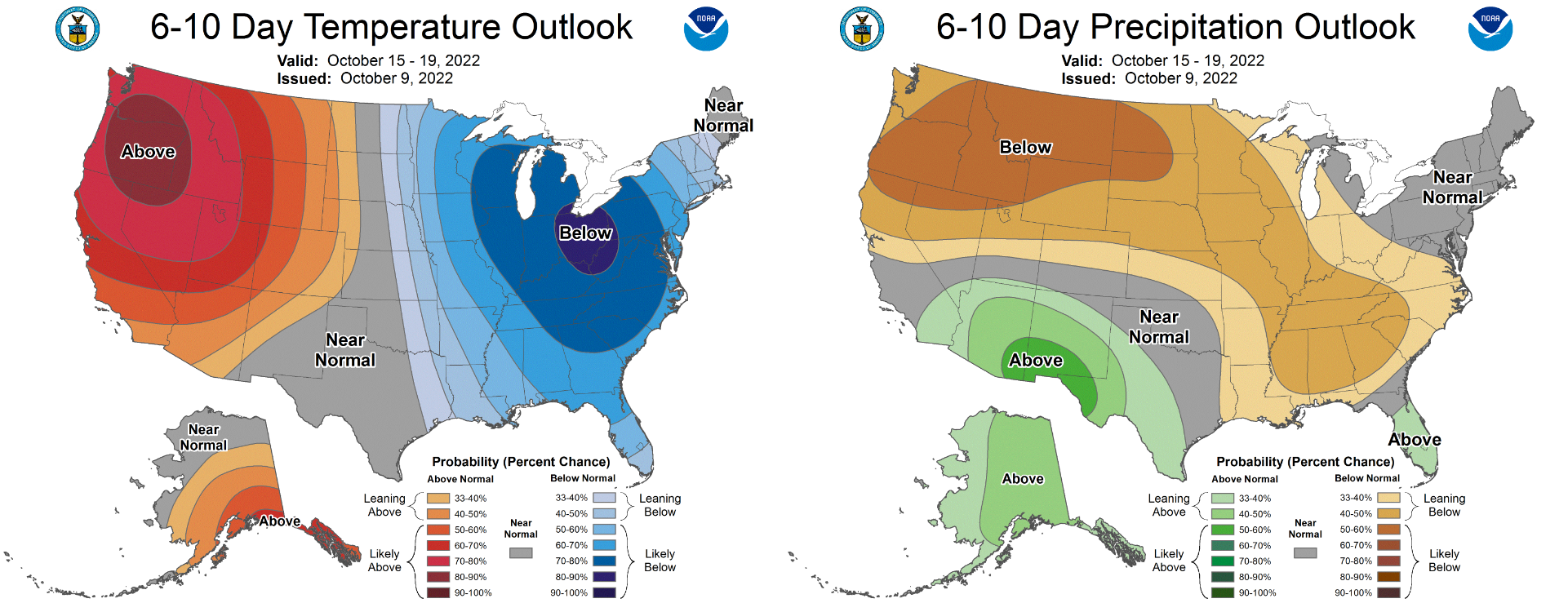
Towards the end of the week, that trough will move into the Great Lakes and a strong dipole pattern will develop across the United States — one with a deep trough over the Great Lakes and a formidable ridge in the Pacific Northwest. Models advertise this setup as a persistent one indeed, likely lasting from the weekend through most of next week! Ultimately this will translate into continued but gradually weakening northwest flow over Colorado in the extended.
By Friday, temperatures will warm up nicely into the middle to upper 70s with mostly sunny skies. For the weekend, another backdoor cold front is projected to reach our area with a timing varying in the global models from early Saturday to early Sunday. This will of course play into how warm we get over the upcoming weekend. Regardless, Saturday and Sunday will be dry and partially sunny. Do keep an eye on that weekend system for potential frost and freezing conditions Sunday into Monday. Given the clear skies, even the weakest of weather-makers this time of year can translate into frost or freeze conditions for the Front Range. The nights are getting too long for Mother Nature to hold off those chilly temperatures much longer…
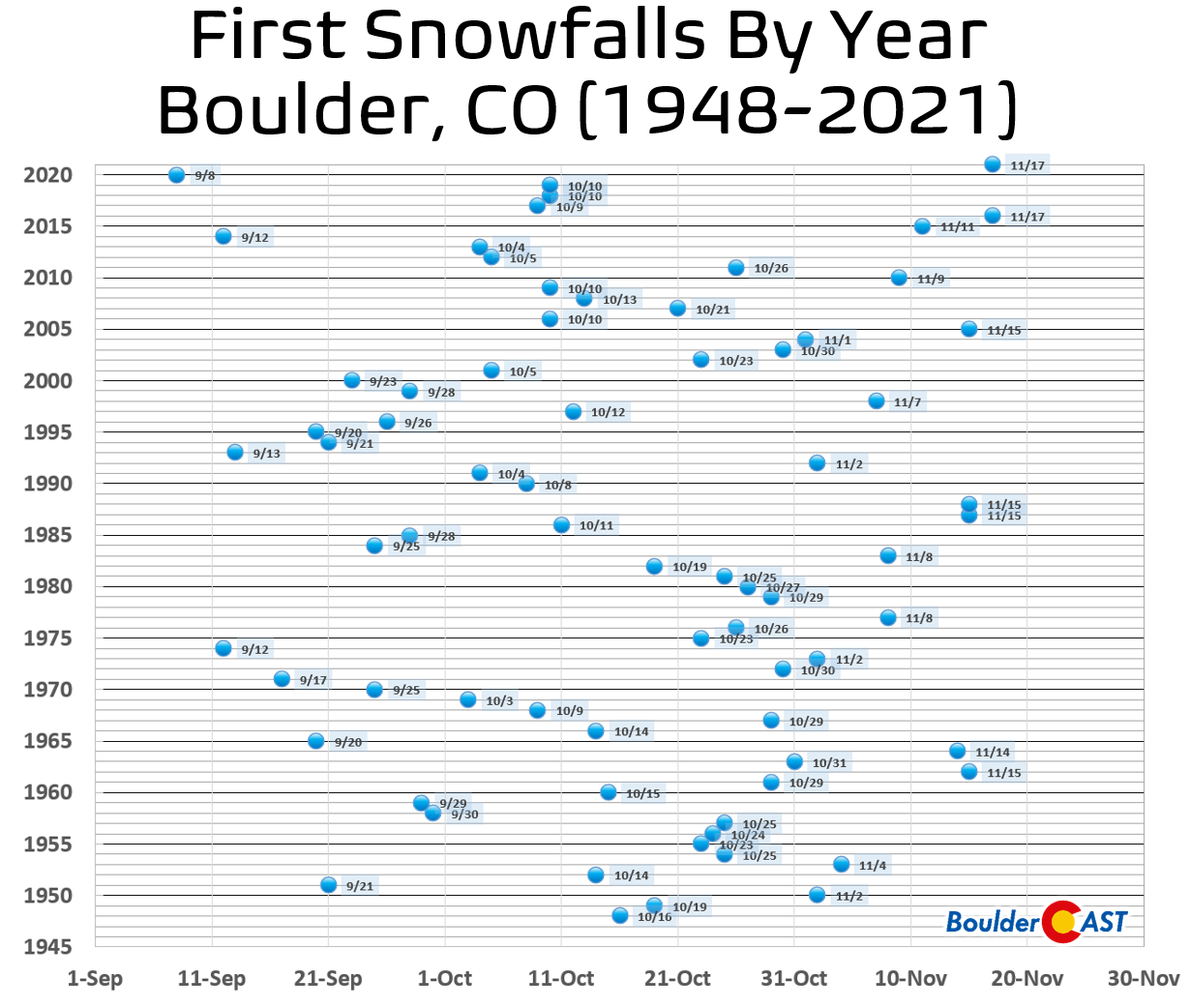
There’s still no real chance of snow in the pipeline for the Front Range lower elevations. The median date of Boulder’s first accumulating snowfall is October 17th. That date is next Monday and will surely come and go without any frozen precipitation to speak of — thereby dooming this snow season to commence later than normal for the second year in a row…
Forecast Specifics:
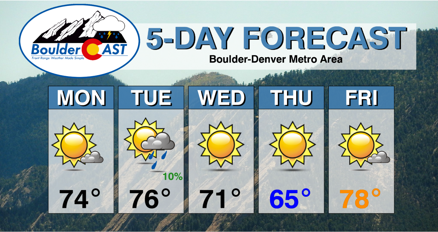
Monday: Lots of sun early with some clouds rolling off the higher terrain in the afternoon. Highs in the middle 70s across the Plains with lower 60s in the Foothills.
Tuesday: Quite mild with increasing clouds during the afternoon/evening. Breezy with northwest winds gusting 15 to 25 MPH during the afternoon. A slight chance of rain showers is possible late afternoon into the evening, but most spots remain dry. Highs reach the middle 70s again on the Plains with lower 60s in the Foothills.
Wednesday: Sunny again with slightly cooler readings and light breezes. Temperatures top out in the lower 70s on the Plains and in the middle 50s in the Foothills. A secondary cold front moves through during the day with declining temperatures.
Thursday: After potential morning frost in outlying areas, temperatures rise into the middle 60s on the Plains with full sunshine. Highs only in the lower 50s in the Foothills.
Friday: Mostly sunny and warm with highs topping out in the middle to upper 70s on the Plains with middle 60s in the Foothills.
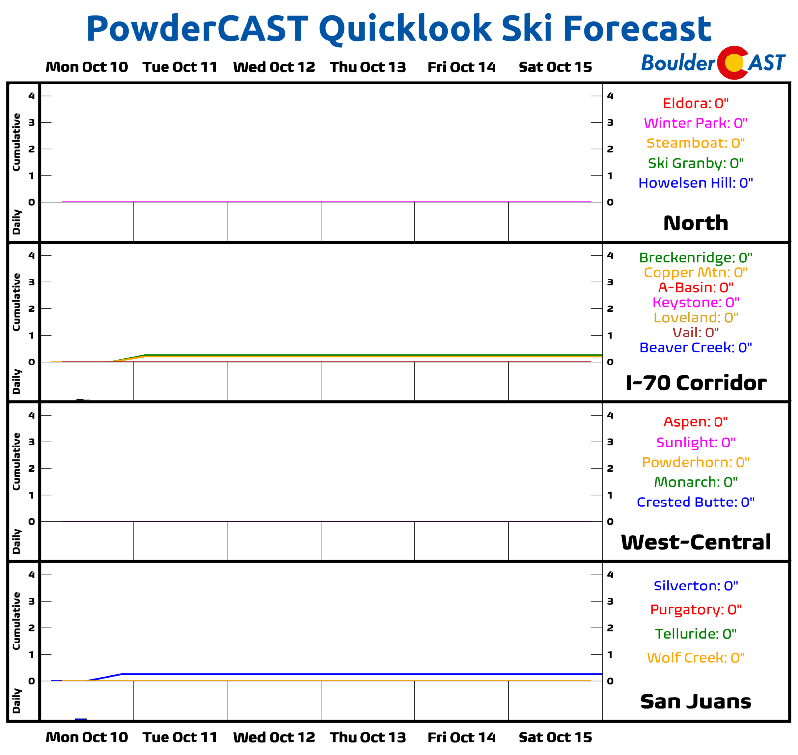
High Country: Just like the Denver Metro area, the week will be mostly dry in the Mountains as well. There is a slight chance of isolated showers Monday afternoon and evening. Otherwise, winds will be gusty out of the northwest much of the week with mostly sunny skies. Nighttime temperatures are getting cold enough that many higher elevation ski resorts (such as A-Basin) are able to turn on the snow machines.
Help support our team of Front Range weather bloggers by joining BoulderCAST Premium. We talk Boulder and Denver weather every single day. Sign up now to get access to our daily forecast discussions each morning, complete six-day skiing and hiking forecasts powered by machine learning, first-class access to all our Colorado-centric high-resolution weather graphics, bonus storm updates and much more! Or not, we just appreciate your readership!
Spread the word, share the BoulderCAST forecast!




You must be logged in to post a comment.