Overnight, there has been a few changes in the models which will ultimately result in an earlier start and higher snow amounts for much of the region, especially the Foothills. This is probably already apparent, considering light snow has been falling through the day. Read on for our final forecast details and snow map.
In our forecast update yesterday, we cautioned that things weren’t entirely set in stone yet for this system. The intensity and track were still a little uncertain. Today the picture is a little more clear, and with the high-resolution models for the first chunk of the event confirming things, confidence is higher at this point.
The main aspects from yesterday’s forecast update remain unchanged. The system is still sliding into Colorado this evening. The cold front is still on track to arrive in the 4pm to 6pm time frame for the Denver Metro area, with snow intensifying around that time. Finally, snow will likely linger all the way into Friday afternoon or evening.
The most important forcing factors for this event will be:
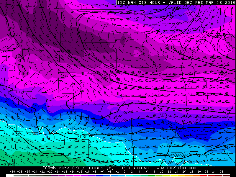
- Jet overhead: This will produce heavy bands of snow oriented WNW to ESE, with snowfall rates of 1 to 2 inches per hour. They will be localized, but just about everyone should get in on the action at some point before all is said and done
- Instability: Some very cold air aloft will be present to provide added instability for lift, particularly this evening when the lower levels are still “warm”
- Upslope: Recent runs bring slightly better upslope southward towards Boulder. It is still going to be quite shallow, but will persist from about 6pm tonight until Friday morning. It definitely isn’t a huge player, but having a bit of low-level upslope will provide some enhancement to things
The southward shift will bring slightly colder air in the Denver area for the event. This will allow for more favorable snow-to-liquid ratios and less overall melting. With more extensive cloud cover this afternoon, temperatures will peak many degrees cooler than we were thinking yesterday. We won’t get out of the mid 30’s this afternoon. As of 1pm, it is only 30 degrees at the BoulderCAST weather station. It will be an all snow event for Boulder, with some rain possibly mixing in early on east of Denver.
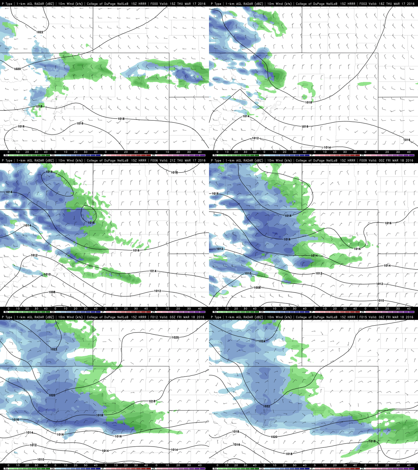
The HRRR and RAP are showing that precipitation will begin to intensity for Boulder between 4pm and 6pm (shown below). The best overall forcing is tonight, between 5pm and 3am. During this time, widespread moderate snow will be possible. Temperatures quickly cool down to sub-freezing by 6 or 8pm for everyone, so snow will start to stick early on.
Snow will linger through the day Friday. It won’t be as widespread and heavy as overnight, but some isolated jet-forced banding will be possible. With the high sun angle, roads should quickly melt off on the Plains on Friday. Temperatures will remain in the mid to upper 20’s down low, with teens higher up. Saturday morning temperatures will be in the teens. Brr!

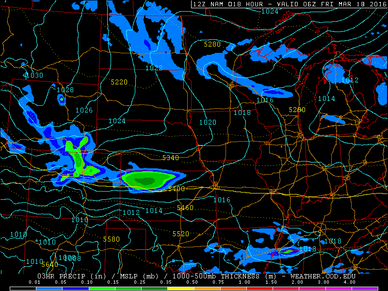
NAM forecast pressure and precip valid at midnight tonight. Heavy precipitation possible north and west of Denver, especially in the Foothills.
Final Forecast
Model differences from yesterday are still there. The GFS only wants to produce 0.3-0.5″ of liquid on the Plains, with 0.5-0.7″ in the Foothills. The Euro and NAM have 0.4-0.8″ on the Plains, with 0.6-1.1″ in the Foothills. There may also be some locally higher amounts due to the banding. Combining all the factors listed above and blending the various model solutions, we are forecasting:
- 3-7″ for a bulk of the Denver Metro area
- 5-10″ for the western suburbs and lowest Foothills, including the city of Boulder
- 8-16″ for the Foothills of Boulder County northward (including Eldora)
- 5-12″ for Foothills of Jefferson County
Here is our map:
Remember, we forecast snow accumulation, not snow depth (I know, silly right?). Due to the long duration of this event (24+ hours), the time of year, and the warm ground, melting and compaction will definitely be taking place. The amount of snow on the ground will be (much) less than the actual accumulation.
Enjoy the snow and be safe! We’ll shoot out any updates if needed (not likely). As always, subscribe to stay in the loop. Follow us on Facebook and Twitter for live storm updates.


You must be logged in to post a comment.