Thanks to everyone that entered our 2022 First Snowfall Contest. We briefly review the entries which actually trend towards a later date than Boulder’s climatology would suggest. We may not have to wait too long for a winner as cooler weather and maybe a few snowflakes are brewing in the extended forecast. Contest prizes and recognition will be awarded in the days following our first dumping of snow — big or small!
Reviewing the contest entries
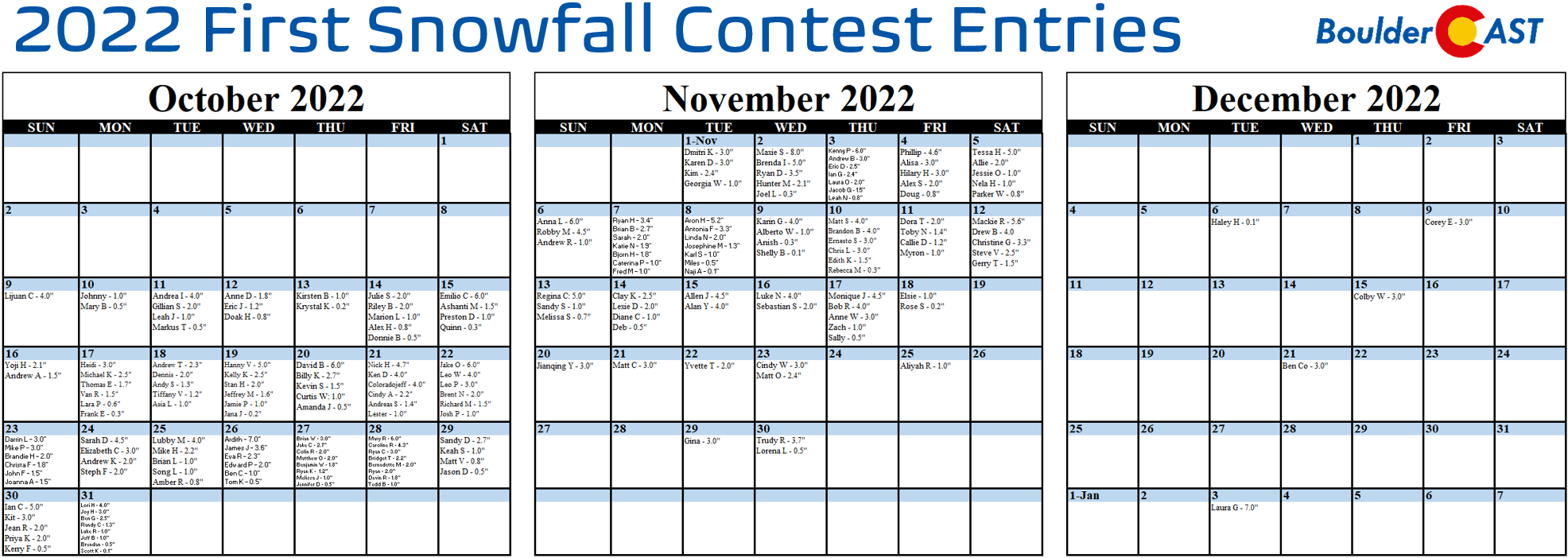
n the announcement post for this contest, we offered a little insight by providing a few of Boulder’s “first snow” statistics. More than 200 of you came up with “educated” guesses for the timing and amount of Boulder’s first snow of the 2022-23 winter season. All of the entries are contained in the calendar view below (click to enlarge):
A few notes about the predictions:
- Dates range from October 9th to January 3rd, the latter being latest guess we’ve ever had in eight years running this contest!
- Amounts range from 0.1 to 8.0 inches
- The median date of the guesses were October 30th. This is ten days later than climatology, perhaps a sign of public sentiment following last year’s historically late first snow
- The most popular days chosen were October 27th, 28th and 31st which were each selected eight times
- 88% of entries predict a first snow of 4.0 inches or less
- Due to our procrastination in ingesting the entries, about 20% of contestants have already been eliminated thanks to the boring month of October weather so far
SUMMARY OF SCORING:
Those who come closest to the actual date of Boulder’s first MEASURABLE SNOW (defined as snowfall at or above 0.1″) win! For verification, we’ll go off the official Boulder climate station located at the NIST building in south Boulder. Only the first calendar date of snow will be used (i.e. if the first snow event spans two days, only the amount of the first day will count). In the event that multiple participants select the same date, the tie-breaker of snowfall amount will be used.
SUMMARY OF PRIZES:
The prizes for the contest are as follows:
- 1st place: 12-month Premium subscription + $30 Amazon Gift Card
- 2nd place: 6-month Premium subscription + $10 Amazon Gift Card
- Anyone who guesses within 1 day OR 0.1″ correct: 2-month Premium subscription
- All other entries: Virtual “pat on the back”
Is that snow in the extended forecast?
The boring pattern is set to finally collapse this weekend with the record-breaking ridge across the Pacific Northwest self-destructing and a new autumn storm system dropping south towards Colorado in its wake Sunday into next Monday. The trough digging in is advertised by all major weather models right now which is a good sign — unsurprisingly they don’t agree so well on the exact punch, track or timing of the storm. Nonetheless, the back-to-back-to-back days of sunshine and warmth so common the last few weeks will be soon be nothing more than a distant memory.
At the moment, the track of the incoming storm would not favor much snowfall east of the Continental Divide. However, light to moderate accumulations will be likely in the High Country late Saturday through Sunday night. It’s good to finally see appreciable snow on the map across our state once again!
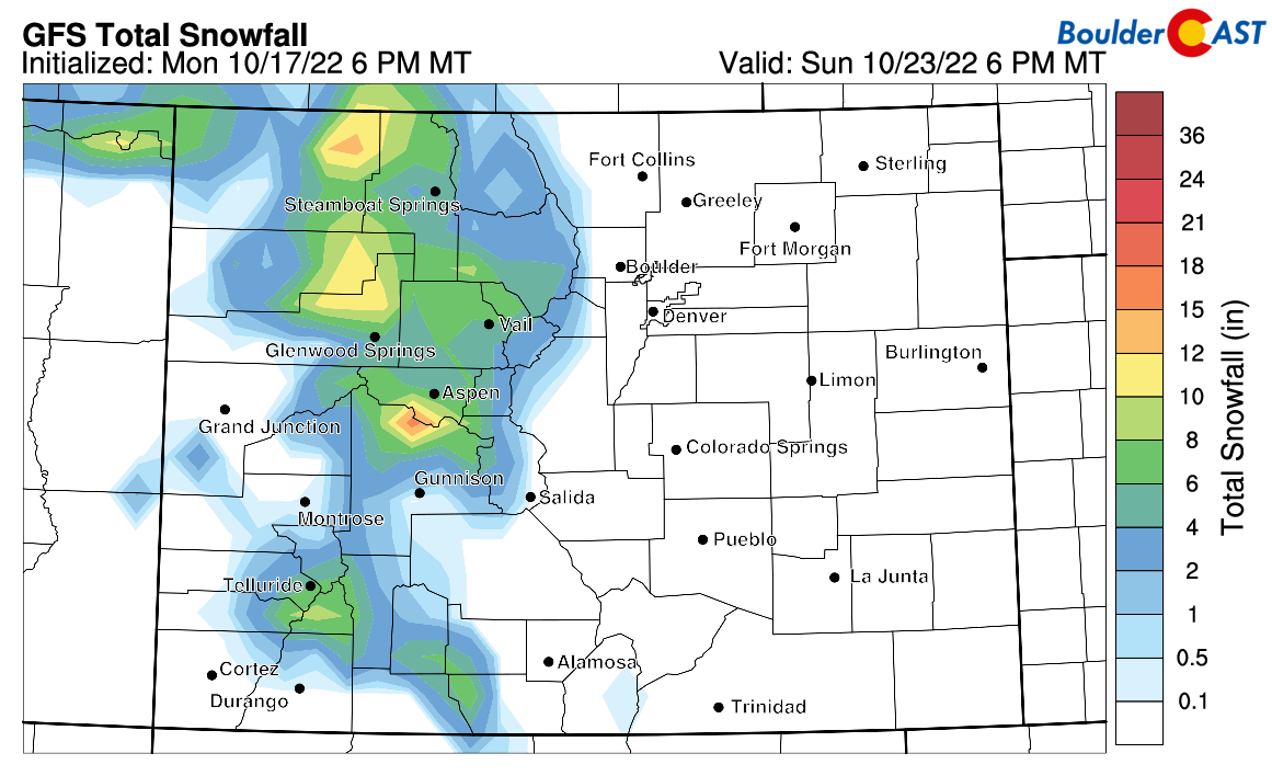
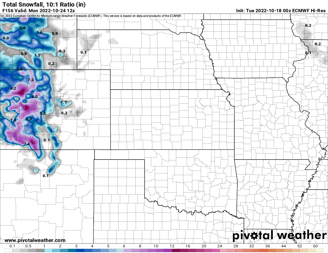
GFS snowfall forecast for Colorado this weekend
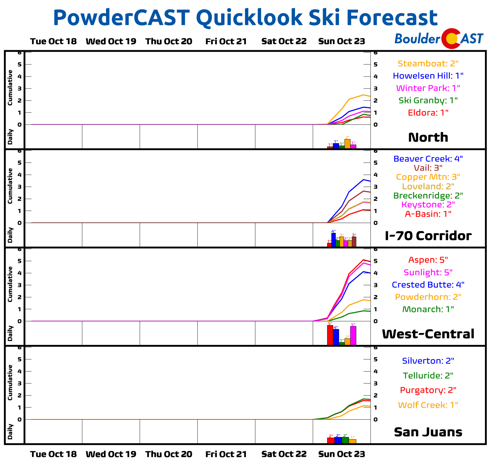
It’s still too early for exact numbers, but the ski resorts could perhaps receive a small, lap-sized blanket of powder this weekend, too!
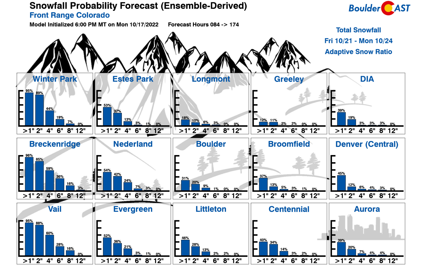
There will also be a chance of snow across the Denver Metro area as well, but only if the storm somehow takes one of the less likely tracks in the models right now. While snow looks like a safe bet this weekend in the mountain towns — for example in Breckenridge:
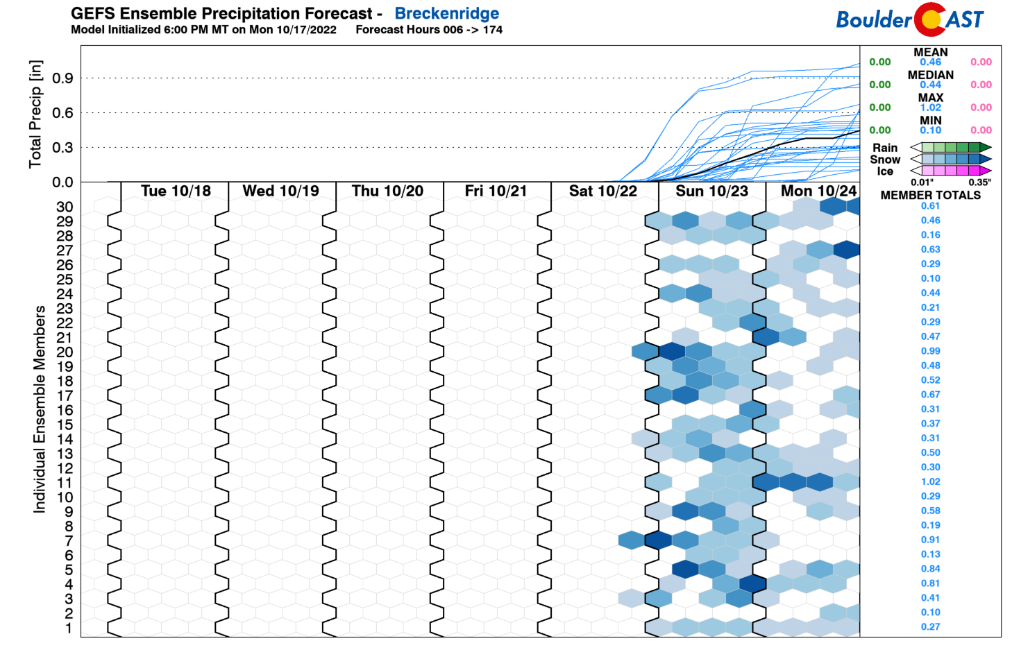
…the details are much fuzzier across the lower elevations with a significantly lesser chance of snowfall in places like Denver or Boulder. It may even be too warm for much snow if anything does develop east of the Divide.
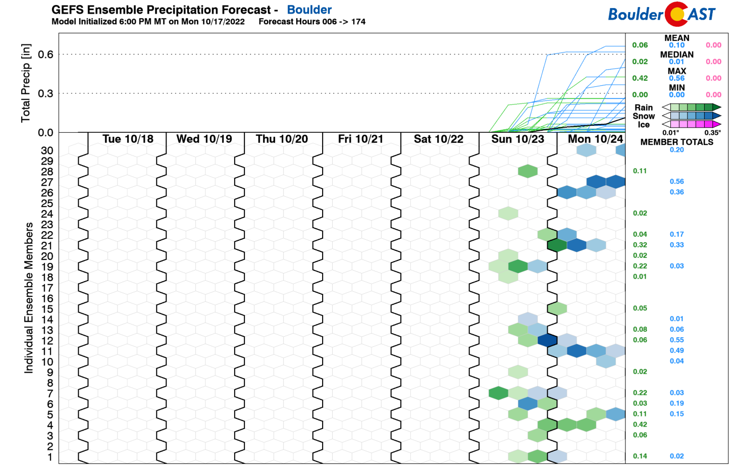
Still there are plenty of models which do produce a little white stuff in the Denver area, including last evening’s European model run:
Euro model snowfall forecast through Sunday night. Light snow is indicated in the Denver area with a dusting of accumulation in spots
To be honest, our team is not overly hopeful that the first accumulating snow of the season in Boulder or Denver will accompany this system. We just wanted to give a small forecast update to go along with the release of the First Snowfall Contest entries today. Chances are rather slim for snow outside of the higher elevations.
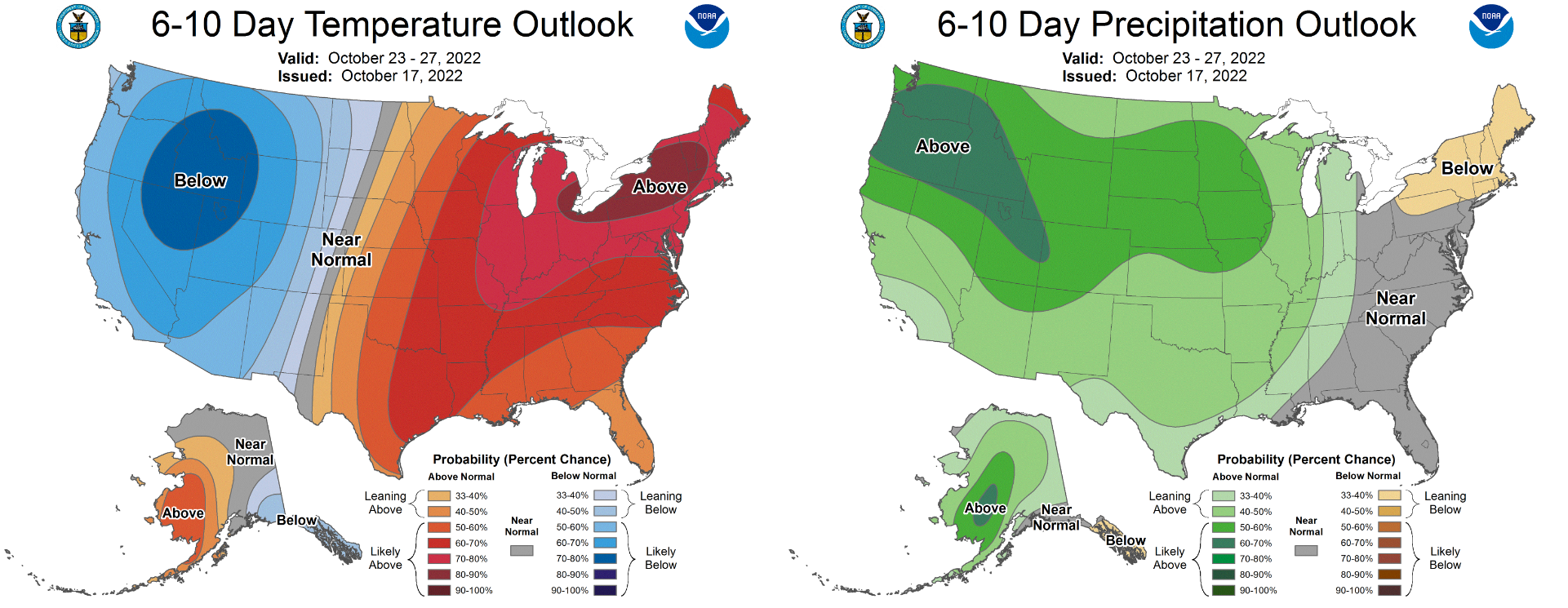
Regardless of what transpires this weekend into early next week, a more seasonally-appropriate weather pattern for late October is indeed brewing — one which will surely usher in below normal temperatures and unsettled conditions for much of the state.
2022 First Snowfall Contest prizes and recognition will be awarded in the days following our first dumping of snow, BIG or SMALL. Let’s hope it’s one to remember!
Let it snow!
Share this post:


You must be logged in to post a comment.