After a lengthy stretch of relatively quiet weather this past week as we officially transitioned from winter to spring, things are set to change on Sunday as a quick-moving storm system races into Colorado from the west with rain, hail, and thunder Sunday afternoon transitioning to heavy snow by Sunday evening. Several inches of accumulation will be possible with this storm, favoring the Palmer Divide and southern Foothills, but for the most part it’s moving too quickly to generate significant snow in our area. Winds will gust upwards of 45 MPH at times Sunday evening and night creating brief near-blizzard conditions in some locations. Read on as we discuss the latest forecast details, timing, and our projected snowfall amounts.
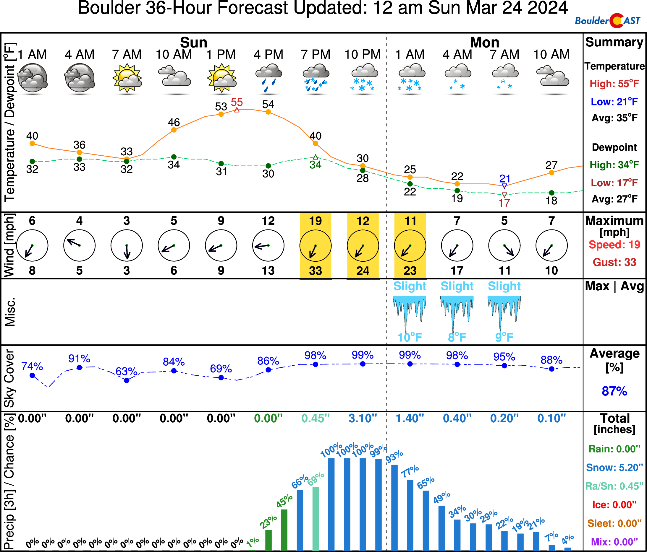
UPDATE (Sun 3/24/2024 8AM): Snowfall amounts were adjusted upwards an inch or two in some areas. Check our updated snowfall forecast map near the end of the post. Otherwise, the going forecast looks fine with afternoon thunderstorms quickly changing to snow after 6PM. Snow could be very heavy at times Sunday evening with 2″/hr snowfall rates. Gusty winds will create blowing snow and reduced visibility as well. Snow is still expected to end late Sunday night after midnight.
At a Glance
- Rapid Weather Shift Expected: A quick-moving storm system is expected to bring a mix of weather to Colorado on Sunday with afternoon thunderstorms transitioning to heavy wet snow by evening.
- Snow Accumulations: While the storm is moving too fast to cause significant snowfall in the area, several inches are still possible with the highest totals expected in the Palmer Divide and southern Foothills.
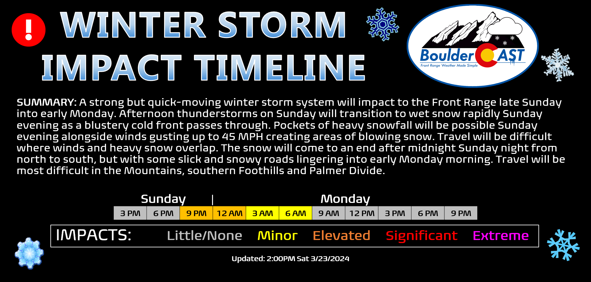
- Snow Timeline: Rain is expected to change to snow between 6PM and 8PM Sunday evening and could be heavy at times for a few hours. Snow will wrap up quickly from north to south after midnight Sunday night.
- Windy Conditions: Wind gusts could reach up to 45 MPH Sunday evening and night, potentially creating brief blizzard conditions in some locations. Travel may become difficult due to blowing and falling snow, even though accumulation amounts won’t be that high.

Go Premium, get all the perks.
Daily Forecast Updates
Get our daily forecast discussion every morning delivered to your inbox.
All Our Model Data
Access to all our Colorado-centric high-resolution weather model graphics. Seriously — every one!
Ski & Hiking Forecasts
6-day forecasts for all the Colorado ski resorts, plus more than 120 hiking trails, including every 14er.
Smoke Forecasts
Wildfire smoke concentration predictions up to 72 hours into the future.
Exclusive Content
Weekend outlooks every Thursday, bonus storm updates, historical data and much more!
No Advertisements
Enjoy ad-free viewing on the entire site.
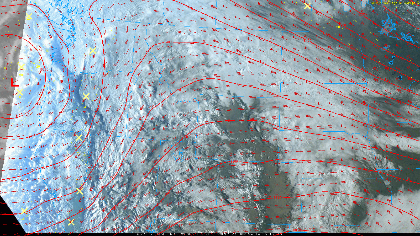
A
s of Saturday afternoon, the incoming storm is currently located offshore from Oregon over the Pacific Ocean. The closed-low pressure is looking just lovely from GOES-East’s visible band right now:
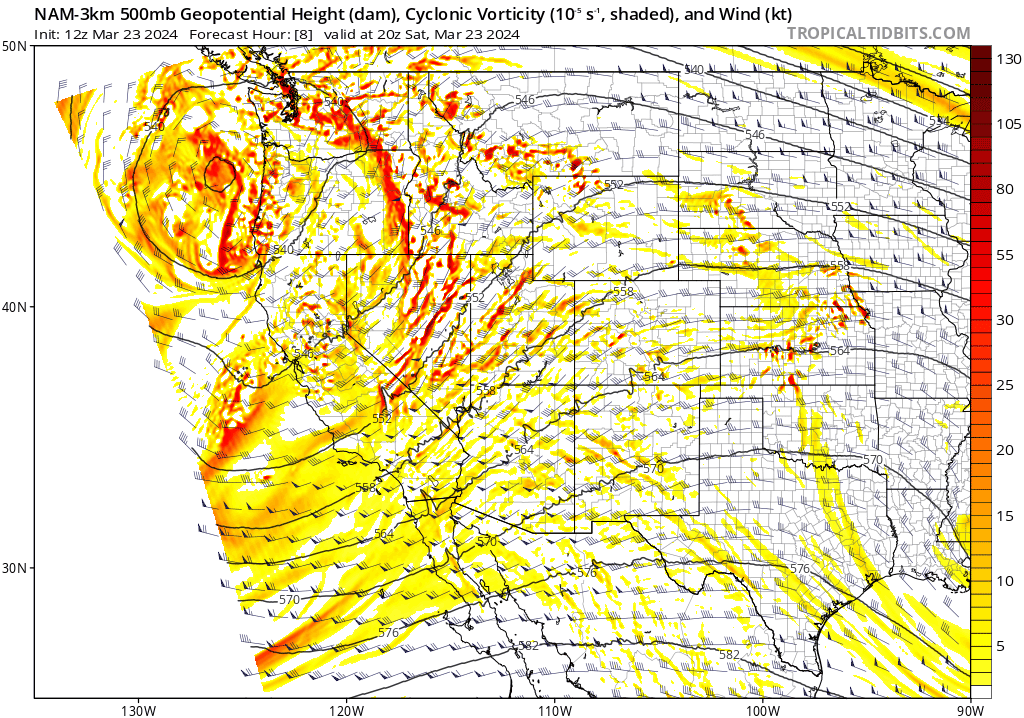
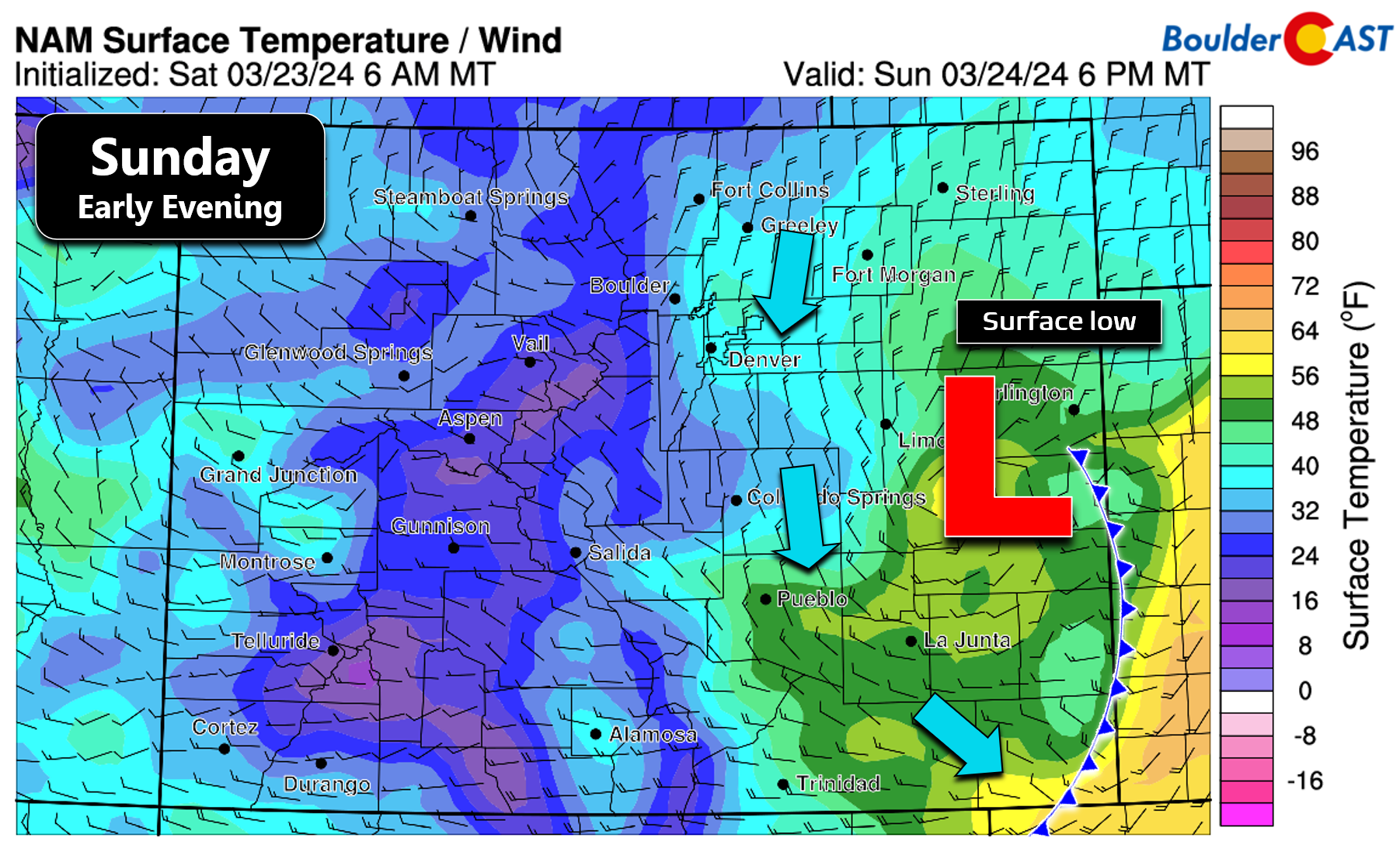
Over the next 48 hours, this vigorous trough will swoop across the Rockies, with the first low pressure fizzling out as a secondary one spawns across southeastern Colorado on Sunday in the lee of the Rockies. The storm will then quickly race off to the northeast into the Upper Midwest by Monday afternoon.
The mid-level storm will become coincident with a strong developing surface low in southeast Colorado. Several models, including the GFS depicted below, show this surface low blowing up with its central pressure plummeting down to ~980mb by Sunday evening, perhaps even a tad lower. This rapid pressure drop will create quite a bit of wind across most of eastern Colorado and nearby states. The wind is only half the story though as there will be plenty of rain and snow to go around as well!
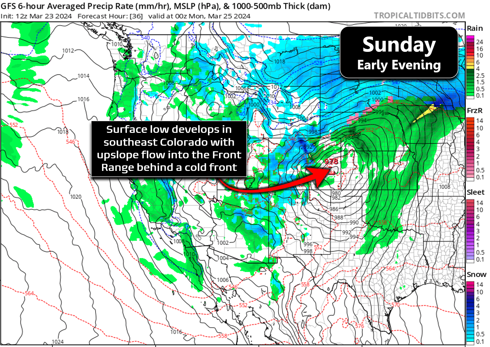
As this surface low develops quickly in eastern Colorado on Sunday, it will act to pull a potent cold front southward across our area Sunday afternoon with strong winds and upslope flow taking over afterwards. Winds with this system will be closer to northerly than easterly and thus aren’t ideal upslope for Boulder or areas northward. This system will instead favor the Palmer Divide and southern Foothills, including Golden and areas to the west/south.
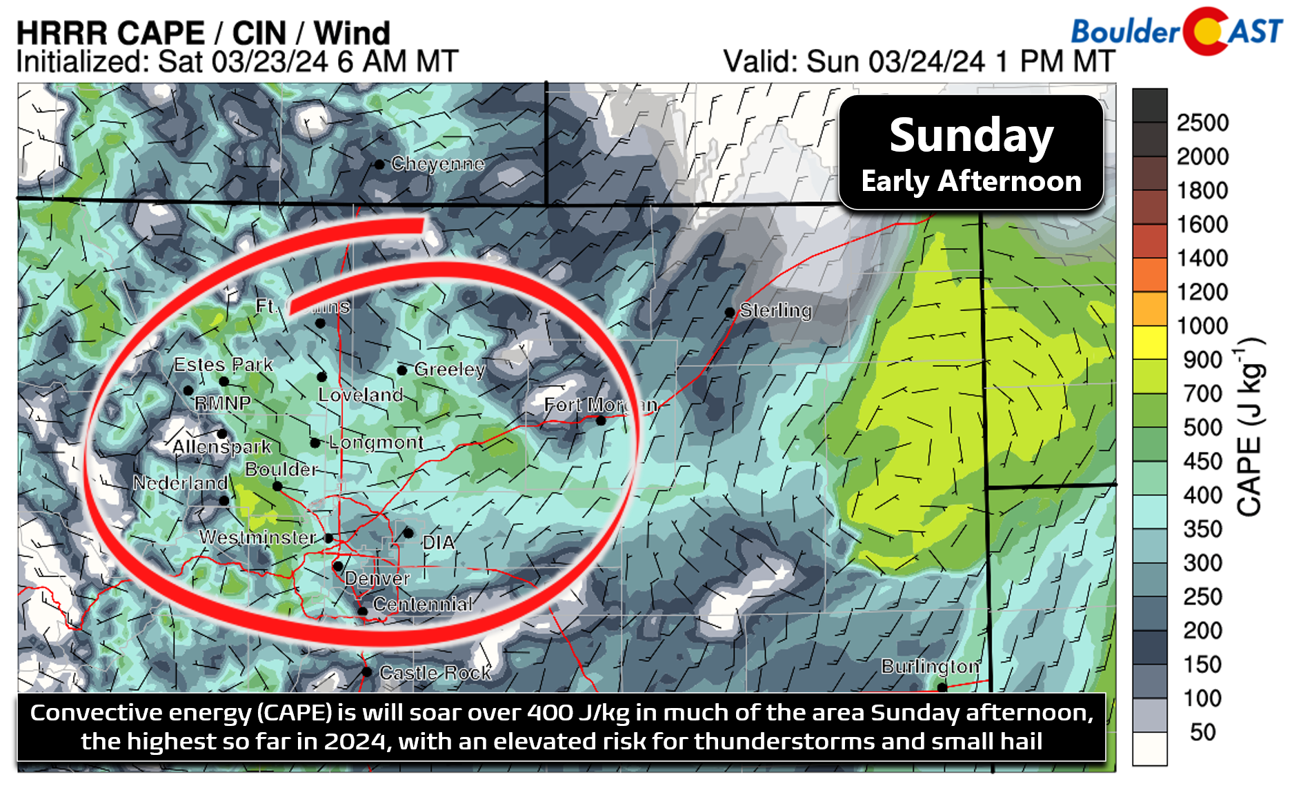
Precipitation will initially begin as rain across the Denver Metro area Sunday afternoon, including a risk for hail-producing thunderstorms (small hail, that is), as CAPE will be greater than 400 J/kg in the afternoon, even up to 700 J/kg in some areas.
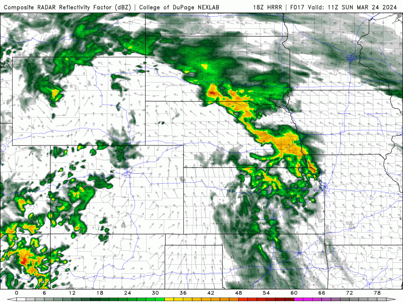
Strong cold air advection and widespread precipitation should allow everyone to change-over to snow somewhat quickly, with the latest model trends suggesting a change-over timing between 6PM and 8PM for the Metro area. For a few hours following this change-over, there will still be some convective energy available and snow could be heavy at times with ~2″ per hour rates in the more intense bursts of snow. Light to moderate snow will continue into part of the overnight period, especially south and southeast of Denver. Further north and west, winds may quickly shift to downslope from Boulder northward which should kill off the snow pretty fast in these areas near or slightly after midnight Sunday night. Snow will linger longest in the far southern fringes of the Metro area.
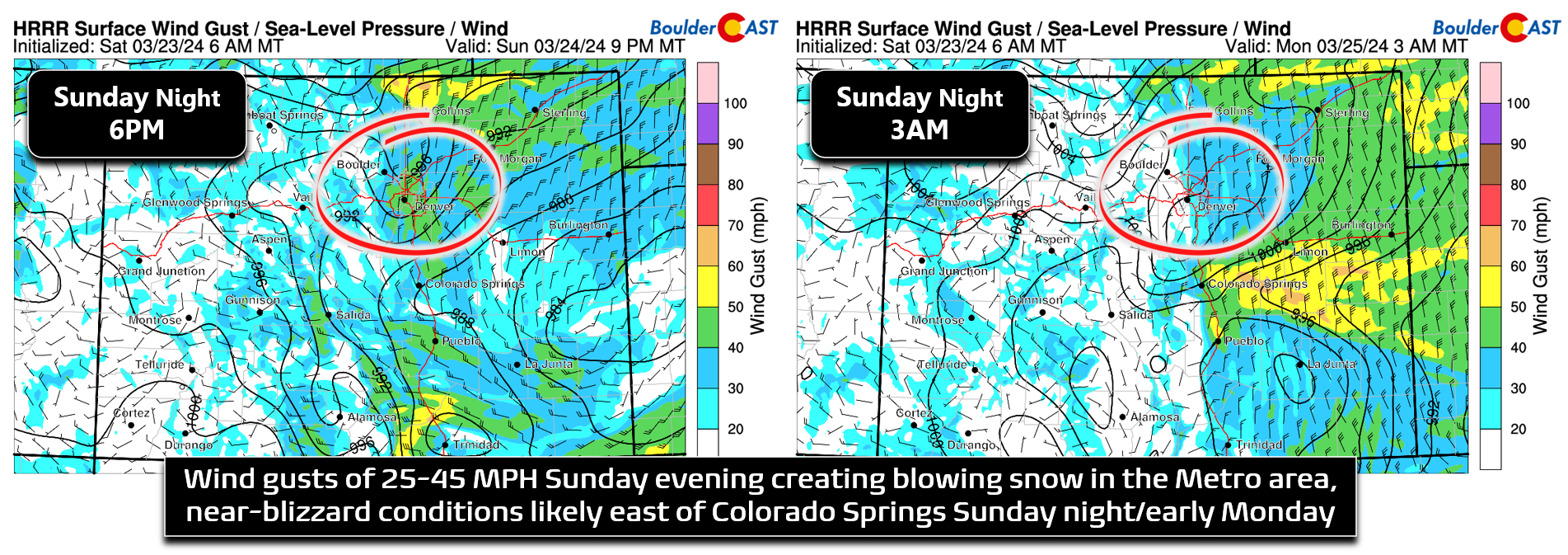
Speaking of wind — the winds will be whipping at times Sunday evening and overnight with north-northeast gusts of 25-45 MPH possible. While we hesitate to predict true widespread blizzard conditions, there probably will be some localized “blizzard-like” conditions, especially southeast of Denver and up atop the Palmer Divide.
As for moisture totals, it’s looking like most areas should see around 0.5″ of liquid from this storm, with up to 1″ in the Foothills and across the Palmer Divide. The ensemble mean in Boulder is around 0.75″, with close to half of that coming as rain before the change-over. Once we transition to the white stuff Sunday evening, snowfall ratios should be close to 10:1 or better as temperatures fall into the 20s, though there will be a lot of melting due to elevated ground temperatures. It’s been warmer than 60 degrees most of the last week here, don’t forget!
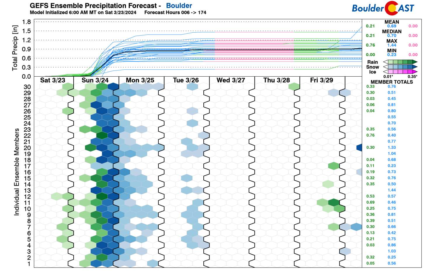
Our snowfall forecast map for the event is shown below, covering all snow through Monday morning (Updated). The highest snowfall totals are expected across the southern and southwest Metro area, especially in the higher terrain. Our forecast calls for 2-5″ in most of the Denver Metro, but with 3-8″ in the far southern and western suburbs, including western Boulder (but not east Boulder). Double digit snowfall totals are possible in the Mountains and southern Foothills.
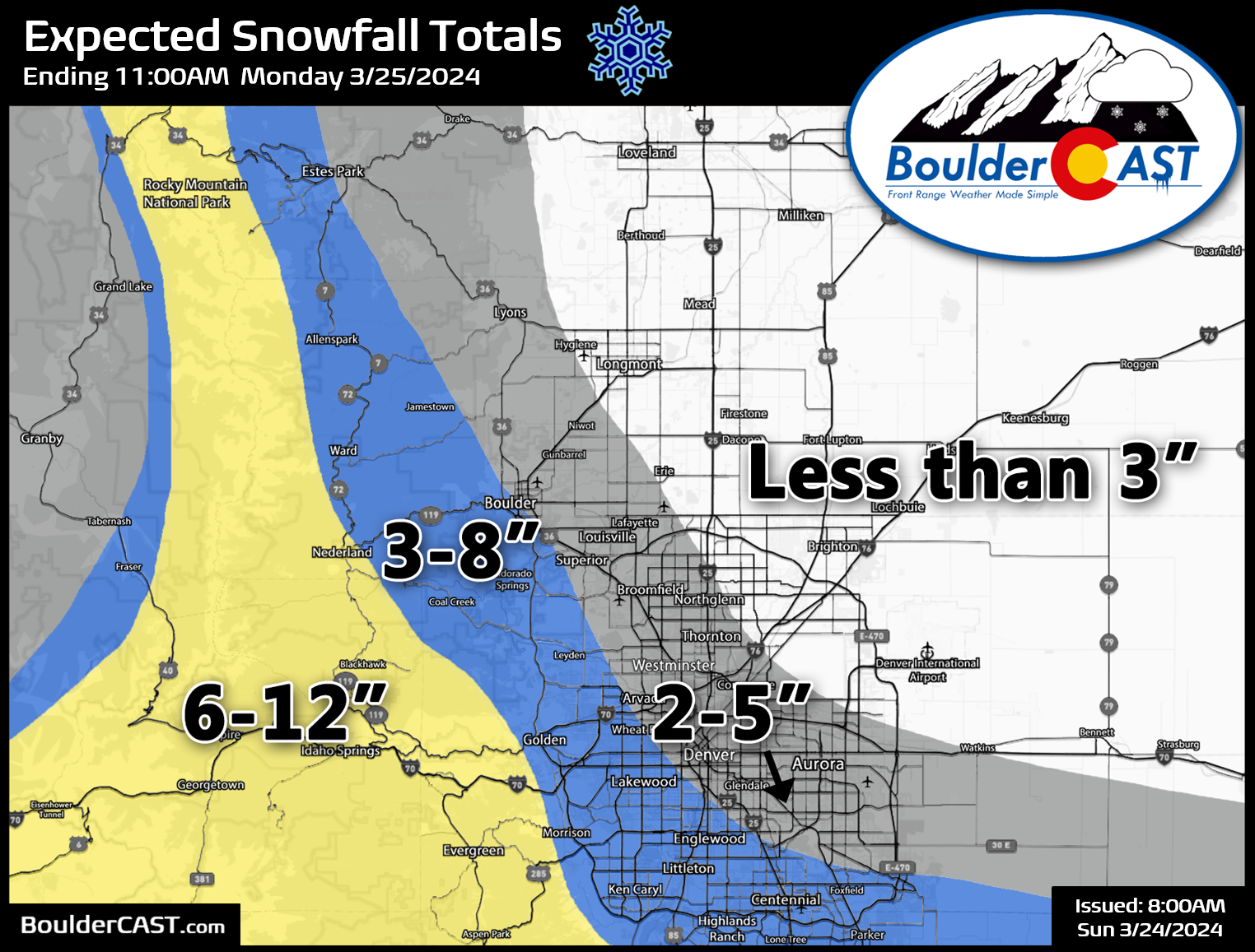
Travel impacts will be greatest Sunday evening when pockets of heavy snow will overlap with winds gusting up to 45 MPH, especially along east of I-25. Brief blizzard conditions may unfold across parts of the Palmer Divide Sunday evening/night so do plan accordingly if you live there or are headed though there.
Overall, this system is greatly limited by its speed. Had this setup been able to linger for longer, we may be talking significant snow in our area, but not this time. The biggest headline from this one will be just how quickly things transition from 60 degrees and thunderstorms to wet, blowing snow and sub-freezing temperatures! “Spring” in Front Range Colorado never disappoints, does it?!
There’s a slight chance we may need to adjust snow totals Sunday morning (better chance for things to go up than down currently, but drastic changes are not likely). If we need to make any forecast tweaks in the next 24 hours, they will be amended into this post so do check back. Enjoy what’s left of your weekend and brace for a quick hit of wet snow late Sunday!
Get BoulderCAST updates delivered to your inbox:
Go Premium, get all the perks.
Daily Forecast Updates
Get our daily forecast discussion every morning delivered to your inbox.
All Our Model Data
Access to all our Colorado-centric high-resolution weather model graphics. Seriously — every one!
Ski & Hiking Forecasts
6-day forecasts for all the Colorado ski resorts, plus more than 120 hiking trails, including every 14er.
Smoke Forecasts
Wildfire smoke concentration predictions up to 72 hours into the future.
Exclusive Content
Weekend outlooks every Thursday, bonus storm updates, historical data and much more!
No Advertisements
Enjoy ad-free viewing on the entire site.
Enjoy our content? Help us out and give it a share:


You must be logged in to post a comment.