After a stretch of December warmth so extreme it rewrote some record books across the Front Range, we’re finally staring down a pattern shift—though not quite the snowy one we initially hoped for. A pair of cold fronts will bring a sharp temperature drop, a few chances for rain and snow, and at least the feeling of winter back to Boulder and Denver. The details have changed quite a bit in the last 24 to 48 hours, but we’ll walk you through what’s still on the table, what’s no longer likely, and where a few surprises could still sneak in Saturday night.
What You Need to Know
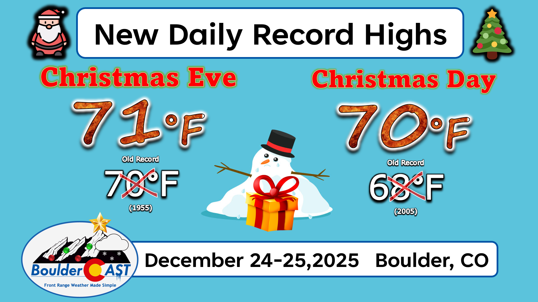
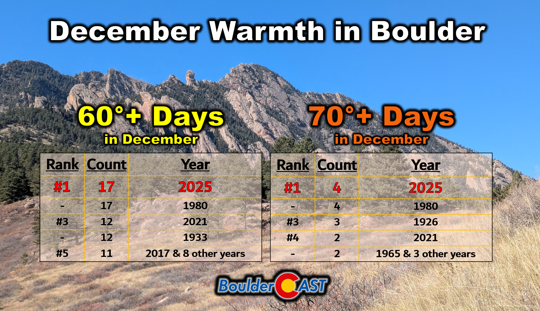
- 🌡️ Record warmth continues — Boulder had tied its all‑time December record for the number of 60°+ and 70°+ days, and also soared to its warmest temperatures ever on both Christmas Eve and Christmas Day.
- 🌧️ Two fronts today — a weak one at sunset may spark isolated showers this evening; a stronger Arctic front arrives around midnight.
- 🥶 A reminder that we’re indeed in winter — temps plunge into the teens/20s with highs near freezing and a few slick spots possible at sunrise.
- ❄️ Snow chances have tumbled — most of us see just a trace to dusting, but isolated bands, if they form, could still produce locally 1–4 inches.

Go Premium, get all the perks.
Daily Forecast Updates
Get our daily forecast discussion every morning delivered to your inbox.
All Our Model Data
Access to all our Colorado-centric high-resolution weather model graphics. Seriously — every one!
Ski & Hiking Forecasts
6-day forecasts for all the Colorado ski resorts, plus more than 120 hiking trails, including every 14er.
Smoke Forecasts
Wildfire smoke concentration predictions up to 72 hours into the future.
Exclusive Content
Weekend outlooks every Thursday, bonus storm updates, historical data and much more!
No Advertisements
Enjoy ad-free viewing on the entire site.
Record holiday warmth
We’ll try to keep today’s forecast short for the holiday weekend… but you know how that usually goes.
December’s warmth along the Front Range has been nothing short of remarkable—borderline historic in a few ways. We’ve smashed records multiple times over the past week, culminating in what became the warmest Christmas Eve and Christmas Day ever recorded for many Front Range cities. Boulder and Denver both soared into the low and mid‑70s and broke records on back‑to‑back days.
As of this morning, Boulder has now logged 17 days of 60°+ warmth in December, with four of those days pushing into the 70s. Both numbers tie the all‑time December record set in 1980 and easily outpace the warm December of 2021. It’s been an exceptionally mild month, especially considering how dry the fall was leading into it.
Big changes arrive Saturday evening
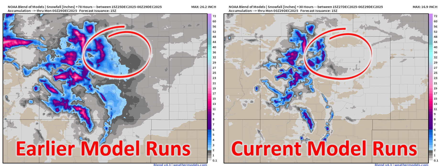
We’ve been tracking this weekend’s cold front—and the potential for snowflakes—for several days now. Early on, the setup looked promising for a widespread accumulating snow event from Cheyenne down to Colorado Springs. But we also noted that the outcome would hinge heavily on banded snowfall, which is notoriously difficult to forecast more than 12–24 hours out.
Unfortunately, the latest model runs have backed off significantly. The once‑optimistic projections of 1–4 inches along the urban corridor have largely evaporated. The short‑range guidance simply isn’t showing much banding over Boulder or Denver anymore.
So instead of dwelling on what isn’t likely to happen, let’s focus on what is…
Today (Saturday)
Highs will still be mild—upper 50s to lower 60° across the Metro area—but a touch cooler than the past few days.
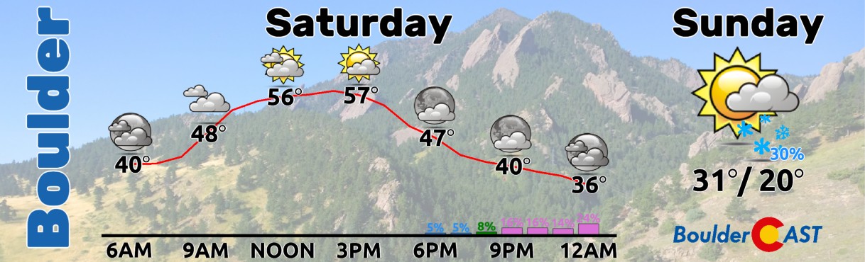
A weak Pacific front slides through around sunset. That may be enough to spark a few isolated rain showers this evening.
The stronger, borderline Arctic front is still on track to arrive around midnight. This is the one that brings the real change.
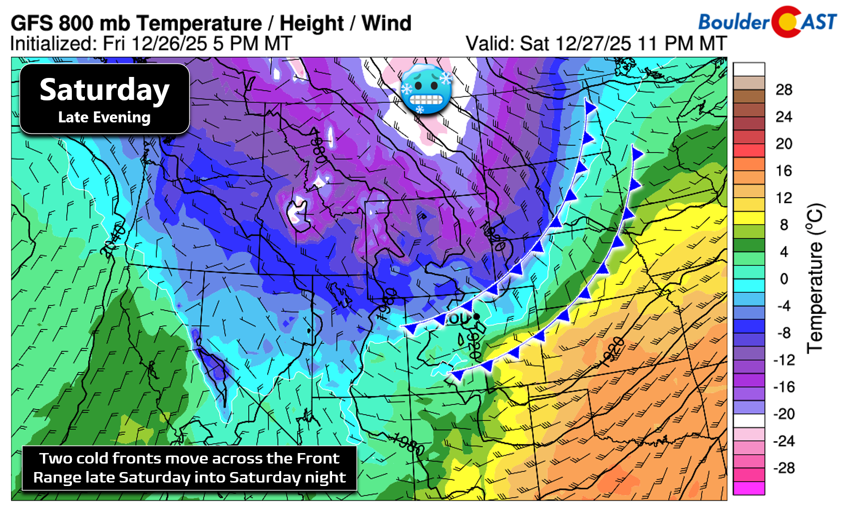
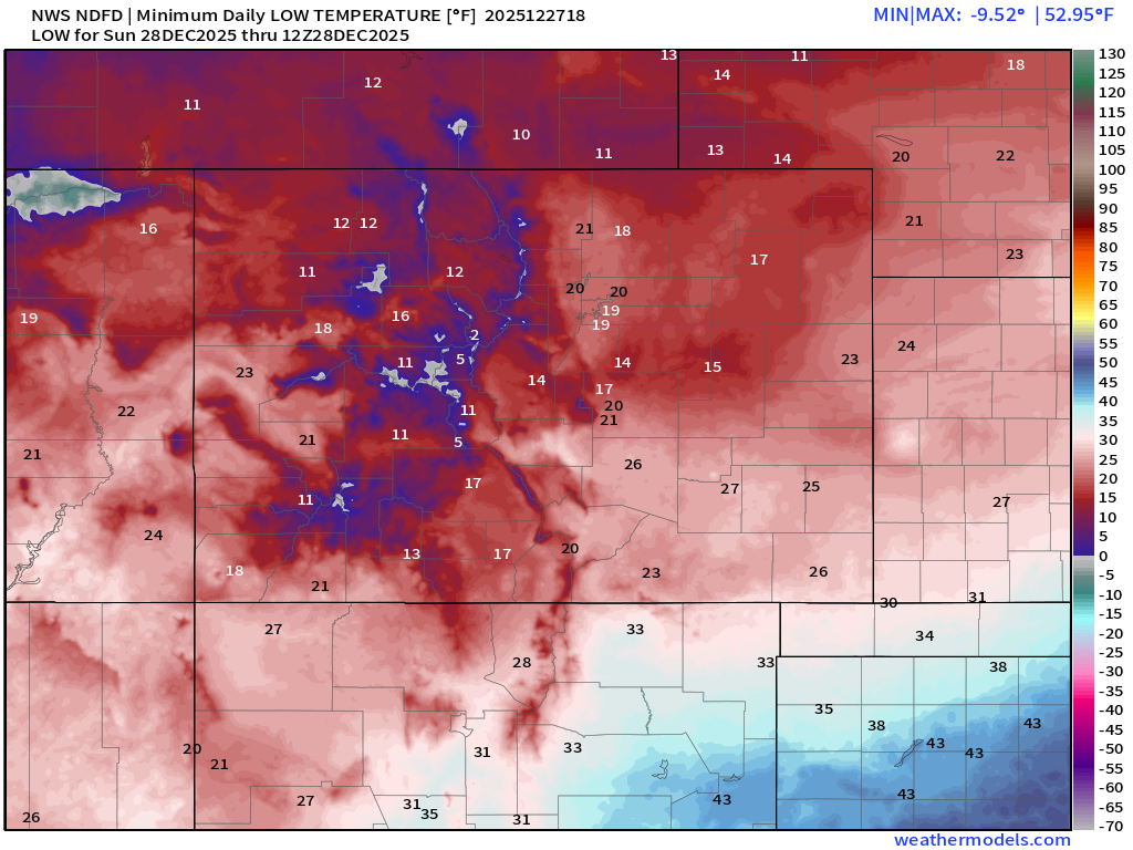
Confidence is high in the cold punch behind these fronts: temperatures tumble into the teens and 20s by Sunday morning, with highs Sunday struggling to reach freezing. This will be our coldest stretch since early December, the last time it snowed for us.
Snow potential: confidence much lower
The snowfall side of the forecast is where things get murky…
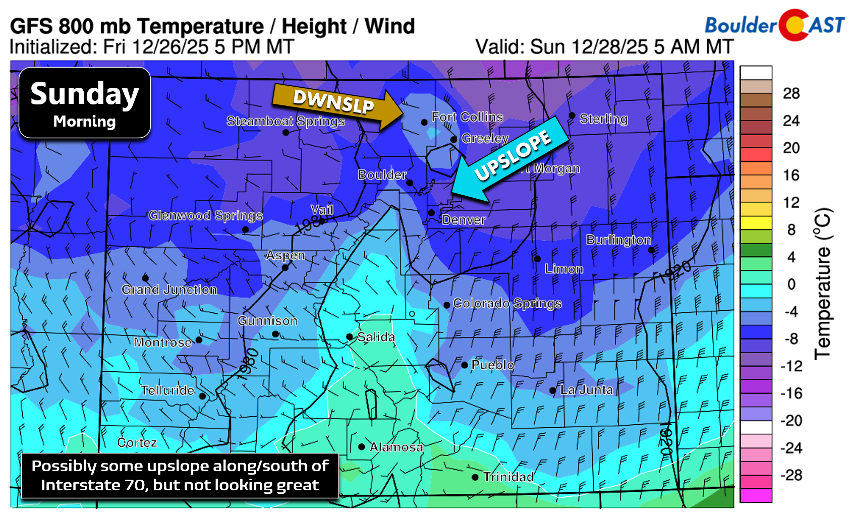
Behind the Arctic front, wind fields no longer show meaningful upslope—just straight northerly flow, and even some downslope north of Boulder. The GFS (shown below) is one of the few models still hinting at upslope along and south of I‑70, but it’s increasingly an outlier.
Short‑range models are also struggling to generate any organized snow bands east of the Mountains.
The main culprit appears to be a deep layer of dry air near the surface, several thousand feet thick. The best lift overnight is occurring within this dry layer, which is not a recipe for efficient snow crystal growth.
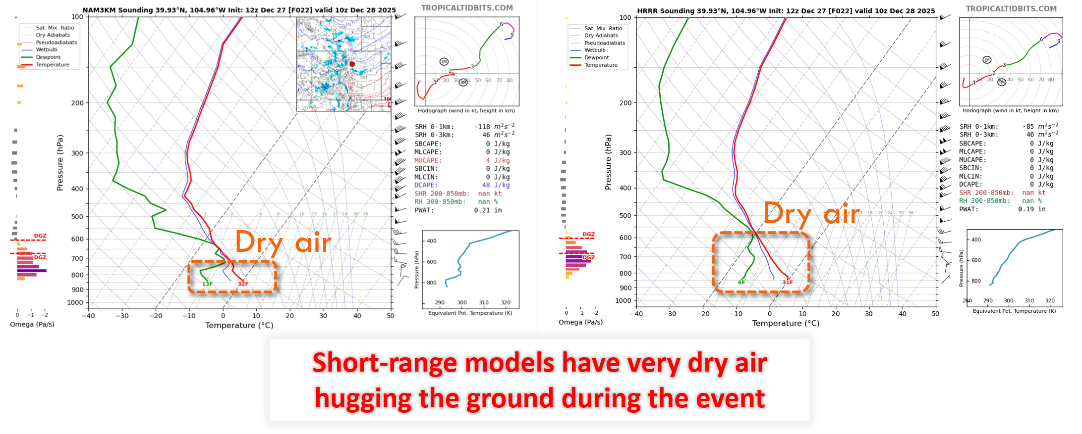
Put all that together and the event at-hand has a good chance of underperforming:
- Lack of upslope
- Dry air holding on down low
- Best lift not co-located with the snow growth layer
- Lack of any banded snowfall in the short-range guidance
- Quick-moving nature of the entire system
That said, if a band does manage to form, localized totals of 1–3 inches (maybe 4″) are still possible—mainly west of I‑25 and south of I‑70. But at this point, only the global models are hanging onto that idea, and it’s unclear how they plan to overcome the dry air problem.
Our low-confidence snowfall forecast map for this event is shown below. We expect many areas will see at least a small amount of snow (trace to a dusting). The odds of anything more have plummeted. But past events under this type of setup keeps us wary for locally higher amounts up to 3 inches if banding does occur tonight.
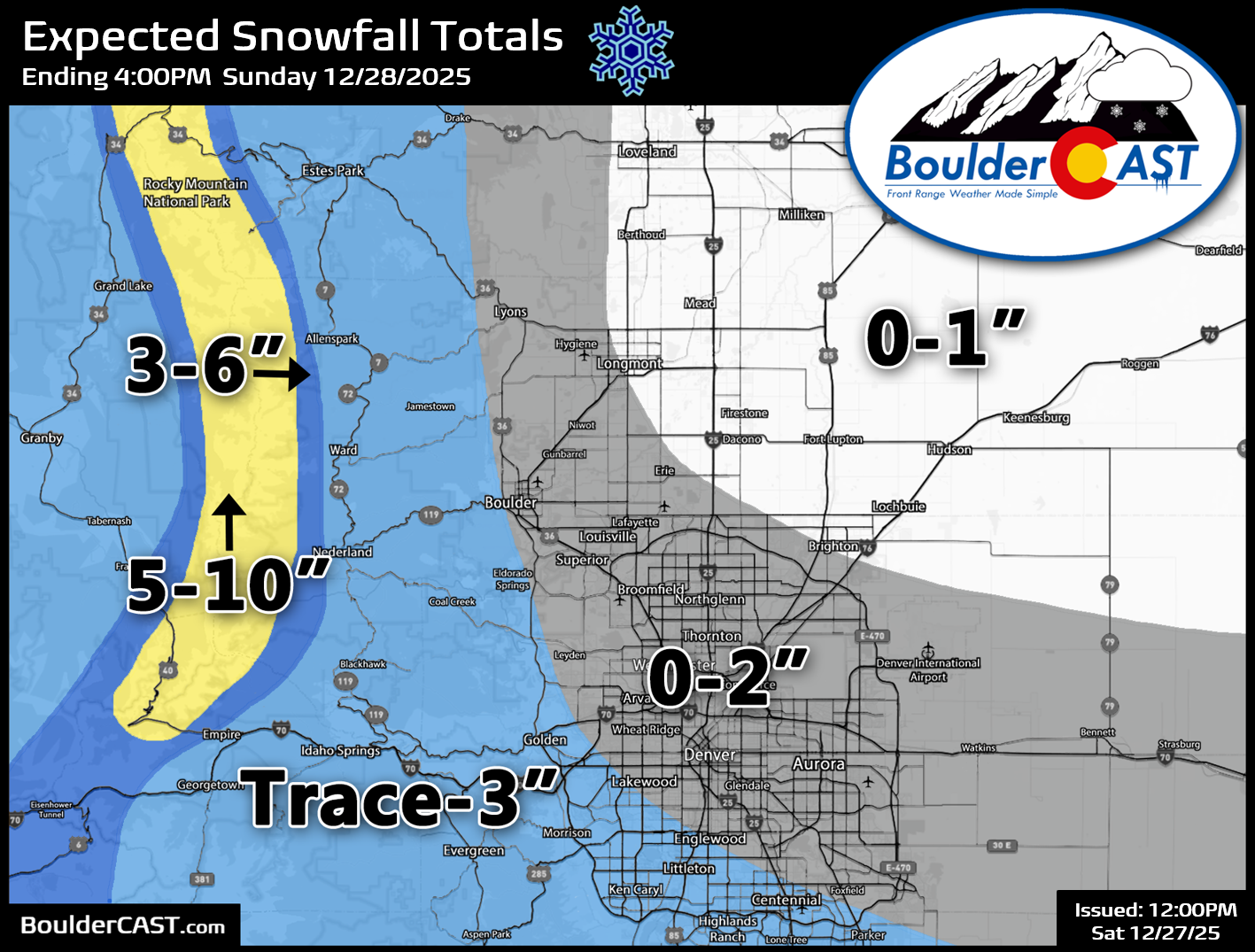
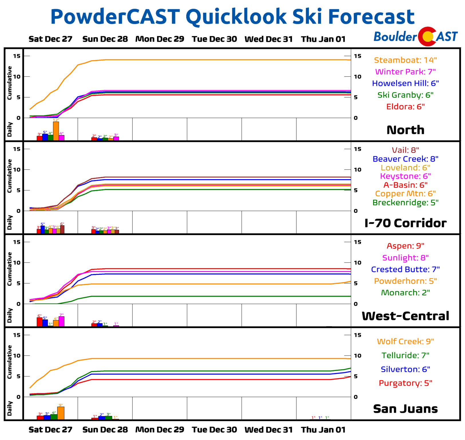
Snow will spread into the Mountains during the afternoon and especially Saturday evening, with totals of 5 to 10 inches possible in the high peaks north of Interstate 70 by midday Sunday. Skiers should plan to stay near or north of I-70 for the best skiing this weekend.
How we expect this event to unfold
- Saturday: Partly cloudy, upper 50s to near 60°. Pleasant!
- Saturday around sunset: First weak front arrives; isolated raindrops possible through the evening.
- Saturday night into Sunday : Strong Arctic front moves in; a few snow bands may develop after midnight.
- Many areas: little to no accumulation
- Isolated pockets: up to a few inches if a band sets up
- Sunday morning: Temps fall to ~20°; roads will turn slick if/where appreciable rain/snow occurs
- Sunday late morning: Any lingering flakes wrap up
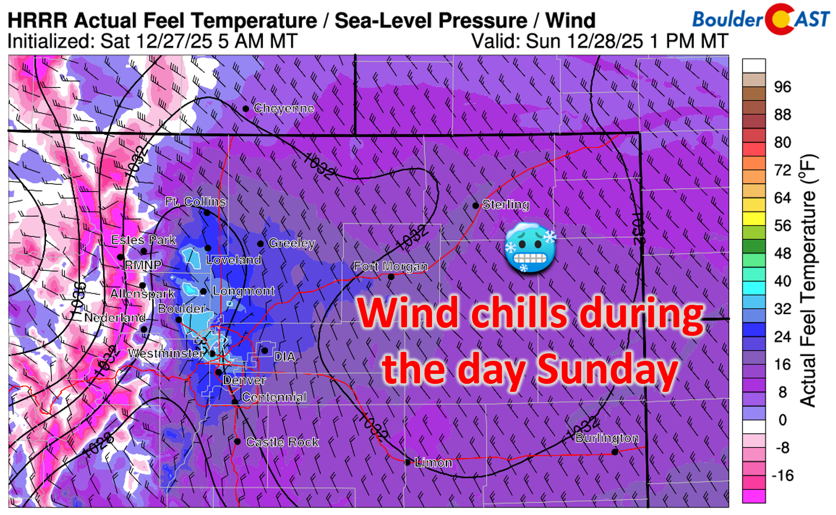
- Sunday afternoon: Highs near freezing; blustery north winds east/northeast of Denver with wind chills in the teens and single digits
- Sunday night: Lows in the teens, possibly single digits
Though this quick-hitting storm is no longer expected to be a big snow-maker for us, it’s still a sharp reminder that yes, despite the record‑shattering warmth we’ve been basking in lately, it is indeed winter on the calendar.
Spread the word, share our crazy Colorado weather:
Go Premium, get all the perks.
Daily Forecast Updates
Get our daily forecast discussion every morning delivered to your inbox.
All Our Model Data
Access to all our Colorado-centric high-resolution weather model graphics. Seriously — every one!
Ski & Hiking Forecasts
6-day forecasts for all the Colorado ski resorts, plus more than 120 hiking trails, including every 14er.
Smoke Forecasts
Wildfire smoke concentration predictions up to 72 hours into the future.
Exclusive Content
Weekend outlooks every Thursday, bonus storm updates, historical data and much more!
No Advertisements
Enjoy ad-free viewing on the entire site.


You must be logged in to post a comment.