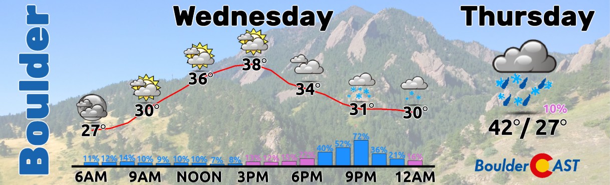
Conditions early Wednesday morning are a bit of a mix bag out there with freezing fog, freezing drizzle, and light snow ongoing across portions of the Metro area. Things will remain mostly dry but chilly as the day progresses, but another more widespread round of light snow is expected to develop for the evening commute Wednesday. Accumulations will generally be light and will favor areas south and southeast of Denver. We’ve got the latest details and our snowfall forecast map for you.
O
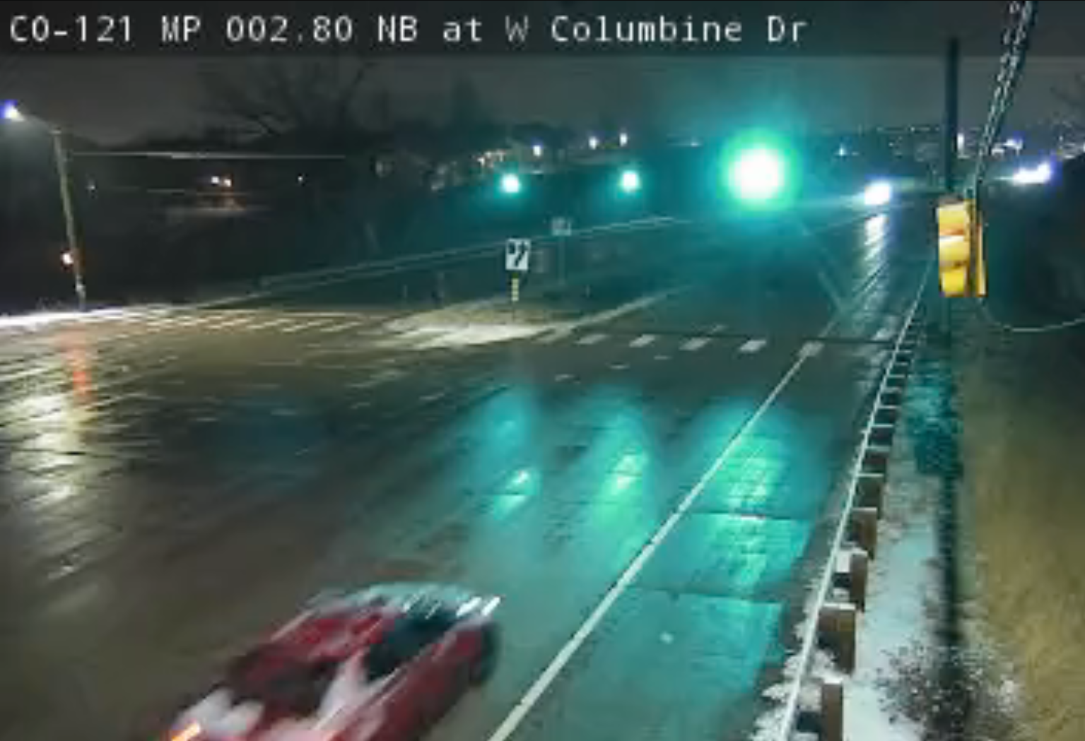
vernight a wave of flurries, light snow, and freezing drizzle developed across portions of the Metro area, mainly along and south of Interstate 70. Some of the cameras this morning are showing slick conditions with iced-over roads and a light coating of snow, like this view from Lakewood-ish.
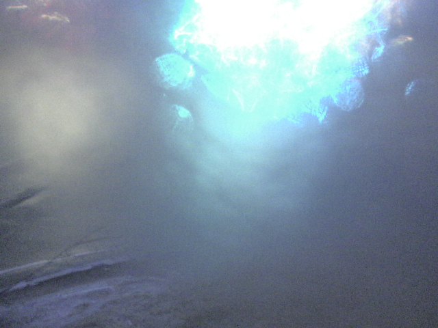
Things are somewhat less snowy in much of the northern Metro area, including around Boulder, though as of writing I am seeing a few snowflakes out the window here as well. There is also a light glaze of ice on things from a round of freezing fog and mist. The image below is a live view just south of Boulder along Highway 93. It’s hard to tell what’s exactly going on there, but it doesn’t look good! With that said, use caution if traveling this morning as your path to your destination may be icier than your origin point.
Yesterday was a cold and gloomy day across the Front Range with temperatures struggling to get above freezing. Today won’t be all that different with mostly cloudy skies and chilly temperatures staying the course. There could be a few flurries around at any point today, though they won’t amount to much if any accumulation. Look for highs in the middle to (at best) upper 30s this afternoon.
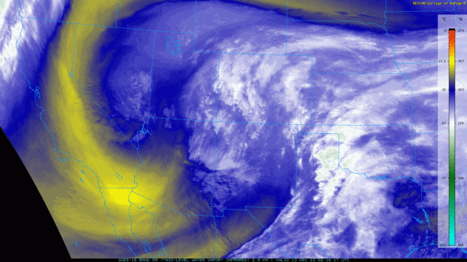
As we head into this evening, another slightly more substantial round of snow will spread into the Front Range from the south — a somewhat anomalous approach. This incoming snow is associated with a potent cut-off low pressure system that will track to our south tonight into Friday. Current GOES-East water vapor imagery Wednesday morning shows clearly the powerful low located near Las Vegas. Lots of moisture is getting wrapped in from the south towards Colorado ahead of the low — this is setting the stage for a widespread snow event this evening into Thursday morning across the state.

Over the next 48 hours, this system will move almost due eastward from its current location, ultimately bringing it across central New Mexico during the day Thursday, a track that has shifted roughly 150 miles further northward compared to earlier model runs.
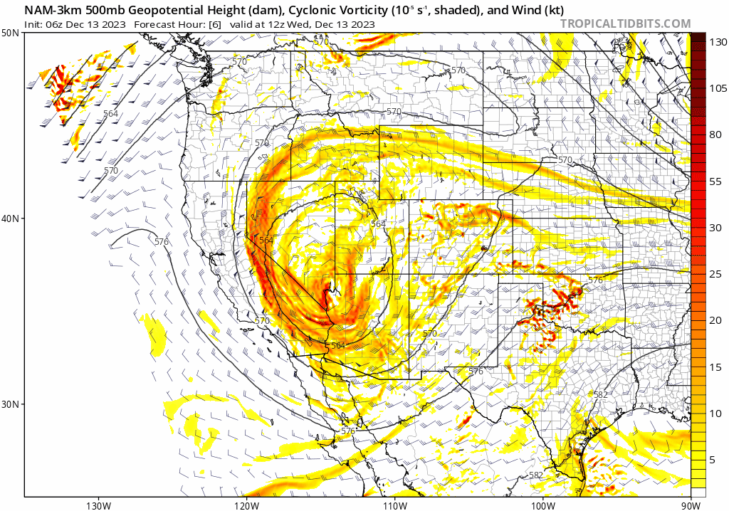
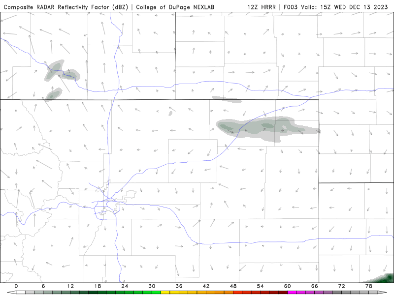
Despite the shift back to the north, this system is still forecast to mainly impact the southern tier of Colorado, with only a slight glancing blow expected in the Denver Metro area Wednesday evening. The latest simulated radar animation from the HRRR model shows the wave of snow moving northward into our area this evening, roughly from 4 to 10PM — this will be the best chance of snow we have this week. This wave is being boosted by an embedded jet streak aloft and thus may contain a band of moderate snowfall capable of putting down a quick 1-2″ in some locations, with timing that could impact the evening commute. Plan for worsening travel conditions to unfold this evening south of Denver — nothing too bad, but head home earlier today if you can!
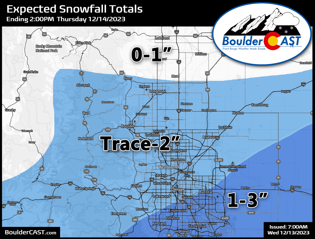
Our snowfall forecast map for this evening’s snow is shown below. Overall, most of us see just a few flakes or a dusting, but lucky southern areas may see an inch or two. Some flurries and/or freezing drizzle may linger into Thursday morning, but the bulk of the snow accumulation will be over and done with by 10PM tonight.
Winter Weather Advisories and Winter Storm Warnings are posted for much of Colorado, but not Boulder or Denver. The advisories in the Foothills west of town are actually for this morning’s freezing fog and drizzle — not for tonight’s snow. 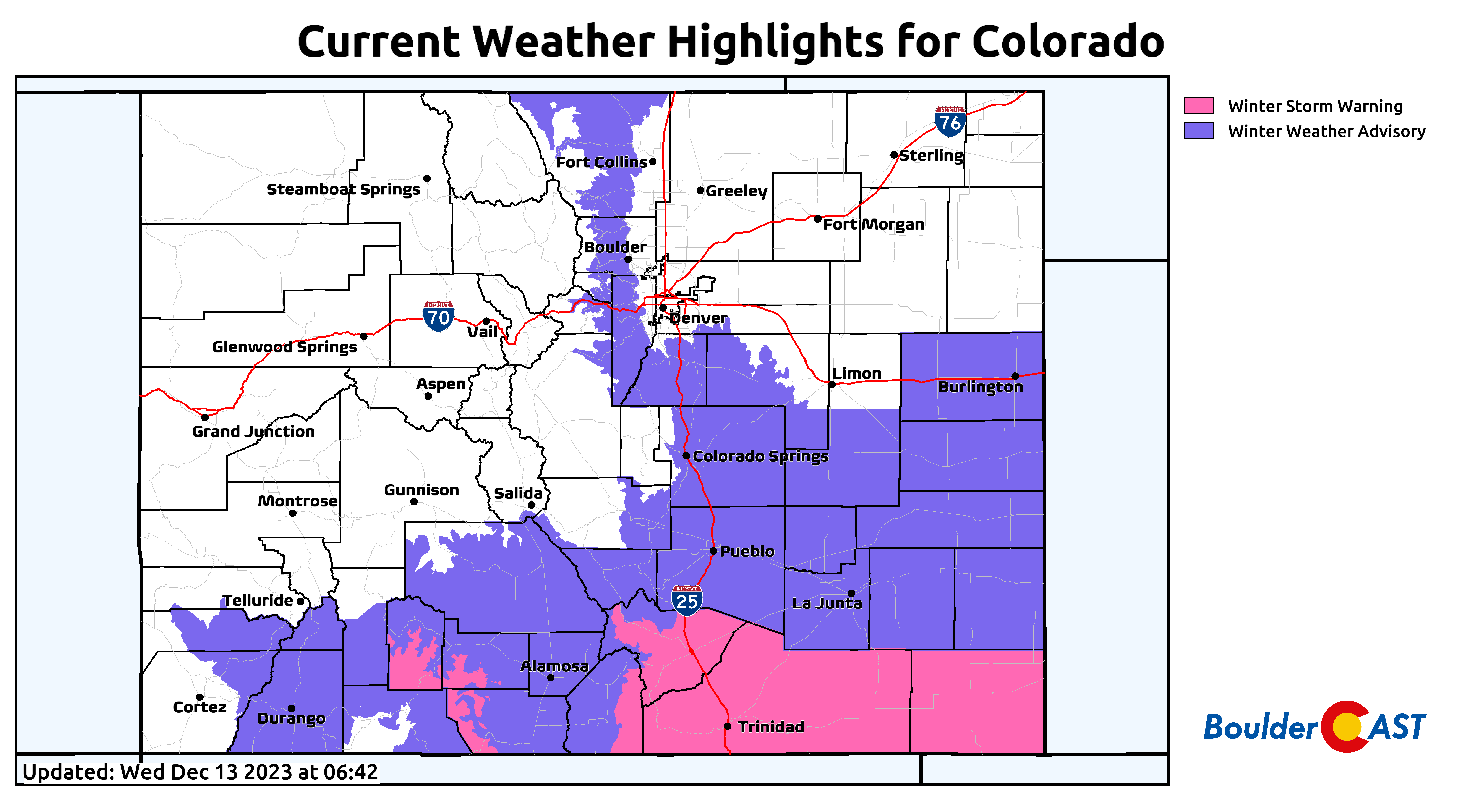
While this storm is definitely a miss for the Denver area, it will keep the feel and look for winter around for at least one more day — fitting as we near ever-closer to the Winter Solstice next week. Enjoy the wintry weather and travel safe!
Get BoulderCAST updates delivered to your inbox:

Go Premium, get all the perks.
Daily Forecast Updates
Get our daily forecast discussion every morning delivered to your inbox.
All Our Model Data
Access to all our Colorado-centric high-resolution weather model graphics. Seriously — every one!
Ski & Hiking Forecasts
6-day forecasts for all the Colorado ski resorts, plus more than 120 hiking trails, including every 14er.
Smoke Forecasts
Wildfire smoke concentration predictions up to 72 hours into the future.
Exclusive Content
Weekend outlooks every Thursday, bonus storm updates, historical data and much more!
No Advertisements
Enjoy ad-free viewing on the entire site.


You must be logged in to post a comment.