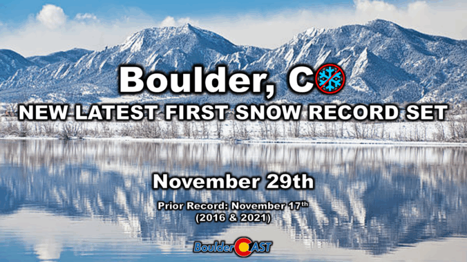
Boulder’s long snow drought has finally ended—just shy of a record streak. An Arctic front swept through early Saturday, dropping temps fast and delivering the season’s first flakes. Boulder picked up 0.3″, the latest first snowfall ever recorded in the city and it wasn’t even close. Curious how our forecast stacked up and what’s next? Spoiler: Another round of snow is already knocking on the door for Sunday.
Storm Recap: Record late first snow behind us
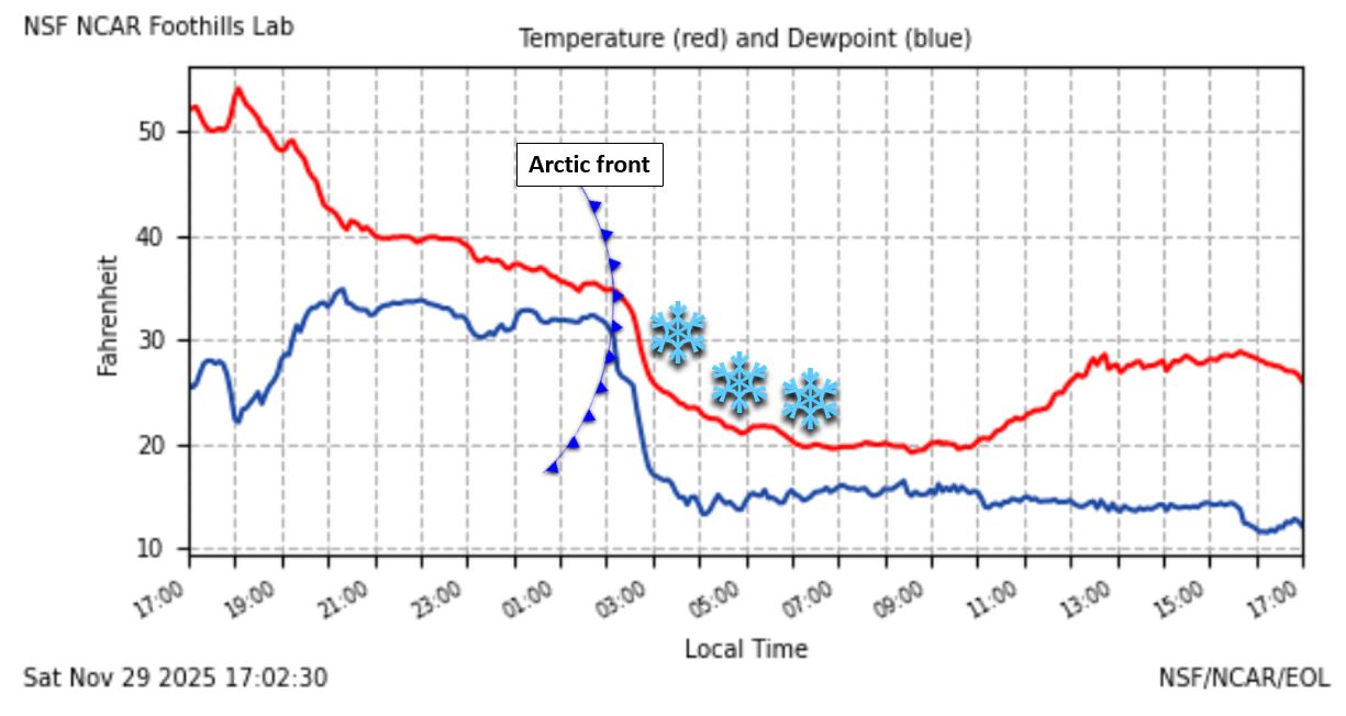
It nearly took until the month of December, but the exceptionally delayed first snow of the year is now behind us thanks for an Arctic frontal boundary that blew through early Saturday morning. The temperature graph below (red line) shows the front passing into Boulder just after 2AM Saturday morning, with temperatures dropping from the 30s quickly into the lower 20s.
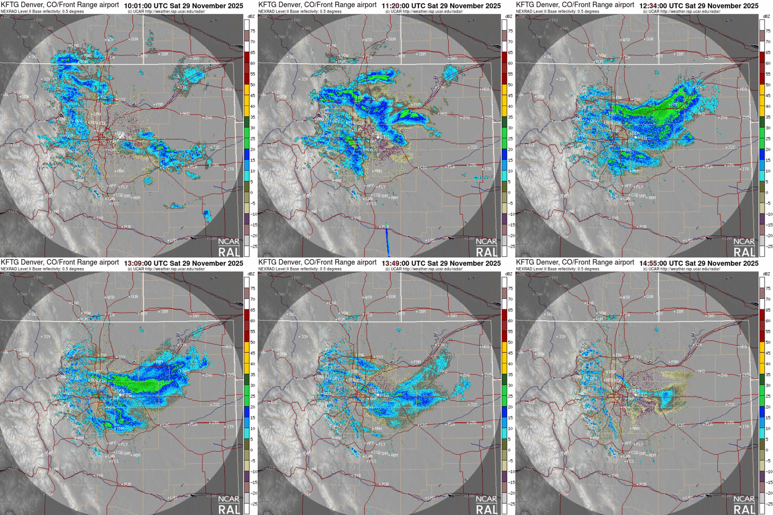
Behind the front, scattered snow showers blossomed across the Front Range. Most spots picked up at least one or two of these, with radar showing narrow bands sweeping through the Metro area:
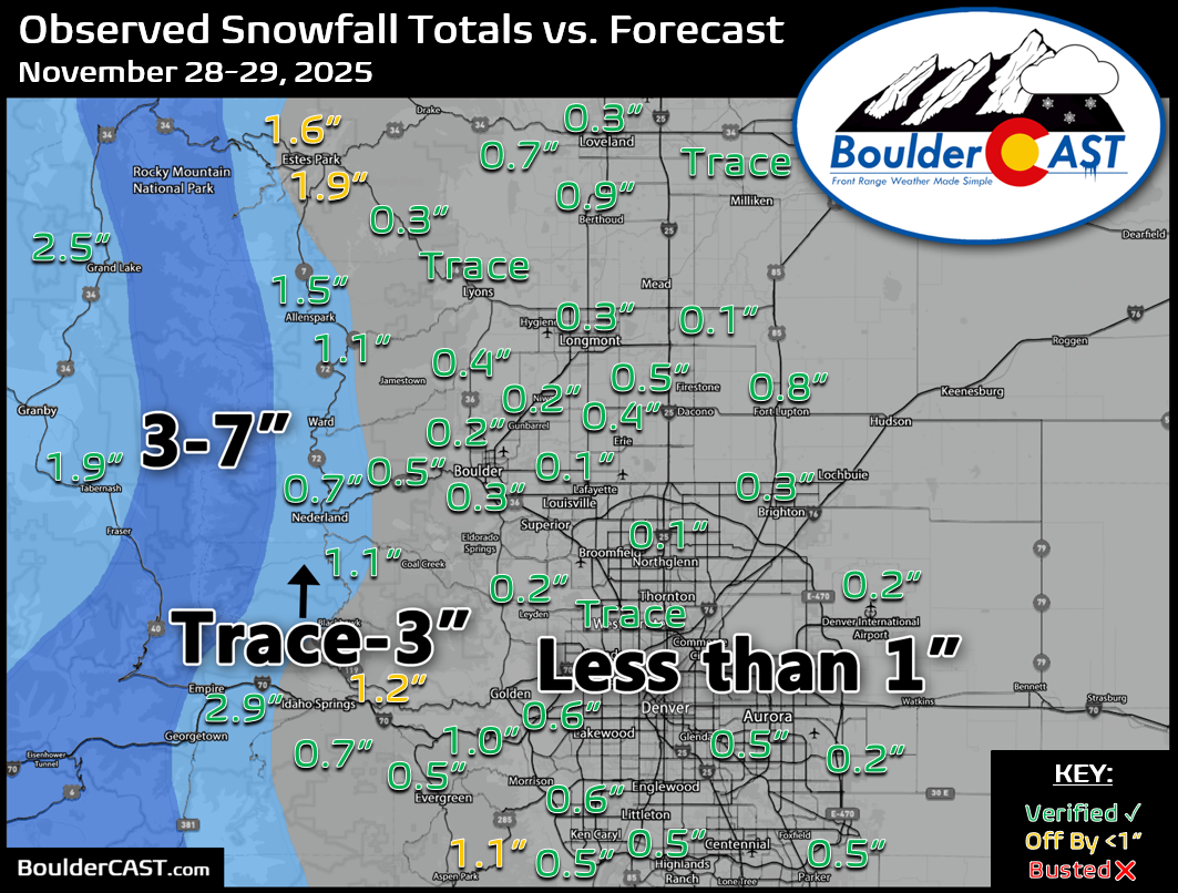
Our snowfall forecast map for the event is shown below with storm totals overlaid. Green values indicate our forecast verified, Yellow values mean the observed total was just outside our forecast, while Red was a busted forecast (more than 1″ off). With few exceptions, the entire Boulder-Denver Metro area picked up a dusting of snow from the scattered snow showers/bands. Some Foothills locations received just over an inch.
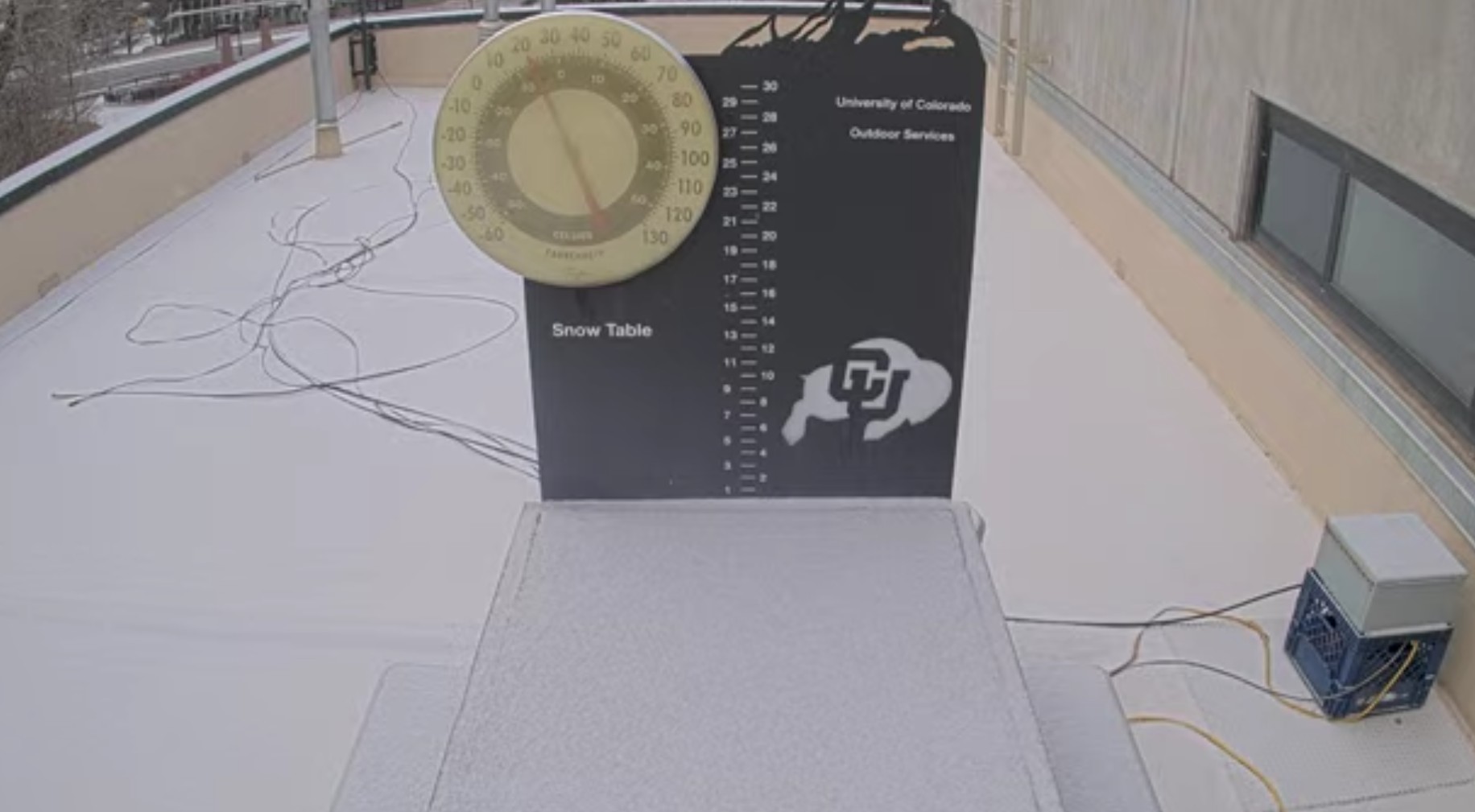
Boulder’s official tally was 0.3″, and it sure was beautiful to see the city dusted in white again!
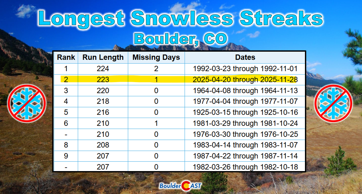
Today’s meager flakes ended a remarkable 223‑day snowless streak in Boulder, just one day shy of the all‑time record set in 1992.
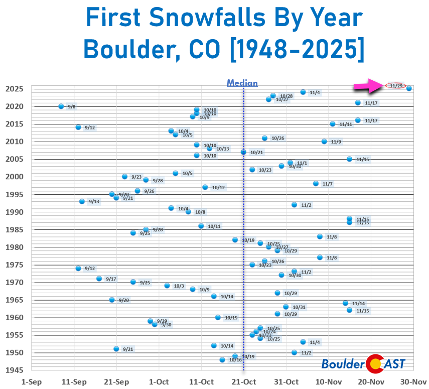
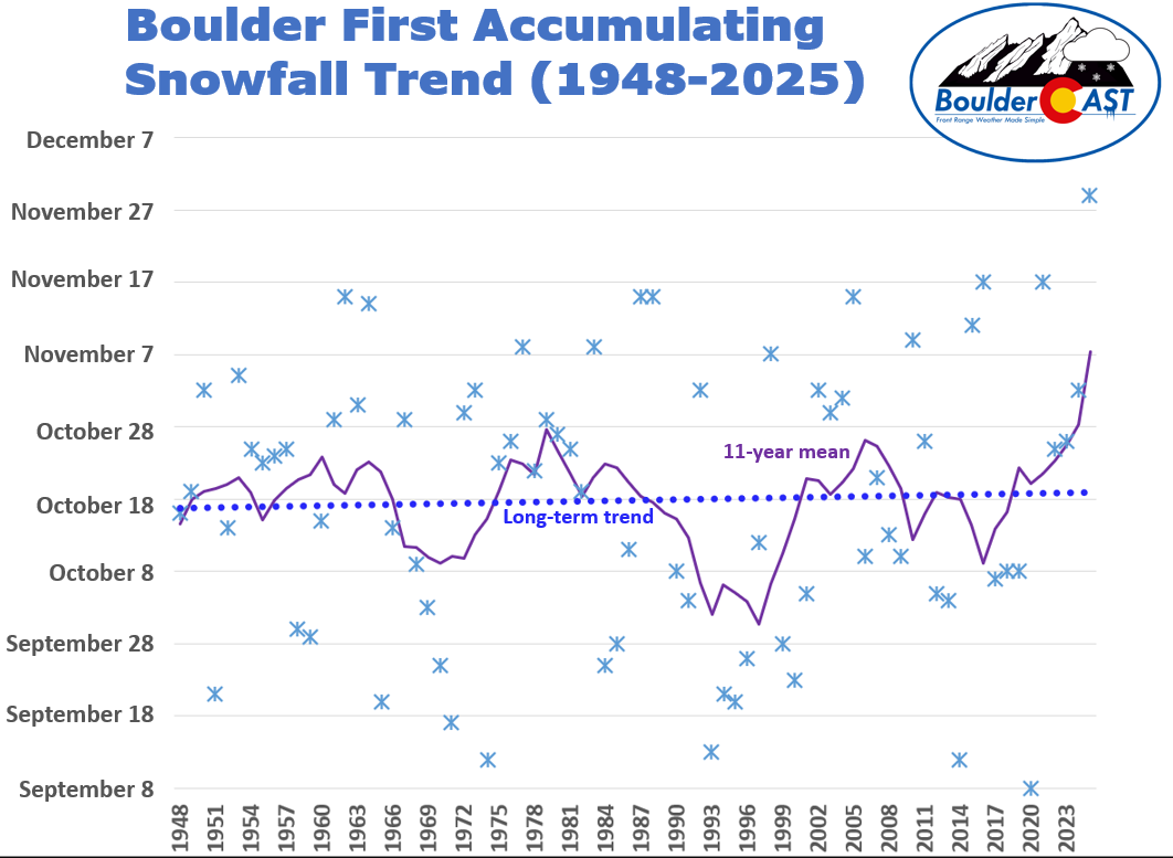
This year’s first flakes arrived about five weeks later than average, and nearly two weeks later than the previous “latest first snow” benchmarks (November 17 in both 2017 and 2021).
The fact that Boulder and Denver both set near‑record late snow season starts is a reminder of how climate variability is reshaping seasonal expectations in the Front Range—snow droughts are becoming more common, and their impacts ripple into our water supply and fire risk.
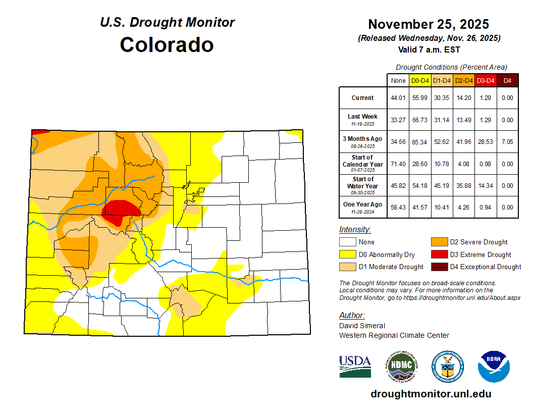
It’s hard to deny the similarities between this exceptionally warm and dry autumn and the one leading up to the Marshall Fire four short years ago. Just take a look outside at our forests, at our grasses. While today’s snow was somewhat exciting, it melted quickly and contained barely any moisture to help the tinderbox surrounding the area (generally less than 0.05″ of liquid).
Fortunately we won’t have to wait long to get back on the snow horse again. Another round of white stuff arrives to the area on Sunday with spotty totals up to 1″ possible again, but higher amounts in the Foothills just to the west. Check back tomorrow for our forecast update or subscribe.
Get BoulderCAST updates delivered to your inbox:
Daily Forecast Updates
Get our daily forecast discussion every morning delivered to your inbox.
All Our Model Data
Access to all our Colorado-centric high-resolution weather model graphics. Seriously — every one!
Ski & Hiking Forecasts
6-day forecasts for all the Colorado ski resorts, plus more than 120 hiking trails, including every 14er.
Smoke Forecasts
Wildfire smoke concentration predictions up to 72 hours into the future.
Exclusive Content
Weekend outlooks every Thursday, bonus storm updates, historical data and much more!
No Advertisements
Enjoy ad-free viewing on the entire site.
Enjoy our content? Help us out and give it a share:



You must be logged in to post a comment.