
More white stuff is in the forecast for early Thursday morning. Unfortunately, poor timing could interrupt the morning commute. We discuss why this snow is “sneaky”, the timeline for the event, and potential snow amounts.
Since ringing in the New Year, a persistent ridge has been in place directly over the United States which has led to most of the country experiencing temperatures significantly above normal over the last three weeks or so, including eastern Colorado…

This quiet pattern has slowly been transitioning into one that will be much more active for the north central and northeastern regions of the United States for the coming week or two. The aforementioned ridge has shifted westward into the northeast Pacific Ocean and has amplified all the way into the Arctic Circle (see below).

ECMWF ensemble forecast for 500 mb height anomaly for Thursday evening
We first discussed these changes likely coming from this pattern shift with our Premium members nearly two weeks ago.
.
This alteration in the position of large-scale weather features over North America allows more frequent Arctic air intrusions to occur, particularly across the central and eastern tiers of the country. These cold airmasses can sometimes glance northeast Colorado as well, though the much more favorable scenario keeps the coldest air well east of the Front Range. The night-time snow to close-out M.L.K. Day was an example of what this pattern can bring to the table. A secondary, weaker system will “follow suit” tonight into Thursday morning. This system is the topic of today’s forecast…
Shown below is the GFS 500 mb vorticity map for Wednesday at mid-day. Note the ridge off the California Coast and the deep trough in the cental part of the country (that was our MLK Day snow-maker!). The storm system we are tracking is located in Idaho and western Montana right now. It will bring snow first to the Mountains today and tonight and eventually to the Metro area by early Thursday morning.
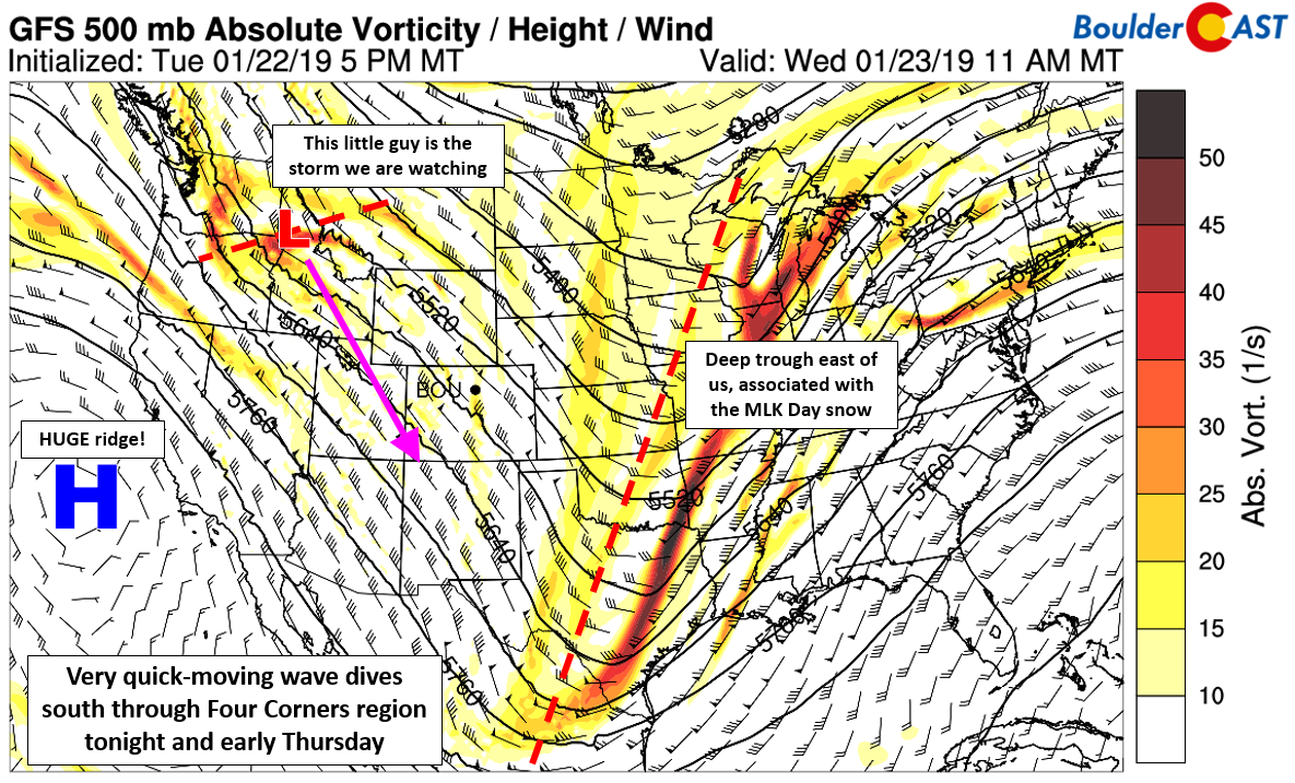
GFS 500 mb vorticity map for Wednesday at mid-day
Notice the precipitation shield (mainly snow) spreading south and east with the storm system below. This animation goes through Thursday evening.
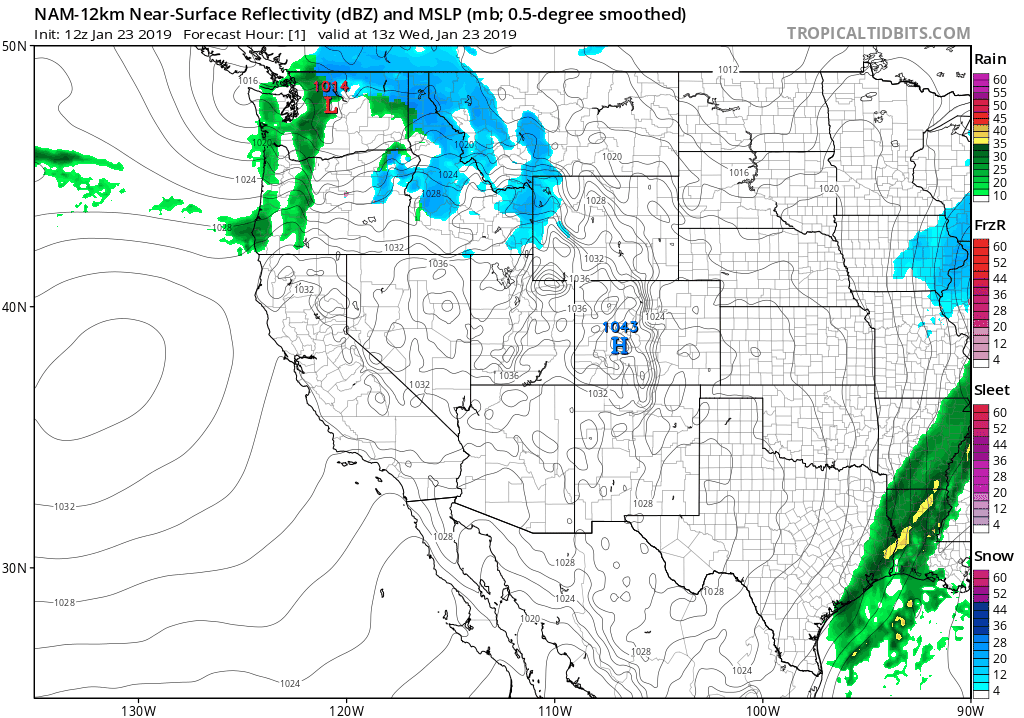
NAM model hourly precipitation forecast animation through Thursday evening
You are probably wondering why we used the adjective “sneaky” to describe the chance of snow for Thursday. Well, there really is no better way to characterize it…
The incoming storm system is moving so rapidly that there will only be a very short window of opportunity for snow across the lower elevations. The short window is due to the necessary ingredients only overlapping ever-so-briefly. But while they do, the resulting snowfall produced could be localized and intense across the Metro area. Below is the NAM model forecast sounding over Boulder at 6:00 AM on Thursday. We like the look of the 25 knot northeasterly winds and also a fully-saturated “snow growth layer” which also happens to be co-located partially with the best lift.
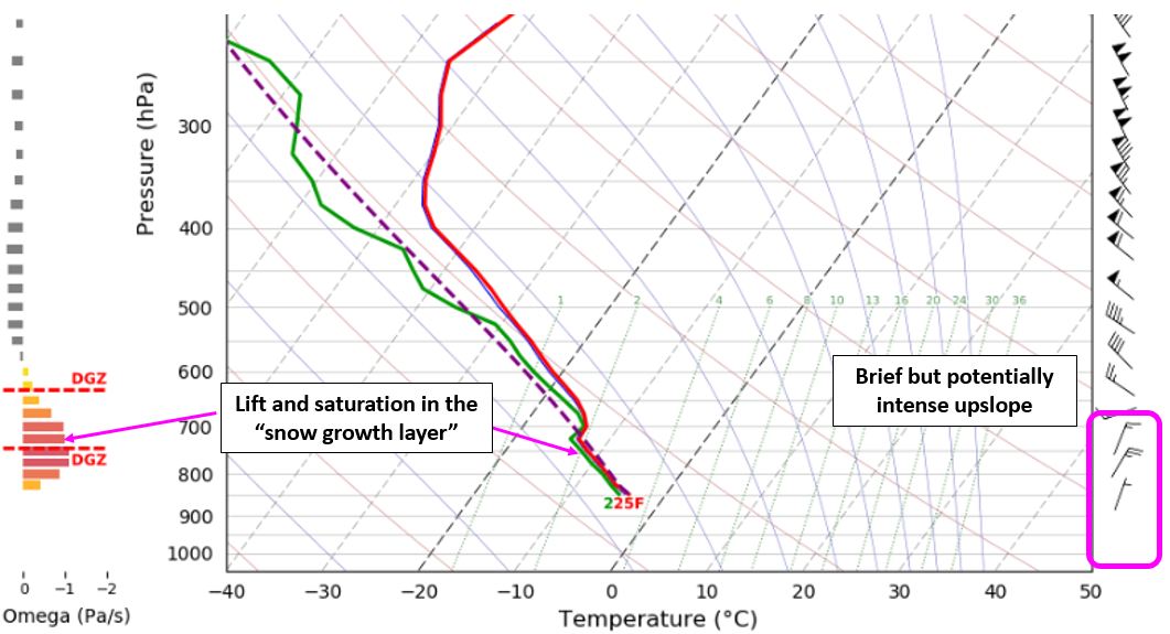
NAM model sounding for Boulder Thursday morning
For the last few days, models were not in great agreement for this overlap to occur. Some had it, others didn’t. This created large discrepancies in potential snow amounts, with just the subtle timing of things as the only explanation for the resulting differences. However, just about every model is now on-board. So yes, we have the MOISTURE, we have the COLD AIR, we have the UPSLOPE, and finally, now, have good reason to believe that they will indeed OVERLAP!
Timing
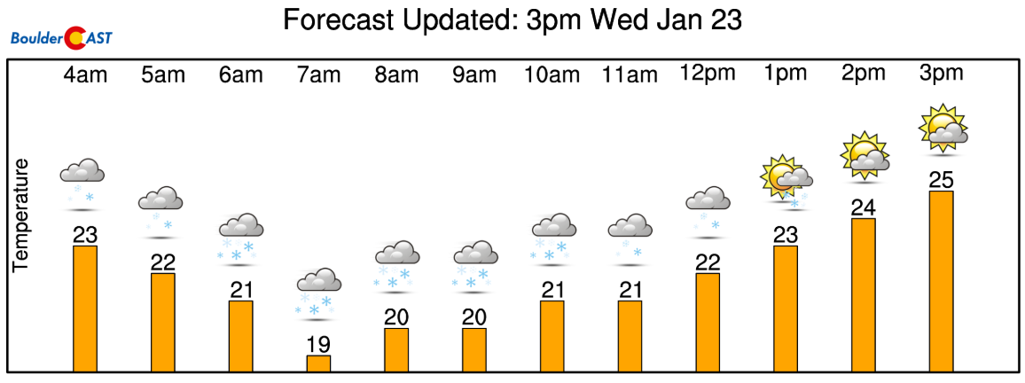
Based on what most models are showing right now, the window runs from about 2:00 AM to 2:00 PM on Thursday, with the highest probability of snow in the 6:00AM to 10:00AM timeframe. Snow during the peak of things could be heavy with blustery winds making for white-out conditions.
As winds quickly turn to downslope Thursday afternoon, any chance of snow goes away as well with temperatures warming into the upper 20’s.
Snow Amounts
Here are the latest QPF (liquid precipitation) forecasts from the various models across the Metro area:
- GFS: 0.25 – 0.3″
- NAM: 0.1 – 0.2″
- Euro: 0.1 – 0.2″
- HRRR: 0.1 – 0.2″
- High-res NAM: 0.2 – 0.25″
We’re seeing good agreement for 0.1 to 0.3″ across the board. The GFS and its ensembles are definitely on the higher end of things, but not outside the realm of possibilities..

GFS ensemble precipitation plume forecast
Given that temperatures will be in the lower 20’s with good snow-growth conditions aloft, we expect moderately high snow ratios for this event. Our algorithms tell us 16:1 to 18:1 will be common for the Metro area.

GFS model-derived snow ratio forecast for Thursday morning.
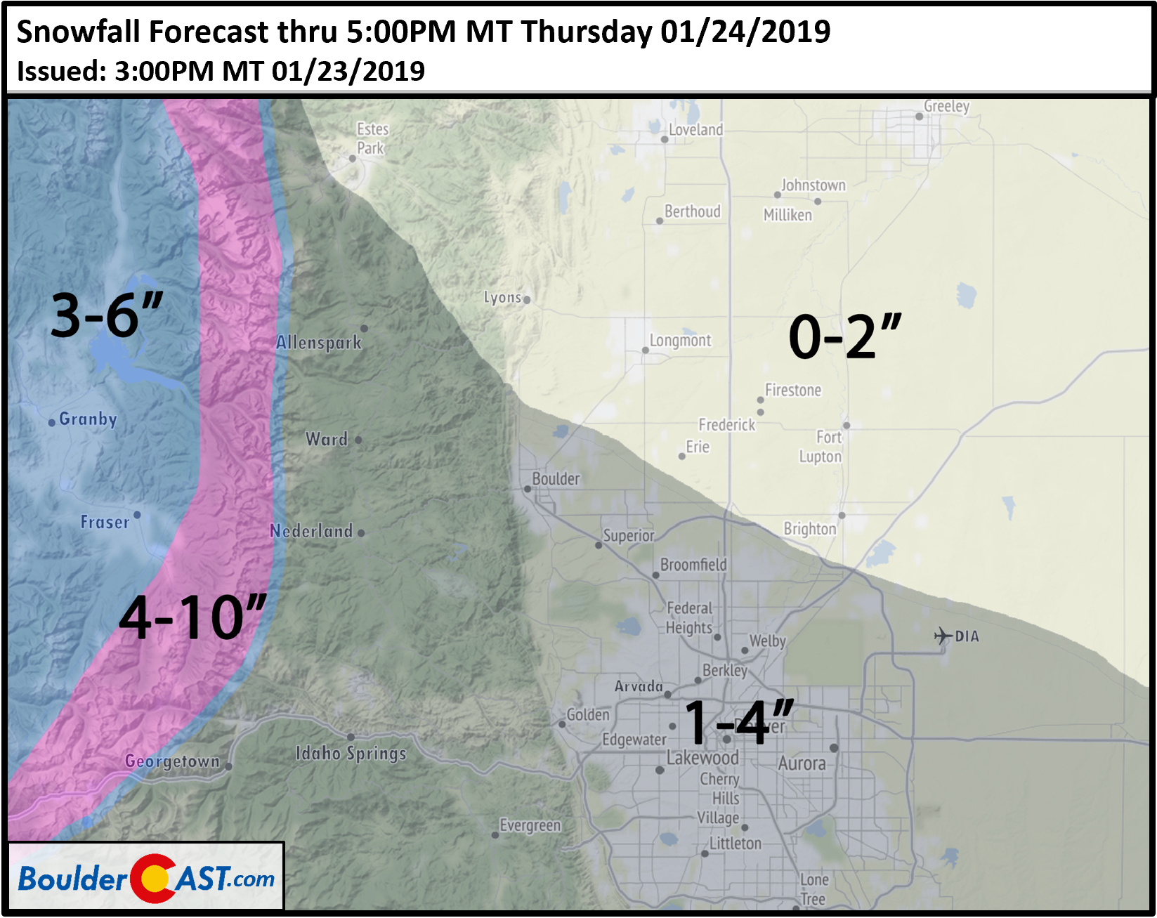
With the consistency the models are now showing and the snow ratios, most areas from Boulder southward should see at least an inch of snow, with 1-3″ likely to be the most common spread across the Metro area. We do see the potential for localized spots to pick up higher amounts, maybe closer to 4 or 5″. This means that for many of us, Thursday’s snow event will be more substantial than the one earlier this week.
Our snowfall forecast shakes out as follows:
Thursday morning’s rush hour has the potential to be impacted, mostly due to the timing of the snow. If you are traveling through an area that sees a heavier snow shower and gusty winds, roads could be slick and visibility drastically reduced.
.
Words of caution: While EVERYTHING we are seeing right now looks to be on-track with our forecast, any small changes in any one of the key ingredients, related to either the intensity or timing, could make or break the snow event entirely. We won’t call it uncertainty, but just know it wouldn’t take much for things to be a little tamer, or get a little crazier, than our forecast.
P.S. It’s also dumping in the Mountains, if that is your fancy!
Spread the word, share our forecast:


You must be logged in to post a comment.