
This week begins right where last week ended….with an approaching storm and the chance of showers for the region. Then, a high-amplitude ridge will build by midweek bringing quiet and somewhat warmer weather for us heading into the weekend. Read on for details.
Friday night’s snow recap:
The powerful spring storm late last week ended-up tracking just a hair too far north. This limited the upslope into the Boulder area Friday evening and night. This track deviation also brought the storm’s dry slot in our region Friday afternoon, suppressing much of the convective activity that was expected across the Foothills and Mountains. The higher elevations thus missed out on A LOT of snow from this storm, while the forecast across the Plains met our expectations in most regards.
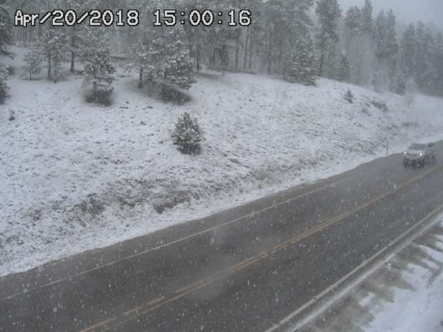
Heavy convective snow falling Friday afternoon near Nederland.
Shown below is our original snowfall forecast map (issued Friday morning), with the observed storm totals per location contained in boxes. Green ones indicate that the observed snowfall was within one inch of the given forecast range, while red was outside the scope of our forecast.
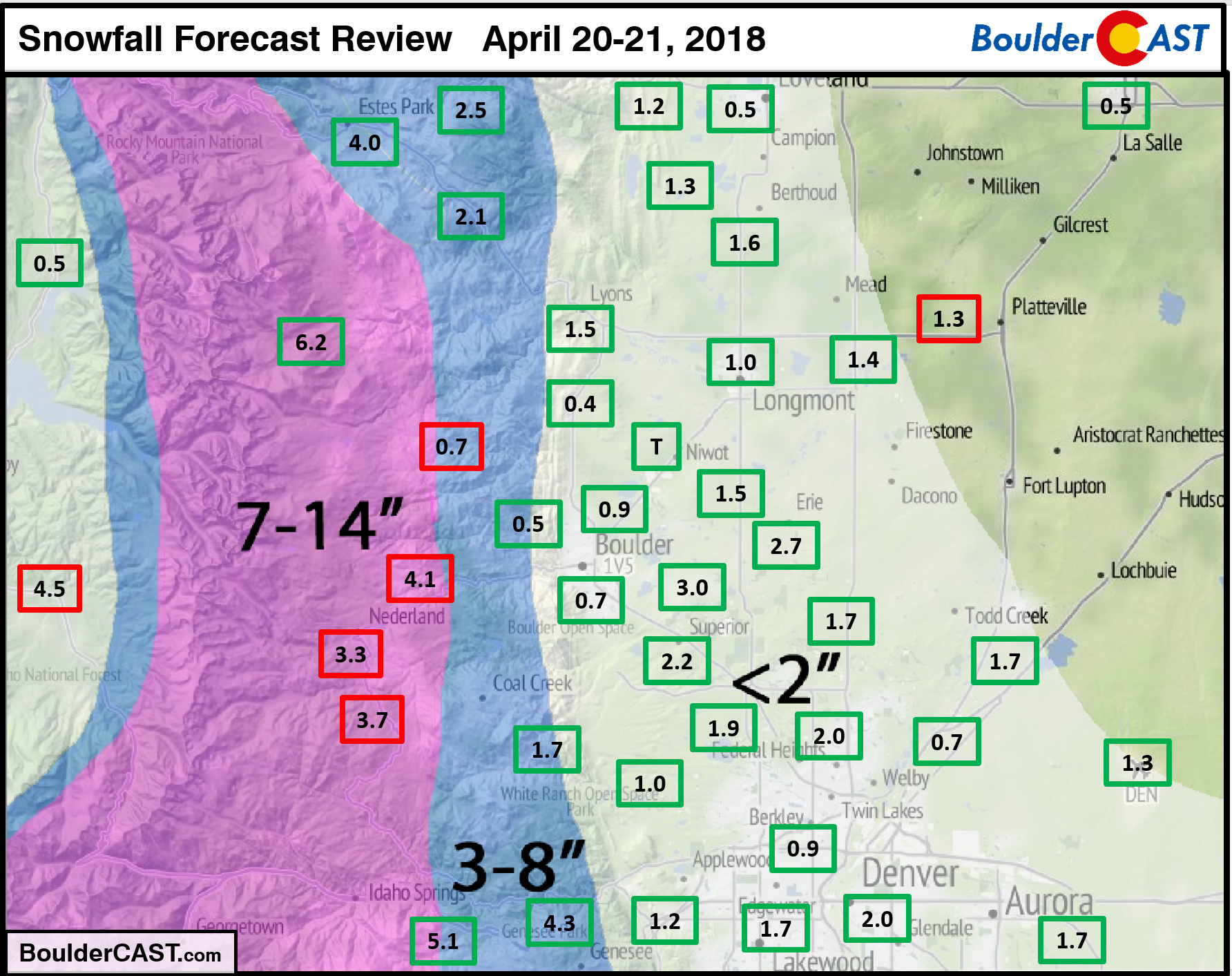
Snow totals ranged from 0 to 2″ across the Plains and from 1 to 6″ in the Foothills and Mountains. Boulder reported 0.7″, with Denver surprisingly slightly higher at 1.3″. Liquid precipitation totals across the Metro area ranged from 0.4 to 0.8″, just slightly below our projections of 0.5 to 1.0″. Overall, we had a decent forecast for beneficial moisture, but we can’t help but feel some disappointment for what this storm could have been had it gotten its act together at little better as it moved across the Front Range!
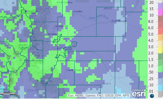
Observed precipitation totals from across the Metro area for the event.
The week ahead: Unsettled early week
We get right back on the meteorological-horse early this week with another storm system approaching Colorado on Monday! Unlike our last spring storm, this one is hitting Colorado from the northwest. As would be expected, it will be weaker, drier, and slightly colder than what we saw late last week.
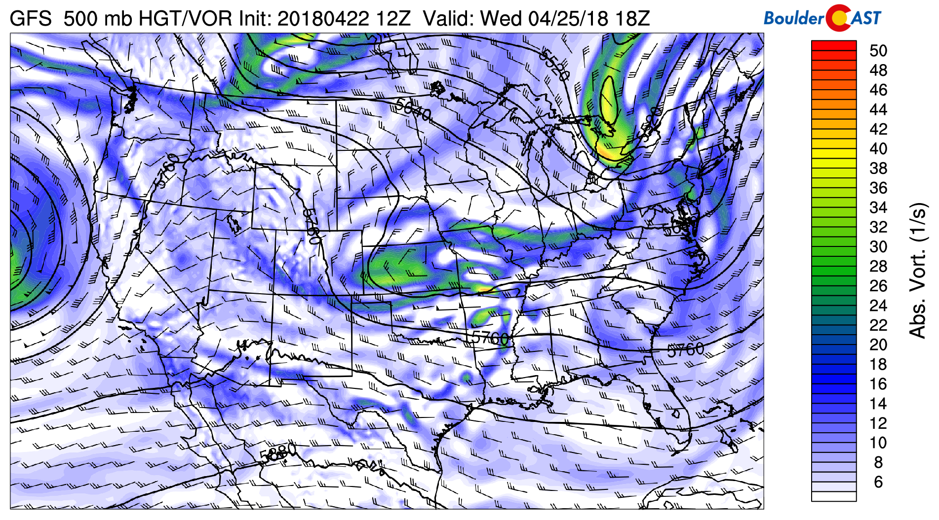
The GFS 500 mb map below shows the position of the trough axis as of Monday evening. Though it’s not entirely obvious, the storm system is indeed cut-off from the jet stream and will be a slow-mover over the next two days. It will bring a lengthy period of unsettled weather to the Front Range, encompassing Monday night and much of the day Tuesday.
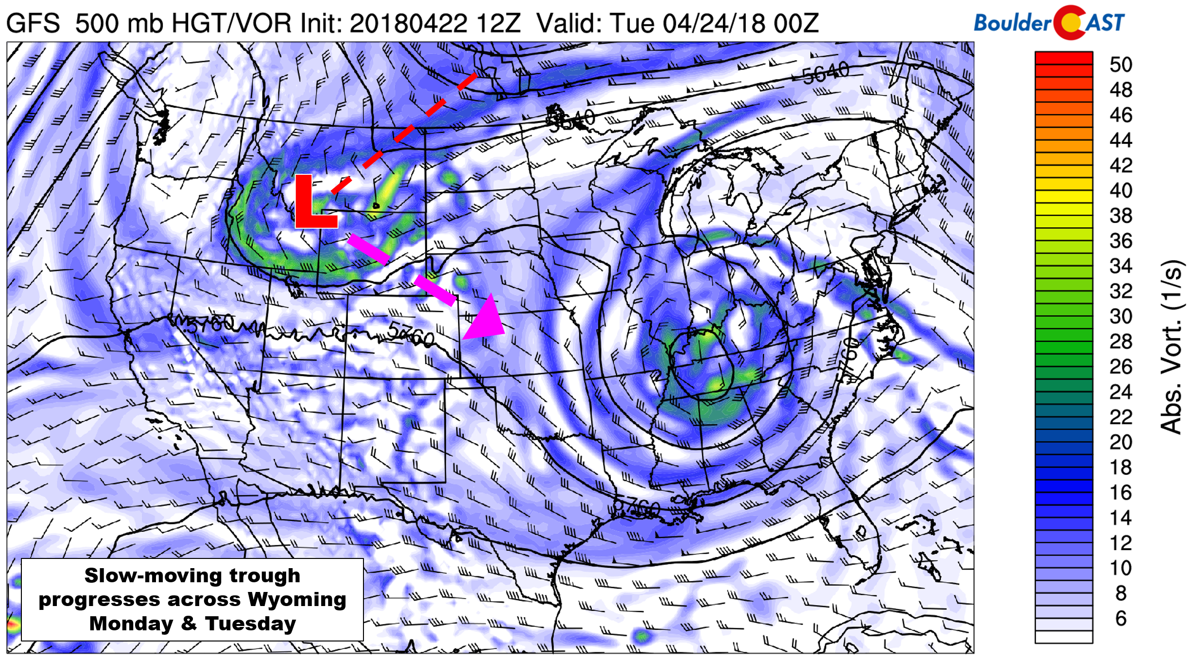
GFS 500 mb vorticity map for Monday evening showing the approaching trough/storm.
Monday will actually be rather pleasant for the most part, with partly sunny skies and temperatures in the 70’s across the lower elevations. It’s not until the late afternoon or early evening hours that we expect isolated showers and a few embedded thunderstorms to begin developing across the higher terrain, then moving eastward onto the Plains. These storms will preclude the passage of a cold front, likely to arrive into the Metro area around sunset or slightly after. The NAM 800 mb temperature and wind map below shows the position of the front at midnight Monday night.
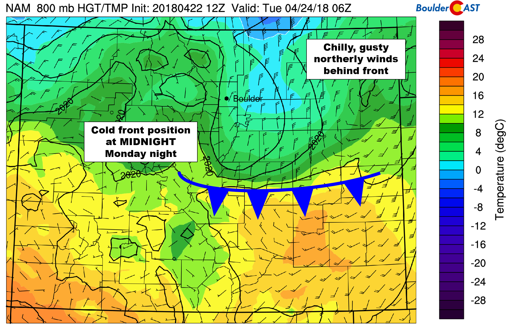
NAM 800 mb temperature and wind forecast for Monday night at midnight.
After the front passes, moist northeasterly flow will move into the Metro area. This will produce widespread light upslope-forced precipitation for the region and gusty winds to 30 mph at times. Temperatures are likely to become cold enough in the wee-morning hours Tuesday for rain to change to light snow, even across the lower elevations. Accumulations though are expected to be less than 1/2″ for the Plains, with up to 2″ in the Foothills.
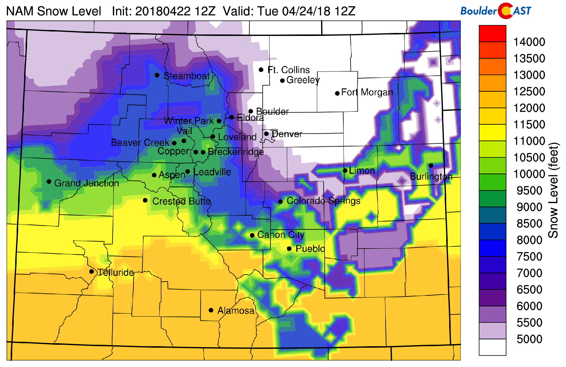
NAM model-derived snow level forecast for 6:00 AM Tuesday. The airmass should be cold enough to support snow down to around 5,000 elevation.
Light precipitation and dreary skies will continue through much of Tuesday morning with shallow upslope in place. For areas in and near the Foothills, it will probably last into the afternoon or evening hours before skies finally clear Tuesday night. It should be cold enough for snow in the early morning hours, eventually warming to become rain or mist for the Plains by lunchtime.
The ski resorts can expect generally 1-3″ Monday night and Tuesday from this storm…not much at all really…
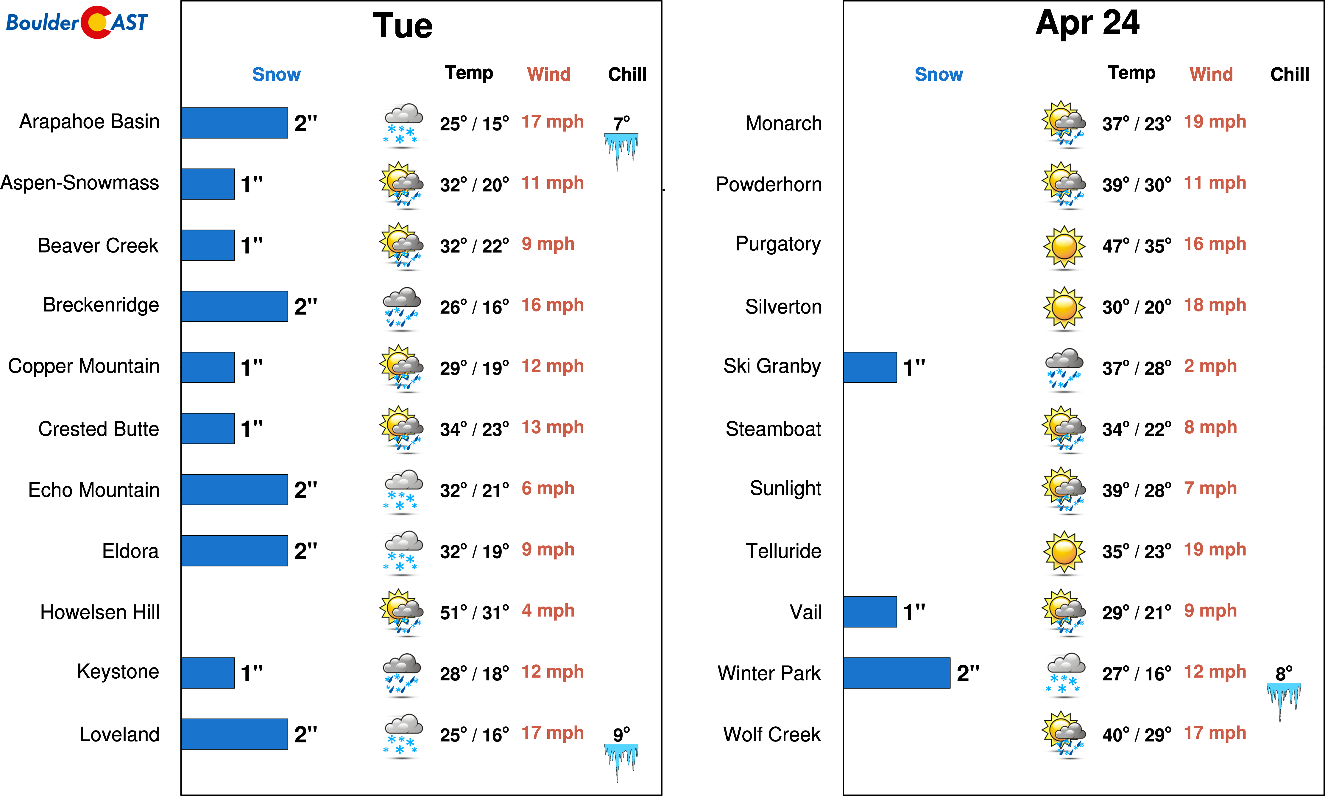
PowderCAST ski forecast for Tuesday. 1-3″ of snow is expected for the Interstate 70 resorts.
Warming up late week
The second half of the week will be mostly quiet across Colorado. The 500 mb map below for Wednesday shows that the system has pushed to our south and east into Kansas, with northerly flow remaining across the Front Range. Wednesday will be very sunny with temperatures remaining on the cooler side under that northerly flow. Highs will be in the middle 60’s.
GFS 500 mb vorticity map for Wednesday afternoon.
For Thursday and Friday, models are in good agreement that a high-amplitude ridge will build across the axis of the Rocky Mountains. However, on the eastern edge, a weak system will skirt across the lower elevations Thursday morning with a backdoor cold front. This wave will be very weak and dry, producing nothing more than a few clouds for us along with a very slight cool-down.
By Friday, we’ll be well within the ridge which will facilitate a nice warm-up for Colorado along with calm weather and winds. Temperatures are expected to near 70 degrees on Friday.
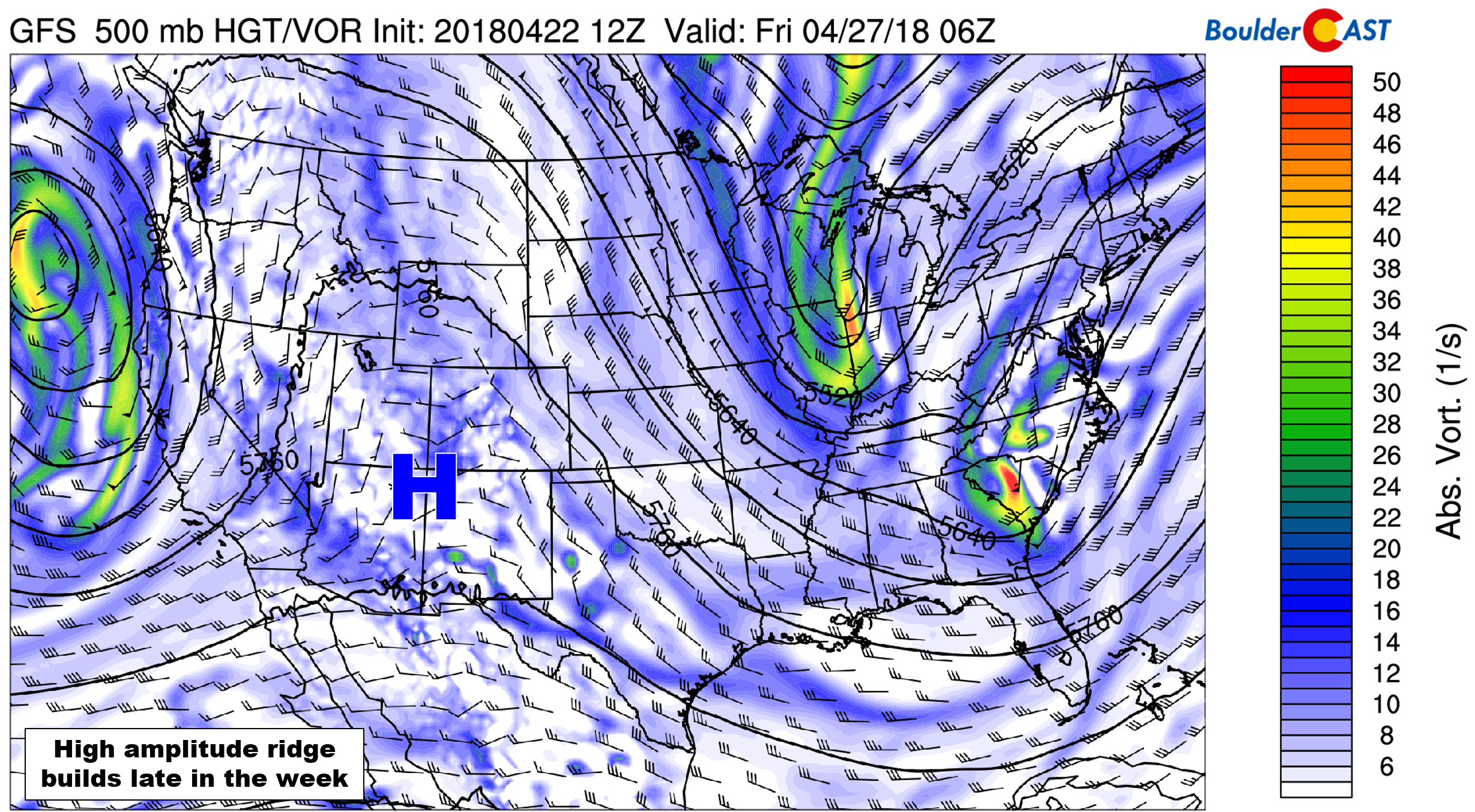
GFS 500 mb vorticity map for Thursday evening. A large ridge axis amplified across Colorado.
The upcoming weekend is shaping up to be rather warm as well, though we are seeing indication of a few isolated storms on Saturday. It’s too early to tell however.
Enjoy the warm, cold, and then warm week ahead!
Forecast Specifics:
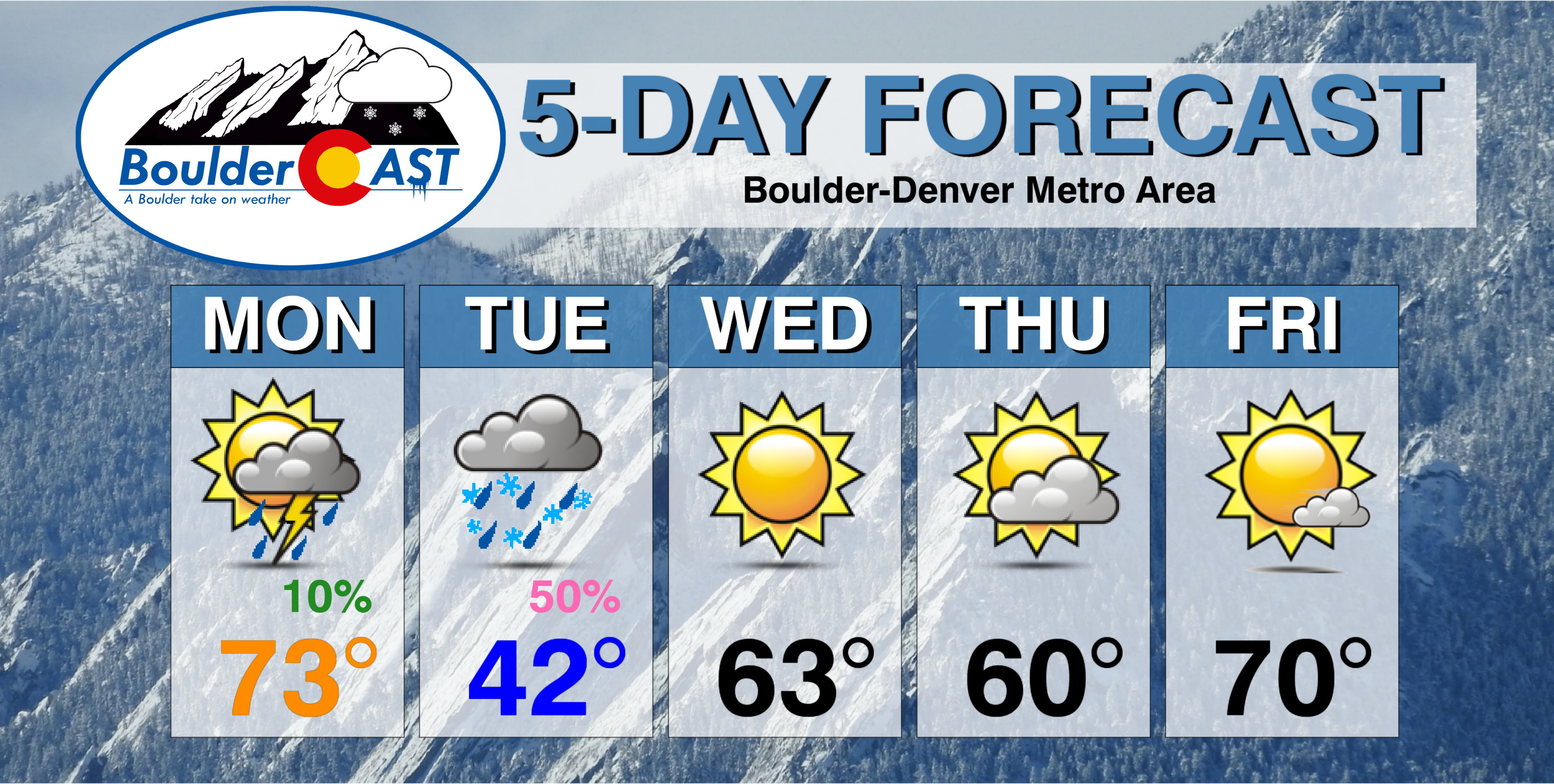
Monday: Partly cloudy and warm with isolated showers and storms developing during the afternoon and evening. Highs will be in the lower 70’s for the Plains, with upper 50’s in the Foothills. An evening cold front will bring blustery northeast winds through the night, with rain showers mixing with or changing to snow before sunrise across the Plains. Less than 1/2″ of snow is expected on the Plains, with up to 2″ in the Foothills.
Tuesday: Dreary weather with low clouds and light snow showers in the morning. Precipitation may continue in and near the Foothills into the late afternoon, mixing back to rain on the Plains. Winds will be breezy, up to 20 mph from the north. Highs will be chilly in the low 40’s across the Plains and in the low 30’s in the Foothills. Little additional snow accumulation is expected.
Wednesday: Sunny and warmer with high temperatures in the mid 60’s on the Plains, with low 50’s in the Foothills.
Thursday: Partly sunny and seasonal with high temperatures near 60 degrees on the Plains and in the upper 40’s in the Foothills.
Friday: Quiet with mostly sunny skies. Expect highs in the low 70’s on the Plains and in the low 60’s in the Foothills.
High Country: Rain/snow showers will increase across the Mountains Monday afternoon, continuing into Tuesday evening. 1 to 3″ of snow is expected for the northern Colorado Mountains and along Interstate 70 above 11,000 feet. Winds will also be blustery out of the west on Tuesday with the jet overhead. Wednesday through Friday will be beautiful with quiet weather statewide. Find the latest forecast for all your favorite Colorado ski resorts on our PowderCAST page.
DISCLAIMER: This weekly outlook forecast was created Monday morning and covers the entire upcoming week. Accuracy will decrease as the week progresses as this post is NOT updated. To receive daily updated forecasts, subscribe to BoulderCAST Premium.

.
Share our forecast!


You must be logged in to post a comment.