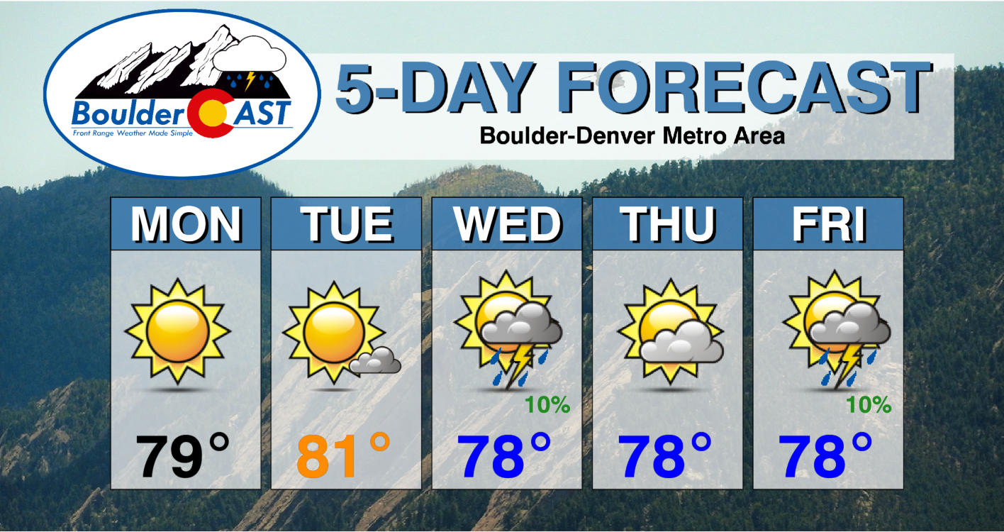
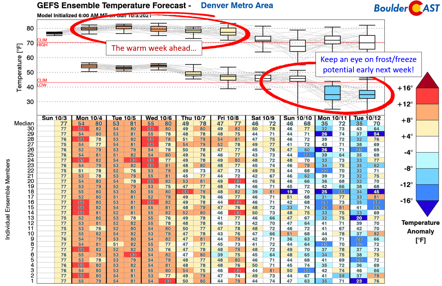
Despite an active pattern across the country, this week will be yet another warm and dry one for the Front Range as Mother Nature continues to focus attention on other parts of the nation with the most impactful weather. Highs throughout the week will be above average with only miniscule chances of rain in the Denver area. However, things will become more unsettled for the upcoming weekend with early signs of substantially colder weather taking hold next week and potential freezing temperatures.
This week’s highlights include:
- Warm & largely pleasant summerlike weather will persist throughout the week
- Highs in the 70’s to near 80 degrees every single day
- A slight chance of rain Wednesday and Friday, but otherwise dry
- Long-range models indicate the chance of potential freezing overnight temperatures next week
DISCLAIMER: This weekly outlook forecast is created Monday morning and covers the entire upcoming week. Accuracy will decrease as the week progresses as this post is NOT updated. To receive daily updated forecasts from our team, subscribe to BoulderCAST Premium.
Warm & mostly quiet this week despite active weather over the nation
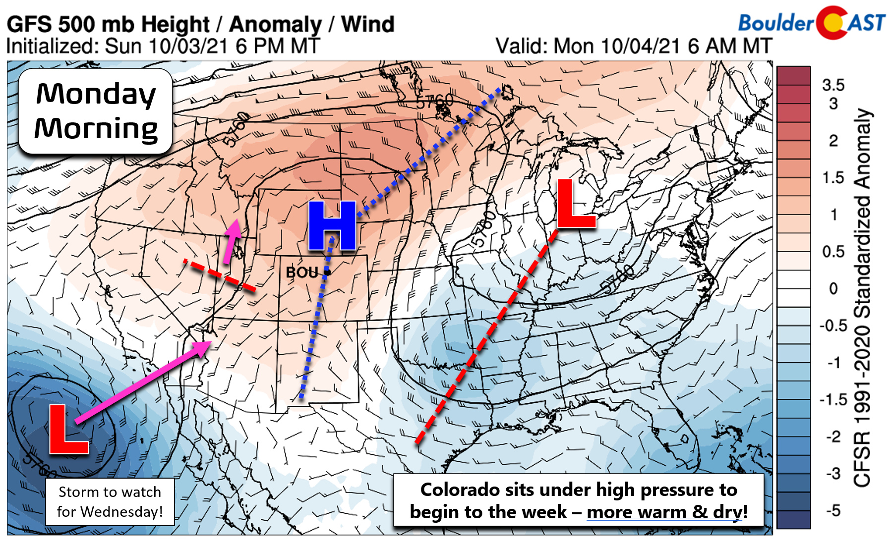
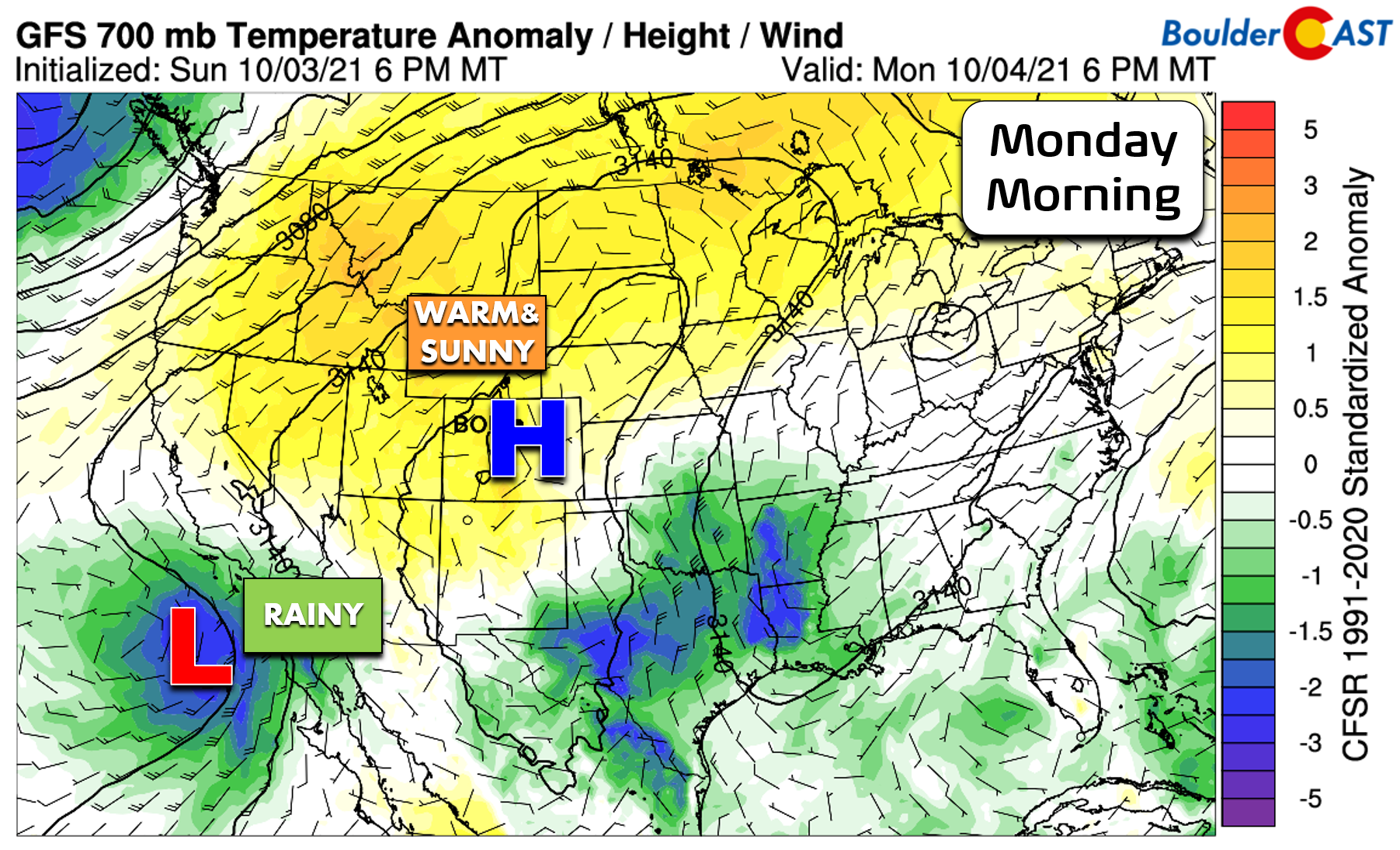
This week will begin right where the weekend left off with continued mild temperatures and sunny skies as a ridge of high pressure sits directly over Colorado as of Monday morning. The large-scale atmospheric pattern to kick off the week is shown below. The seasons are in transition and we are for sure starting to see more active weather in general across the country. A deep trough resides from the Great Lakes to the Gulf Coast. A weak disturbance is moving northward through Nevada which will not be a concern for us. Finally, a surprisingly potent cut-off low pressure sits off the coast of southern California. We’ll be watching this system the next few days as it tracks towards the central Rockies and likely brings some moisture to our state on Wednesday.
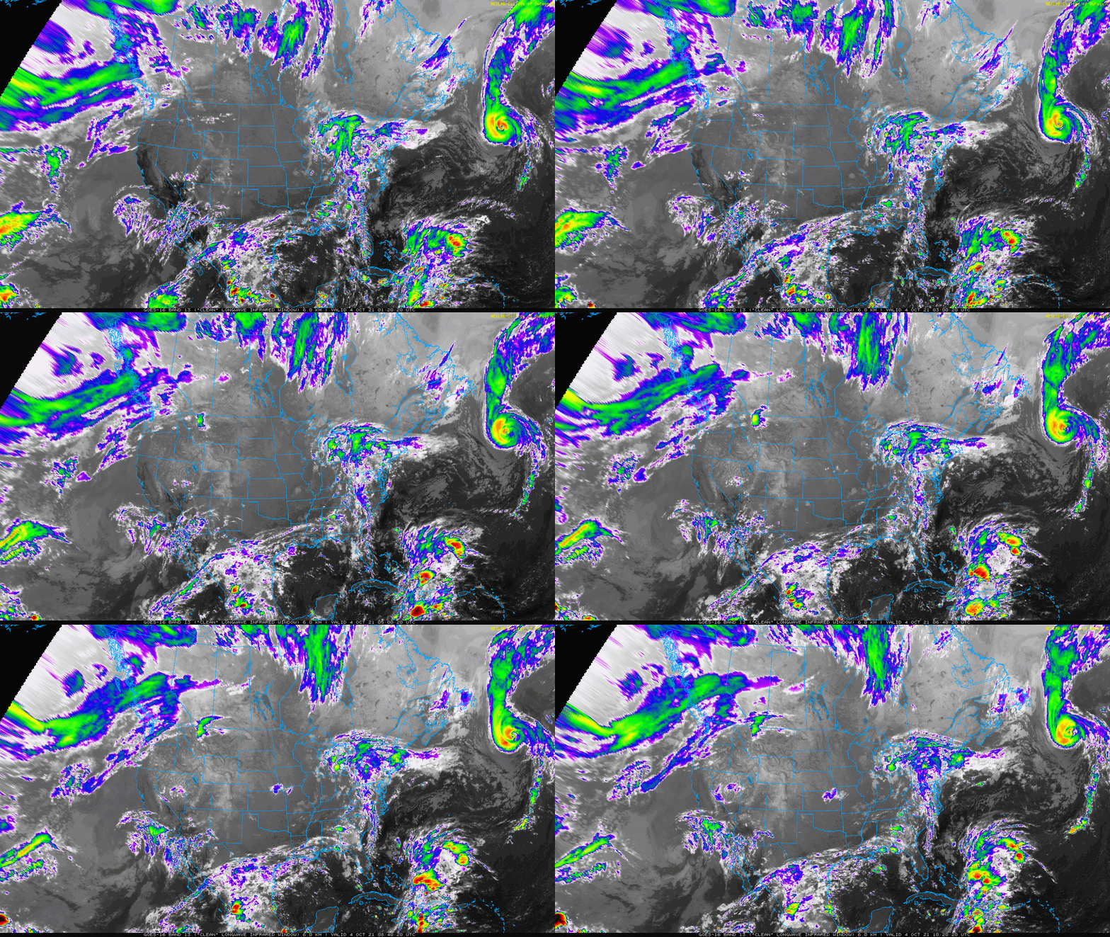
The GOES-East infrared satellite animation from Monday morning is shown below. Notice the rather quiet weather over Colorado, while there is plenty of action in the Great Lakes and with the system near southern California. Category 2 Hurricane Sam can be seen rapidly moving northward in the Atlantic well off the coast of Nova Scotia Canada.
As mentioned, it will be a rather tame start to the week for us in the Denver Metro area as high pressure holds through Tuesday night with temperatures above normal and mostly sunny skies. This time of year, our average highs should be in the upper 60s to lower 70s, but we will be above that range all week long. Each day through Wednesday will be around 80 degrees in Boulder and Denver.
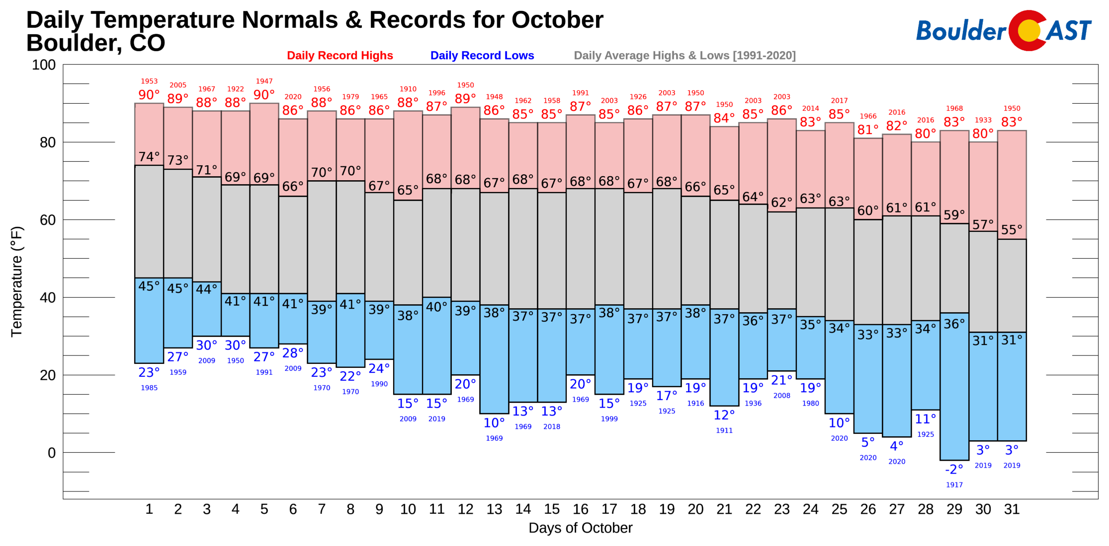
Despite the early autumn warmth permeating the forecast, we do have some good news for those of you that are tired of summer weather. Boulder has never reported a single 90-degree day after October 5th (red bars below). Even better, by the end of October, our average highs drop into the 50s! Something to look forward to, perhaps?
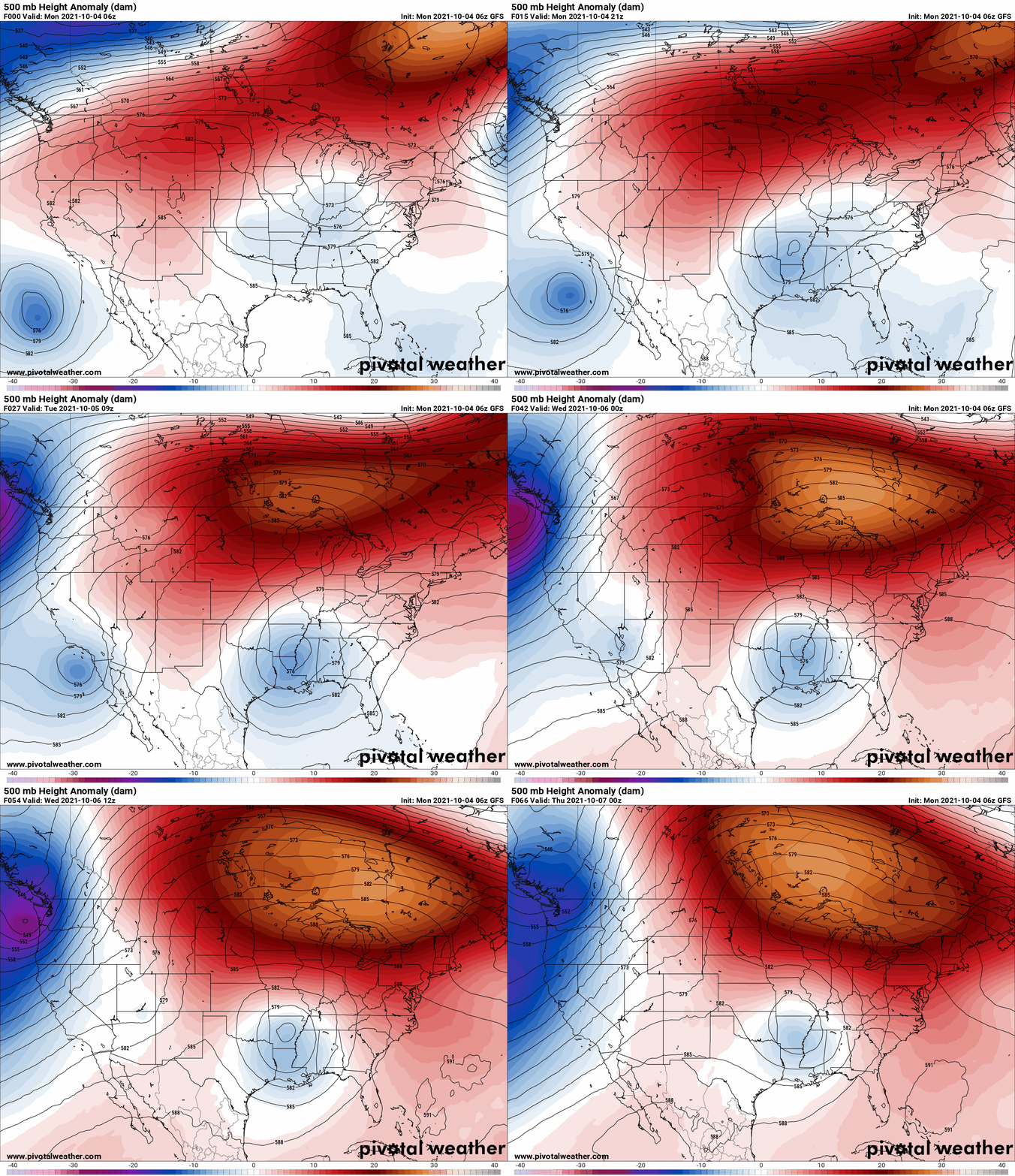
The animation below shows how the large-scale pattern will evolve through mid-week. Pay attention to the southern California storm system. As it moves northeastward, it weakens considerably and mostly loses its identity before reaching Colorado. Typical right?
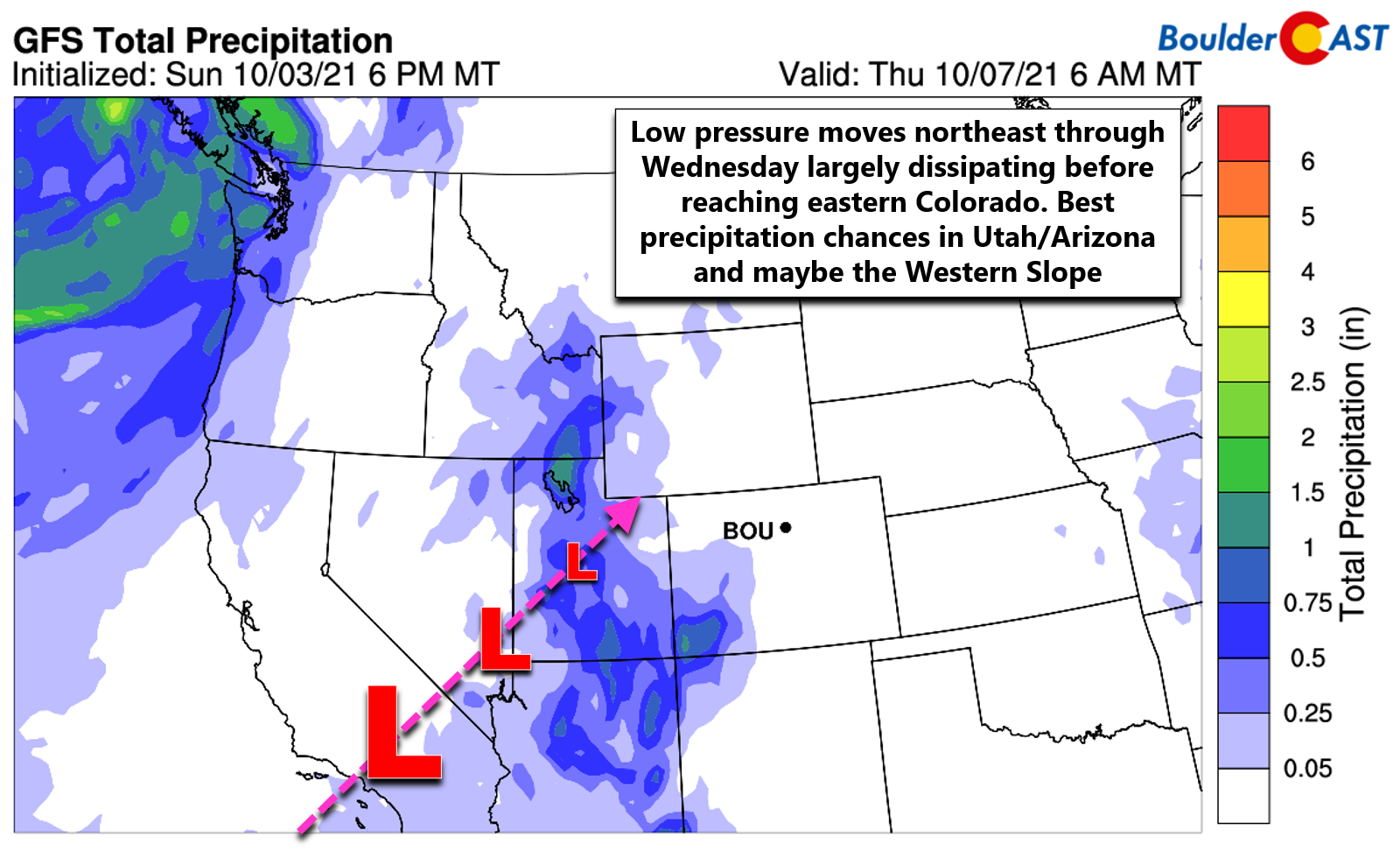
As it appears now in the weather model guidance, Utah and Arizona stand the best chance of precipitation from this system before it ultimately weakens. The Western Slope and San Juans should see some beneficial rainfall late Tuesday night into early Wednesday, but overall the spread of precipitation into Colorado will be light. Southwesterly flow will be across the Front Range on Wednesday with an uptick in moisture aloft associated with the passing disturbance. The models are indicating weak lift across our area Wednesday afternoon and evening and the daytime timing is not bad. Thus, we could see a few isolated showers or weak thunderstorms late in the day Wednesday, but that’s about it. Most of the rains will be along and west of the Divide. Temperatures Wednesday will again be in the ballpark of 80 degrees. There will be a weak cold front pushing through the area late Wednesday, but it won’t knock our temperatures down much if at all to end the week.
A trough approaches late-week
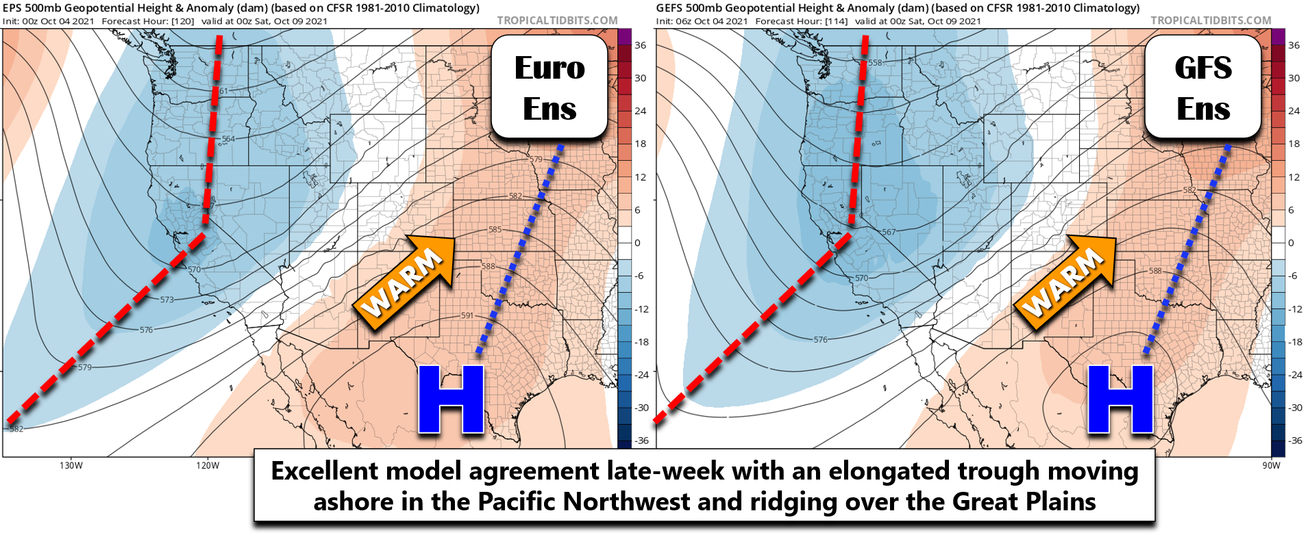
Towards the end of the week we endure yet another shortwave ridging pattern while a deeper trough moves into the Pacific Northwest and California. The graphic below compares the 500mb height ensemble mean forecast from 50 European model runs (left) and 30 GFS model runs (right). We see remarkable agreement with a ridge over the Great Plains and also with the shape and location of the trough dipping into California. Colorado will rest in between the two under warm southwest flow aloft leading to continued summer-like conditions. We’ll end the week fairly quiet overall with warm temperatures in the mid to upper 70s. However, notice how closely packed the height lines are across Colorado in the forecasts below. This is indicative of increasingly strong winds and thus elevated fire danger considering the widespread drought across the Four Corners region. Both Thursday and Friday could see concerning Red Flag conditions in the Mountains.
We’ve also added a 10% chance of showers and storms for the Front Range late in the day Friday, though confidence is somewhat low right now on this facet with moderate downslope flow in the works and only limited moisture. The best chance of late-week precipitation will reside across central and western Colorado. The week wraps-up just as warm as it started in the 70s to near 80 degrees.
As the aforementioned trough approaches Colorado over the upcoming weekend, temperatures will start to drop with chances for rain and Mountain snow increasing across the state. The coldest air is NOT expected to penetrate this far east and south in recent model runs, so we’re not expecting any snow for the Denver Metro quite yet (sorry snow bunnies!). There is some indication in the extended forecast runs for near-freezing overnight temperatures around the early to middle part of next week. It’s too early to recommend taking precautions now, but the growing season may be on the brink of coming to an end…
Stay up to date with Colorado weather and get notified of our latest forecasts and storm updates:
We respect your privacy. You can unsubscribe at any time.
Forecast Specifics:
Monday: Lots of sunshine and warm with highs in the upper 70s on the Plains and middle 60s in the Foothills.
Tuesday: Mostly cloudy and warm with temperatures reaching near 80 degrees on the Plains and in the upper 60s in the Foothills.
Wednesday: More clouds overall with a slight chance of a late-day shower or thunderstorm, mainly across the higher elevations. Highs in the upper 70s on the Plains and middle 60s in the Foothills.
Thursday: Dry, mild and partly sunny. Look for high temperatures in the middle to upper 70s on the Plains with middle 60s in the Foothills.
Friday: Clouds mixed with some sun alongside isolated late-day showers and storms. The best chance of any rain will be across the Mountains. Highs in the middle to upper 70s on the Plains with middle 60s in the Foothills.
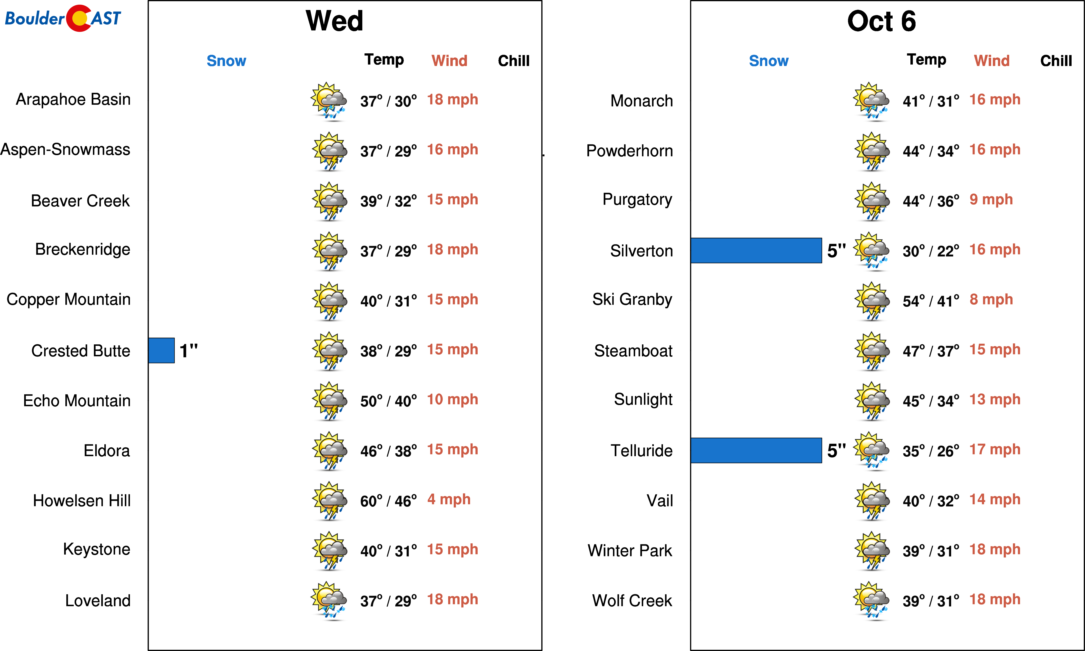
Mountains: Dry weather is in the forecast across the High Country through Tuesday afternoon. Tuesday evening into Wednesday afternoon rain and high elevation snow will spread across the state with the San Juans above 11000 feet favored to see a few inches of snow. Drier but blustery weather takes over Thursday and Friday with increasing fire danger under moderate southwest flow. Cooler temperatures and chances for more rain/snow works in over the upcoming weekend. Check our SummitCAST page for up-to-date forecasts for more than 120 mountain destinations across Colorado, including all the 14ers.
Help support our team of Front Range weather bloggers by joining BoulderCAST Premium. We talk Boulder and Denver weather every single day. Sign up now to get access to our daily forecast discussions each morning, complete six-day skiing and hiking forecasts powered by machine learning, first-class access to all our Colorado-centric high-resolution weather graphics, bonus storm updates and much more! Or not, we just appreciate your readership!
.
Spread the word, share the BoulderCAST forecast!
.





You must be logged in to post a comment.