As we wrap up November and head into Thanksgiving week, the weather is serving up a mix of calm and intrigue. The lead up to the holiday will be pleasant enough, but there are growing signs of a big pattern shift waiting in the wings. Could Arctic air and long-awaited snowflakes finally arrive by the weekend? The details are still coming into focus, but we’ve got the latest outlook and what it could mean for your holiday weekend plans.
This week’s highlights include:
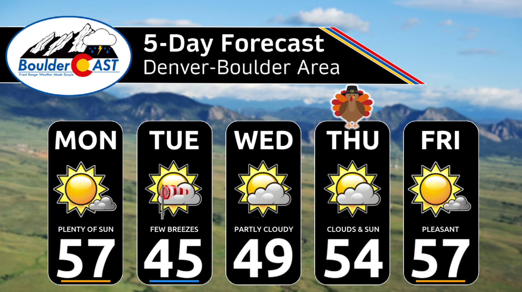
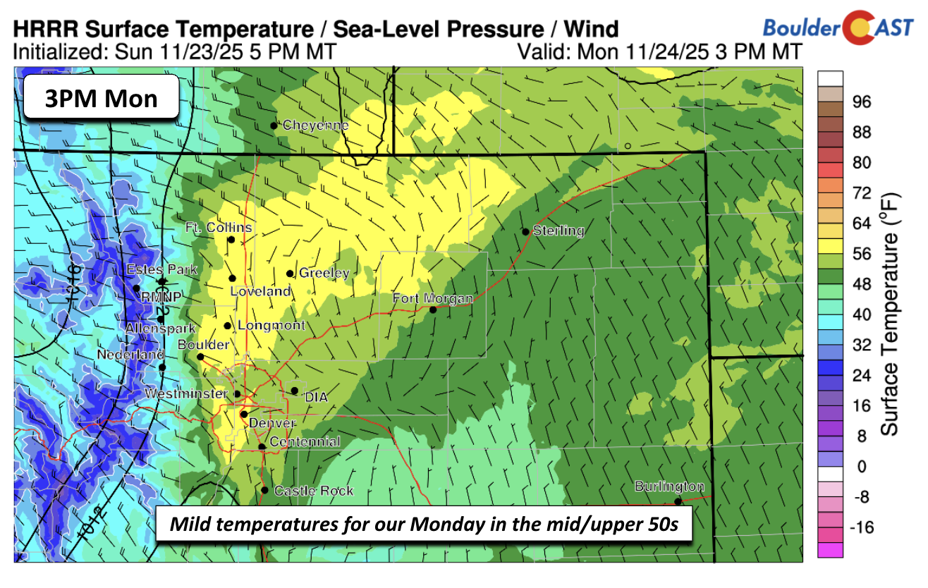
- Mild Monday: The final week of November begins mild, with downslope warming pushing highs into the mid to upper 50s on Monday under partly sunny skies.
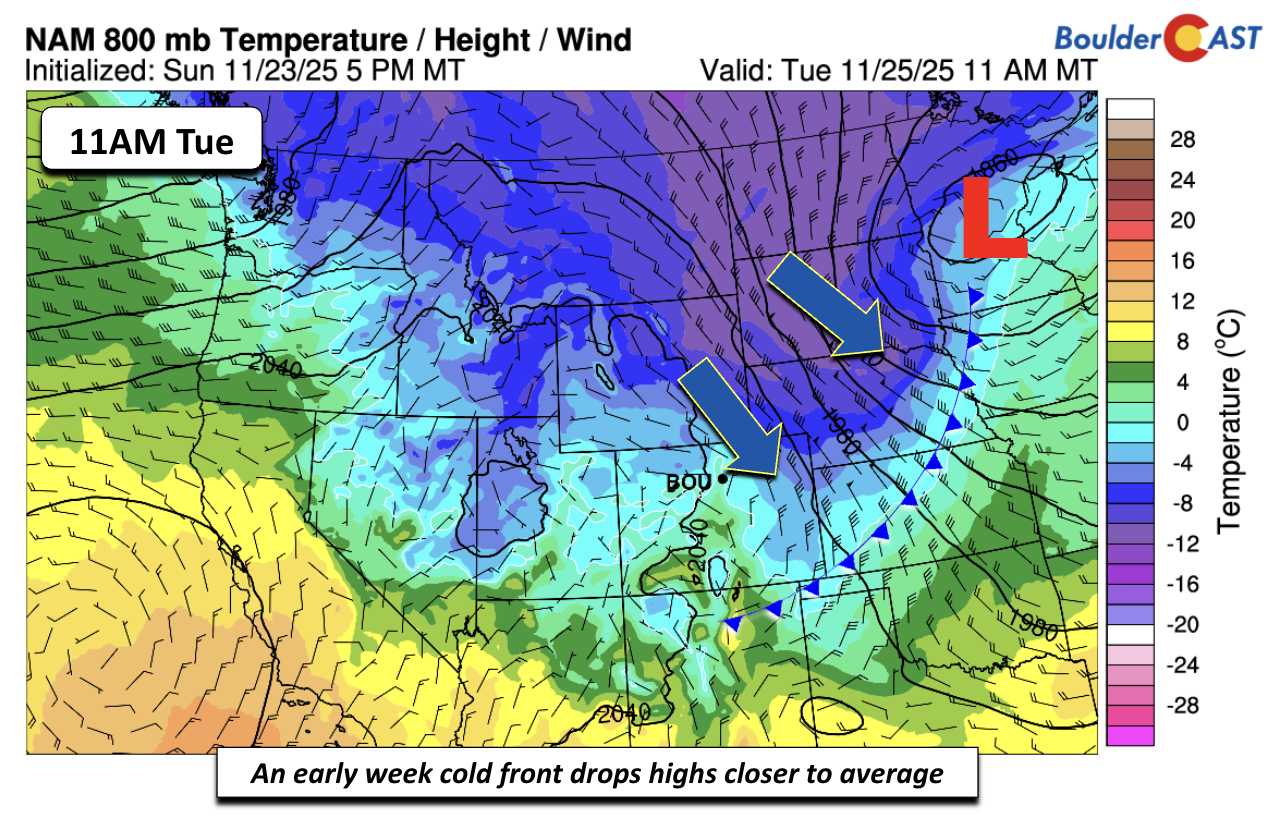
- Cooler into Tuesday: A dry cold front arrives late Monday night into Tuesday, bringing gusty winds up to 30 MPH on the eastern Plains and cooler highs in the low to mid-40s.
- A Few Mountain Flakes: Light snow showers may develop on northwest-facing slopes of the Rockies, but most of Colorado will remain dry.
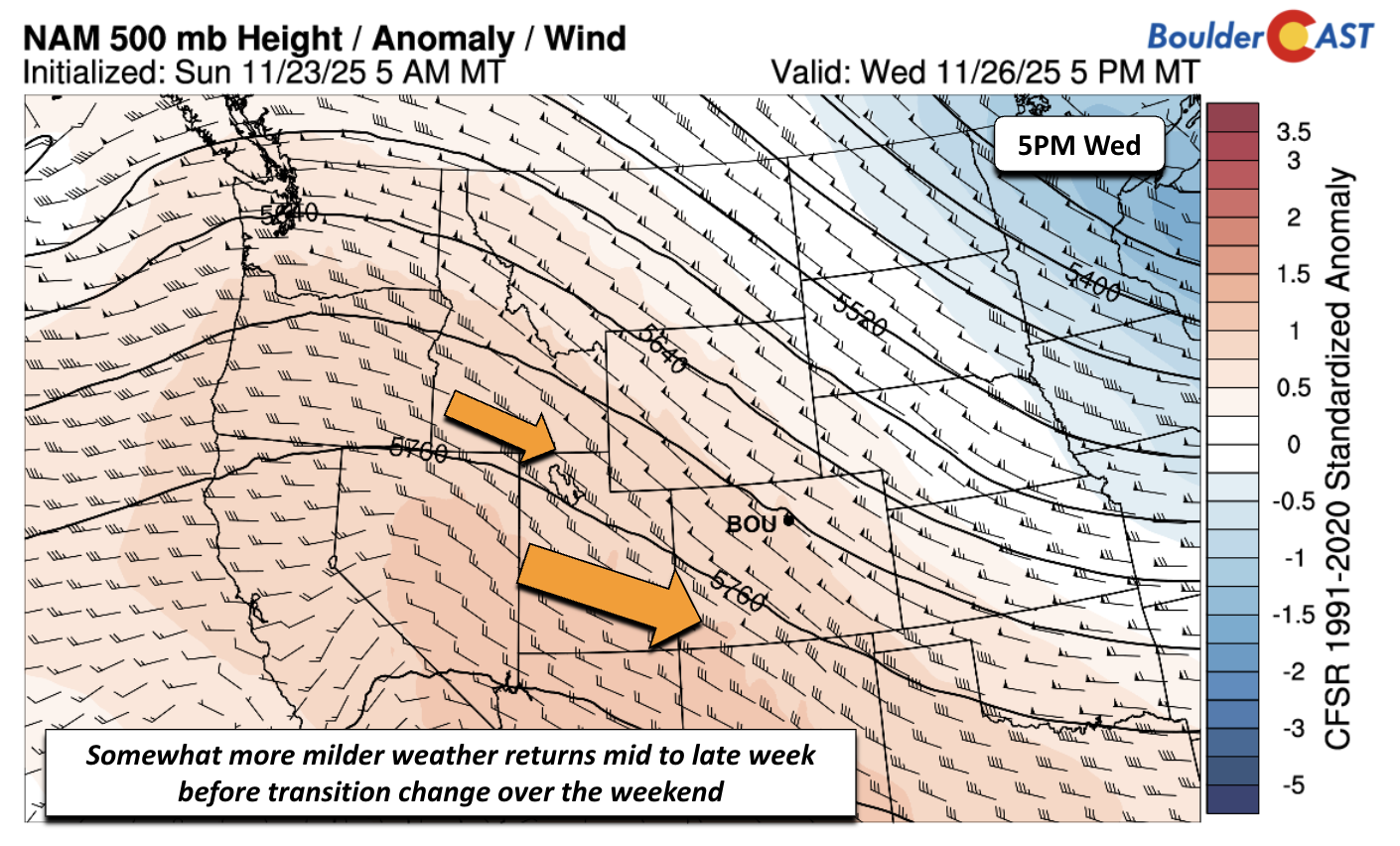
- Warming Trend: Midweek ridging allows temperatures to rebound, climbing from the mid-40s Wednesday to the mid and upper 50s by Thursday and Friday.
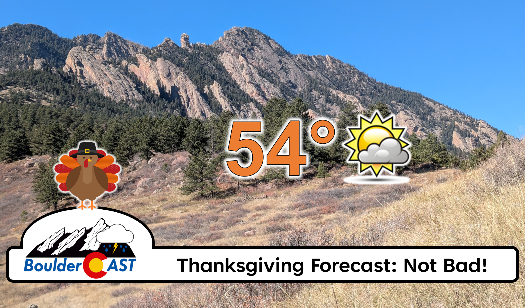
- Holiday Forecast: Thanksgiving Day looks pleasant, with partly cloudy skies and highs near 54, before a potential weekend pattern shift.
- Weekend Arctic Blast Brewing: Ensemble guidance suggests a trough and Arctic air intrusion by late Friday into the weekend, with highs possibly in the 20s, lows in the single digits, and strong signals for snow across Boulder and the rest of the Metro area.
DISCLAIMER: This weekly outlook forecast is created Monday morning and covers the entire upcoming week. Accuracy will decrease as the week progresses as this post is NOT updated. To receive daily updated forecasts from our team, among many other perks, subscribe to BoulderCAST Premium.

Go Premium, get all the perks.
Daily Forecast Updates
Get our daily forecast discussion every morning delivered to your inbox.
All Our Model Data
Access to all our Colorado-centric high-resolution weather model graphics. Seriously — every one!
Ski & Hiking Forecasts
6-day forecasts for all the Colorado ski resorts, plus more than 120 hiking trails, including every 14er.
Smoke Forecasts
Wildfire smoke concentration predictions up to 72 hours into the future.
Exclusive Content
Weekend outlooks every Thursday, bonus storm updates, historical data and much more!
No Advertisements
Enjoy ad-free viewing on the entire site.
A pleasant stretch of weather through Thanksgiving
It’s hard to believe, but here we are in the final week of November with Thanksgiving already upon us. Where has 2025 gone? December is right around the corner, and we’re starting this week on a mild note. Thanks to downslope warming, highs today will reach the mid-50s, with a few spots sneaking into the upper 50s under a mix of sun and clouds.
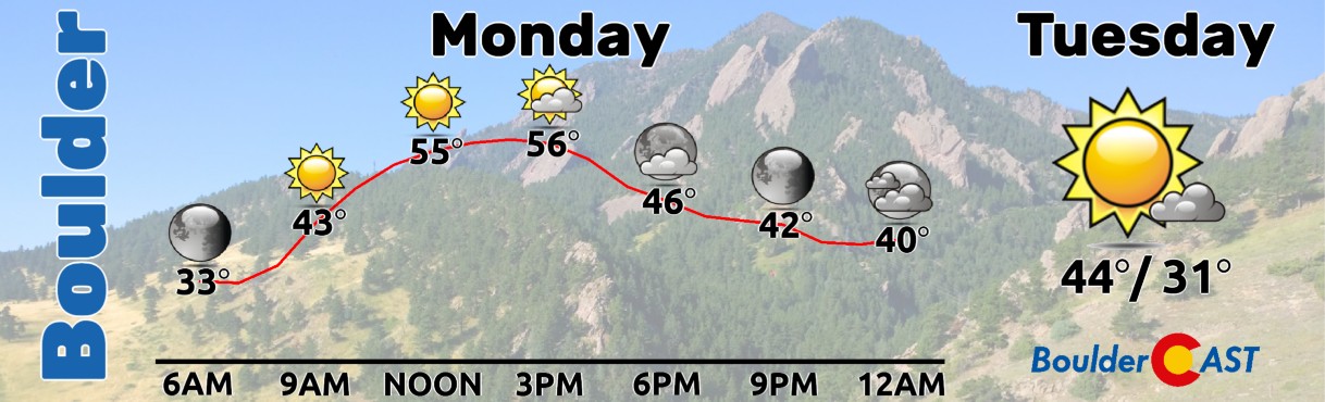
A dry cold front arrives late Monday night into early Tuesday. Expect gusty winds across the Plains east of Interstate 25, reaching 20 to 30 mph at times Tuesday afternoon, and a noticeable cool-down. Highs will only reach the low to mid-40s around Boulder and Denver, which is below average for late November. The front may squeeze out some light snow showers on the northwest-facing slopes of the northern Mountains, but most of the state will stay dry.
By midweek, a ridge builds in aloft, allowing temperatures to rebound. Wednesday starts in the mid-40s, climbing into the 50s by Thursday and Friday.
That sets us up for a pleasant Thanksgiving Day: partly cloudy skies and highs near 54.
Overall, the holiday ahead will be calm and relatively comfortable—at least until the weekend…
Weekend Pattern Shift: Snow and Arctic Air?
The bigger story is what may unfold as we head into the holiday weekend. Ensemble guidance (100 different model members) suggests several possible scenarios for Saturday night. Three out of four show a trough developing near Colorado or just to our west, while one weaker solution (Cluster #4) keeps things more zonal. On average, the signal favors a trough near Utah. Confidence is still low to moderate, but the setup hints at a deeper trough interacting with Arctic air dropping south from Canada.
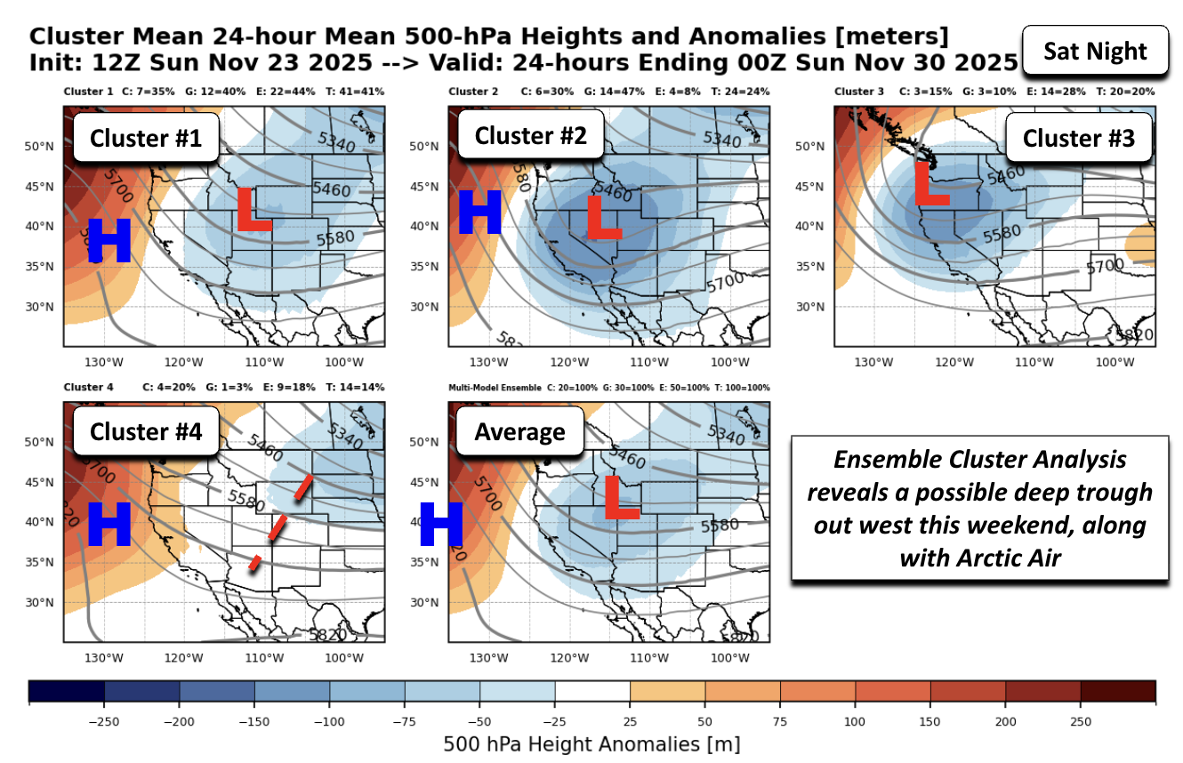
Could this finally break our snow drought? Too early to say, but this promising pattern shift is something our team will be watching closely.
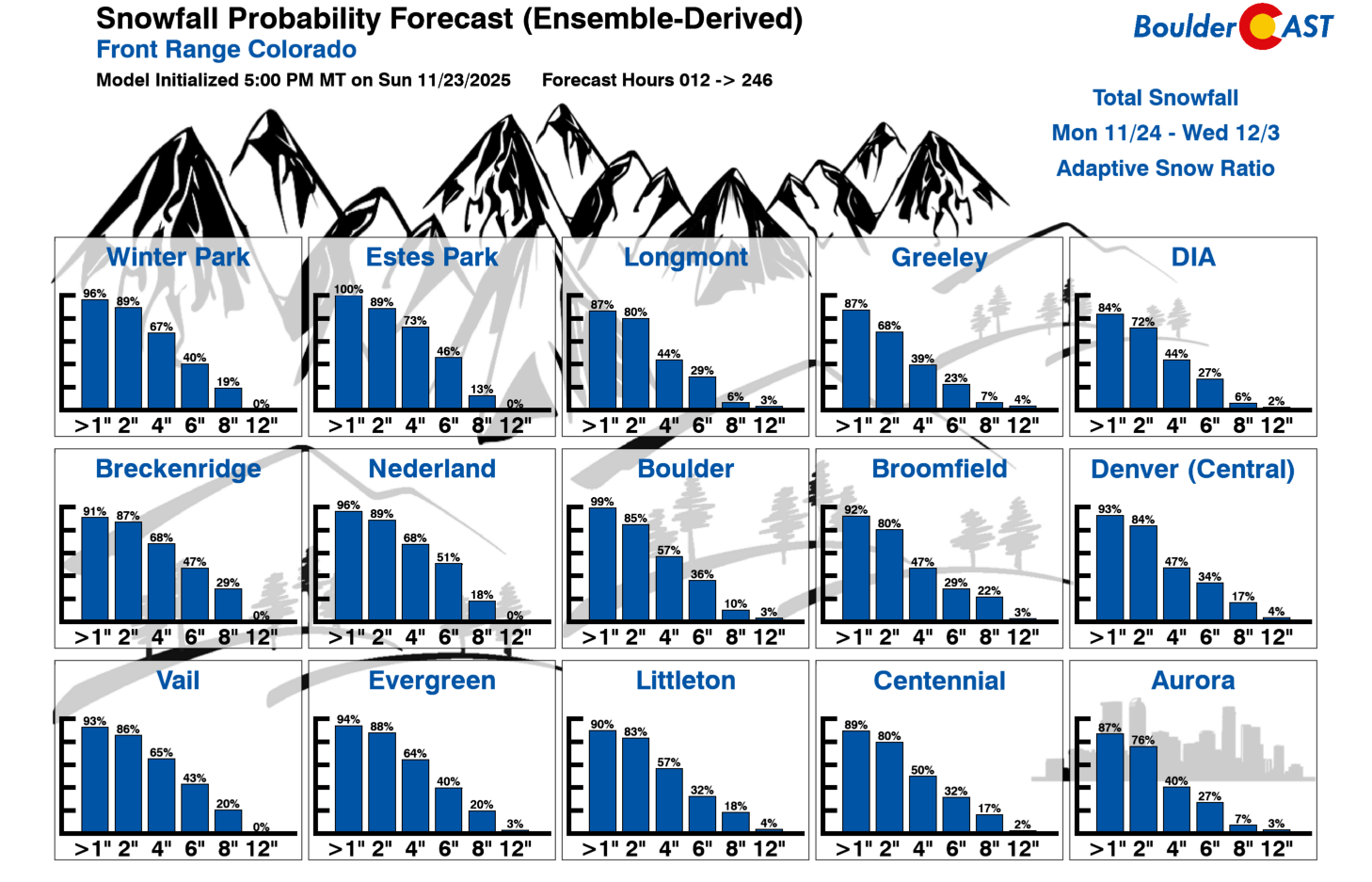
Looking at our Snowfall Probabilities through December 3rd, the models are already picking up on this potential trough. Boulder shows a 99%+ chance of at least one inch of snow sometime this weekend into early next week. That’s a strong signal indeed, but keep in mind it’s still a long way out. The details will sharpen as we get closer.
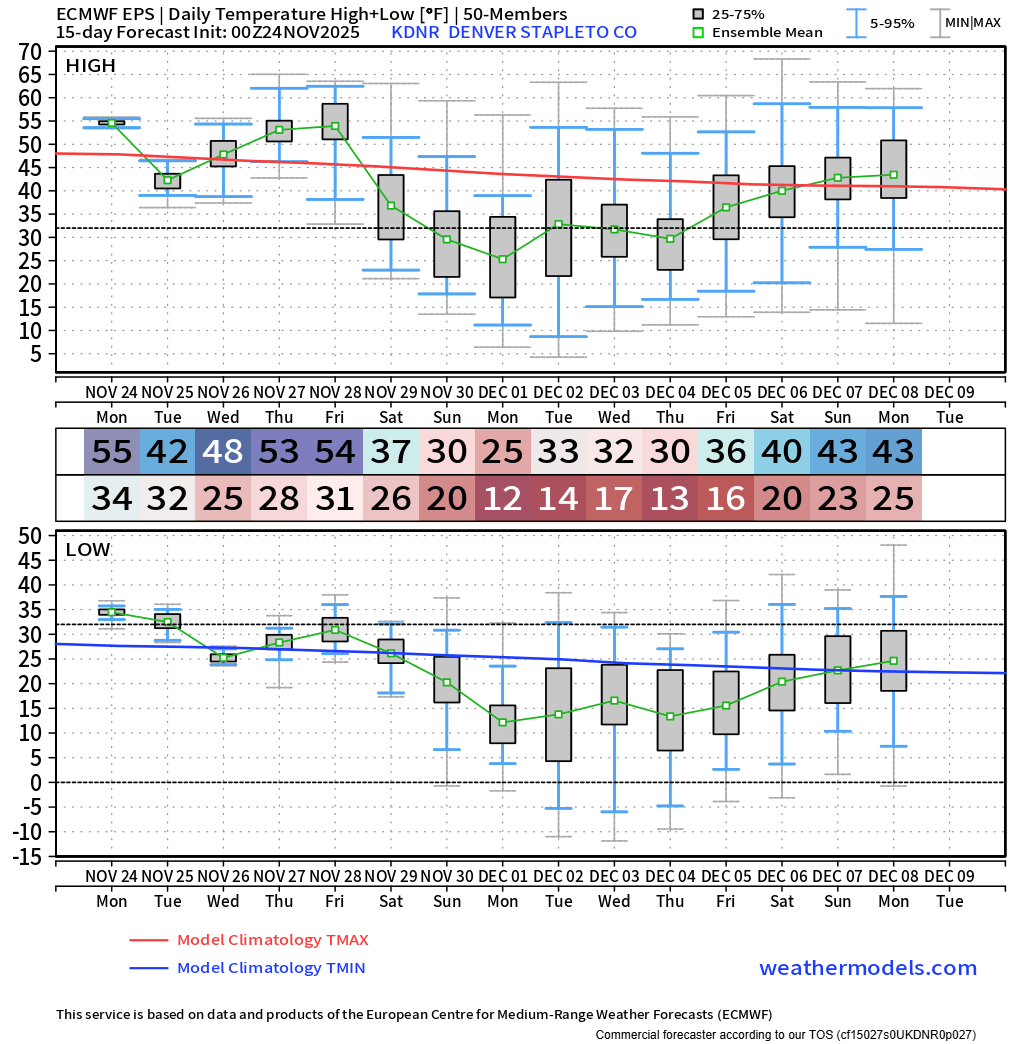
What looks more certain is the cold air itself. Many ensemble members show Arctic—or at least continental polar—air spilling south by Saturday and becoming entrenched Sunday into early next week. If that verifies, highs could tumble into the 20s late in the weekend, with lows dipping into the teens or even single digits.
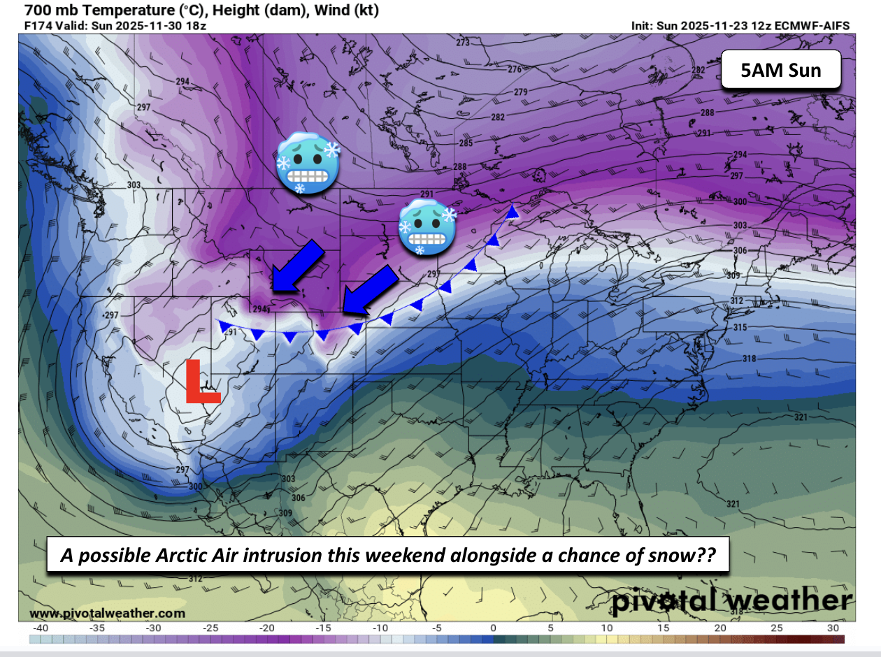
Cold air would likely stick around well into early next week, possibly longer. The Euro ensemble has mean high temperatures below 40°F in Denver for 8 consecutive days beginning Saturday, though the uncertainty particularly Tuesday and beyond is quite high — the cold air may vacate briefly before getting reinforced sometime next week.
That’s it for now. We’ll keep you updated as the weekend pattern shift comes into focus. In the meantime, enjoy the mild stretch leading into Thanksgiving. Happy Turkey Day—and let’s all think snow!
![]()
Forecast Specifics:
Monday: Mostly sunny and mild. Highs in the mid to upper 50s over the Plains and middle 40s in the Foothills.
Tuesday: Partly cloudy, cooler and below normal. Highs in the low to middle 40s on the Plains and middle 30s in the Foothills. Some breeziness will develop during the day, mainly east of Interstate 25 with gusts over 20 MPH.
Wednesday: Partly cloudy, quiet and somewhat warmer with upper 40s on the Plains and upper 30s in the Foothills.
Thursday: Increasing clouds with warmer highs but still seasonal with middle 50s for the Plains and lower 40s for the Foothills.
Friday: Mostly cloudy with middle to upper 50s for the Plains and lower 40s in the Foothills.
Weekend: A pattern shift is expected with Arctic or Continental Polar air building in either late Friday or sometime Saturday, entrenching over the region for the latter part of the weekend into early December. A chance of snow for the entire area will likely accompany the colder air. Highs late in the weekend could only be in the 20s, with lows in the single digits or teens.
DISCLAIMER: This weekly outlook forecast is created Monday morning and covers the entire upcoming week. Accuracy will decrease as the week progresses as this post is NOT updated. To receive daily updated forecasts from our team, among many other perks, subscribe to BoulderCAST Premium.
Go Premium, get all the perks.
Daily Forecast Updates
Get our daily forecast discussion every morning delivered to your inbox.
All Our Model Data
Access to all our Colorado-centric high-resolution weather model graphics. Seriously — every one!
Ski & Hiking Forecasts
6-day forecasts for all the Colorado ski resorts, plus more than 120 hiking trails, including every 14er.
Smoke Forecasts
Wildfire smoke concentration predictions up to 72 hours into the future.
Exclusive Content
Weekend outlooks every Thursday, bonus storm updates, historical data and much more!
No Advertisements
Enjoy ad-free viewing on the entire site.
Enjoy our content? Give it a share!


You must be logged in to post a comment.