
The last few days of March will bring a series of temperature swings from above to below average and back again, along with a chance of snow. However, as we enter into April, spring-like conditions will firmly take charge with dry weather and temperatures in the 70’s likely for an extended period lasting through the upcoming weekend.
This week’s highlights include:
- Warm and windy ahead of a cold front Monday evening
- Scattered rain/snow showers develop Monday night and linger into Tuesday with much colder temperatures
- High pressure builds to begin April with sunny skies and 70+ degrees to end the week
- The weekend looks gorgeous with highs in the mid to upper 70’s!
DISCLAIMER: This weekly outlook forecast is created Monday morning and covers the entire upcoming week. Accuracy will decrease as the week progresses as this post is NOT updated. To receive daily updated forecasts from our team, subscribe to BoulderCAST Premium.

Warm & windy ahead of Monday evening’s cold front
Warm and windy conditions will exist Monday with an approaching mid-level trough and cold front from the north and west. With the trough axis to our northwest oriented from southwest to northeast, westerly to southwesterly flow exists in the lower to middle levels of the atmosphere. That combined with an upper-level jet streak crossing the High Country will create strong downslope flow on the Plains. This will first aid in allowing high temperatures to reach the lower 70’s Monday afternoon under mostly sunny skies.
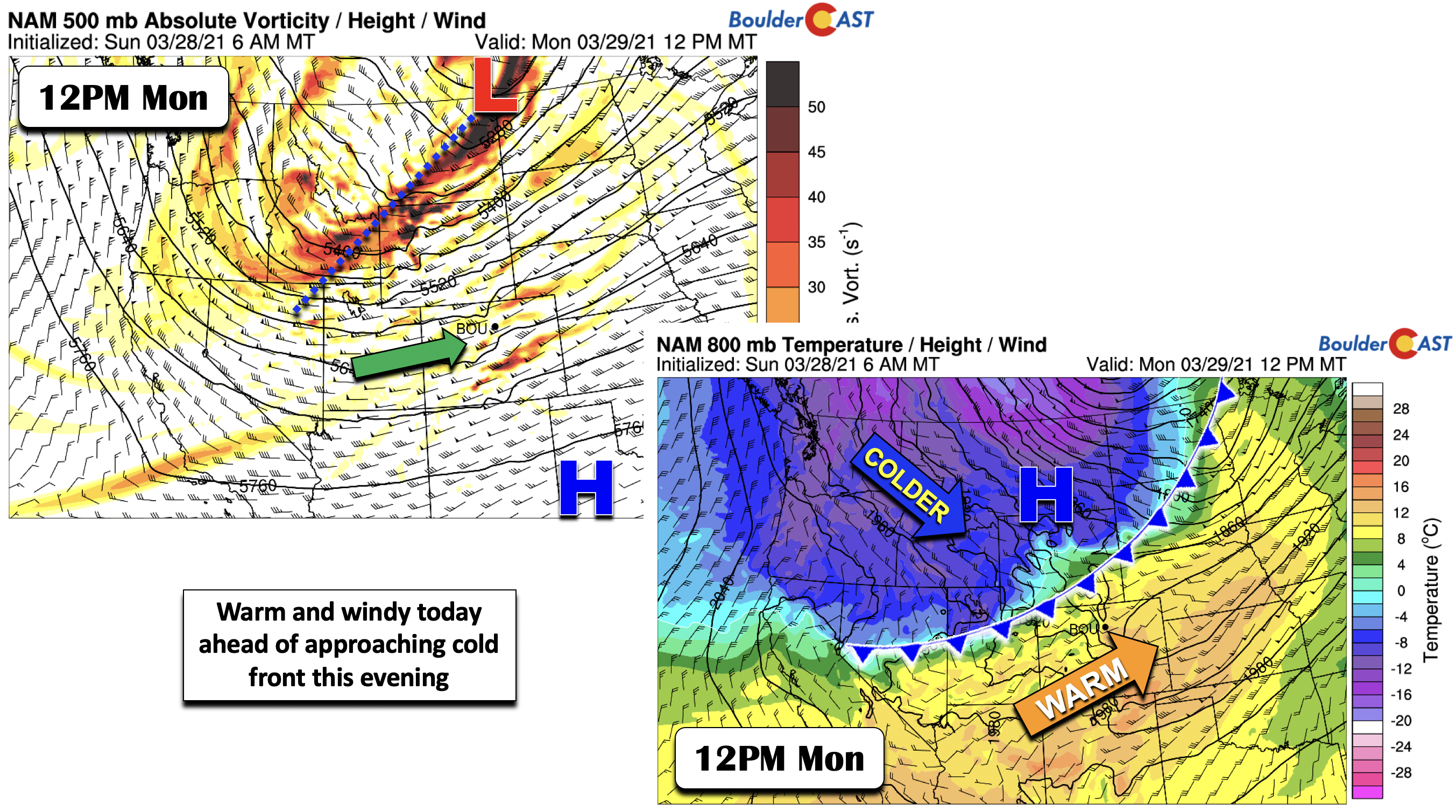
The second thing the downslope flow will create are rather strong winds at the surface from the Foothills all the way to eastern Colorado. Wind gusts in the Foothills will exceed 60 MPH, while Boulder will be between 40 and 50 MPH and Denver between 30 and 40 MPH during the daytime. These winds will die down this evening as the front passes through.
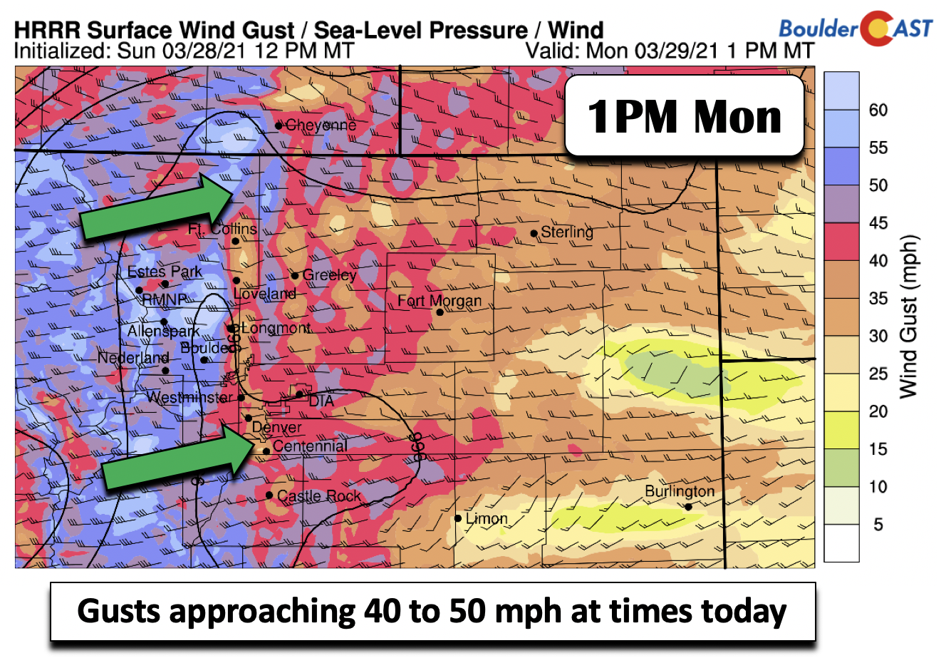
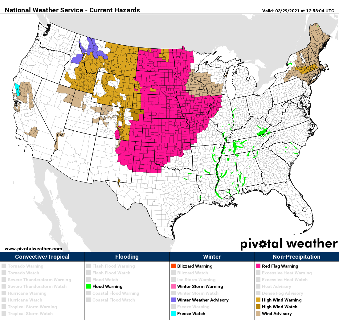
At the time of writing Monday morning, High Wind Warnings are posted for the Foothills, but not across the Denver Metro area (see below). A broader view shows wind-related highlights present over a massive portion of the United States right now, including the Rockies, the Great Plains, California, the Midwest, and New England!
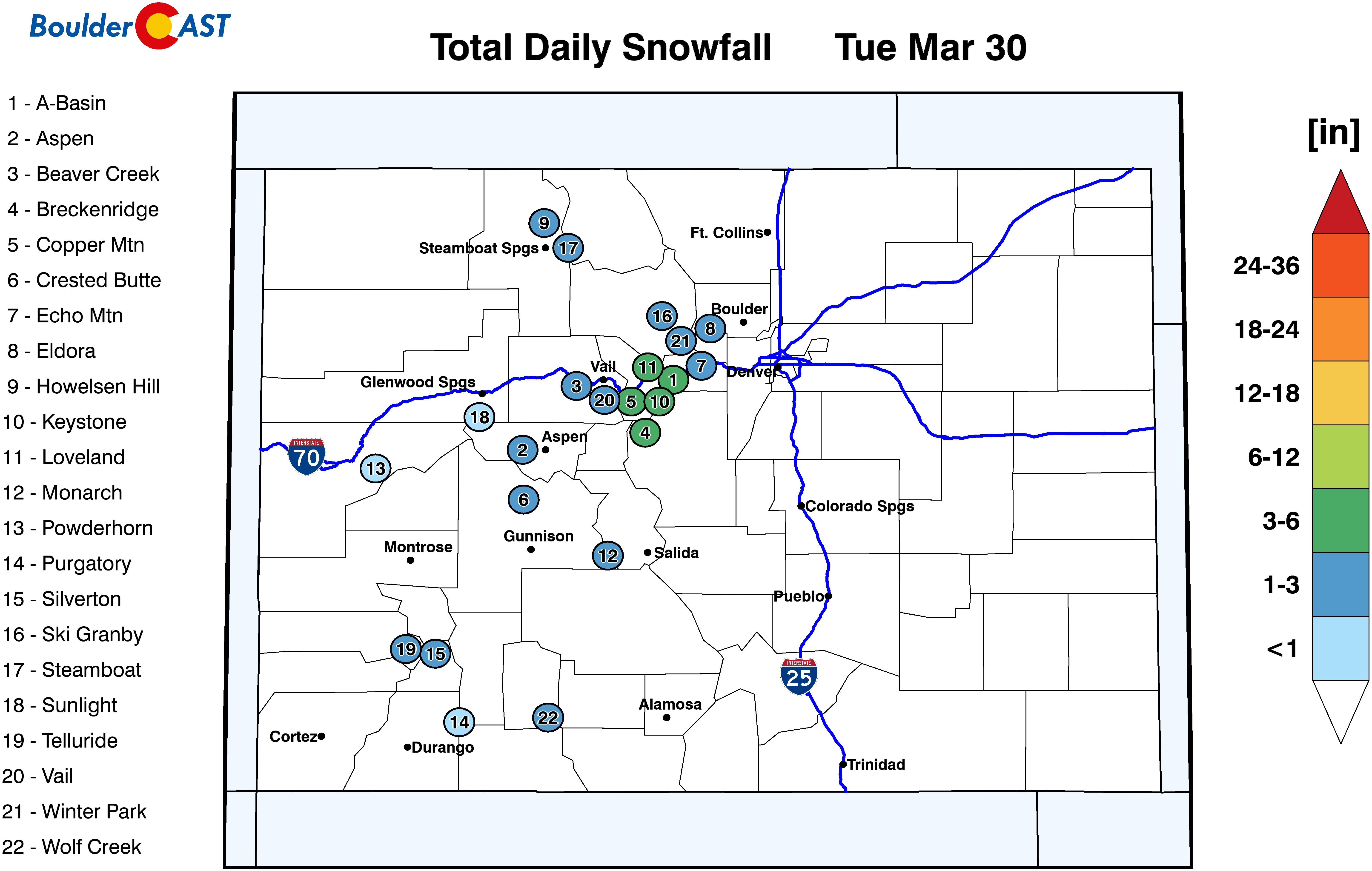
The cold front will arrive roughly around 8:00 PM in the Denver Metro area Monday evening, as indicated by several high-resolution models. As the front passes, temperatures will dip into the 40’s and eventually the 30’s by early Tuesday morning. As the cold air becomes entrenched, snow levels will drop far enough to allow for snow showers to develop late tonight to early Tuesday morning. We don’t expect much in the way of accumulation, roughly a dusting to maybe 1″ on grassy surfaces, cars, and overpasses. The southern Foothills stand to see a little more, perhaps 1 to 4″. There is not a whole lot of lift to work with, even though the jet stream passing overhead is rather bodacious.
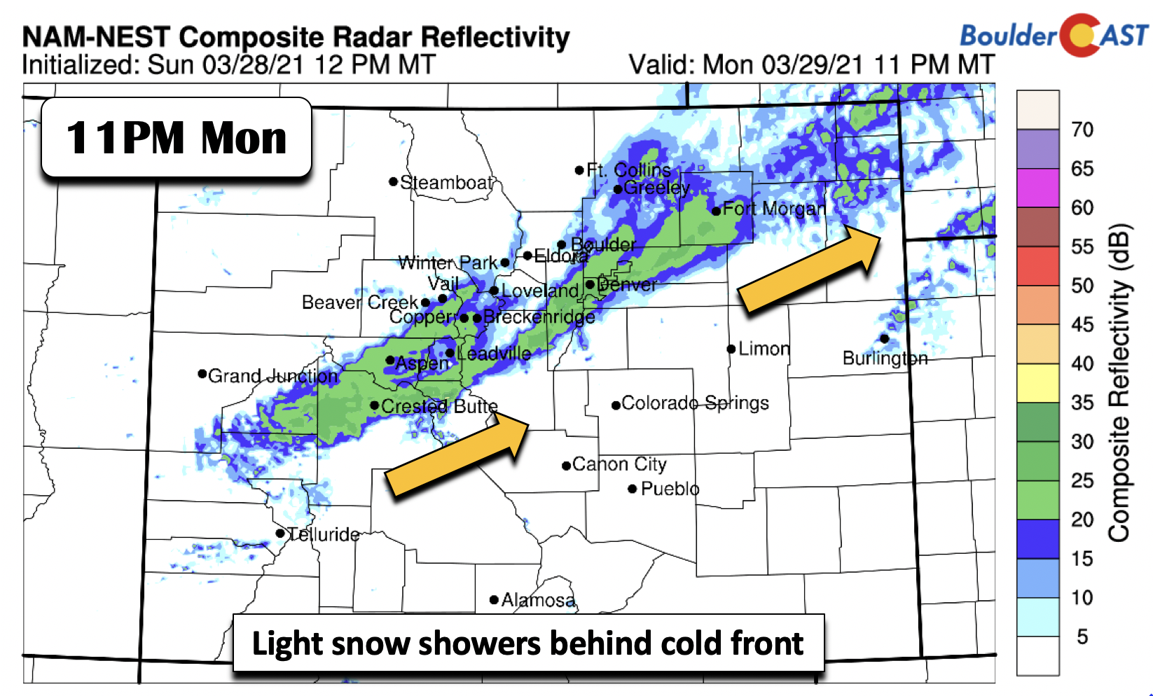
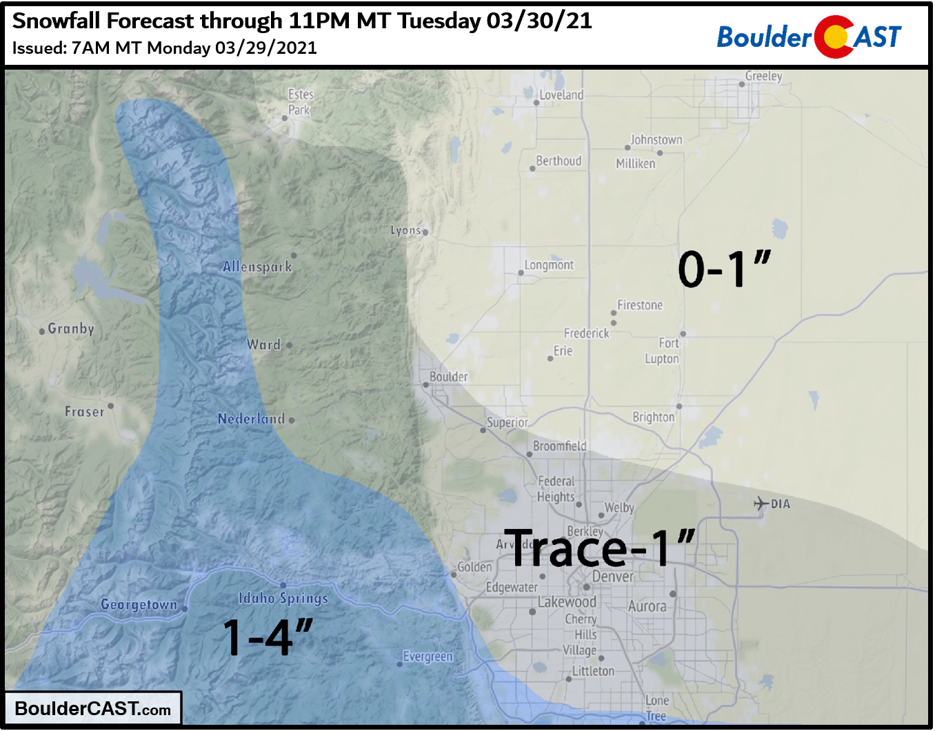
Our snowfall forecast map through Tuesday evening is shown below. As mentioned, the best chance of any accumulation will occur late Monday night into Tuesday morning, but we could see a few snowflakes linger through the day Tuesday as well. With temperatures so warm beforehand on Monday, travel impacts are very unlikely, except in the Foothills of Jefferson County where a tiny amount of slush may be possible.
Wild temperature swings to end March
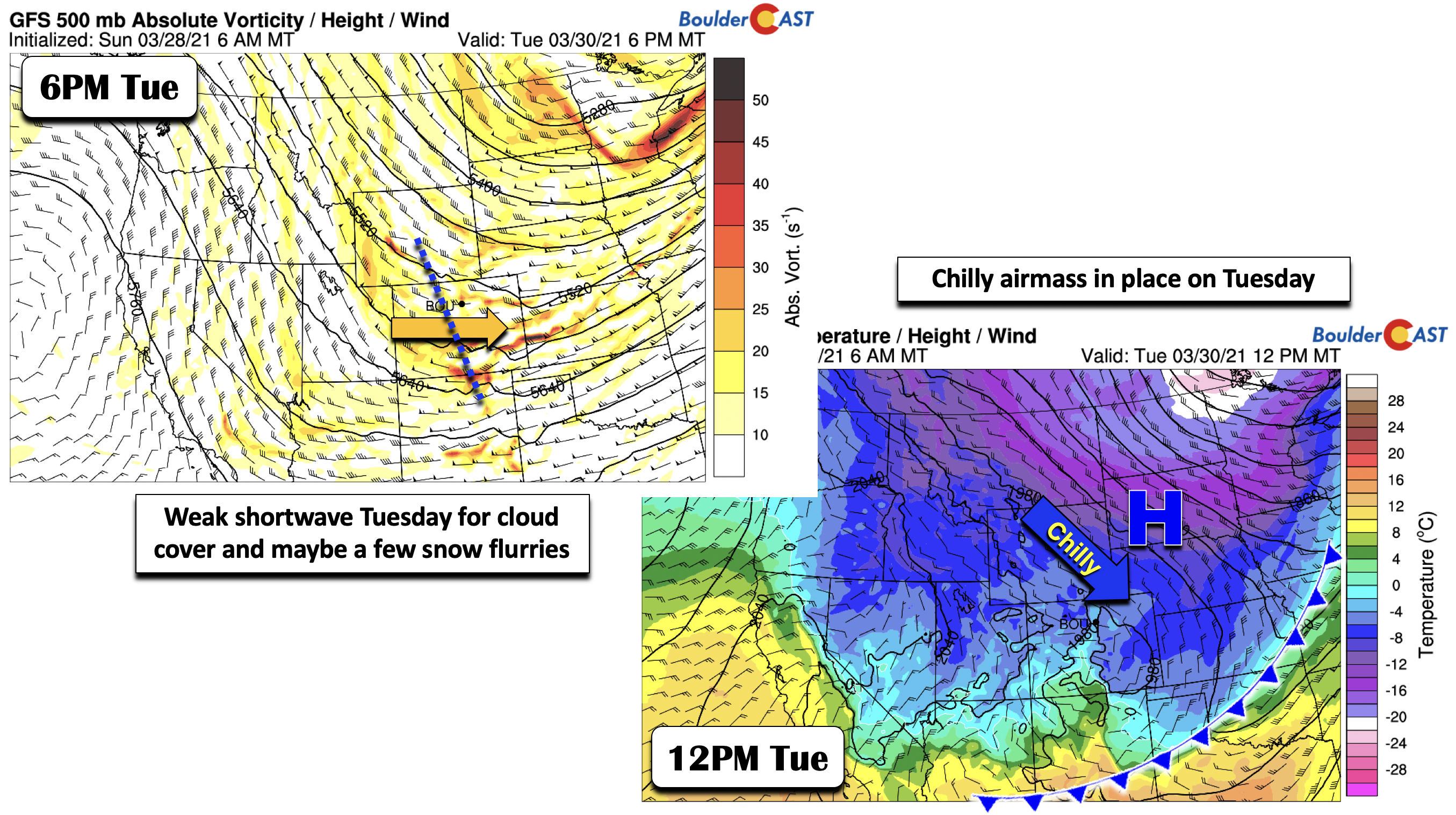
The front will be well south of Colorado by mid-day Tuesday. From temperatures in the lower 70’s on Monday, we’ll only see highs Tuesday in the upper 30’s to around 40 degrees, some 30 degrees colder! Obviously a rather sharp swing in temperatures. The GFS model shows a secondary trough axis to push through during the afternoon/evening hours (below left) on Tuesday, which with the cold air in place could produce some light snow showers or snow flurries. It’s mainly going to increase cloud cover on Tuesday, keeping us rather chilly and unsettled.
Spring-like to begin April
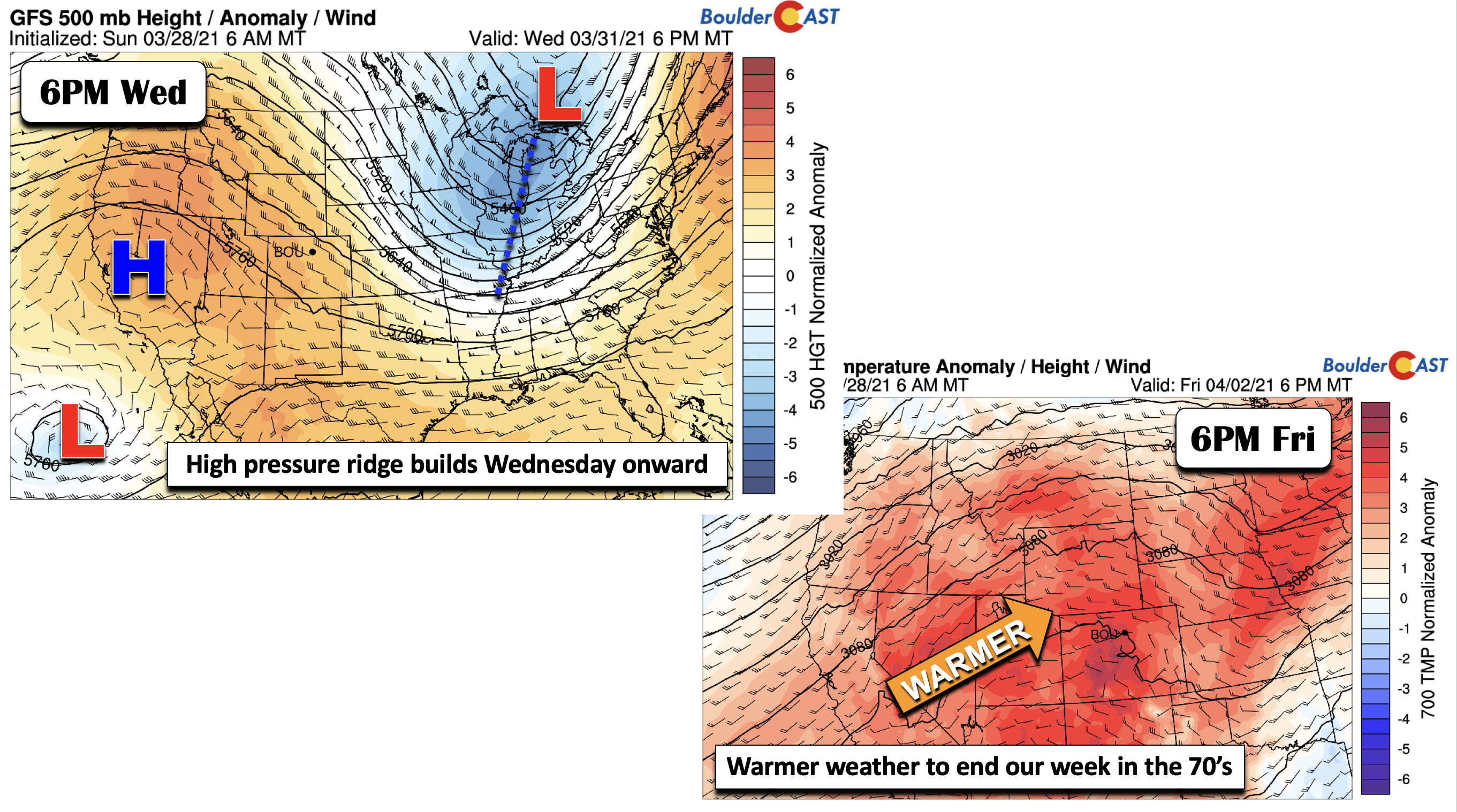
The swing in temperatures to conclude March does not stop there. By Wednesday, the trough axis shifts east, with a ridge of high pressure centered over central California Wednesday evening. While we will still be seeing the cold airmass retreating, temperatures will warm but only to near 50 degrees on Wednesday with sunshine, thus likely still below average. By the end of the week, the aforementioned ridge will entrench much of our state, with very warm weather returning sharply by Thursday and Friday.
Shown below is the latest GFS ensemble temperature outlook for the Denver Metro area. You’ll first notice the sharp swings in temperatures ending March. But note the huge rise in temperatures once we get into April on Thursday and Friday. Highs in the low to middle 70’s appear likely, perhaps even upper 70’s for the upcoming weekend!
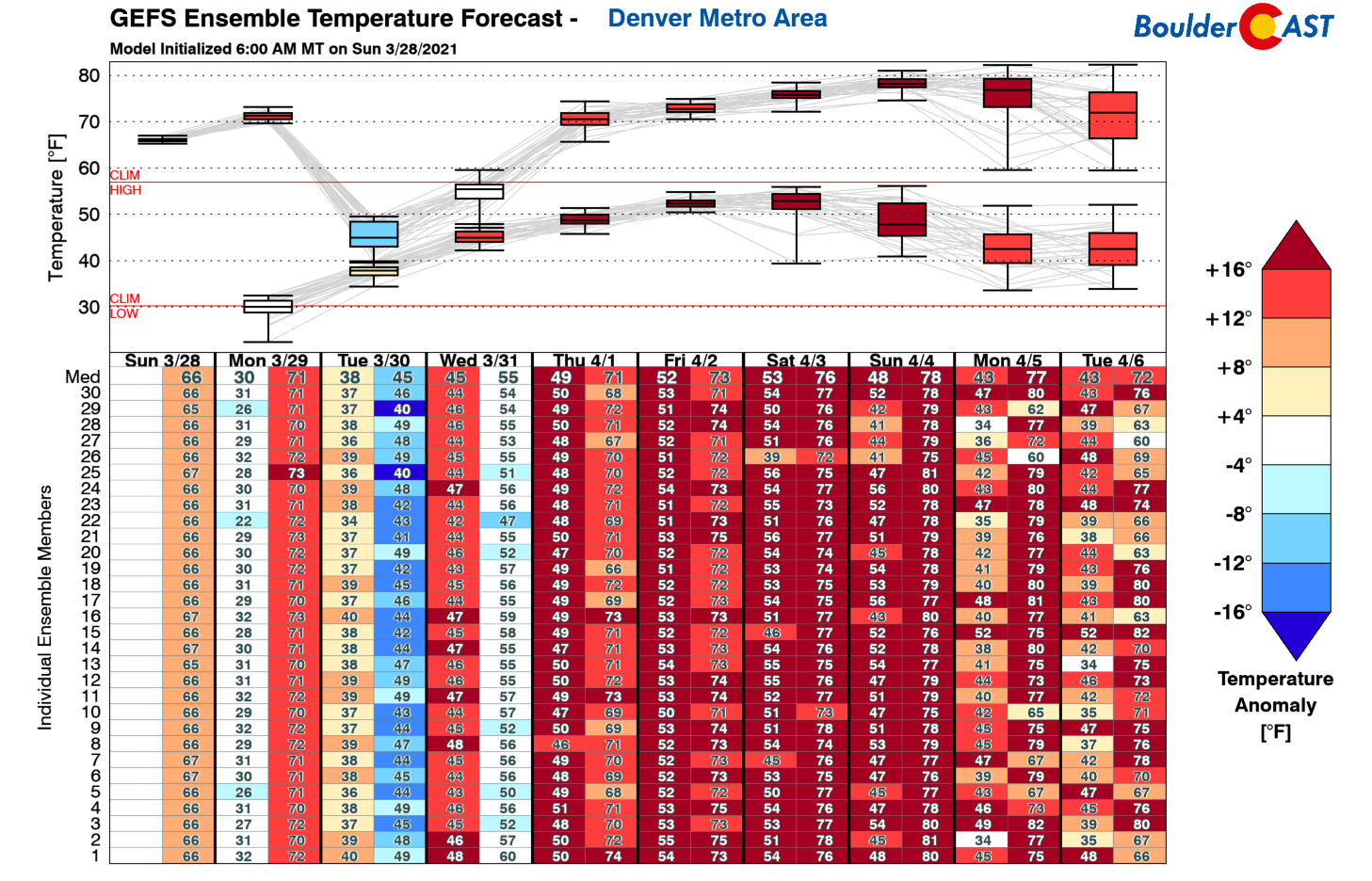
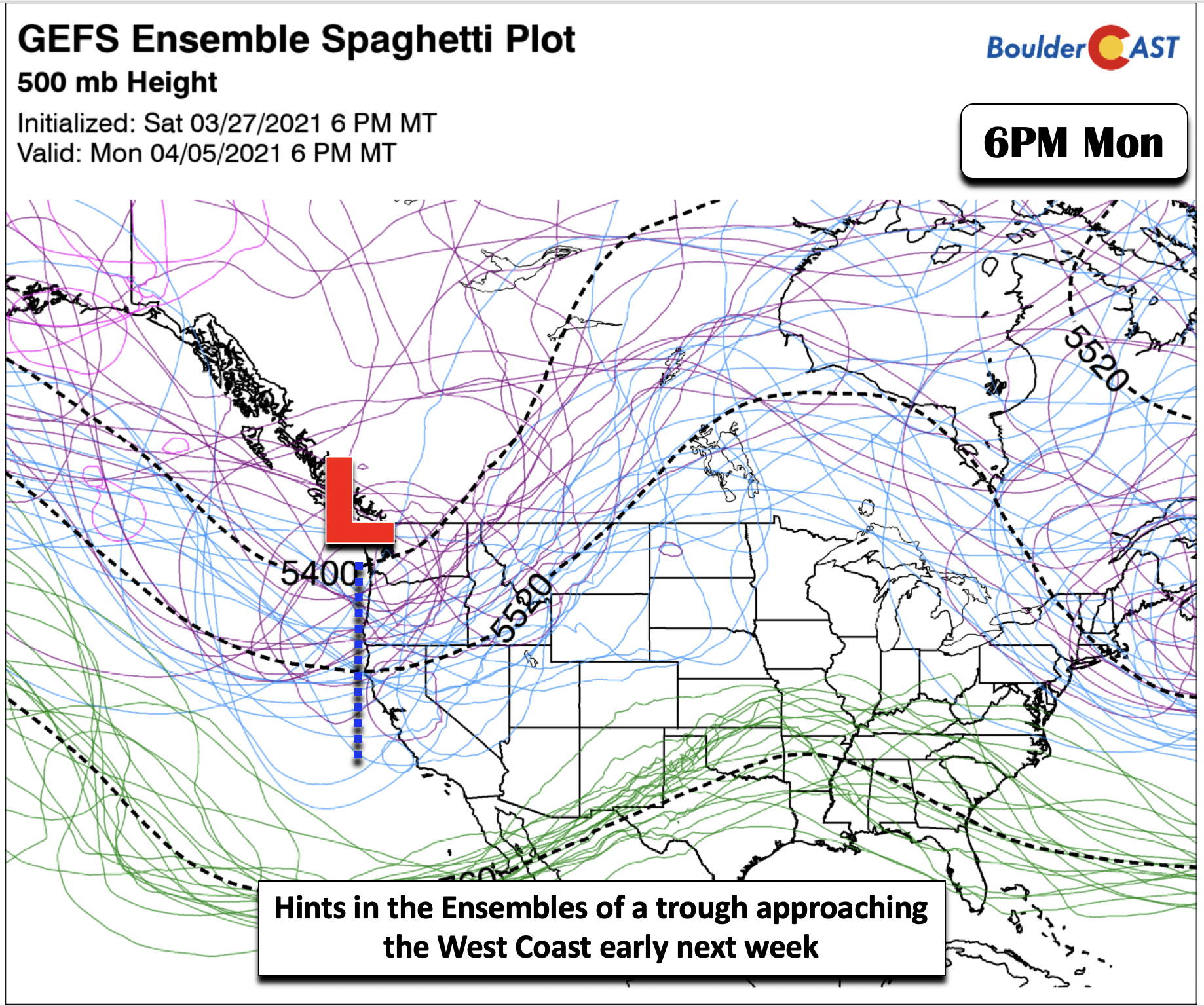
The end of the work week and weekend will remain largely devoid of precipitation thanks to high pressure and bone dry air. The long-range outlook from the GEFS ensembles shows that our next possible chance of precipitation would not be until the early to middle part of next week with a potential developing trough arriving to the West Coast. All in all, we’re staring down a very gorgeous stretch of weather to kick off the month of April.
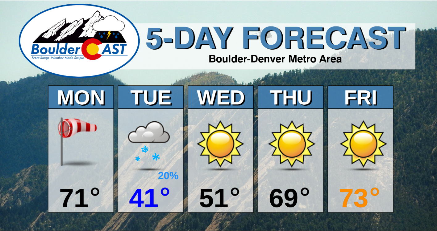
Forecast Specifics:
Monday: Sunny, windy, and warm with highs in the lower 70’s on the Plains and upper 50’s in the Foothills. Winds will gust between 30 and 50 mph on the Plains and 50 to 80 mph in the Foothills. A chance of snow showers will a light dusting is possible overnight tonight as temperatures plummet into the lower 30’s. A inch or two is expected in the southern Foothills.
Tuesday: Partly to mostly cloudy skies and chilly. Highs near 40 degrees on the Plains and upper 20’s in the Foothills. A slight chance of flurries or snow showers with little to no additional accumulation expected through the daytime.
Wednesday: Mostly sunny and not as cold with highs near 50 on the Plains and upper 30’s in the Foothills.
Thursday: Warmer and sunny with highs upper 60’s to near 70 degrees on the Plains and middle 50’s in the Foothills.
Friday: Sunny and warm with temperatures in the lower 70’s on the Plains and near 60 degrees in the Foothills.
Mountains: Light snow showers will exist over portions of the Divide and High Country today and tomorrow. It will also be rather windy across the mountains today and tonight. Drier weather ensues Wednesday through Friday with largely sunny conditions.
Help support our team of Front Range weather bloggers by joining BoulderCAST Premium. We talk Boulder and Denver weather every single day. Sign up now to get access to our daily forecast discussions each morning, complete six-day skiing and hiking forecasts powered by machine learning, first-class access to all our Colorado-centric high-resolution weather graphics, bonus storm updates and much more! Or not, we just appreciate your readership!
.
Spread the word, share the BoulderCAST forecast!
.


You must be logged in to post a comment.