The ongoing heatwave will last through Monday with near-record high temperatures expected once again. A welcomed cold front Monday night will offer a reprieve from the heat for a couple days, but the sizzling temperatures return in full-force later in the week. We’ll largely be dry the entire week ahead. However, signs are pointing towards a surge of subtropical moisture during the upcoming weekend into the Four Corners region. This will bring the chance of late-day thunderstorms back into the Front Range.
This week’s highlights include:
- Snowpack in the Mountains is declining rapidly under the recent heat and is now below normal statewide
- One more day of near-record high temperatures on Monday which will also coincide with gusty winds and elevated fire danger
- Smoke from a new large wildfire in Arizona will fill the skies Monday — only minor impacts to air quality expected as most of the smoke is lofted in the atmosphere
- A mostly dry cold front Monday night will usher in cooler weather Tuesday and Wednesday with temperatures more seasonal in the 80s
- Hot weather returns late in the week as yet another even stronger ridge develops across the center of the country
- After a largely dry week, subtropical moisture will increase over the upcoming weekend with late-day thunderstorms returning

DISCLAIMER: This weekly outlook forecast is created Monday morning and covers the entire upcoming week. Accuracy will decrease as the week progresses as this post is NOT updated. To receive daily updated forecasts from our team, among many other perks, subscribe to BoulderCAST Premium.

One last day of near-record heat Monday
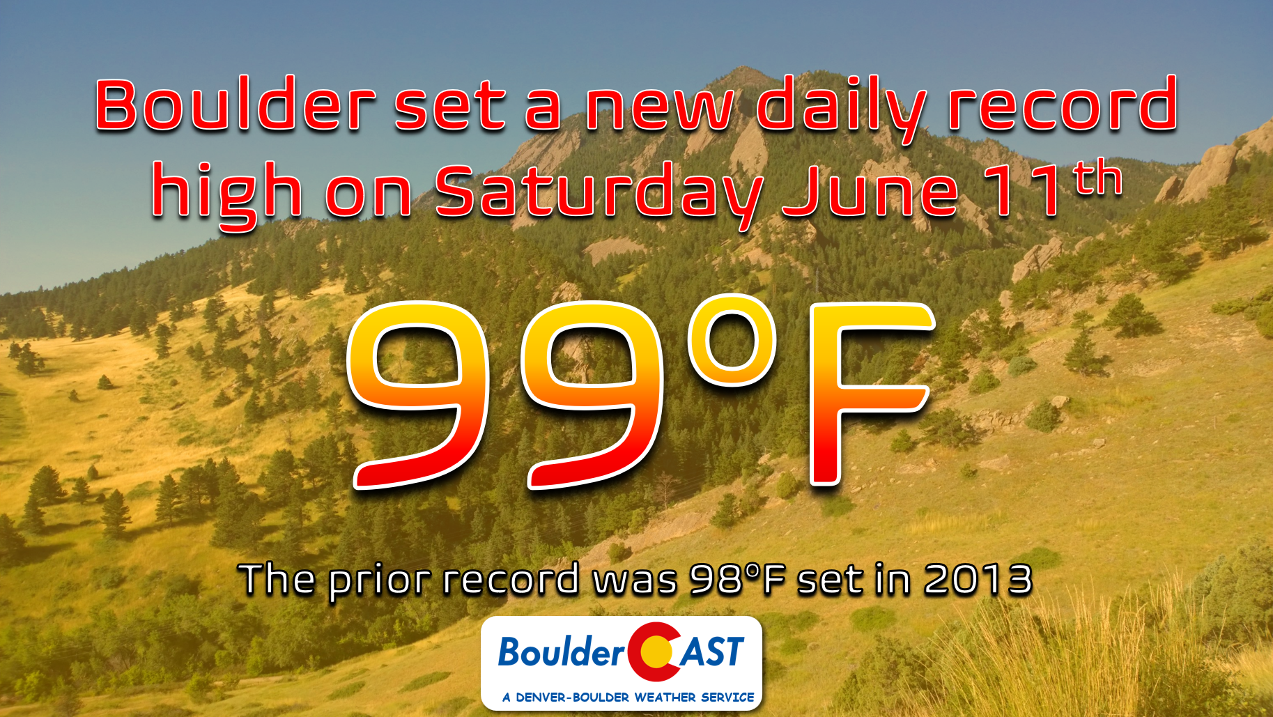
The ongoing heatwave has been brutal across the Front Range — though its not completely out of character for this time of year. Denver officially reached a high of 100 degrees on Saturday tying the existing record for June 11th. Boulder broke its daily record from 2013 soaring to 99 degrees. It was a little bit cooler on Sunday, but readings were still well above normal in the lower 90s.
To escape the heat, I ventured up into the high mountains of western Boulder County on Sunday. There was plenty of snow up there and temperatures were in the lower to middle 60s. It sure was glorious!
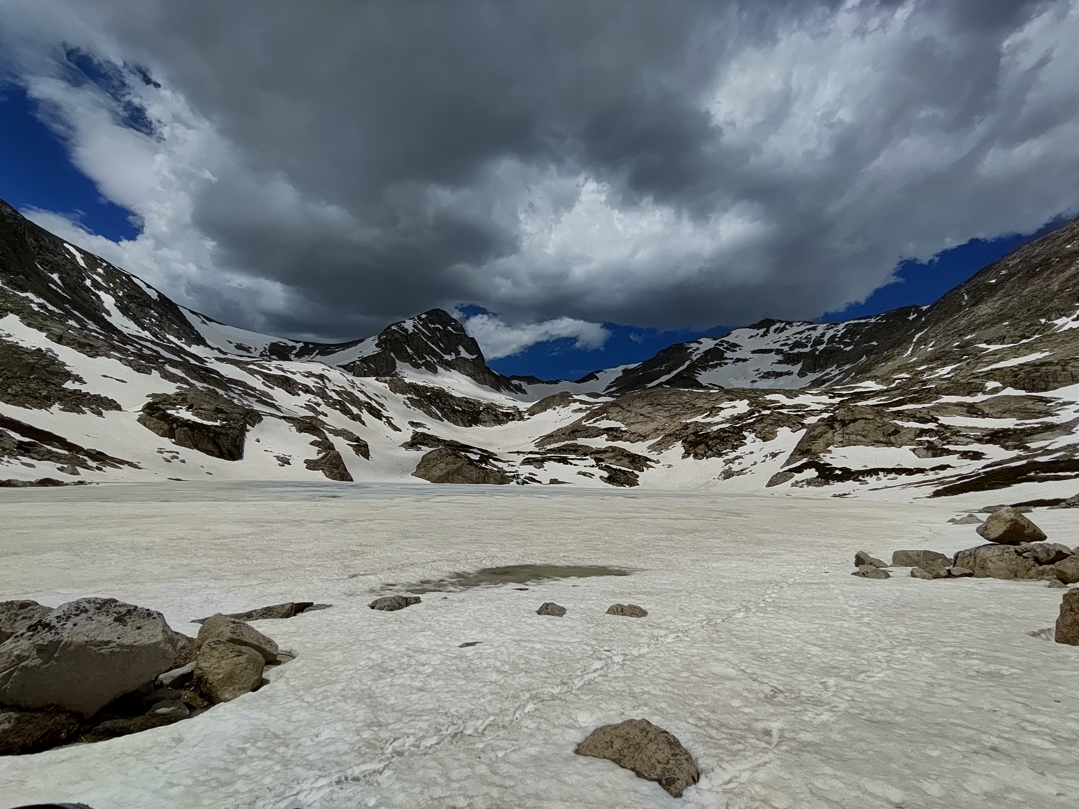
Early storm clouds building over the Continental Divide of western Boulder County on Sunday June 12, 2022.
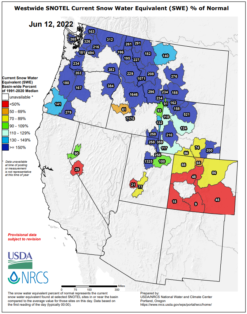
The heatwave of the last several days has also been impacting the Mountains with snowpack melting out very rapidly across the state — check out your local streams and rivers for the proof. After the round of snow at the start of the month, snowpack in the South Platte River Basin has declined from 140% to just 86% of normal. Must of the West has a surplus in snowpack right now — that is not the case in Colorado, though.
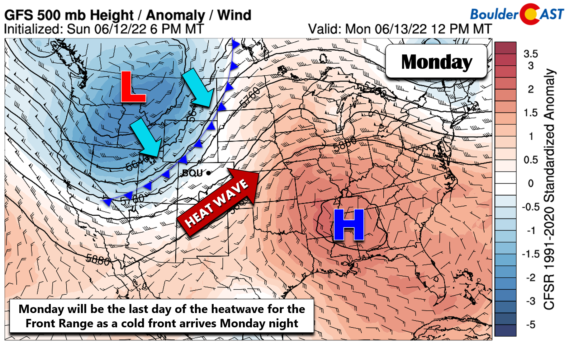
Looking ahead to the forecast for the week, we have just one more day of extreme heat to contend with before cooler weather arrives. As we have been discussing all along, a strong Pacific trough is clipping the northern Rockies early this week bringing cooler weather our way. However, the associated cold front won’t arrive until Monday night so we will have to endure one more day of sizzling temperatures.
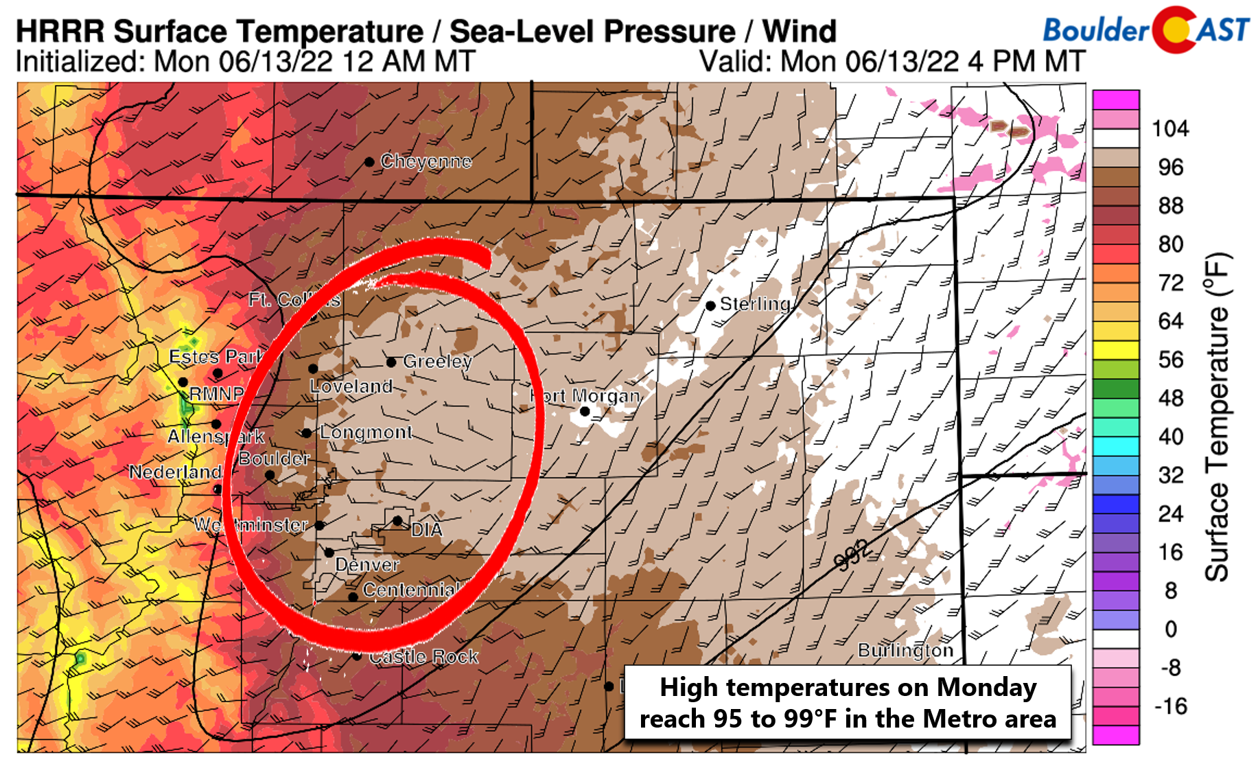
Highs are expected to reach the middle to upper 90s across the Denver Metro region on Monday, with lower elevation spots in eastern Colorado likely to push into the 100s. This will bring many locations within reach of record values again. The existing record highs for June 13th are 98°F and 99°F in Boulder and Denver, respectively. These could both be challenged, with Denver standing a better chance to break it.
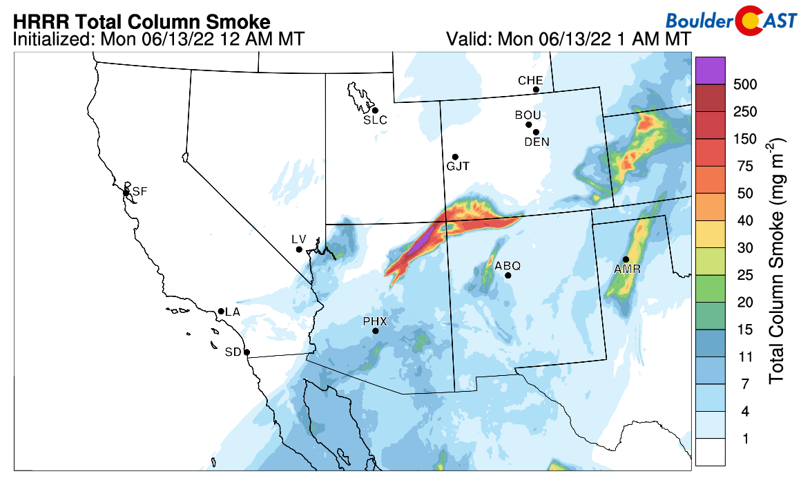
One thing working in our favor Monday — if you want to call it that — is thick, lofted smoke from the brand new Pipeline Fire in northern Arizona. The atmospheric setup of deep southwesterly flow will bring this fire’s smoke plume directly over the Denver Metro area during the day Monday (see below). Smoke plumes like this can block out 10 to 15% of the sun’s energy and it will certainly have a slight cooling effect on our area Monday afternoon. This may ultimately “save” the existing record highs in some spots. Make sure to keep an eye on our Colorado Smoke Forecast page throughout what will likely be a smoky summer ahead…
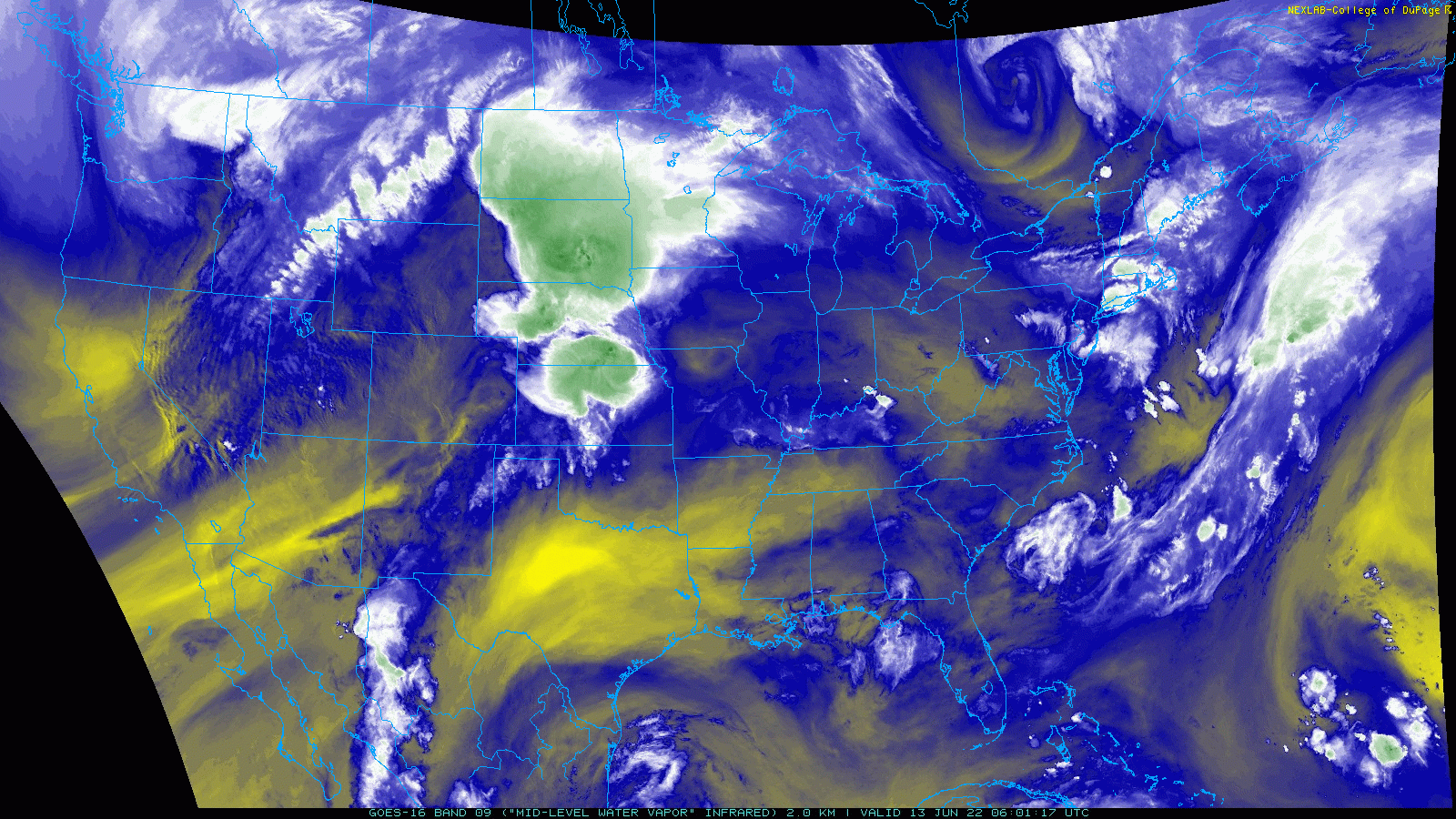
In addition to the heat, very dry air will be in-place across much of Colorado today. The GOES-East water vapor animation from early Monday morning shows a plume of parched air stretching from the Baja into the Denver area. This will lead to almost no clouds on Monday for us.
Fire danger will be elevated as well with the dry air (and record heat) dropping relative humidity percentages well into the single digits. Unfortunately, at the same time southwest winds will be gusting 20 to 30 MPH creating near-critical fire conditions.
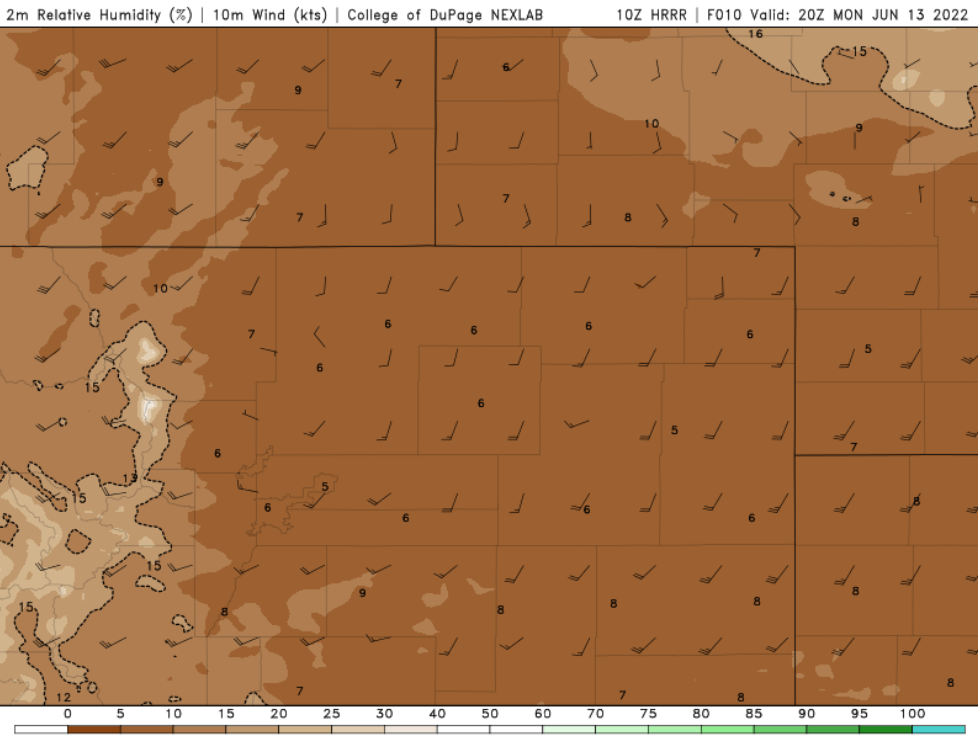
Relative humidity forecast for Monday afternoon from the HRRR model. Values near 5% are expected in the Denver area
Due to the recent dumping of precipitation, the National Weather Service has opted against issuing Red Flag Warnings for Monday, but regardless the atmosphere is primed for rapid fire growth, even with the wetter vegetation around. Use caution and avoid any activities that could create a spark!
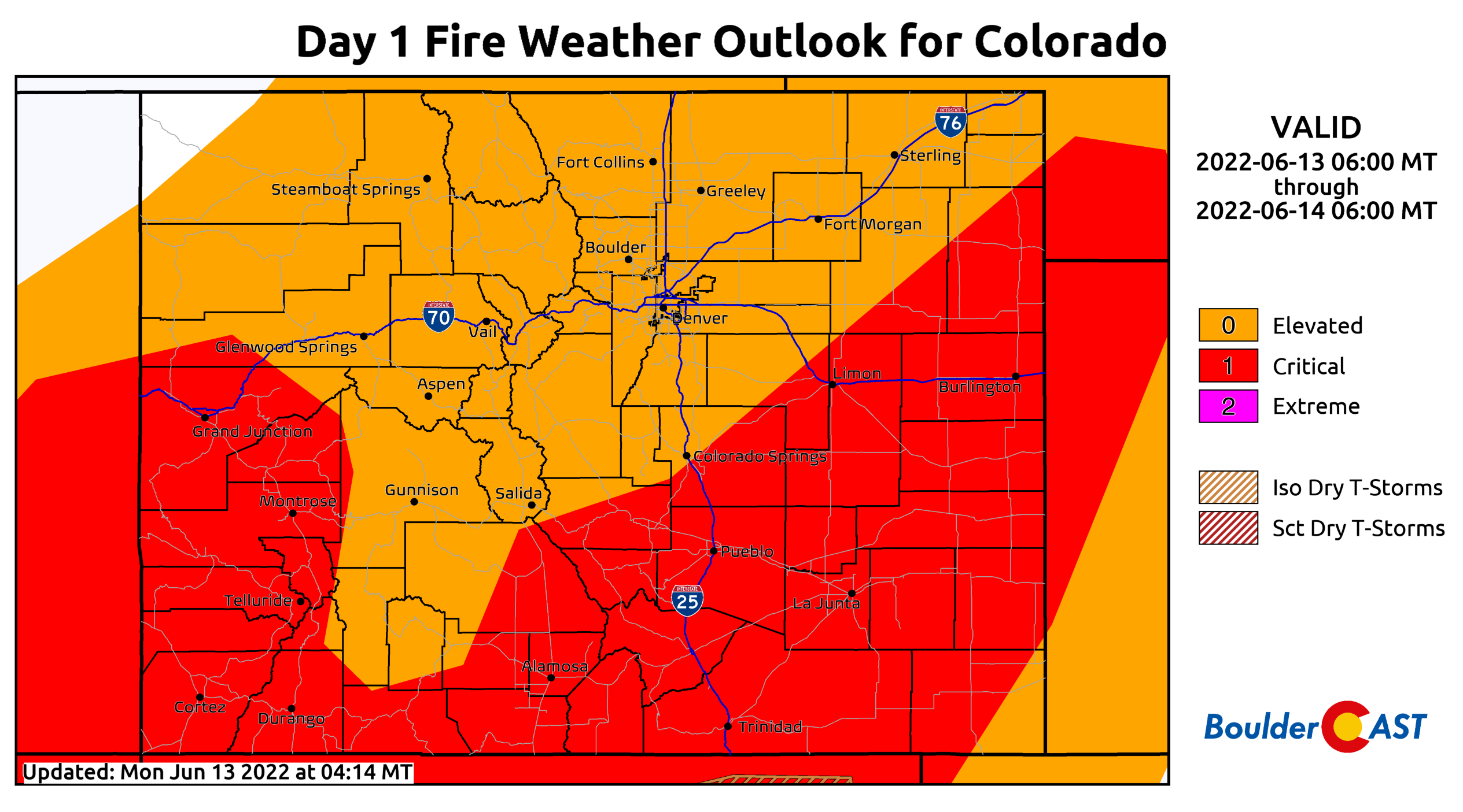
Fire conditions will be elevated to near-critical on Monday
Our forecast calls for sunny skies on Monday with highs in the middle to upper 90s across the area. Winds will pick up by late morning and will remain gusty until the evening in the 20 to 30 MPH range. Make sure to stay hydrated if spending any duration of time outside on Monday. The hot temperatures, abundant sunshine, and very dry air will be somewhat masked by the gusty winds!
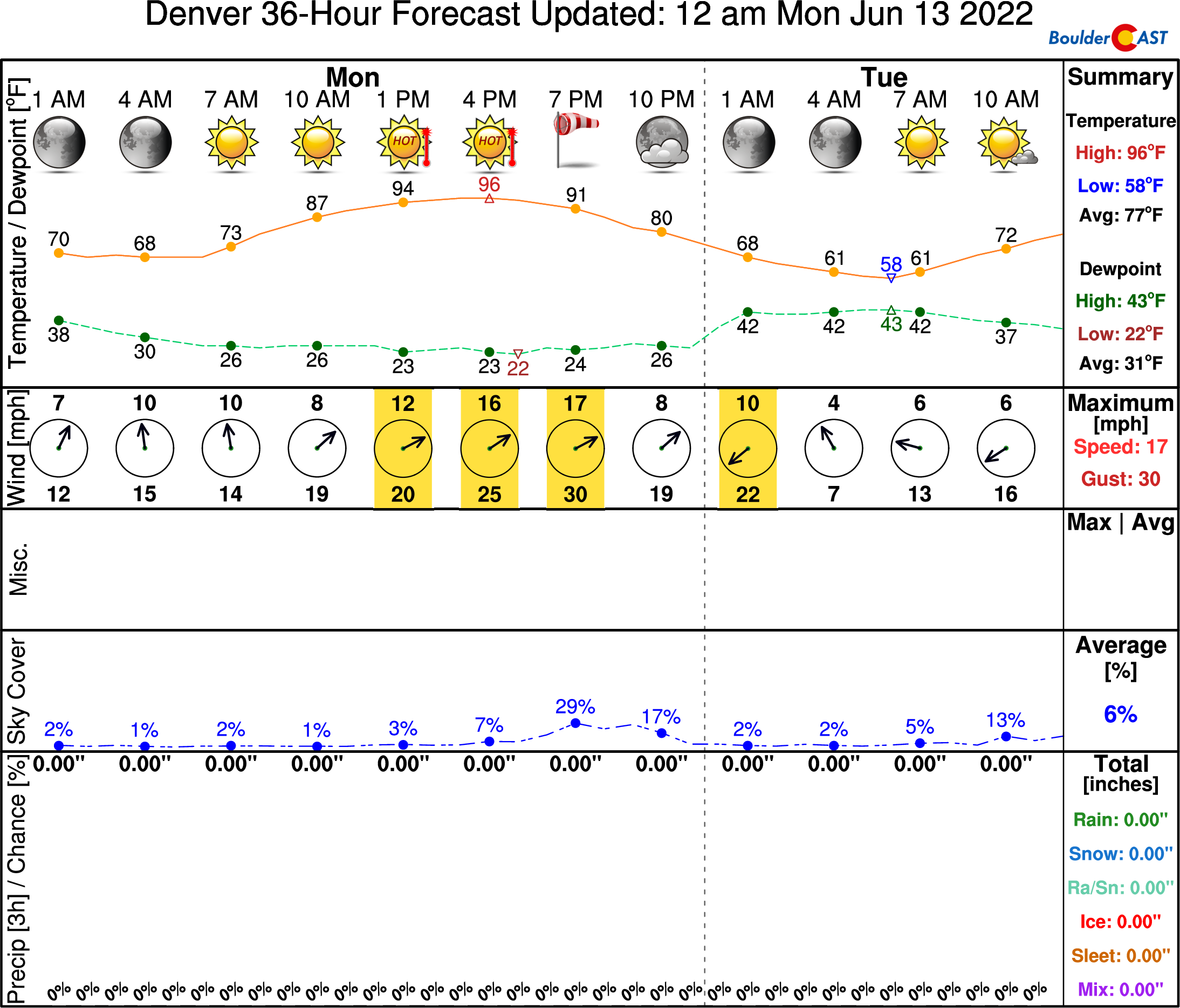
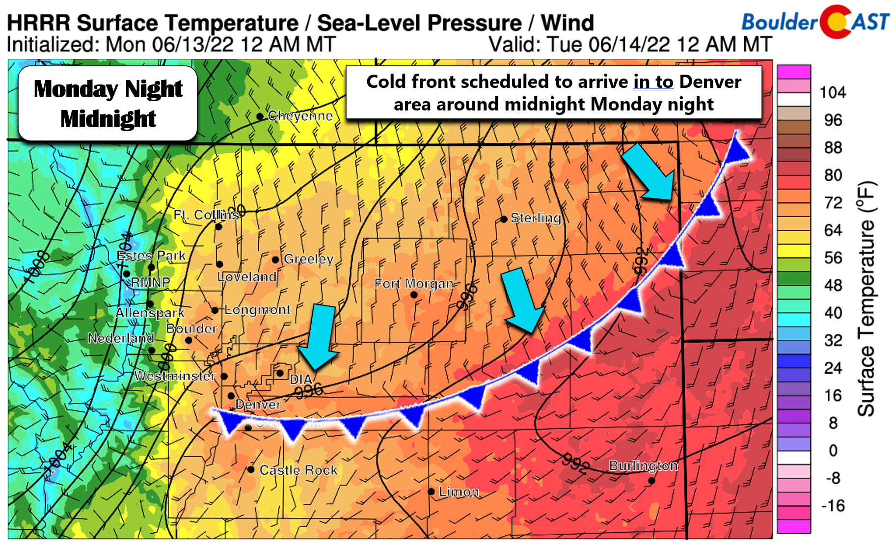
The welcomed cold front will arrive into the Metro area just before midnight Monday night bringing notably cooler weather in the days to follow. Hooray!
Cooler midweek, but the heat ramps up again thereafter
The trough tracking through the northern Rockies this week is an intense one. Heavy snow will fall in the mountains of Montana with up to 2 feet in the coming days. The mountains of far northern Colorado could see a light dusting of snow Tuesday morning.
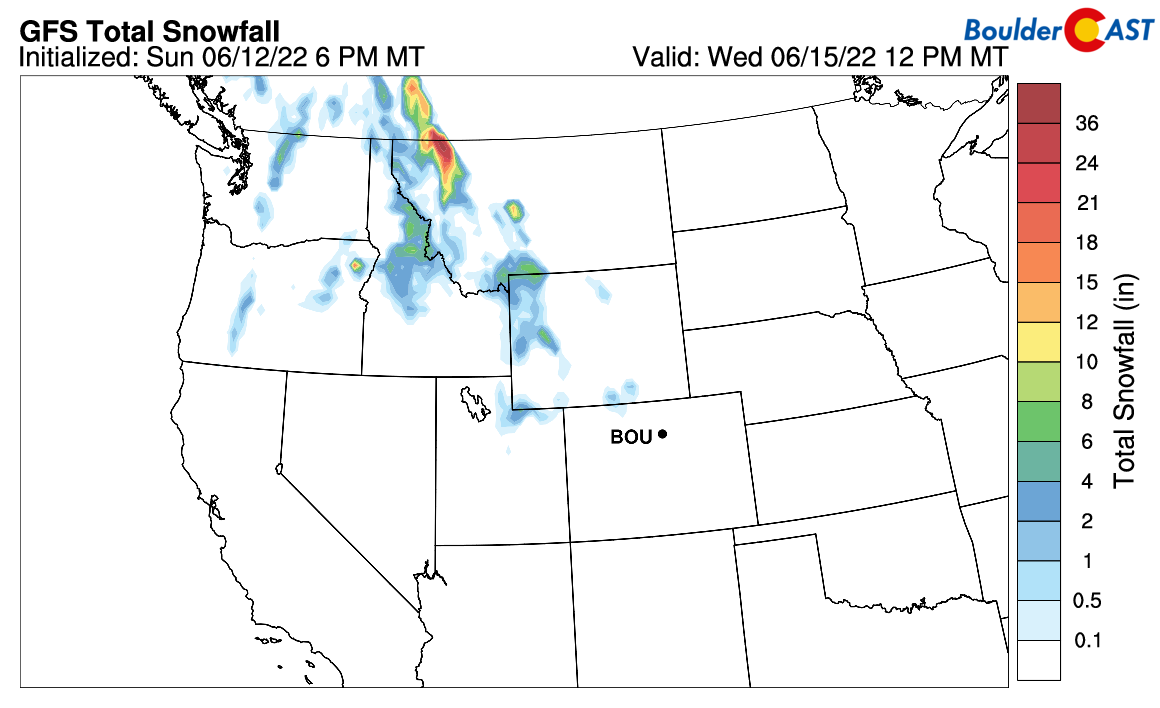
The track of this system is too far north and no precipitation is expected for Boulder or Denver. After the cold front moves through Monday night, temperatures will return closer to seasonal values in the low to middle 80s for Tuesday and Wednesday with sunny skies.
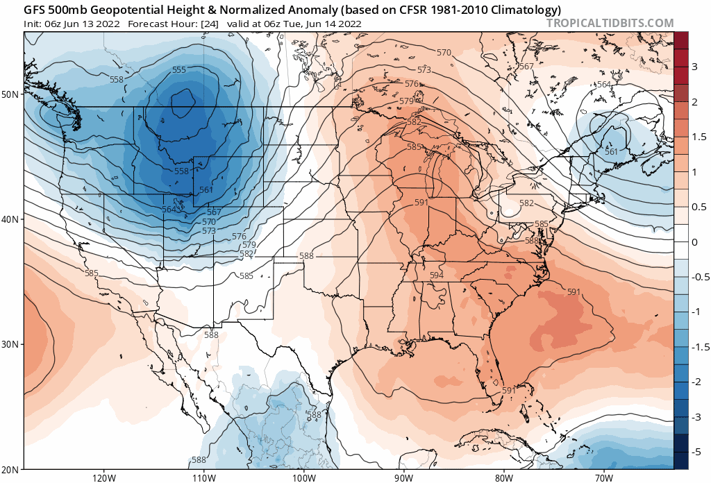
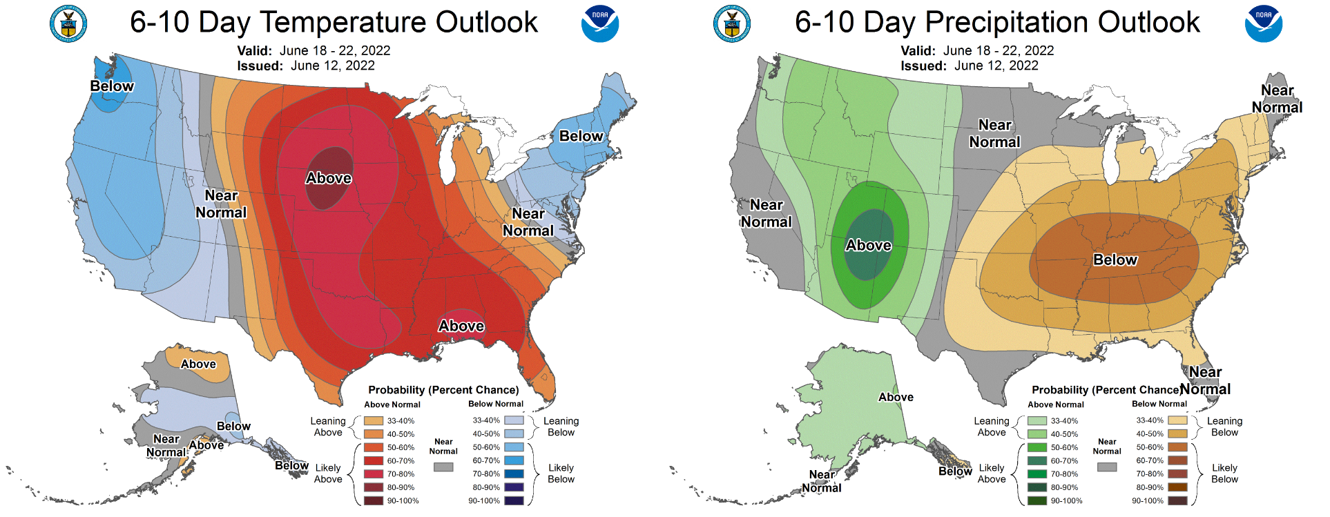
The slightly cooler weather will be short-lived, unfortunately. By late-week another even stronger ridge of high pressure will intensify across the center of the country. Watch this ridgy pattern take shape during the latter half of the GFS 500mb height anomaly animation below.
By the weekend, this ridge will develop into a full-on omega block across the center of the country, with Colorado stuck on the western fridge under toasty southwest flow. Temperatures will return into the lower 90s by Thursday with upper 90s in the works for Friday — discussions about record-challenging heat will return as well.
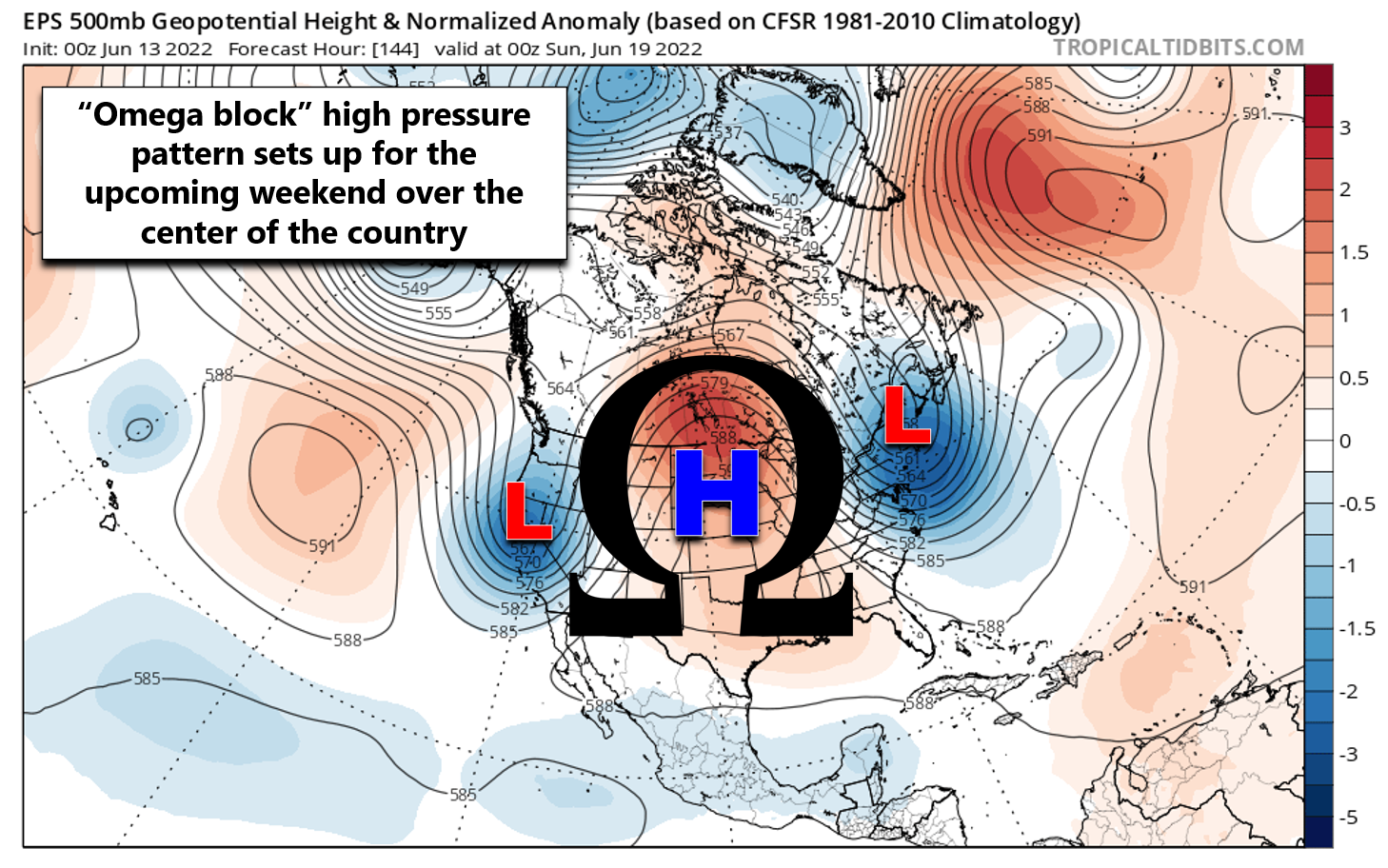
Despite temperatures remaining above normal under this omega block pattern, we will start to see subtropical, almost monsoon-like, moisture get pulled northward over the upcoming weekend by the large high pressure in the center of the country. The best moisture looks to remain across the immediate Four Corners region, including western Colorado.
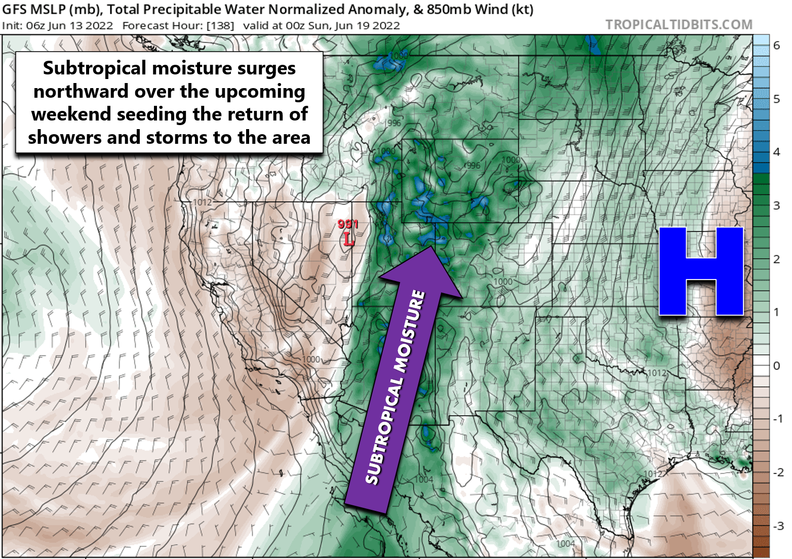
However, the Denver Metro will see an uptick in late-day rain activity as well. The increased cloud cover and spotty storms will help take some of the edge off the heat over the weekend heading into early next week.
Enjoy!
Stay up to date with Colorado weather and get notified of our latest forecasts and storm updates:
Forecast Specifics:
Monday: Hot, sunny and breezy with winds gusting up to 30 MPH from late morning into the evening. Fire danger will be elevated so do use caution. High temperatures will be near record values in the mid to upper 90s on the Plains with lower 80s in the Foothills.
Tuesday: Noticeably cooler following the passage of an overnight cold front. Mostly sunny with light winds. Temperatures reach the middle 80s on the Plains with lower 70s in the Foothills.
Wednesday: Sunny and seasonal with highs in the middle 80s on the Plains and in the lower 70s in the Foothills.
Thursday: Staying mostly sunny with temperatures beginning to warm back up again. Highs reach the lower 90s on the Plains with middle 70s in the Foothills.
Friday: Mostly sunny and very hot with near-record high temperatures. Temperatures soar into the mid to upper 90s across the Plains with middle 80s in the Foothills.
High Country: The Pacific trough moving across the northern Rockies will bring a slight chance of rain/snow showers to the Mountains Monday night into Tuesday morning, with up to a dusting of accumulation possible in the highest peaks near Steamboat. Monday will also be blustery with gusts up to 50MPH in most ranges. Dry weather is expected Tuesday and Wednesday, but isolated to scattered storms will return to the Mountains by Thursday and Friday as moisture begins to increase from the southwest. The upcoming weekend will see widespread late-day storms across the High Country.

Help support our team of Front Range weather bloggers by joining BoulderCAST Premium. We talk Boulder and Denver weather every single day. Sign up now to get access to our daily forecast discussions each morning, complete six-day skiing and hiking forecasts powered by machine learning, first-class access to all our Colorado-centric high-resolution weather graphics, bonus storm updates and much more! Or not, we just appreciate your readership!
Spread the word, share the BoulderCAST forecast!


You must be logged in to post a comment.