
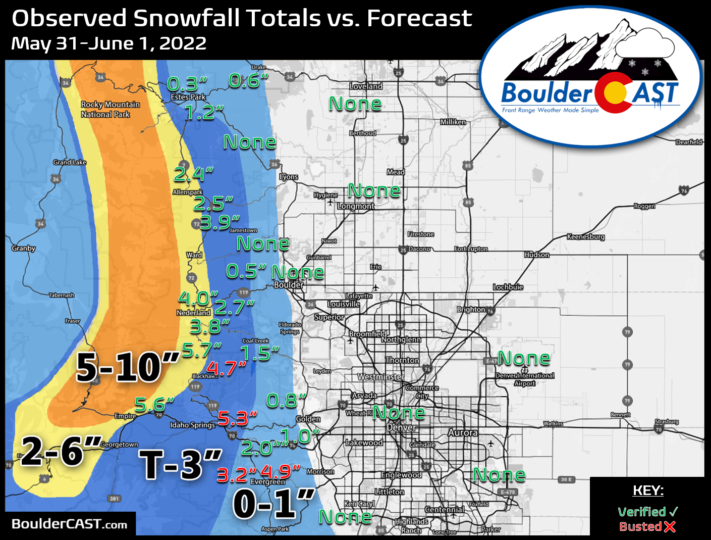
As the rain soaked the Denver Metro area on the last night of May, temperatures were just cold enough for late-season snow in the Foothills above 7000 feet elevation. Let’s take a look at the snow totals across the Front Range!
Shown below is our snowfall forecast map issued Tuesday morning with actual storm totals overlaid. Green values indicate that our forecast verified to within one inch of the observed snowfall total. Red numbers did not. As expected it was too warm for snow below ~7000 feet elevation, so both Boulder and Denver reported no snowfall at all with this event (just a soaking of rain!). Heavy wet snow fell in the Foothills above 8000 feet elevation where temperatures were near or just below freezing much of the overnight period. The highest totals of 3-6″ were reported in these areas.


You must be logged in to post a comment.