After days of scorching heat, this week will fortunately trend cooler and wetter with the return of monsoon moisture to Colorado — perfect timing considering severe drought has now returned to the area and fire danger continues to explode. Following one more toasty outing on Monday, temperatures will tumble below normal by midweek with daily chances for monsoon thunderstorms, some of which could be severe. We review the ongoing heatwave, the recent Dinosaur Fire in Boulder, why the pattern is now shifting and look ahead to which days will offer the best chance of rain this week.
This week’s highlights include:
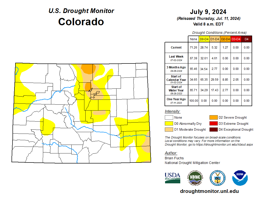
- Severe Drought is Back: Boulder and Larimer Counties have been upgraded to Severe Drought status after eleven weeks of record dry conditions. A small wildfire spawned in Boulder a few days ago and was quickly contained
- Fire Season Outlook: The monsoon season is expected to be weak, leading to a more intense fire season in the Front Range.
- Heatwave Relaxes: A high-pressure ridge caused record high temperatures in Denver the last few days. The ridge is shifting this week, bringing monsoon moisture and rain chances back to Colorado as well as cooler temperatures.
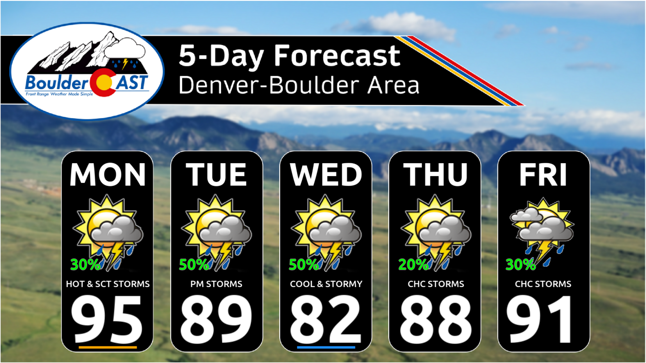
- A Stormy Week: Expect cooler temperatures with scattered thunderstorms throughout the week. The best chance for significant rainfall is on Wednesday. A slight risk of severe storms will exist most days across eastern Colorado, but not necessarily in the Metro area.
DISCLAIMER: This weekly outlook forecast is created Monday morning and covers the entire upcoming week. Accuracy will decrease as the week progresses as this post is NOT updated. To receive daily updated forecasts from our team, among many other perks, subscribe to BoulderCAST Premium.

Go Premium, get all the perks.
Daily Forecast Updates
Get our daily forecast discussion every morning delivered to your inbox.
All Our Model Data
Access to all our Colorado-centric high-resolution weather model graphics. Seriously — every one!
Ski & Hiking Forecasts
6-day forecasts for all the Colorado ski resorts, plus more than 120 hiking trails, including every 14er.
Smoke Forecasts
Wildfire smoke concentration predictions up to 72 hours into the future.
Exclusive Content
Weekend outlooks every Thursday, bonus storm updates, historical data and much more!
No Advertisements
Enjoy ad-free viewing on the entire site.
Severe Drought returns, more fires expected in the coming months
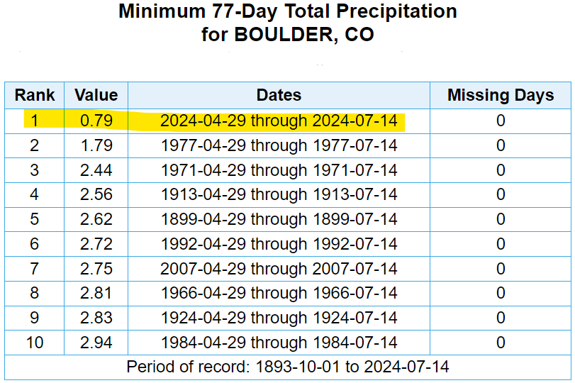
Following eleven weeks of record dry conditions in the Front Range, last Thursday the United States Drought Monitor upgraded (downgraded?) portions of Boulder and Larimer Counties to Severe Drought status. It’s been over two years since the last time we were included in this classification.
The very next day on Friday, a small wildfire ignited just southwest of Boulder at the base of the Flatirons, eventually being called the Dinosaur Fire.
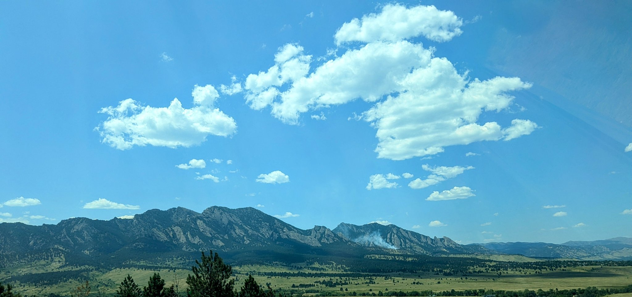
Thanks to rapid firefighting efforts on the ground and through the air, the fire was quickly contained in only 24 hours, burning a total of just 4 acres.
Here is a video I took of the Sky Crane helicopter dropping water on the #dinosaurfire in #boulder. This helicopter can drop ~2500 gallons of water. Big thanks to the aerial and ground crews battling this fire. @boulder_fire pic.twitter.com/Vo5GjqOw8e
— Matt Benjamin (@MBforBoulder) July 12, 2024
Fortunately the winds on Friday were not very strong which helped with the fire’s rapid containment. The exact cause of the fire remains unknown, but surely it was human-caused as there was no lightning at the time and Mother Nature recently misplaced her magical flint and steel kit.
It's currently 91F, 10% humidity and winds around 10-15MPH near the #DinosaurFire at ~7,000 feet elevation just SW of #Boulder. It's dry but the wind is thankfully on our side today! #COwx pic.twitter.com/35GdlY0fQv
— BoulderCAST Weather 🏔️❄️ (@BoulderCAST) July 12, 2024
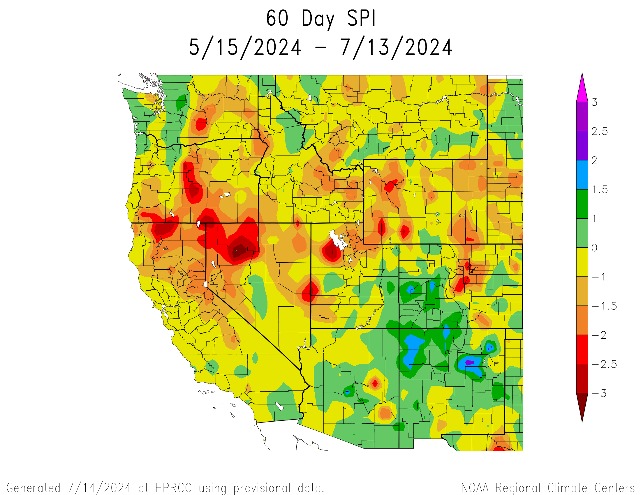
The map below shows the Standardized Precipitation Index (SPI) for the West since the middle of May. SPI is used to compare precipitation as it relates to “average” over regions with vastly different climates. Much of the West has seen drier than normal conditions during this period, with the Front Range one of the worst. Colorado’s Mountains, particularly those on the western side of the Continental Divide, haven’t been nearly as dry with a positive SPI there. The wildflower display in the San Juans right now must be wonderful!
In our recent 2024 Colorado Monsoon Outlook, we warned that monsoon season would be greatly nerfed this year across Colorado and that fire season would hit harder and closer to home. As Keith Urban would say, it’s gonna be a long, hot summer! Expect even more impactful fires to spawn across the Front Range in the months to come. The Dinosaur Fire was a mere test of our wildland fire response readiness — one which we fortunately passed.
Heatwave breaks down as rain returns to the forecast
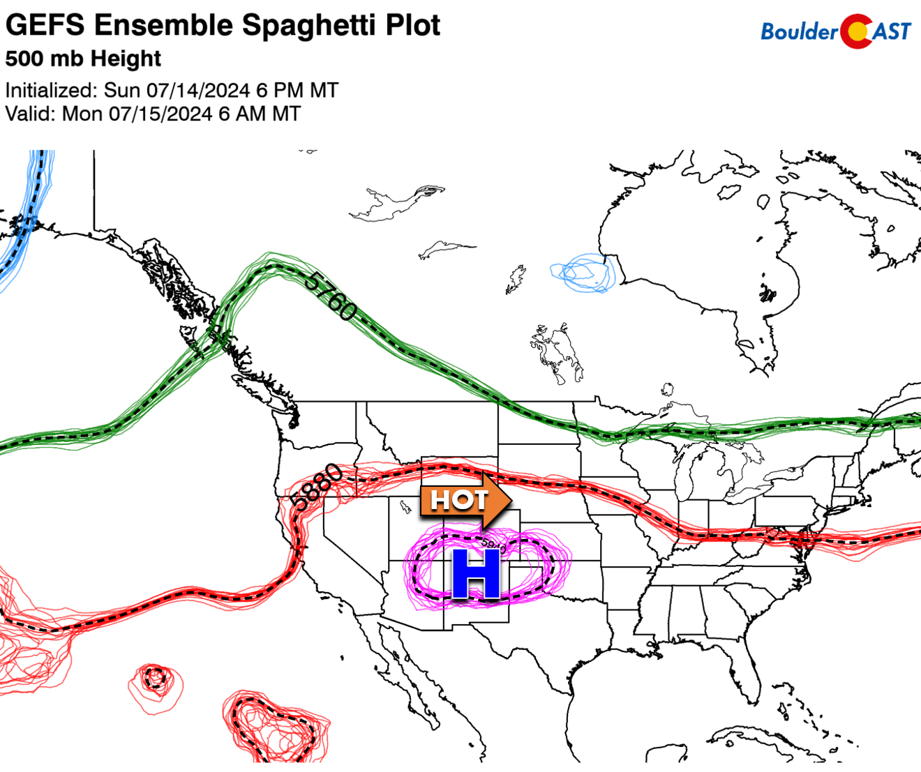
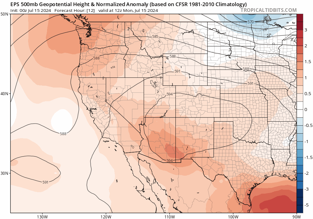
The highly anomalous ridge of high pressure responsible for our ongoing heatwave is currently located across northern New Mexico on Monday with almost due westerly flow present across Colorado.
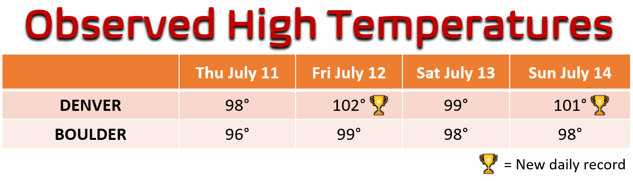
This positioning has allowed for the absolute hottest air to make it into our area over the weekend. Several daily record high temperatures were broken in Denver with two triple-digit affairs. Boulder never managed to reach the century mark and in fact didn’t break any records. However, it’s worth noting that Boulder’s historical temperature data is poisoned with observations taken from the roof of the old downtown fire station during (only) the 1950s. This decade in particular holds many summertime heat records for the city (including July 10, 11, 12 and 13) and was notoriously biased warm due to the improper location of the weather station on the roof. Not considering the 1950s, Boulder would have broken one or two records this weekend as well.
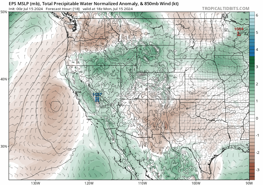
Fortunately the aforementioned ridge will retrograde westward this week, moving closer to Las Vegas with the amplified ridge axis extending northward into western Canada. This can be seen in the European ensemble 500mb height anomaly forecast animation below. This reshaping of the ridge will shift the hottest airmass west and north of Colorado, something that will certainly help to take the edge off the heat here in the Front Range with northwest flow developing.
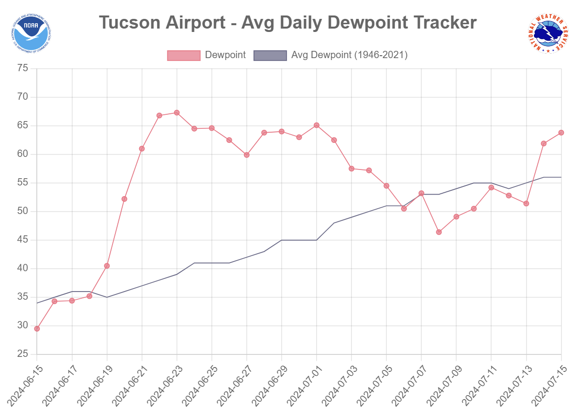
The shift in the ridge is also facilitating a return of monsoon moisture to the American Southwest. Prior to Sunday, there were eight straight days of below normal dew points in Tucson, a sign that the monsoon was completely missing in action. However, dew points have spiked again in Tucson the last day or so. This moisture be trickling into Colorado throughout the week ahead seeding the return of actual rain chances (*gasp*) to our forecast.
Though temperatures will once again skyrocket quickly into the 90s on Monday, we won’t be competing for any record highs. It will be several degrees cooler as a result of rapidly developing storms clouds which will be tapping into the replenished subtropical moisture. There will also be a weak frontal boundary mixed in during the afternoon helping to bring temperatures down as well alongside weak upslope flow.
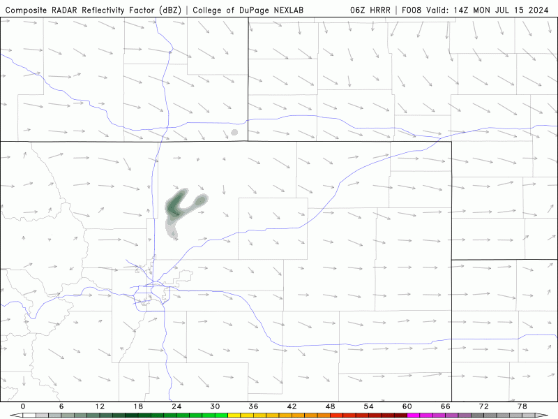
HRRR model-simulated radar animation showing the developing storms on Monday moving west-to-east across the Front Range
Look for highs to reach the middle 90s in the Metro area before trending downward the rest of the day as storm clouds fill in. Scattered thunderstorms will be possible anytime from early afternoon Monday into the evening with gusty winds, lighting and brief light/modertate rainfall the main concerns. Tuesday will see a similar rain chance with temperatures falling back several degrees into the upper 80s.
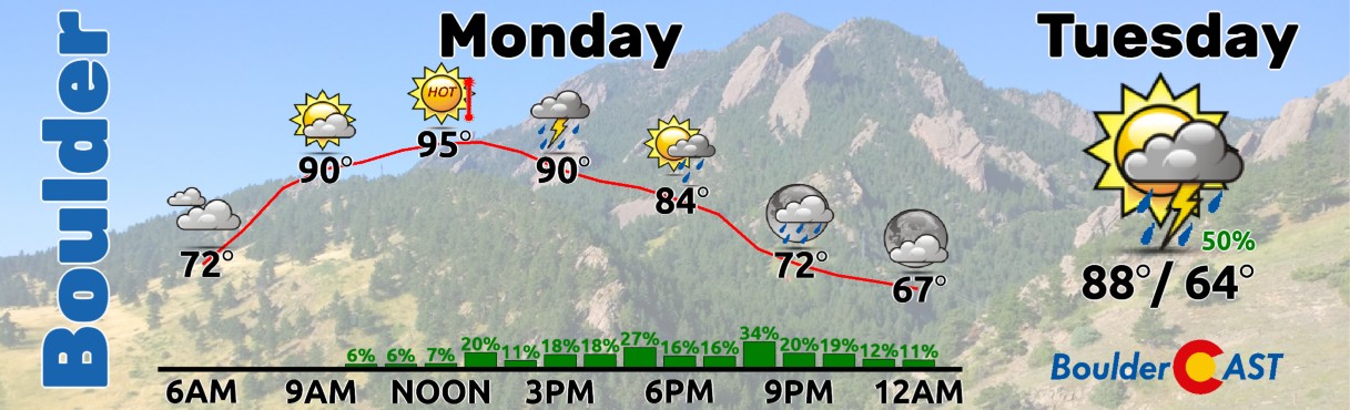
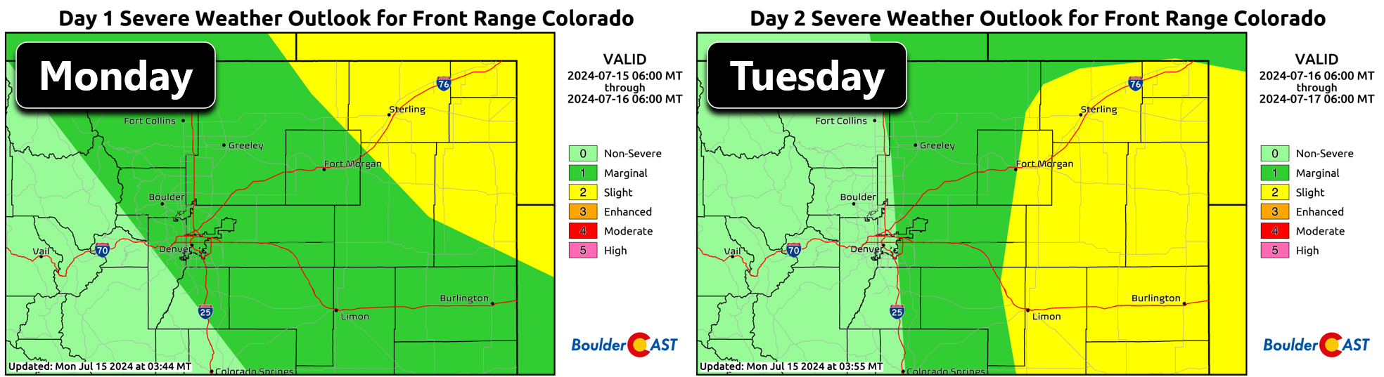
The Storm Prediction Center does include our area at risk for severe weather on Monday (and Tuesday for locales east of Interstate 25). The primary risk is for damaging wind gusts up to 60 MPH with isolated hail up to 1″ in diameter. The risk for severe storms is low in the Denver area, but is higher towards the Nebraska Border.
Monsoon moisture will continue to linger across the Four Corners region the rest of the week as it is trapped under the ridge of high pressure — some of that moisture will reside across Colorado each day in the extended. The precipitable water anomaly forecast animation below runs through Saturday. Notice how slightly above normal moisture remains over our area the entire time.
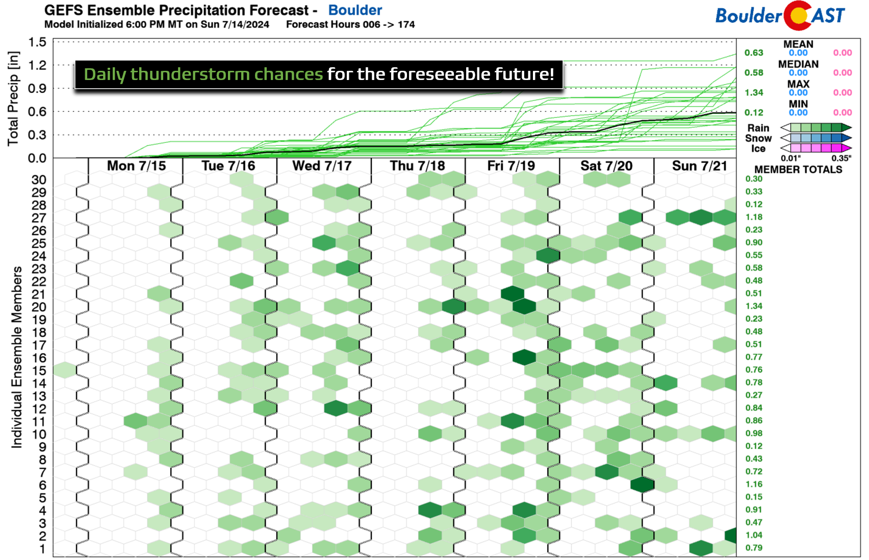
Thus, rain chances are back and are here to stay! We’re looking at daily chances for thunderstorms each of the next seven days.
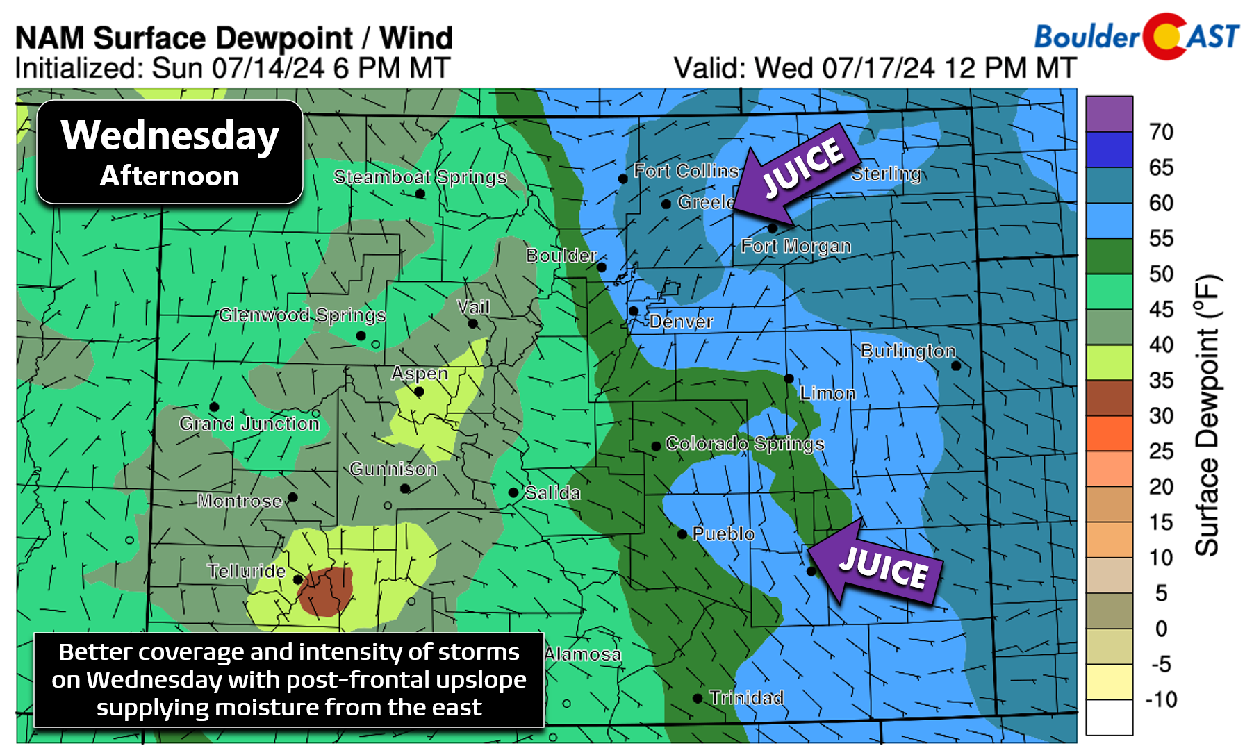
Currently we are closely watching Wednesday for the best chance of appreciable rainfall this week. A cold front will move through during the morning hours with post-frontal upslope helping to pull in low-level Gulf moisture from the east. This will set the stage for a chillier day with highs in the lower 80s — for once a below normal temperature reading! The uptick in moisture will allow for numerous to widespread thunderstorms to develop Wednesday afternoon and evening, with a better chance those storms will contain moderate to heavy rainfall. Severe storms will also be a concern, though the primary risk could end up being a tad east and south of the Denver area.
Late in the week we will resume typical summertime weather with temperatures pushing back towards 90 degrees with a lesser but persistent chance of late-day thunderstorms. Rain chances will continue right into the upcoming weekend. It’s great to see so much rain in our extended forecast — let’s hope we all see some much-needed moisture this week!
Forecast Specifics:
Monday: Staying hot with highs reaching the middle 90s on the Plains and lower 80s in the Foothills. Scattered storms will develop during the afternoon and evening. Generally light rainfall and gusty winds will accompany storms.
Tuesday: Partly cloudy with scattered to numerous showers and storms developing in the afternoon/evening. Storms could turn severe east of Denver. High temperatures will be cooler in the upper 80s on the Plains with middle 70s in the Foothills.
Wednesday: Morning sun, then numerous to widespread showers and thunderstorms later in the day. some could be severe, mainly east and southeast of Denver. Storms will contain heavier rainfall than prior days. Temperatures cool below normal and only reach the lower 80s on the Plains with lower 70s in the Foothills.
Thursday: Morning sun trending partly cloudy by afternoon with widely scattered storms. Highs rebound back into the upper 80s on the Plains with middle 70s in the Foothills.
Friday: More clouds will be around, but also scattered thunderstorms. Look for temperatures to top out in the lower 90s across the Plains and near 80 in the Foothills.
Weekend: More of the same weather with seasonal temperatures (80s) and the chance of late-day storms staying the course both days.
Get BoulderCAST updates delivered to your inbox:
DISCLAIMER: This weekly outlook forecast is created Monday morning and covers the entire upcoming week. Accuracy will decrease as the week progresses as this post is NOT updated. To receive daily updated forecasts from our team, among many other perks, subscribe to BoulderCAST Premium.
Go Premium, get all the perks.
Daily Forecast Updates
Get our daily forecast discussion every morning delivered to your inbox.
All Our Model Data
Access to all our Colorado-centric high-resolution weather model graphics. Seriously — every one!
Ski & Hiking Forecasts
6-day forecasts for all the Colorado ski resorts, plus more than 120 hiking trails, including every 14er.
Smoke Forecasts
Wildfire smoke concentration predictions up to 72 hours into the future.
Exclusive Content
Weekend outlooks every Thursday, bonus storm updates, historical data and much more!
No Advertisements
Enjoy ad-free viewing on the entire site.
Enjoy our content? Give it a share!


You must be logged in to post a comment.