The upcoming week will begin and end rather quiet across the Front Range, but smack in the middle we’ve got an excellent chance of upslope snow on Wednesday. Models remain inconsistent with the specifics of this storm system, but it’s clear that everyone should see some accumulation alongside the markedly colder temperatures. Read on for our preliminary snowfall expectations and a complete outlook for the week ahead.
This week’s highlights include:
- Monday and Tuesday will be mild and mostly pleasant with a flattened ridge moving through the area
- Things begin to change Tuesday evening following the passage of a cold front
- Much colder Wednesday with light upslope snow developing during the day — impacts appear likely for the evening commute
- Several inches of snowfall possible Wednesday into Wednesday night in and near the Foothills, with lighter amounts in Denver and areas east
- Quiet weather returns for Thursday and Friday with plenty of sunshine and temperature warming back towards normal
DISCLAIMER: This weekly outlook forecast is created Monday morning and covers the entire upcoming week. Accuracy will decrease as the week progresses as this post is NOT updated. To receive daily updated forecasts from our team, among many other perks, subscribe to BoulderCAST Premium.

Turning cold & snowy by midweek
The weather has been beautiful over this past weekend and that will continue through Tuesday as a flattened ridge of high pressure pushes across Colorado. The ridge axis can be seen in the 500mb height anomaly forecast map below for Monday. This ridge will facilitate the continued warm pattern for eastern Colorado with northwesterly downslope flow. Highs will be in the upper 50’s with sun on Monday and then just a few degrees cooler on Tuesday as cloud cover thickens.
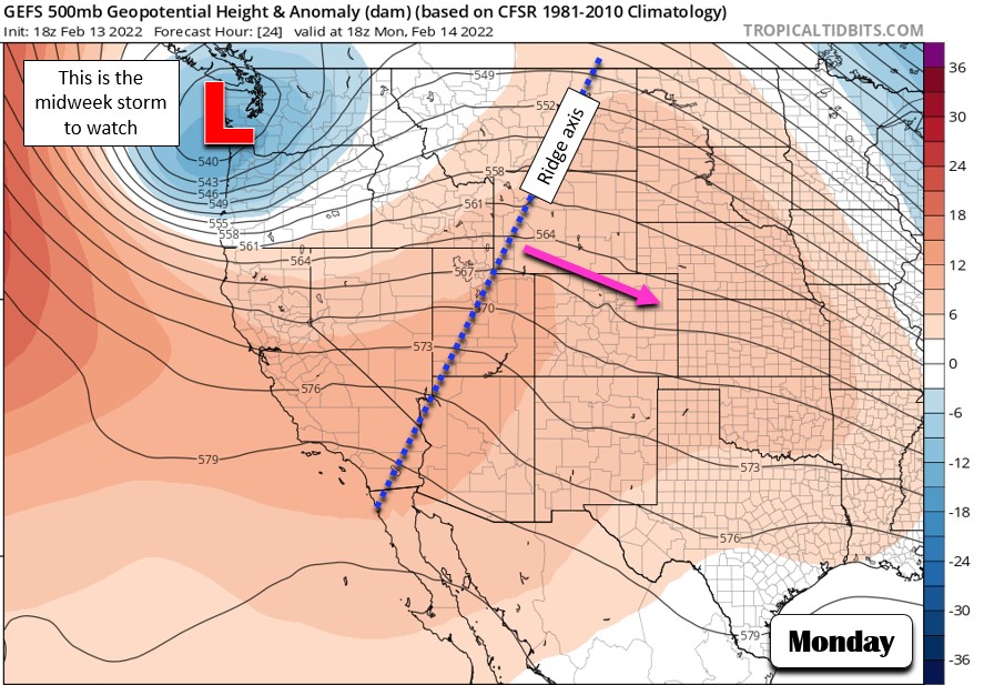
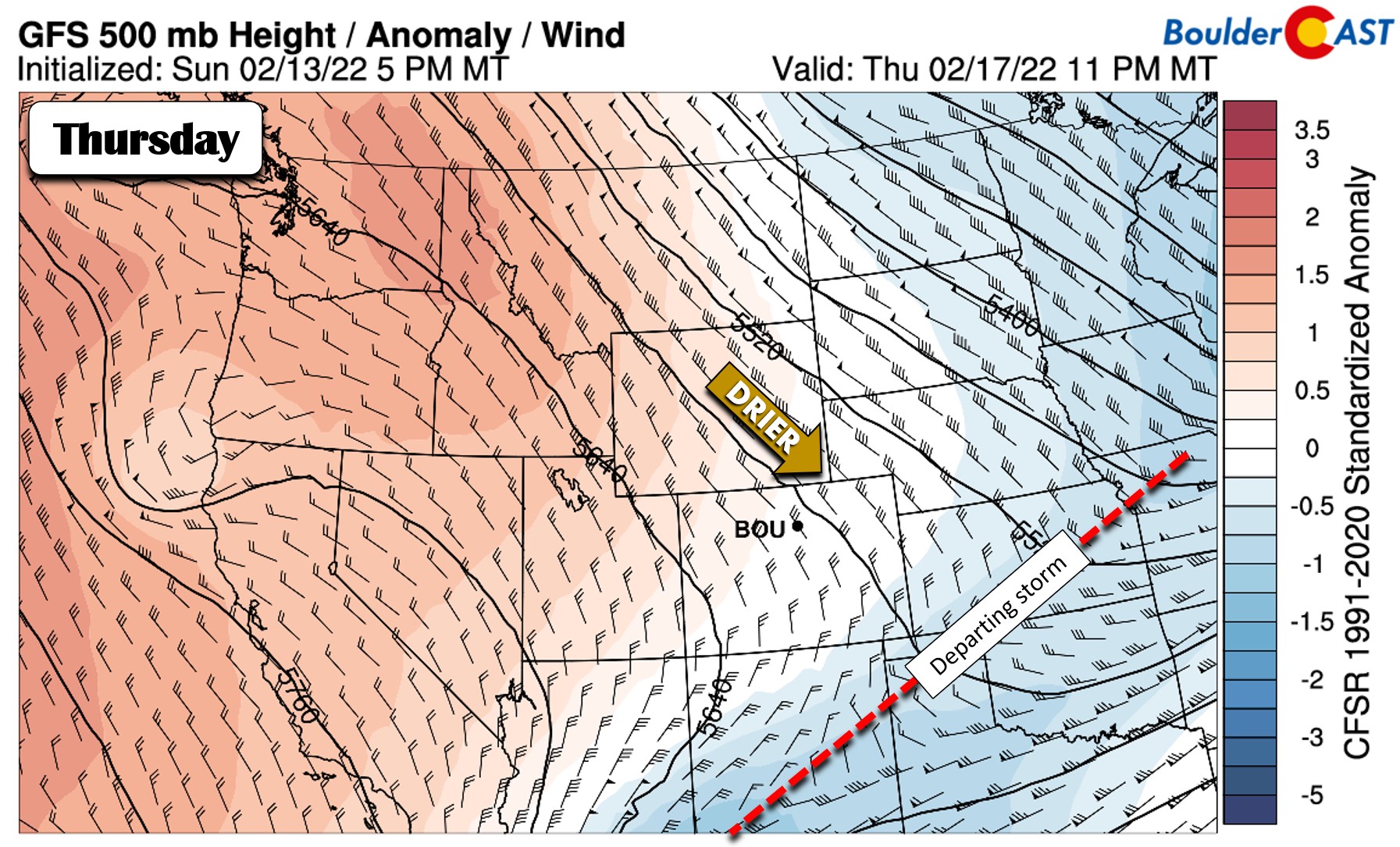
Enjoy the warmth while you can — another Arctic blast is gearing up for midweek! The responsible storm system can be seen over Washington above on Monday. This is really the first storm of this caliber that has been able to penetrate into the Pacific Northwest in a long time — they have been enduring a prolonged dry period recently. This welcomed pattern shift will allow for this low pressure to dive into the Las Vegas area by Tuesday night and then across Arizona and New Mexico on Wednesday. This is shown in the animation below. This entire setup is still more than two days away from reaching Colorado, so naturally it is still somewhat uncertain. However, there is clear indication from all the weather models that a ~24-hour period of upslope will ensue across the Denver area leading to a round of snowfall for us.
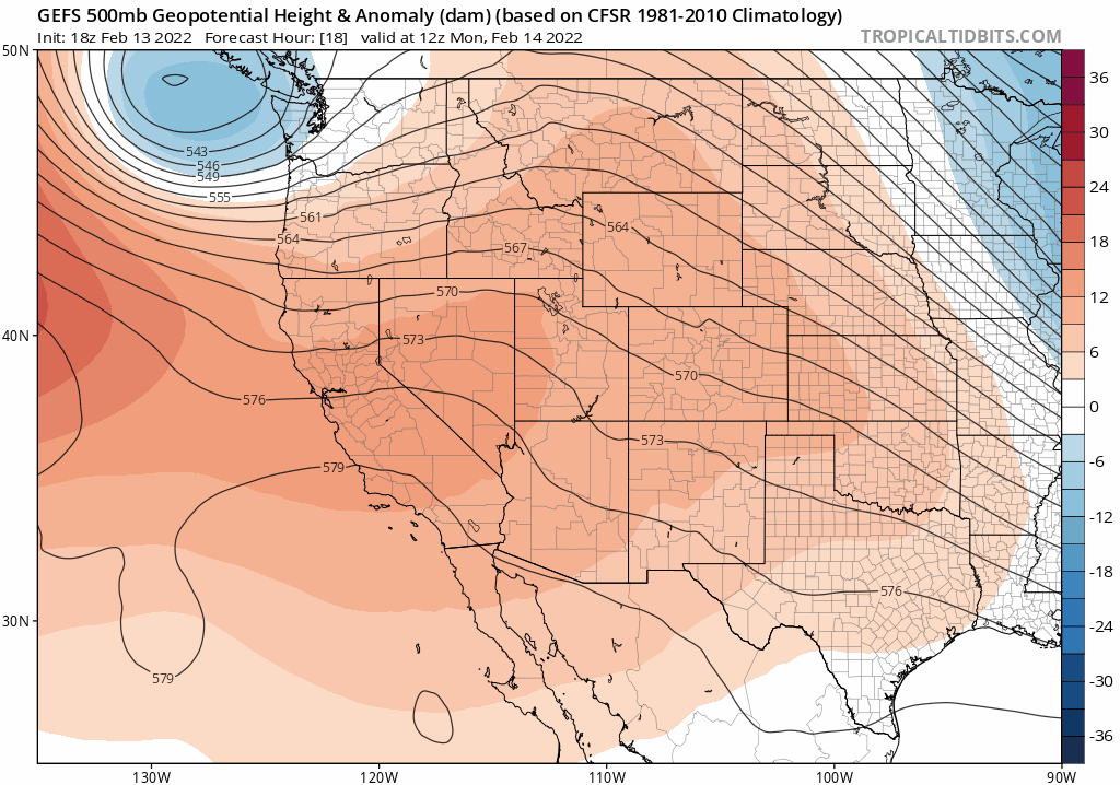
GEFS ensemble mean 500mb height anomaly forecast animation through Thursday evening
The upslope will begin as the first front comes through Tuesday evening after sunset. The GFS near-surface temperature forecast for Tuesday at 11PM is below. The front will already be through Denver at this time with sub-freezing temperatures beginning to filter in front the north. There is not much moisture behind this front initially so this will likely be a dry frontal passage with snow holding off until sometime Wednesday.
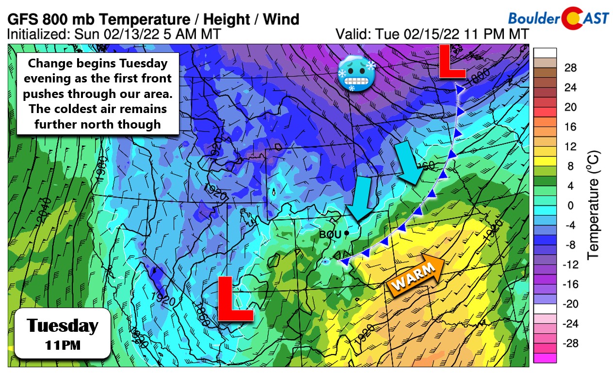
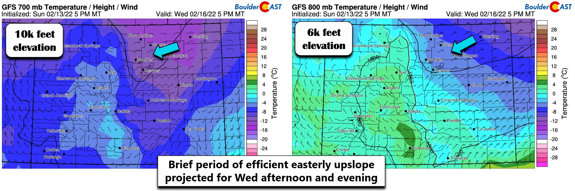
A second surge of even colder air builds into the area during the day Wednesday in response to the southern-track low intensifying across New Mexico and an Arctic high moving across the Dakotas. Wednesday afternoon into Wednesday night will be the key period to watch for this storm as some models are showing winds really picking up from a near due-easterly direction for a brief period.
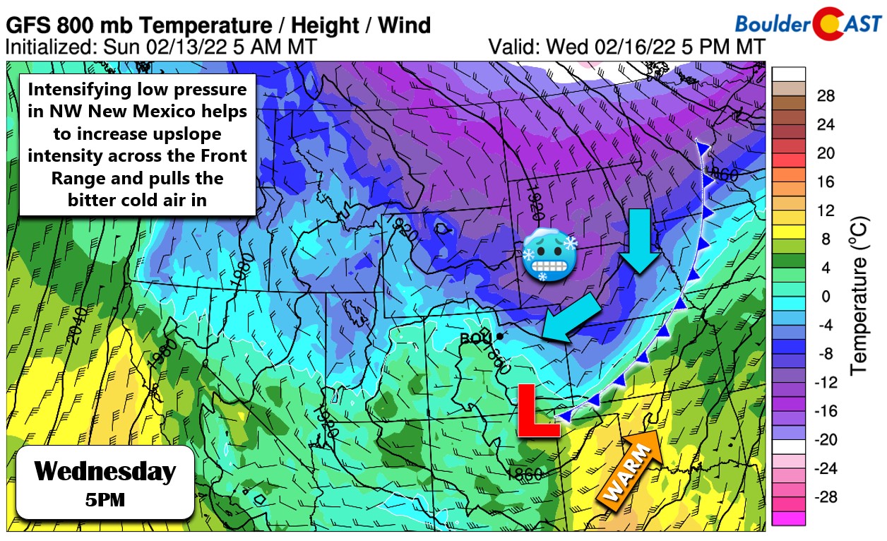
This enhanced fetch of upslope will produce light to moderate upslope snow across the entire area Wednesday afternoon into the overnight period. While not all that strong, the upslope is deep and rather cold which should allow for a period of excellent snow growth leading to fluffy snow ratios. Highs on Wednesday will only be around the freezing mark with overcast skies and increasing snow chances.
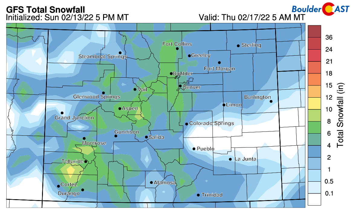
The main problem right now is that models remain all over the place with the track and timing of the low pressure system passing to our south and as a result, what exactly this upslope will ultimately turn out like for northeast Colorado. Thus the forecast remains somewhat uncertain at the moment. The GFS ensembles produce anywhere from 0.3 to 0.6″ of moisture in Boulder during this time — equating to anywhere from 4 to 10″ of snow.
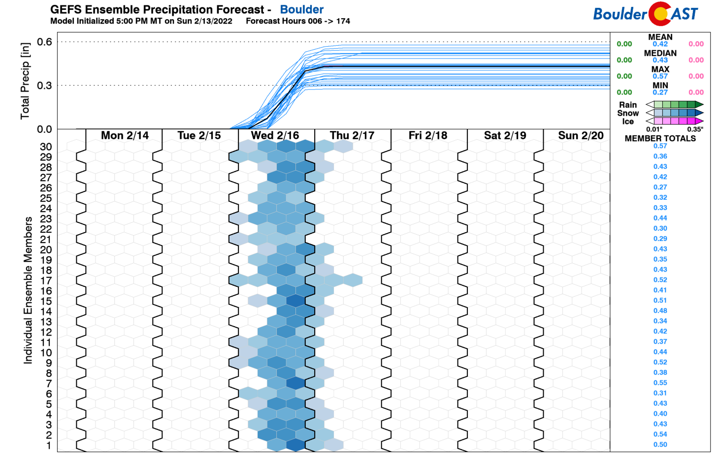
The operational GFS fits right into the middle of this range right now predicting around 7″ of snow in Boulder (shown below), while the Euro model clings to the lower end totals near 4 to 5″. As is normal with most upslope-centric events, expect to see a decent snowfall gradient across the Denver Metro area with the highest totals in and near the Foothills with lower totals east of Interstate 25.
Given everything we are seeing right now, our preliminary snowfall expectations are as follows:
- Boulder area: 3 to 8″
- Denver area: 2 to 5″
- Foothills: 4 to 10″
Based on current timings, most of that snow would fall between midday Wednesday and midnight Wednesday night, with likely impacts to the evening commute. We’ll be releasing our final forecast discussion and snowfall map on Tuesday so stay tuned.
Sunny weather returns late in the week
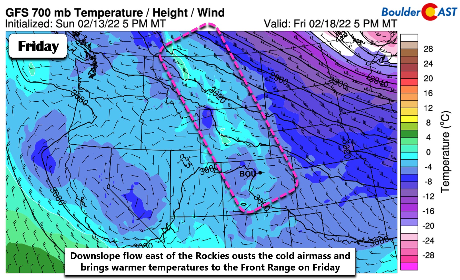
Depending on the exact speed of the departing midweek snowstorm, Thursday morning could see a few lingering low clouds and flurries, or it could be totally dry. Either way, it should clear out quickly with skies turning sunny as subsidence, dry air, and an incoming ridge take control of the area. Temperatures remain cold though with highs only in the 30’s.
Friday will be much warmer with downslope flow chiseling away the cold airmass. Expect sunny skies and highs in the 40’s to near 50 degrees to end the week.
Stay up to date with Colorado weather and get notified of our latest forecasts and storm updates:
Forecast Specifics:
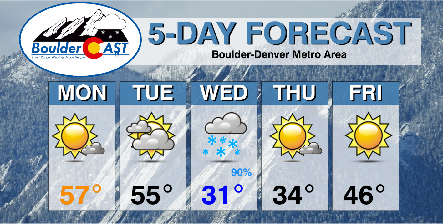
Monday: Mostly sunny with an increase in clouds by afternoon and evening. Highs in the middle to upper 50’s across the Plains with lower 40’s in the Foothills.
Tuesday: Mostly cloudy and mild with highs in the low to middle 50’s on the Plains with upper 30’s in the Foothills.
Wednesday: Overcast with light snow increasing in coverage through the day, starting first in and near the Foothills. More widespread and moderate snow is possible during the afternoon and evening with several inches of accumulation likely. Highs in the lower 30’s on the Plains with upper 20’s in the Foothills.
Thursday: Possibly a few morning low clouds or lingering flurries, then mostly sunny and cold. Temperatures warm into the middle 30’s on the Plains with middle 20’s in the Foothills.
Friday: Sunny skies and warmer with temperatures topping out in the middle 40’s across the Plains with lower 30’s in the Foothills.
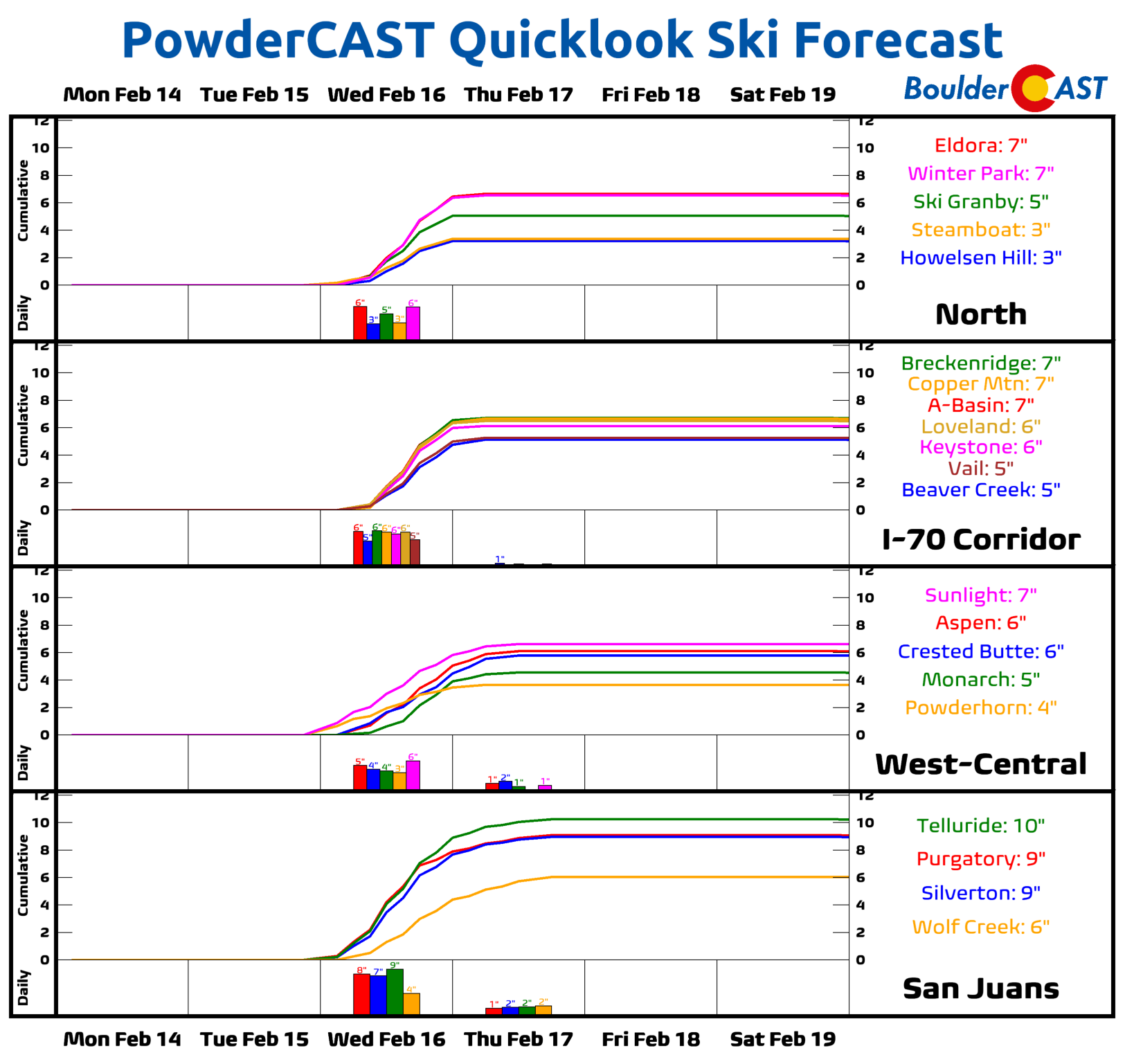
Mountains: The weather in the High Country this week will largely mirror what is happening in the Denver Metro area. The week will be quiet outside of the midweek storm system. Snowfall will increase in the Mountains statewide Wednesday morning and wrap up by Thursday morning. Most ski resorts should see anywhere from 3 to 10″ of snow from this system.
Help support our team of Front Range weather bloggers by joining BoulderCAST Premium. We talk Boulder and Denver weather every single day. Sign up now to get access to our daily forecast discussions each morning, complete six-day skiing and hiking forecasts powered by machine learning, first-class access to all our Colorado-centric high-resolution weather graphics, bonus storm updates and much more! Or not, we just appreciate your readership!
Spread the word, share the BoulderCAST forecast!


You must be logged in to post a comment.