The Front Range has been defined by relentless warmth, gusty winds, and bone‑dry conditions of late—and that theme isn’t breaking anytime soon. Even with a strong cold front charging through midweek, the cooldown will be pitiful, dropping us only back to “normal” while lasting only a single day, and it comes at the price of near‑critical fire danger beforehand. With highs hovering near or above 60° almost every day leading into Christmas and precipitation chances close to zero, a brown holiday is essentially guaranteed for the Boulder–Denver area. Read on for our full outlook of our weather heading into the holiday period.
This week’s highlights include:
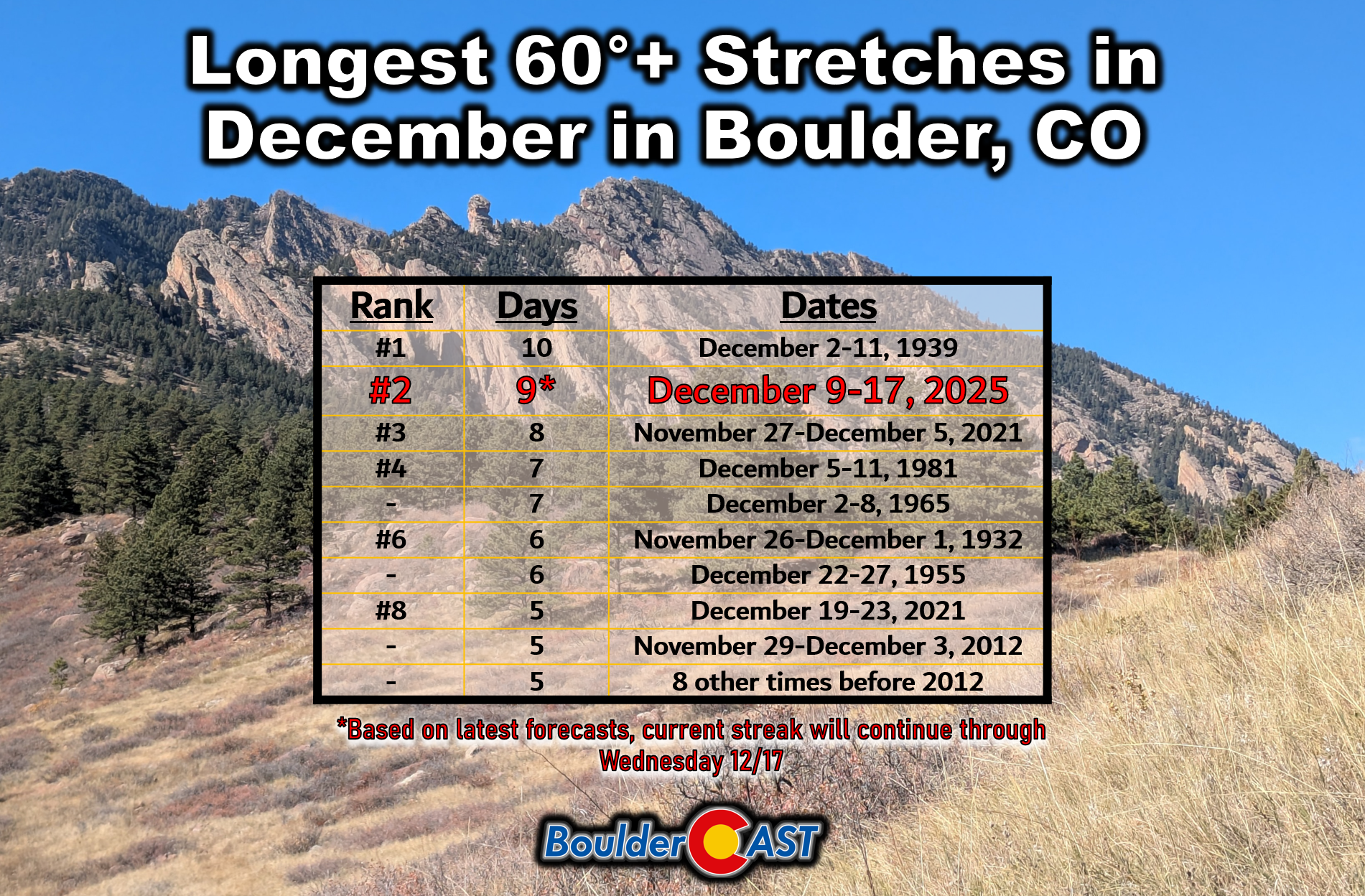
- 🌡️ Sixties Again? Boulder has logged six straight days in the 60s, and with several more ahead, we’re now approaching record territory for December.
- 💨 Winds a Recurring Theme: Calm Monday, breezy Tuesday, then strong downslope bora winds with Wednesday’s cold front. Thursday and Friday will feature some degree of wind also.
- 🔥 Critical fire danger Wednesday: Red Flag Warnings are likely as blustery WSW flow combines with snow‑free, dry fuels and warm temperatures. Fire danger could also return on Friday.
- 🌬️ A Midweek Frontal Blast: The midweek bora cold front brings powerful gusts (45 to 85 MPH, highest in/near Foothills) and modest Mountain snow (2 to 5″), making travel tricky.
- 🌦️ Shower Chance: The lower elevations may see a few light, wind‑driven showers Wednesday evening as the front passes, but precipitation will be minimal.
- 📉 Cooler Thursday: Thursday cools back to “normal” in the upper 40s, but warmth quickly rebounds Friday into the 60s—possibly near 70°.
- 🎄 White Christmas Hope Fading: A brown Christmas is essentially locked in for Boulder and Denver: highs near 60° almost daily, with dry weather and no meaningful moisture between now and then.
DISCLAIMER: This weekly outlook forecast is created Monday morning and covers the entire upcoming week. Accuracy will decrease as the week progresses as this post is NOT updated. To receive daily updated forecasts from our team, among many other perks, subscribe to BoulderCAST Premium.

Go Premium, get all the perks.
Daily Forecast Updates
Get our daily forecast discussion every morning delivered to your inbox.
All Our Model Data
Access to all our Colorado-centric high-resolution weather model graphics. Seriously — every one!
Ski & Hiking Forecasts
6-day forecasts for all the Colorado ski resorts, plus more than 120 hiking trails, including every 14er.
Smoke Forecasts
Wildfire smoke concentration predictions up to 72 hours into the future.
Exclusive Content
Weekend outlooks every Thursday, bonus storm updates, historical data and much more!
No Advertisements
Enjoy ad-free viewing on the entire site.
Another warm, mostly dry week
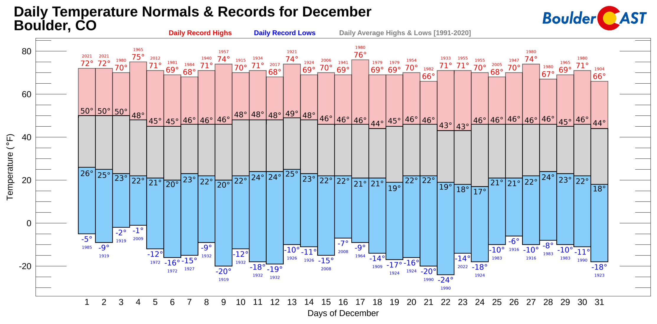
Boulder has now strung together six straight days in the 60s. That’s not unheard of in December, but it’s certainly eyebrow-raising. And with at least three more warm days queued up before any kind of cooldown, this stretch is climbing into rarefied territory—near the top of the December record books. The current 60° streak is projected to extend to 9 days, which would be second all-time for December. If you peek at the Top 10 list, you’ll notice two streaks from late 2021, right before the Marshall Fire. That’s a sobering reminder of how prolonged warmth and dryness can set the stage for dangerous fire conditions. As we discussed last week, this year is not as dire as 2021 was but continued warm and dry conditions lingering into the New Year will bring us closer.
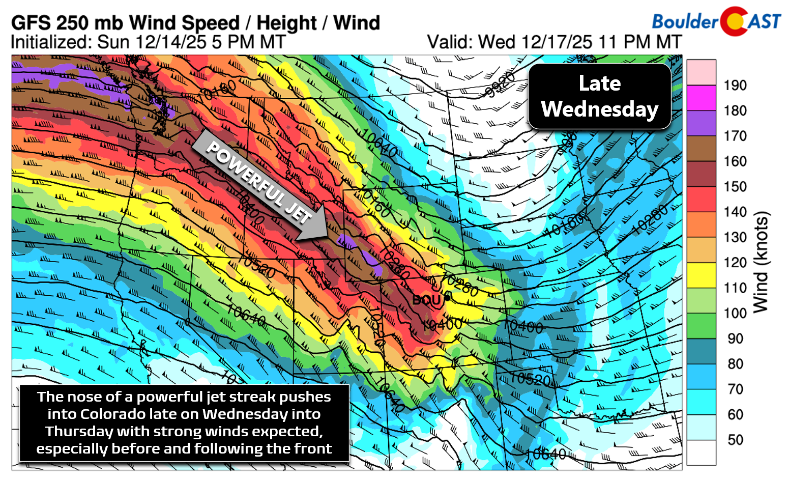
This week is shaping up to feel a lot like last week. The polar jet stream remains locked across the northern Rockies, keeping Colorado just south of the storm track. That means we stay in the warm regime, but never far from the action. Translation: breezy to downright windy conditions will be a recurring theme.
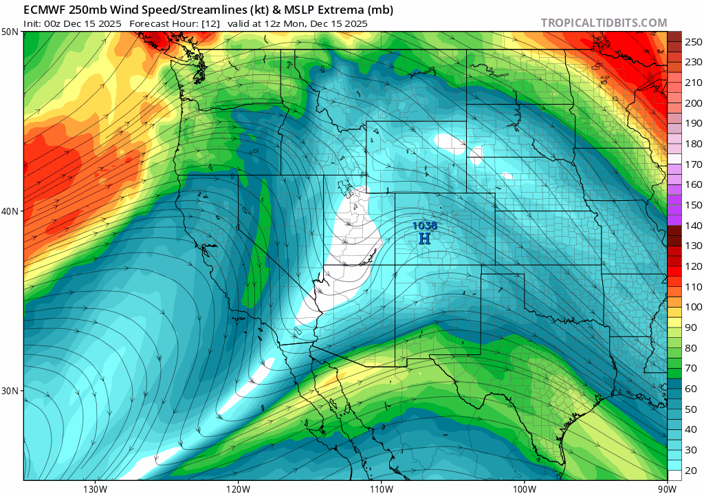
Euro model 250 mb wind (jet stream) forecast through Friday night.
We begin under a moderately strong ridge of high pressure centered to our southwest. Monday is the calmest day of the week—pleasant, sunny, and mild. The ridge weakens as the jet stream pounds away at it in the coming days, and by Wednesday evening, a fast‑moving system racing along the Canadian border will shove a cold front through the Front Range.
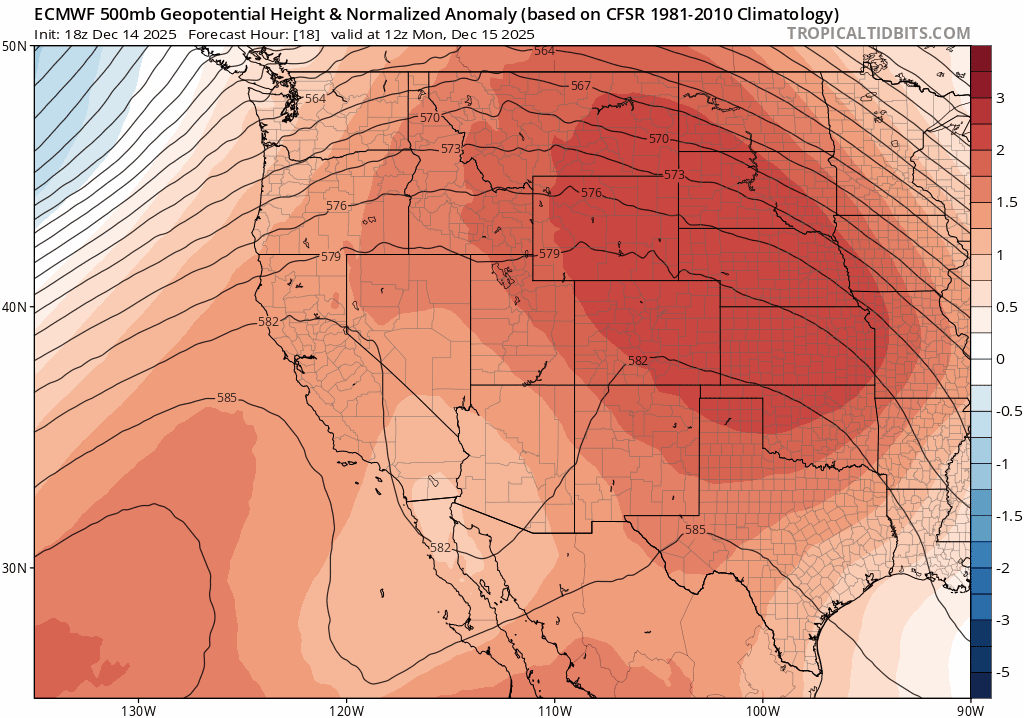
Euro model 500mb height anomaly forecast animation through Friday night
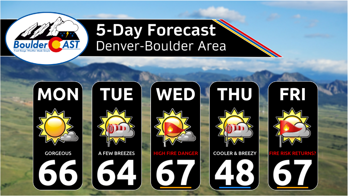
Until then, enjoy the warmth. Monday and Tuesday will both feature highs in the low to mid‑60s. Winds stay tame Monday, but Tuesday could see late‑day gusts of 15–20 MPH around Boulder.
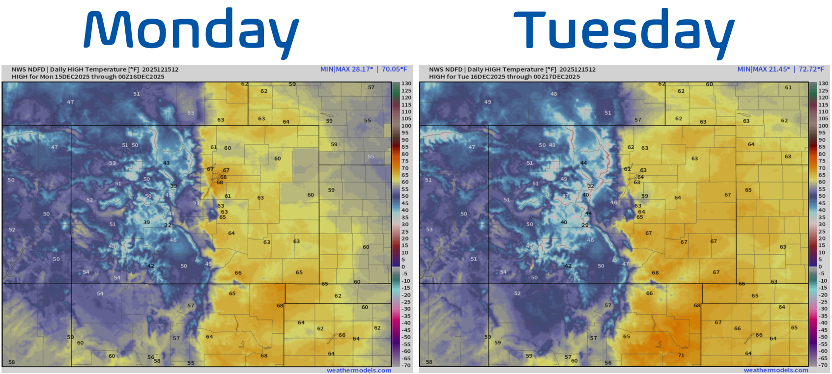
Early week high temperature forecasts for Monday/Tuesday across Colorado.
Wednesday is the headline day in Front Range’s weather this week. Temperatures will surge into the mid to upper 60s, and a few spots in eastern Colorado could flirt with 70°. A strong, bora cold front will barrel in from the northwest between about 3PM and 7PM. These bora-type fronts come from the northwest and are notorious for their chilly downslope winds which spill over the Divide and race across eastern Colorado. Ahead of the front, strong west‑southwest flow will crank up fire danger to near-critical levels. With the Foothills and Plains snow‑free again, Red Flag Warnings will be in play, including the entire Metro area. 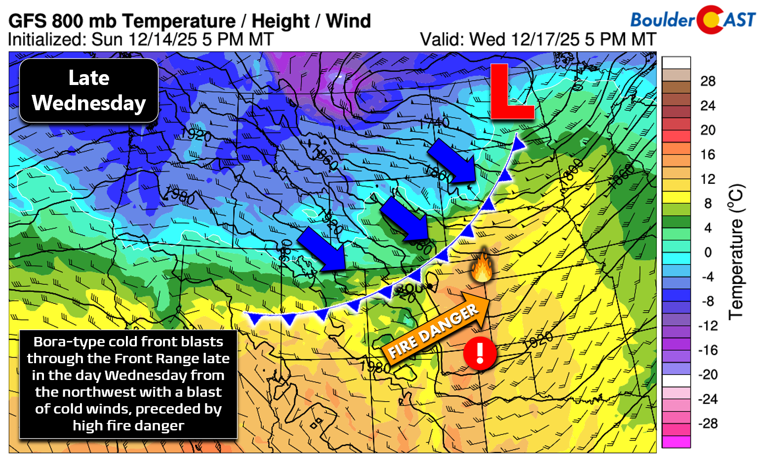
As of Monday morning, Xcel Energy is already warning customers that they may deenergize some lines beginning around 12PM on Wednesday to reduce the risk of fire ignitions. Find more information and if your area is affected here.
If you’re wondering about records—don’t get your hopes up. December 17th holds Boulder’s warmest December record at 76°F (set in 1980). We won’t touch that before the front arrives.
Behind the front Wednesday evening, the nose of a powerful jet streak digs in. Winds will howl across the region, with gusts of 40–65 MPH likely, with even higher gust potential in the Foothills and favored windy spots like Boulder and Rocky Flats where gusts of 80+ MPH could occur. High Wind Warnings are inbound for the western Metro area midweek!
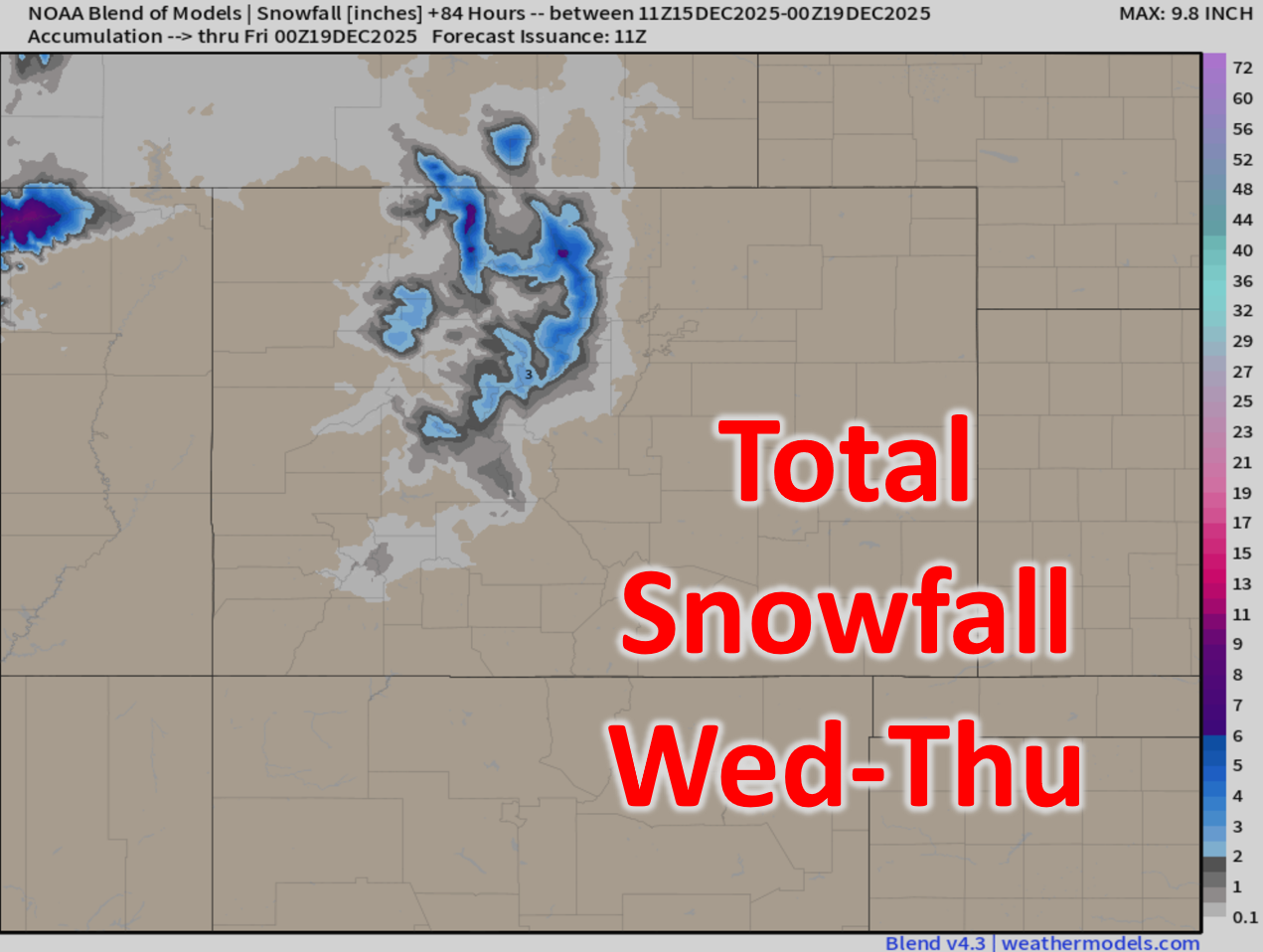
The Mountains will squeeze out some snow as the front passes. Moisture is modest, but northwest flow favors the ranges north of I‑70. Expect 2–5 inches up there, but with winds whipping, travel will be tricky thanks to blowing and drifting snow. A few snow squalls could pop Wednesday afternoon into the night with northern Colorado in the left‑exit region of the jet under strong and concentrated lift.
Down low, a few wind‑driven rain showers may streak through Wednesday evening, but they’ll be light and spotty—just a few hundredths of an inch at best. Downslope bora winds will quickly stabilize things through the evening.
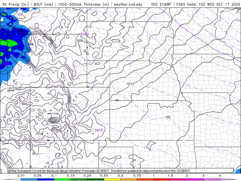
Euro model precipitation forecast for Wednesday as the bora front blasts across Colorado. Mainly light mountain snow, but a few rain showers may spill onto the Plains.
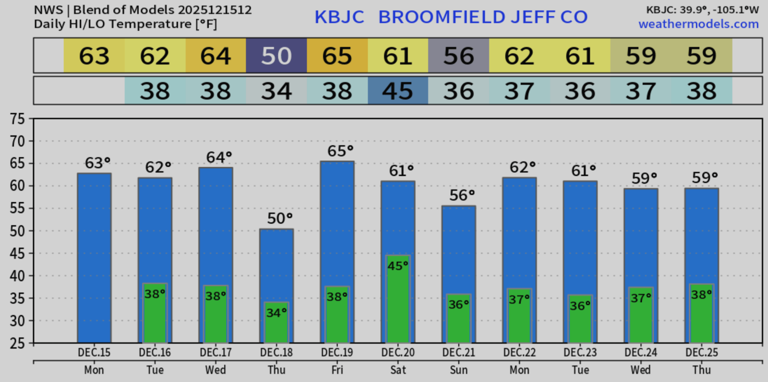
Thursday brings a more seasonal feel. Highs will tumble about 20° into the upper 40s. Northwest winds persist, but skies turn mostly sunny. It’s telling that even after such a dynamic cold front, we only cool back to “normal.” That’s the kind of warm autumn pattern we’re locked into right now.
By Friday, the chill scoots east and another warm surge rides in from the southwest as ridging rebuilds. Highs rebound into the 60s, maybe even near 70°, with fire danger likely returning if modeled winds verify. Get outside and enjoy the largely beautiful December weather this week, but we urge you to use extreme caution to avoid any flames or sparks which could quickly ignite the next grass, brush, or forest fire.
A brown Christmas all but certain
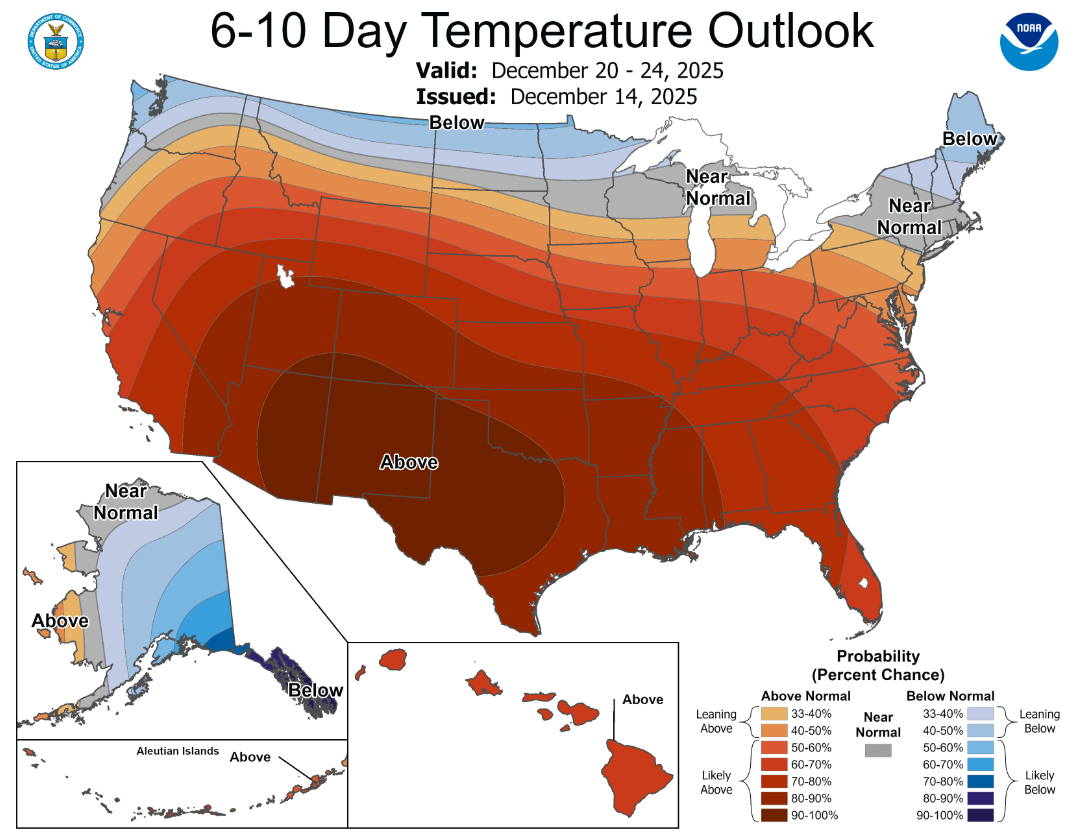
We hate to be the bearer of bad news, but the outlook for any type of white Christmas in the Boulder-Denver area is bleak right now, as our persistently warm and dry pattern is set to continue through the next 10 days, if not longer. The Climate Prediction Center’s 6–10 day outlook paints a toasty picture for nearly the entire nation, save the far northern tier.
The 8–14 day outlook? Same story.
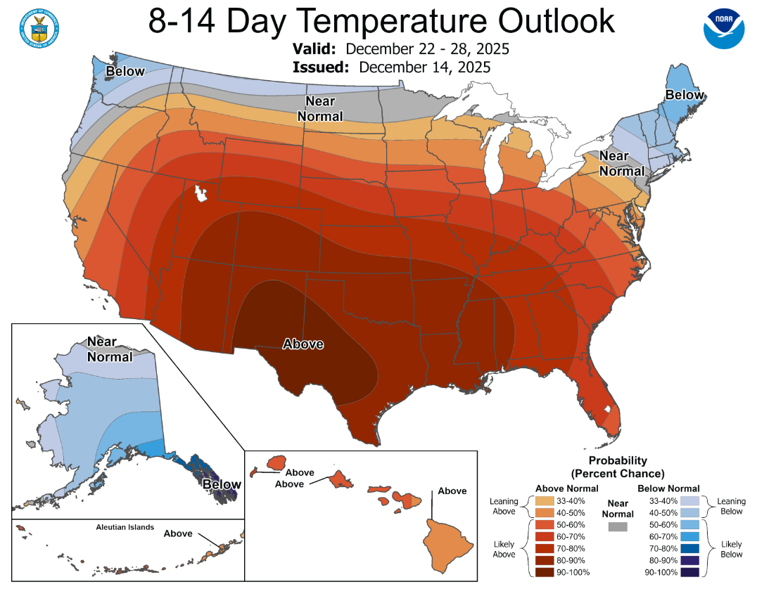
Some long‑range models tease colder air and snow returning to the northern Rockies late month. But given how stubborn this pattern has been, we’re not betting on northeast Colorado cashing in on that just yet.
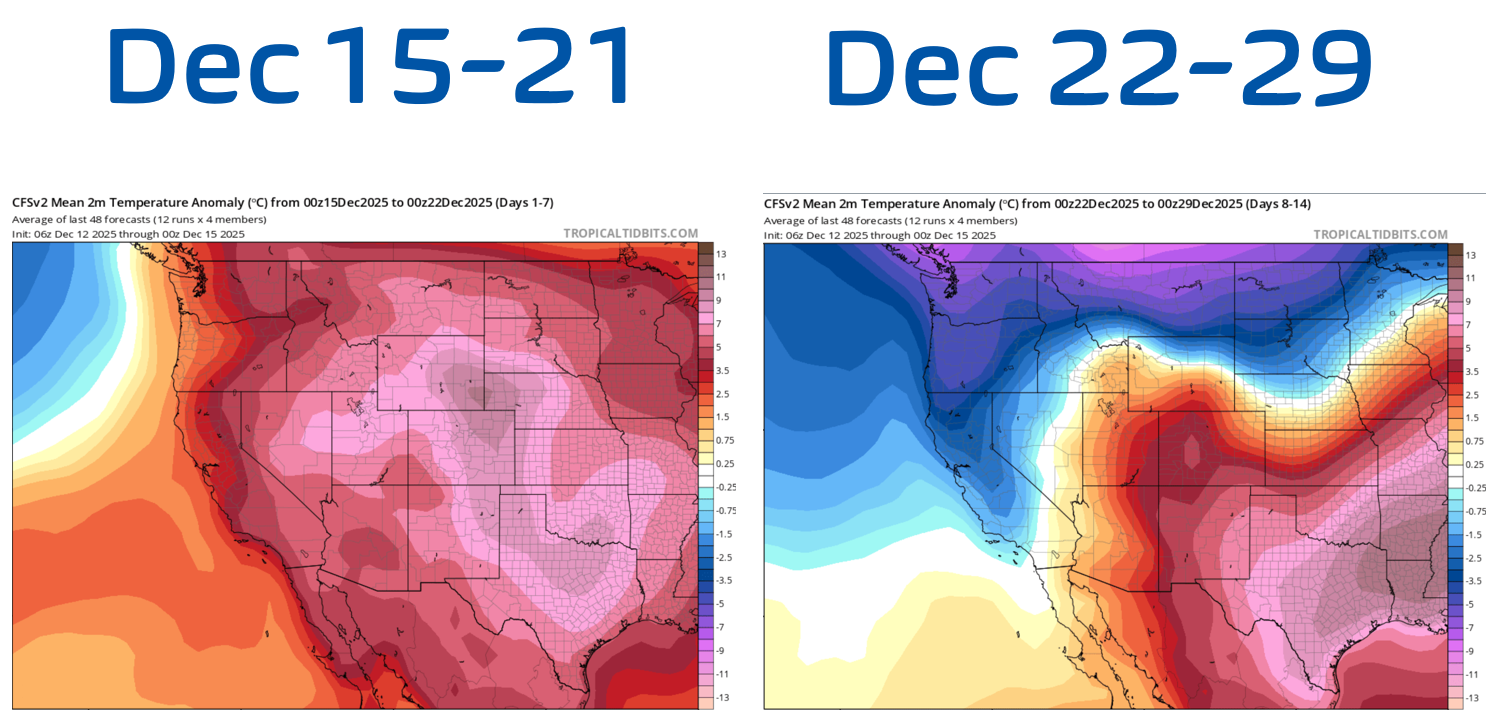
CFS (climate model) 2-meter temperature anomalies for Days 1-7 (left) and 8-15 (right). Warmth remains locked in over Colorado, at least for the next 10 days.
Bottom line: expect daytime highs around or above 60° nearly every day through Christmas. Thursday’s cooldown is the lone exception.
Precipitation chances remain near zero, with ensemble models showing a big donut hole over eastern Colorado. We personally usually find donuts enjoyable—really who doesn’t—but just not in this context.
GFS ensemble cumulative precipitation forecast through December 25th. Eastern Colorado stuck in the donut hole…
The persistence of this pattern at hand is striking. Systems come and go, but the warmth is holding firm, leaving us with a December that has felt more like October and a holiday season that is shaping up to be defined by sun, wind, and fire awareness rather than snow…
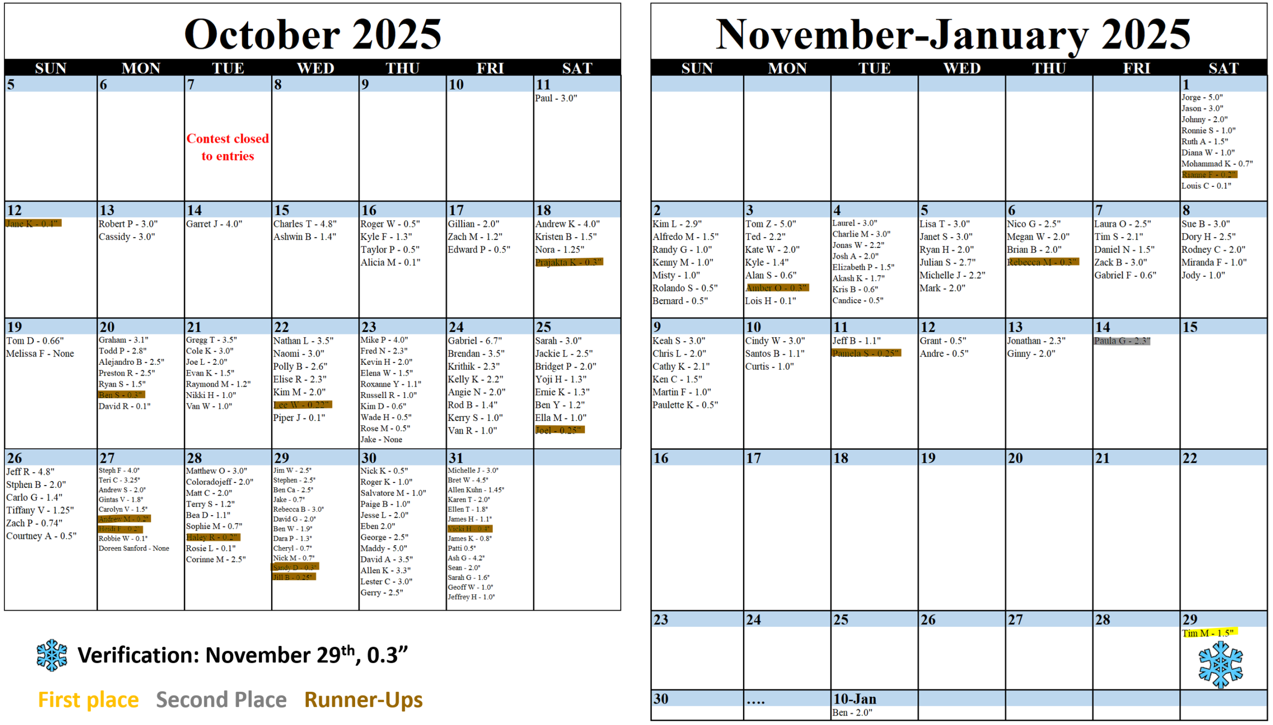
Speaking of snow, we recently announced the winners of the 2025 First Snowfall Contest. Check the table below to see if you’re a winner or jump to the full announcement post here.
And finally, don’t forget that we offer the option to purchase Gift Memberships of BoulderCAST Premium for your friends and family. There’s no better way to surprise your favorite weather enthusiast and also help support the BoulderCAST team!
Happy Ides of December and have a great week!
Forecast Specifics:
Monday: Mostly sunny and warm with highs in the low to middle 60s on the Plains with near 50 in the Foothills.
Tuesday: Partly cloudy and warm with highs in the lower to middle 60s on the Plains and near 50 in the Foothills. Afternoon breezes of 10-20 MPH in Boulder, with up to 40 MPH in the Foothills.
Wednesday: An active weather day with blustery WSW winds gusts 20 to 35 MPH during the day leading to near-critical fire danger. A strong cold front will blow through around sunset followed by strong gusts up to 60 MPH from the northwest. A few raindrops may occur during the evening hours, but these will be spotty. Highs will be in the mid to upper 60s on the Plains with middle 50s in the Foothills.
Thursday: Partly to mostly sunny and cooler with highs in the upper 40s to near 50 on the Plains, and in the middle 30s in the Foothills. Gusty winds are possible through the day.
Friday: Partly cloudy with very warm temperatures returning alongside gusty winds of up to 30 MPH creating near-critical fire danger again. Highs will reach the mid 60s to lower 70s across the lower elevations with middle 50s in the Foothills.
Weekend: Staying mild Saturday in the 60s (possibly gusty) with a weak and dry cold front late in the day. Sunday will be a tad cooler in the 50s but still not bad considering the time of year.
DISCLAIMER: This weekly outlook forecast is created Monday morning and covers the entire upcoming week. Accuracy will decrease as the week progresses as this post is NOT updated. To receive daily updated forecasts from our team, among many other perks, subscribe to BoulderCAST Premium.
Go Premium, get all the perks.
Daily Forecast Updates
Get our daily forecast discussion every morning delivered to your inbox.
All Our Model Data
Access to all our Colorado-centric high-resolution weather model graphics. Seriously — every one!
Ski & Hiking Forecasts
6-day forecasts for all the Colorado ski resorts, plus more than 120 hiking trails, including every 14er.
Smoke Forecasts
Wildfire smoke concentration predictions up to 72 hours into the future.
Exclusive Content
Weekend outlooks every Thursday, bonus storm updates, historical data and much more!
No Advertisements
Enjoy ad-free viewing on the entire site.
Enjoy our content? Give it a share!


You must be logged in to post a comment.