We’ve got no record heat to discuss this time with a cooler pattern taking hold to end the month of August. After Monday’s chance of rain, it will be mainly dry and sunny the rest of the week with temperatures fluctuating up and down. Read on for our complete forecast of the week ahead.
This week’s highlights include:
- Cooler conditions continue to start the week with a trough dropping southward through the Rockies
- Scattered showers and a few storms expected Monday late afternoon into the overnight hours
- A ridge of high pressure regains control across the West from Wednesday into the weekend
- Sunshine will be the story Tuesday and beyond
- At this time, eastern Colorado should see a mix bag of temperatures with a series of dry cold fronts keeping things pleasant
DISCLAIMER: This weekly outlook forecast is created Monday morning and covers the entire upcoming week. Accuracy will decrease as the week progresses as this post is NOT updated. To receive daily updated forecasts from our team, subscribe to BoulderCAST Premium.

Cooler to start, rain showers Monday evening
What an abrupt change in weather for us over the last few days! We went from nearly two straight months of brutal heat to having several cool and dare we say fall-like afternoons in a row with temperatures in the 70’s to middle 80’s. There was even a dusting of snow in spots above timberline Saturday night; a true sign of the changing seasons. This past weekend was certainly glorious!
😯☝️Picture taken this morning, 8/29. Winter is coming! ❄️📸: Scot Wilson pic.twitter.com/q5VlNcAukE
— Copper Mountain (@CopperMtn) August 30, 2020
We have good news for you on this Monday: we will begin the week ahead on the same note with continued cooler conditions as a trough has developed across the northern Rockies. This is the most significant weather system to reach Colorado since mid-June. The longstanding ridge that dominated the summer has been nixed for the time being.
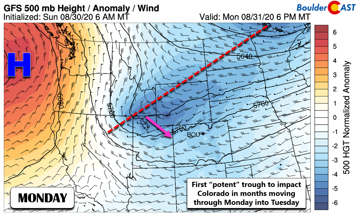
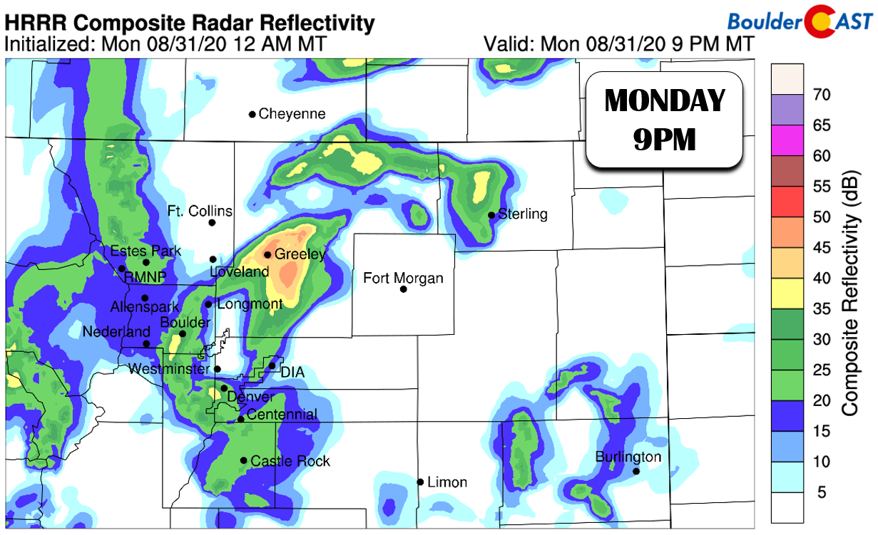
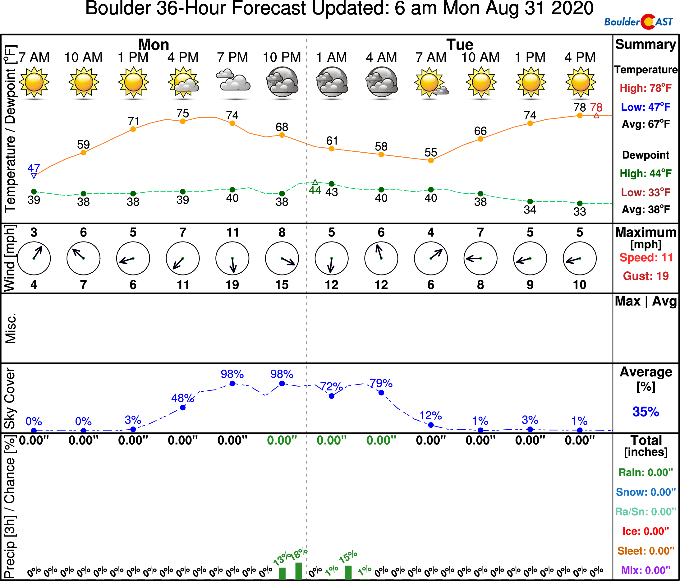
While it previously looked like this low pressure system would target northern Colorado, models have shifted slightly in the last few days with the bulk of the energy now expected to move into southwestern Colorado and eventually New Mexico. In any case, the large-scale lift ahead of this trough will help rain showers develop during the evening across our area. In the thick of it, southeasterly upslope will be present. This particular upslope direction is favorable for enhancing rain showers across the Metro area in these scenarios. Rain showers will taper off after midnight Monday night. Highs on Monday will be in the upper 70’s.
As we discussed last week, there is the potential for light snow accumulations in the highest elevations Monday evening and night. Any accumulation would likely be just a dusting to 1″ and only above 12,000 feet.
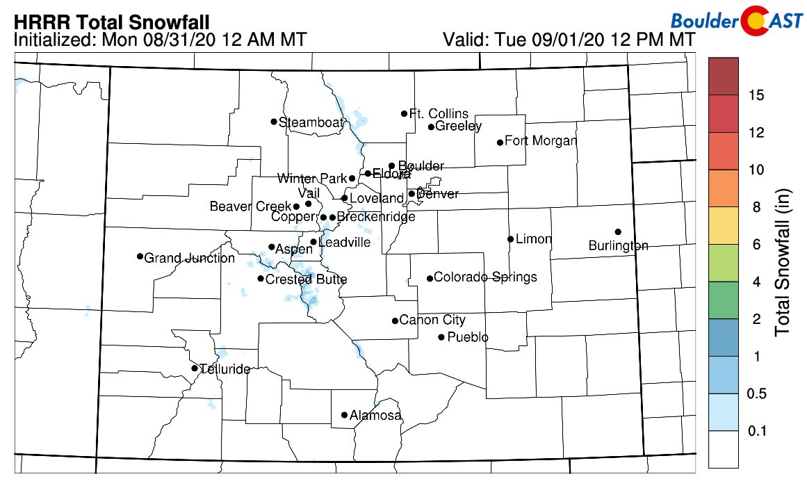
HRRR total snowfall forecast by Tuesday afternoon
Tuesday morning could see lingering low clouds and possibly fog across the Metro area, depending on how much rain really occurs. This should clear out rather quickly giving way to completely sunny skies and dry conditions for the rest of the day (and in fact, as you will soon see, the rest of the week). The more comfortable temperatures will hold with highs in the middle to upper 70’s.
The ridge rebuilds, but the heat wave isn’t coming back
Beginning on Wednesday, the large ridge of high pressure across the Pacific Northwest will slowly build eastward and into the Rockies. This is shown the GFS 500mb height anomaly animation below. The center of the ridge begins in northern California on Wednesday and ends up in southern Utah by Saturday.
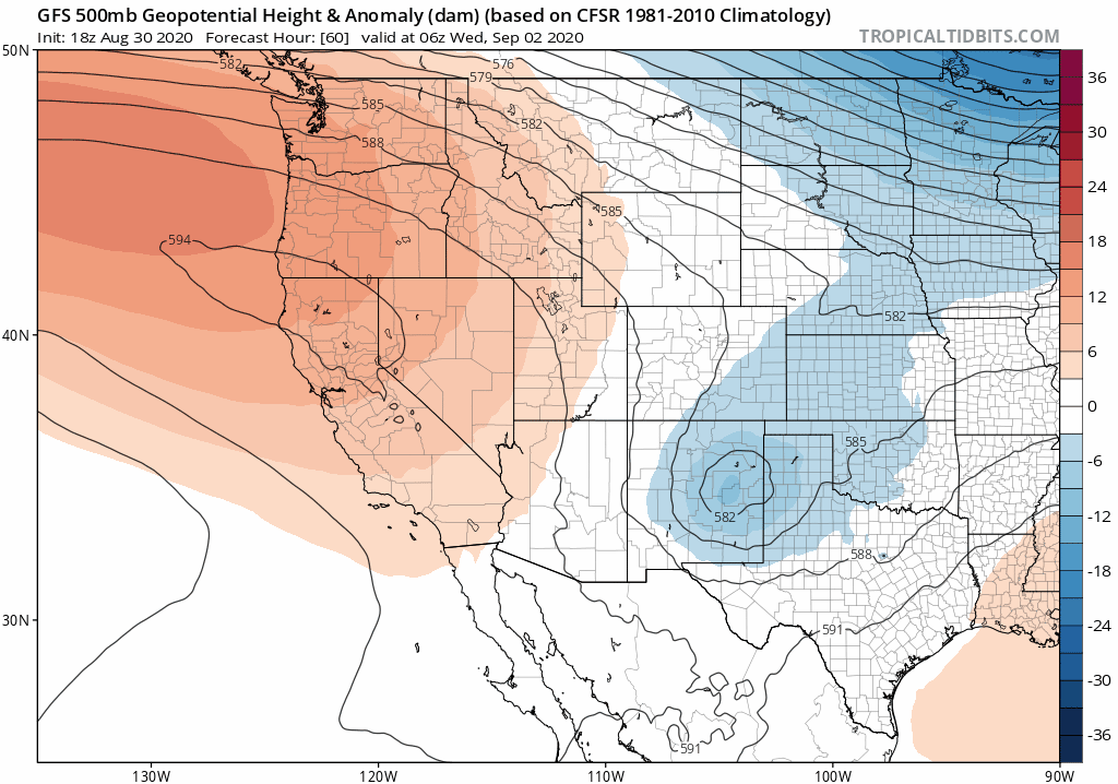
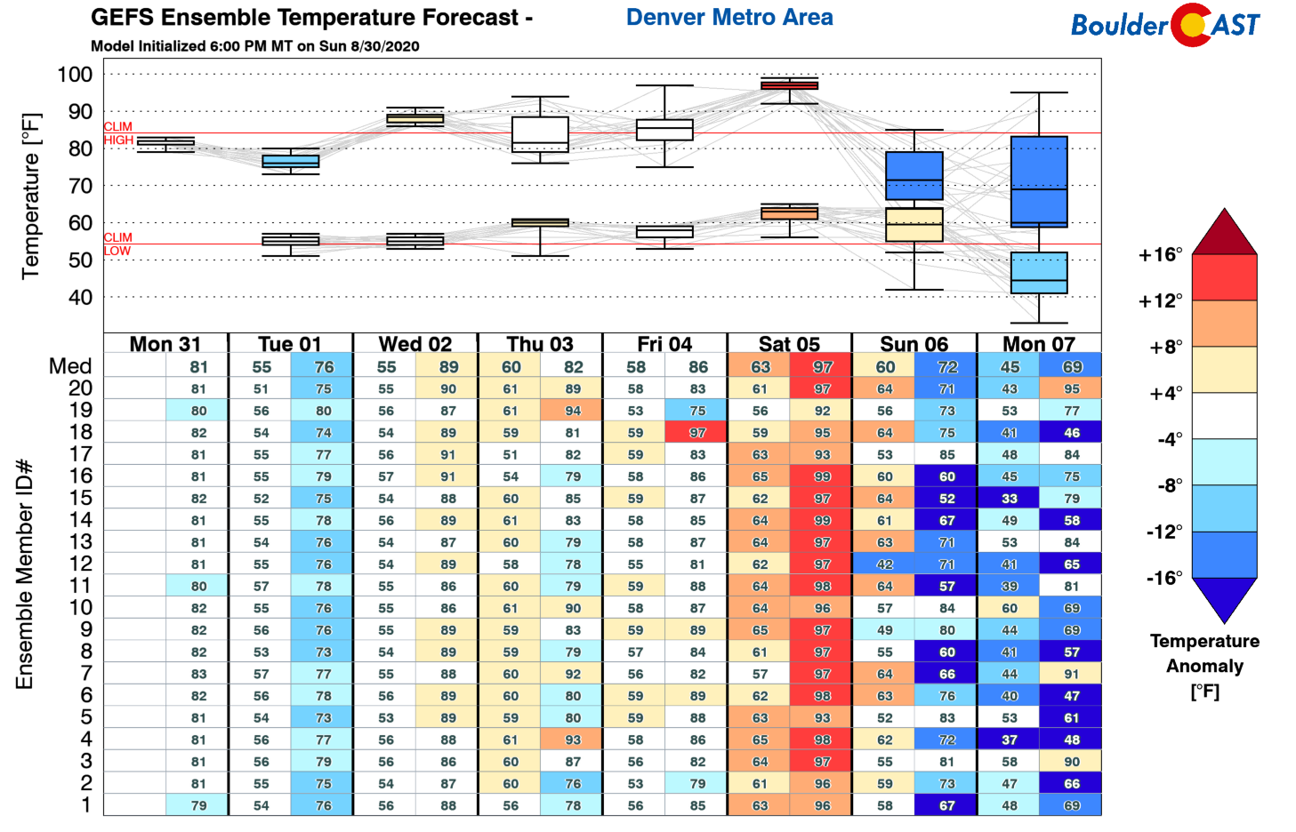
Notice how during this entire period, northwest flow remains across Colorado. While we will see temperatures rebound back above normal for the Front Range, the seasons are changing and the fronts marching into the United States from Canada are beginning to penetrate further south and west. During this prolonged period of northwest flow, we’re likely to see temperatures fluctuate quite a bit with strong warming being interrupted with several dry cold fronts dropping into eastern Colorado. The current forecast guidance shows a warm Wednesday, a cooler Thursday, then temperatures rising back up Friday before another cold front marches southward over the upcoming weekend. Specifics on the timing and magnitude of the cooling/warming periods will likely change as the week progresses. Generally, we’re talking about temperatures in the 80’s most days, though lower 90’s are not out of the question on the warmer ones.
The rest of the week will be sunny with little in the way of clouds and no precipitation expected from any of the fronts. The GFS ensemble temperature graphic below shows the up-and-down nature of our temperatures over the next week. Saturday is currently the warmest day in the pipeline with highs well into the 90’s, nearing record heat actually. We are monitoring that cold front over the weekend as the air on the backside could range from chilly to downright autumn-like.
Finally, today is the last day of our end of summer sale on BoulderCAST Premium. Join by midnight August 31st to save 30% on our annual subscription. With snow and winter weather right around the corner, this is a great time to sign up!

Save 30% and Join Premium Today
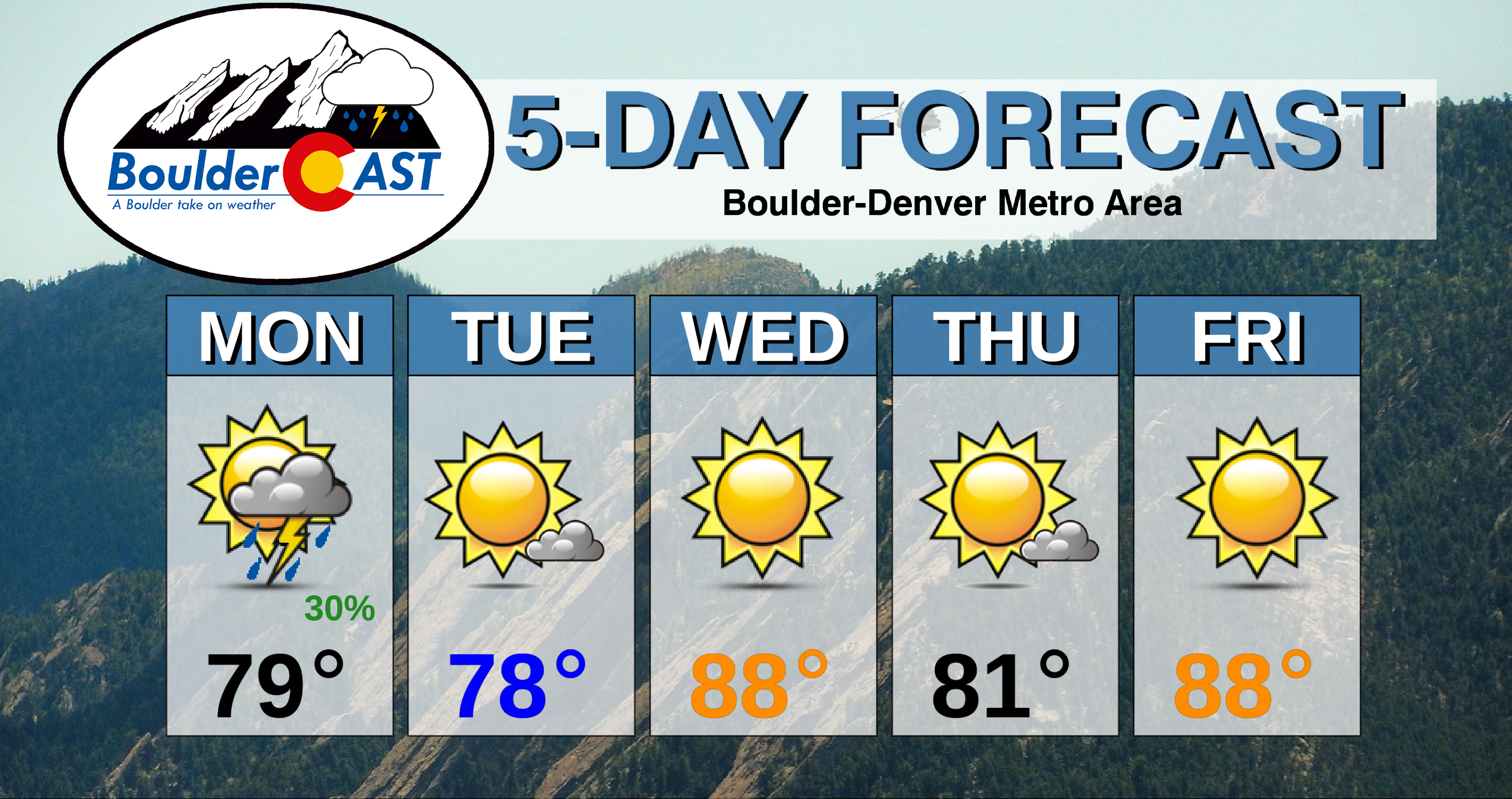
Forecast Specifics:
Monday: Morning sunshine, then increasing clouds with scattered showers and thunderstorms from late afternoon into the overnight hours. Highs pleasant near 80 degrees on the Plains and near 70 degrees in the Foothills.
Tuesday: Some morning clouds and patchy fog, then mostly sunny with highs in the upper 70’s on the Plains and middle 60’s in the Foothills.
Wednesday: Sunny and warmer with highs in the upper 80’s across the Plains and in the middle 70’s in the Foothills.
Thursday: Mostly sunny, dry and cooler. Highs in the lower 80’s for the Plains and upper 60’s in the Foothills.
Friday: Sunny and warm with highs in the upper 80’s on the Plains and middle 70’s in the Foothills.
Weekend: Hot Saturday in the 90’s, with cooler weather expected Sunday following yet another cold front. No chances of precipitation are expected over the weekend.
High Country: Isolated to scattered storms will be present across the mountains on Monday and Tuesday. A very light dusting of snow is possible on the highest peaks by Tuesday morning. The entire state will dry out Wednesday through Saturday with mostly sunny skies and no rain expected in the Mountains. Check our SummitCAST page for daily updated forecasts for more than 120 mountain hiking destinations across Colorado. Here’s a look at at the lightning threat statewide on Friday.

.
Spread the word, share the BoulderCAST forecast!
.


You must be logged in to post a comment.