Following another elevated fire danger day on Monday, a late-season snowstorm will trek from the Rockies into the Dakotas in the coming days. While the brunt of this massive winter storm will be felt in the Mountains and well to our north in Wyoming, there are enough ingredients coming together to bring light snow to the Front Range during this time as well. Another chance of snow may develop on Wednesday. Unseasonably cold temperatures will transition back above normal by week’s end with a warm and dry outlook shaping up for much of the extended.
This week’s highlights include:
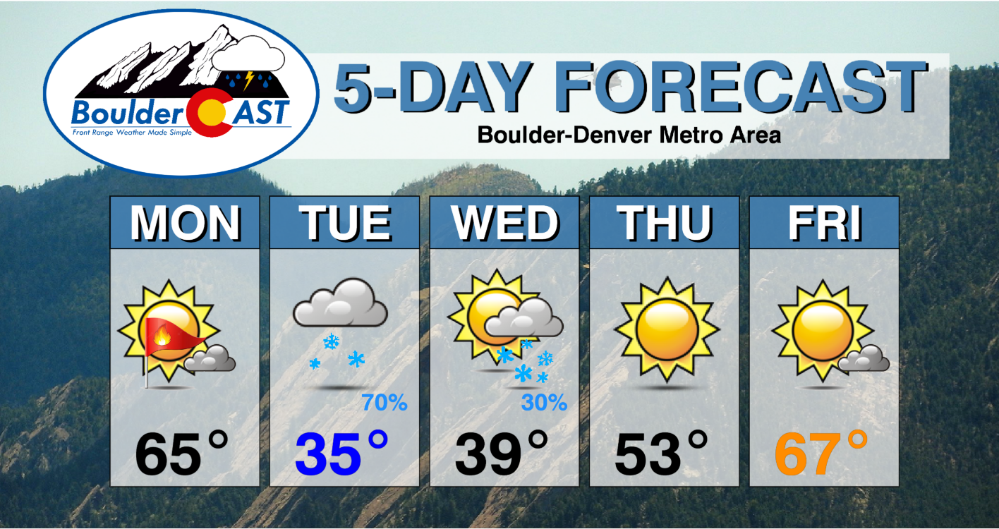
- Winter doesn’t want to let go with two chances of snow this week on Tuesday and Wednesday
- First indications show a dusting to 3 inches of slushy snow in Boulder/Denver with the Tuesday event, and a secondary lesser chance of light snow coming later Wednesday
- Temperatures begin spring-like on Monday, but the bottom falls out into the 30s Tuesday and Wednesday
- A quieter pattern emerges by week’s end, with highs returning to the 60s by Friday
DISCLAIMER: This weekly outlook forecast is created Monday morning and covers the entire upcoming week. Accuracy will decrease as the week progresses as this post is NOT updated. To receive daily updated forecasts from our team, among many other perks, subscribe to BoulderCAST Premium.

Go Premium, get all the perks.
Daily Forecast Updates
Get our daily forecast discussion every morning delivered to your inbox.
All Our Model Data
Access to all our Colorado-centric high-resolution weather model graphics. Seriously — every one!
Ski & Hiking Forecasts
6-day forecasts for all the Colorado ski resorts, plus more than 120 hiking trails, including every 14er.
Smoke Forecasts
Wildfire smoke concentration predictions up to 72 hours into the future.
Exclusive Content
Weekend outlooks every Thursday, bonus storm updates, historical data and much more!
No Advertisements
Enjoy ad-free viewing on the entire site.
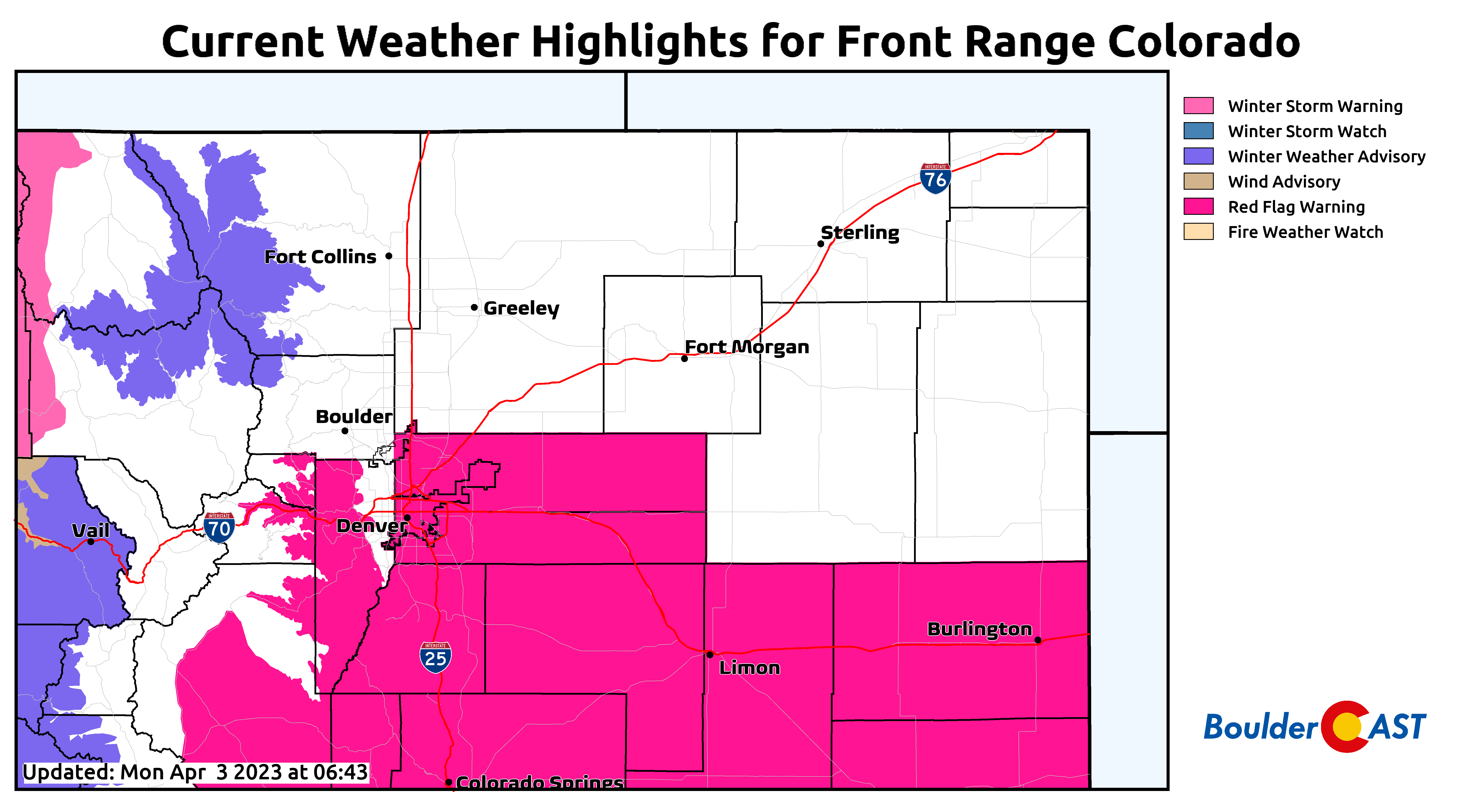
Fire danger Monday, then snow Tuesday and Wednesday
Another day with spring-like temperatures will unfold to start the first week of April. A surface cold front that moved through this morning will lift back north as a warm front during the day — sloshing around in the process. A strong surface low will develop to our west by this evening. To that end, a southerly to southeasterly flow will ensue this afternoon, though temperatures may vary wildly from the upper 50s to lower 60s around Longmont and points north to even the lower 70s in parts of southern Denver.
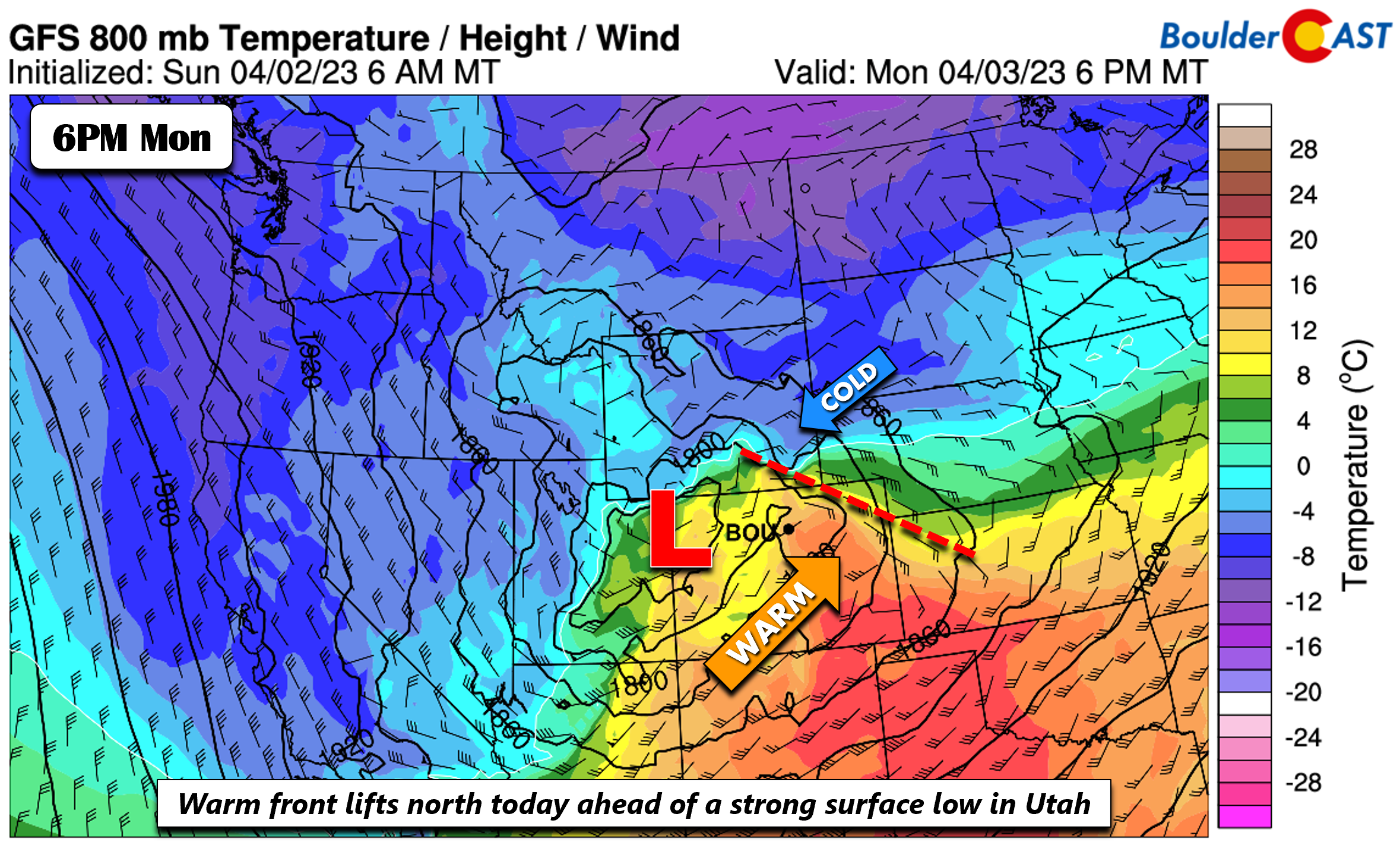
This setup will create elevated to critical fire weather conditions for portions of the Denver Metro area on Monday, especially along and south of Interstate 70 where it will be warmer and windier. Let’s all be vigilant as there have already been too many smaller-scale wildland fires ignited within the last week!
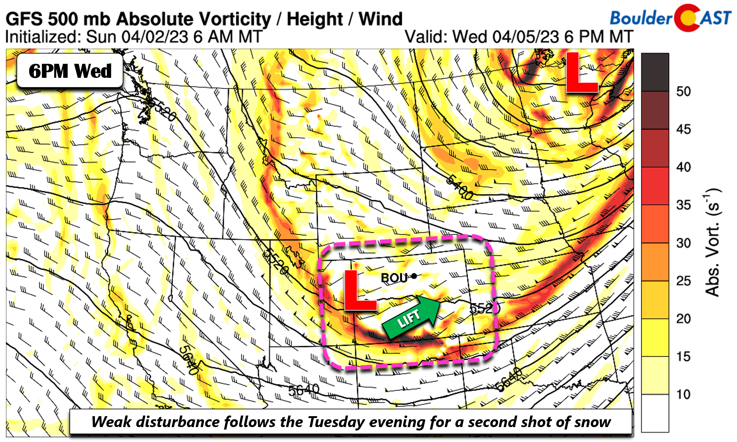
The strong surface low that develops is in response to a potent mid-level circulation that will track into central Utah late Monday night. As this happens, deep lift will overspread the state of Colorado with the impacts being felt first in the Mountains Monday night.
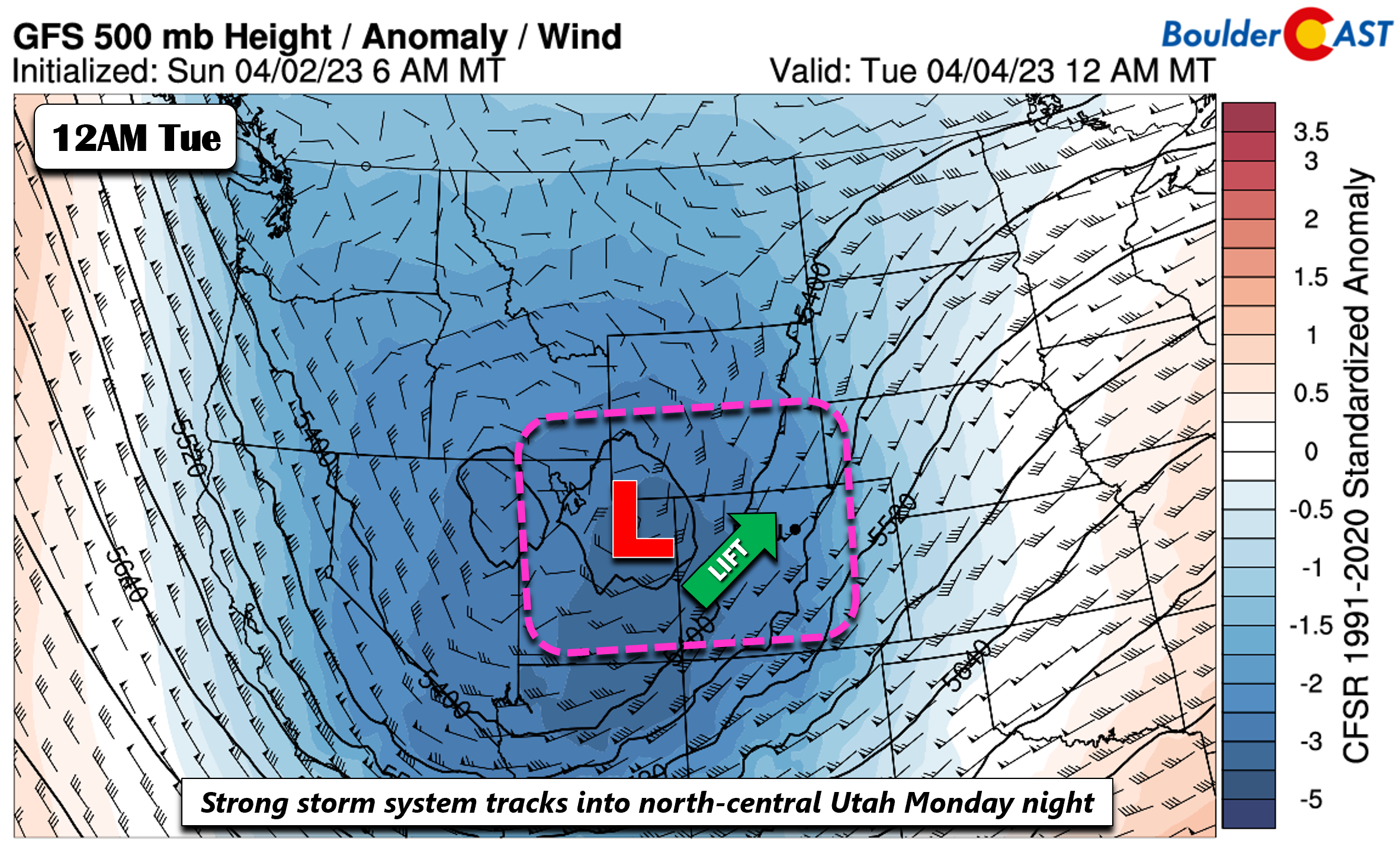
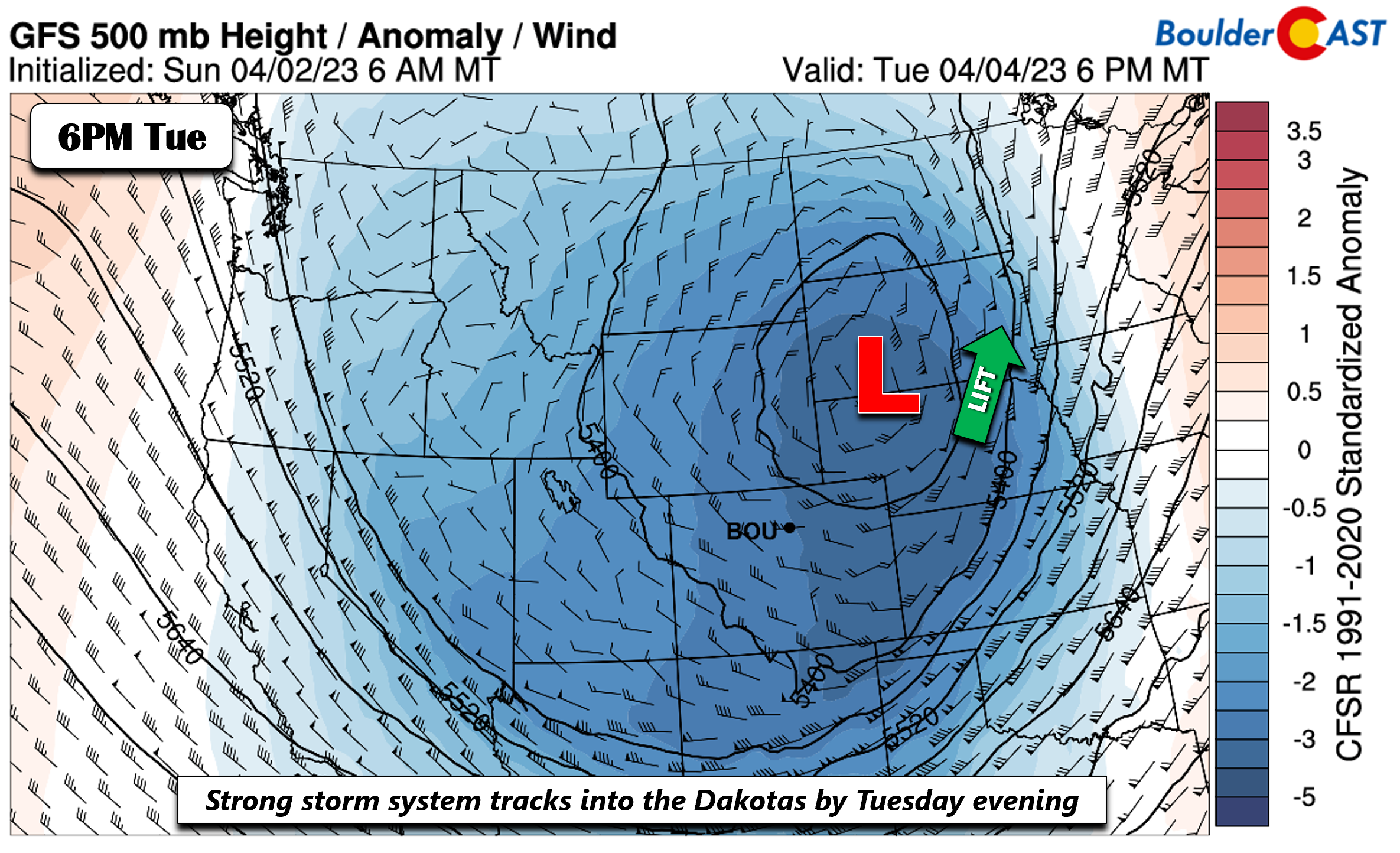
By the time the storm system reaches the Dakotas Tuesday evening, the deep lift will be well to our east-northeast into the upper Mississippi Valley. This storm system is the one that will likely bring a small amount of snow on the Plains Tuesday alongside moderate to heavy snowfall in the Mountains.
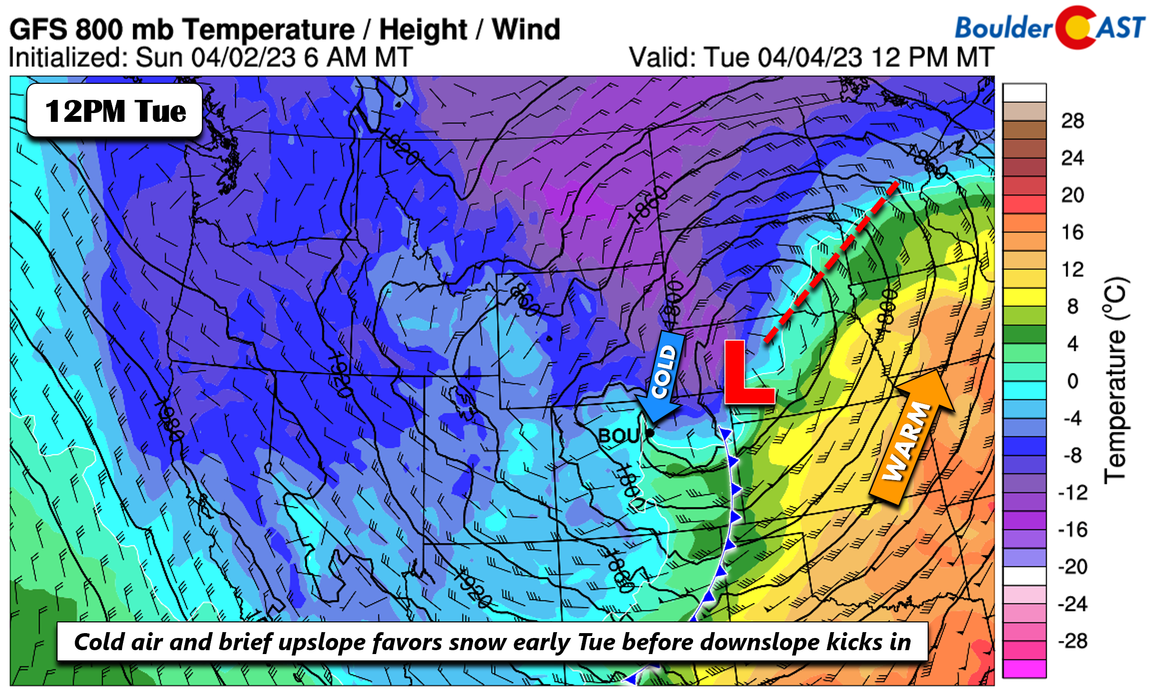
At the surface, the low will track into western Nebraska by midday Tuesday. As this low heads to the east, cold air will wrap around the system over the Plains and Foothills Tuesday morning. Also during this time, a period of upslope will ensue before transitioning to northwest downslope by Tuesday evening.
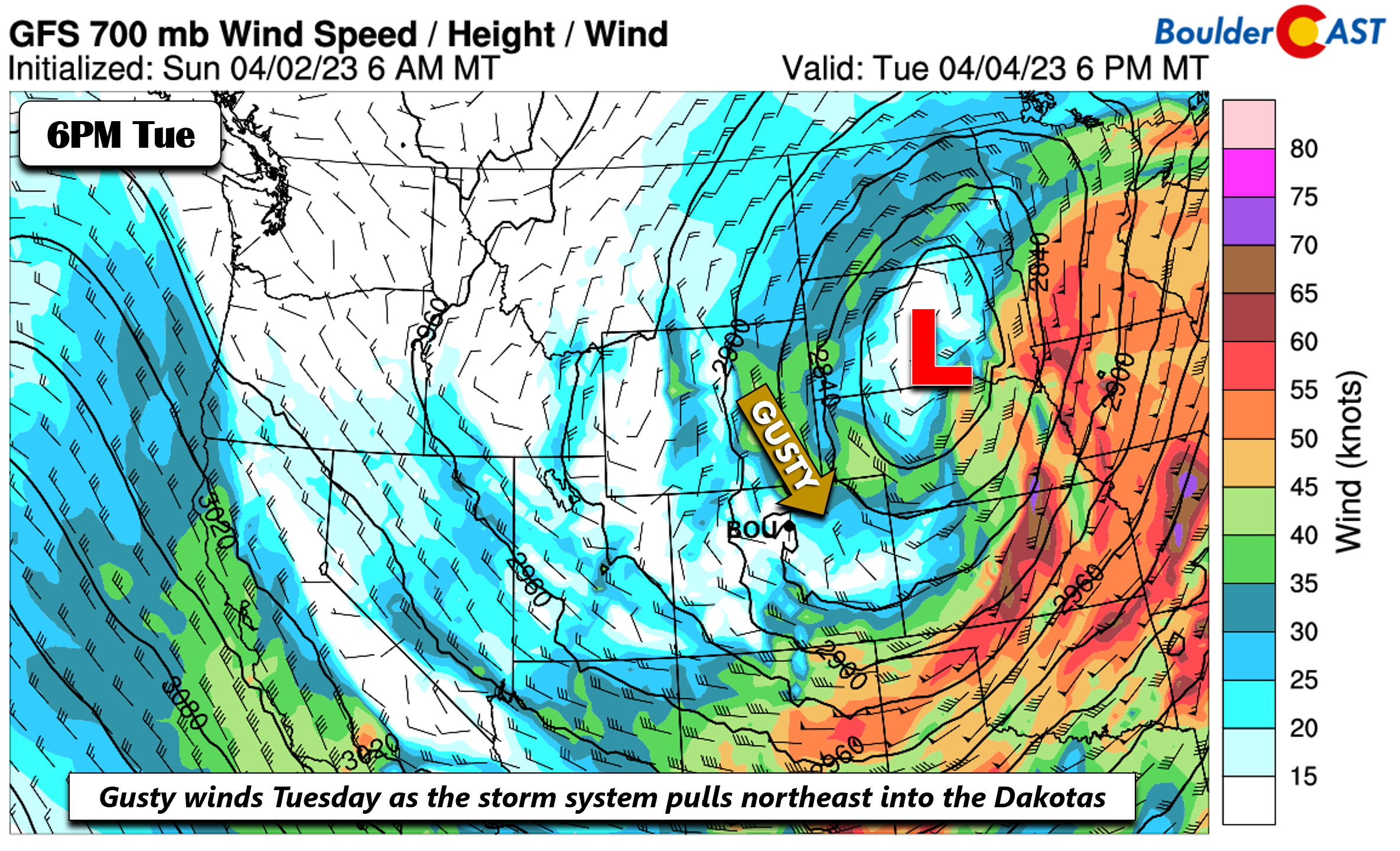
In addition to the chance of snow Tuesday, winds will also be somewhat brisk out of the north-northwest once the system pulls to our east. These gusty winds will most likely be felt in Denver and not as much in Boulder. Gusts up to 35 MPH are possible Tuesday making for an even more wintry chill to go along with the snowflakes.
The global models and their ensembles are in fairly good agreement that this system takes a track which does not favor large snowfall accumulations for us. Instead, this winter storm will be a huge snowmaker bringing blizzard conditions to Wyoming and the Dakotas where more than a foot of snow will be possible in the coming days.
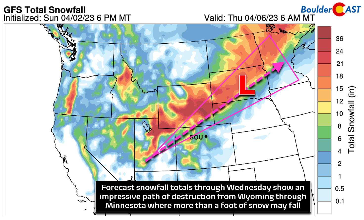
If the system were to track further south, this would be a whole different story for the Front Range. As it is, unless the pattern changes drastically, the GEFS snowfall probabilities give us the sense that snow amounts will be light for our are. We are forecasting perhaps 1-3 inches in Boulder/Denver, consistent with our Snowfall Probabilities below. Higher amounts closer to the 3 inch range would be favored in Boulder, Golden and the Foothills where pockets of banded snowfall may occur before the system pulls east late Tuesday. Further away from the terrain amount should be very minimal east of I-25. Overall this event would have only minor impacts given the warm ground and road surface temperatures.
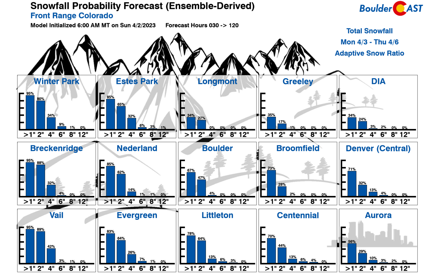
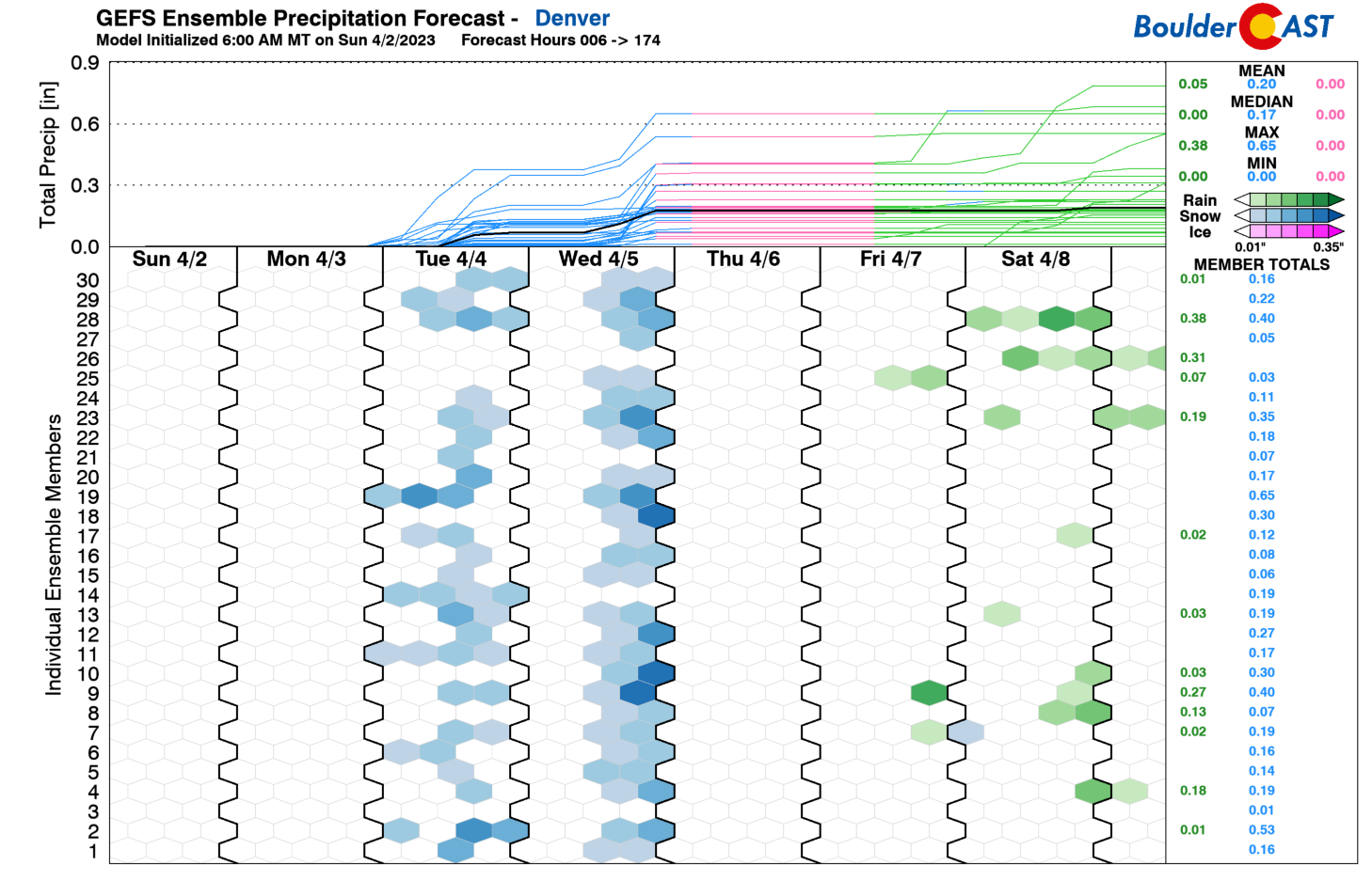
We have another chance of snow come Wednesday evening as the GEFS depicts below. This one could be just as interesting and is something to watch for now. It will have similarly cold air with it but with a slightly more favorable track.
However, the midweek system will be much weaker which would suggest minimal snowfall chances. Right now, indications would favor only light amounts again, especially if the system trends weaker with time, but we could foresee a trace to 2″ at this stage of the game as snow showers develop late in the day Wednesday. High temperatures both Tuesday and Wednesday will remain exceptionally below normal only in the 30s across the Metro area.
Moderating & turning quiet by week’s end
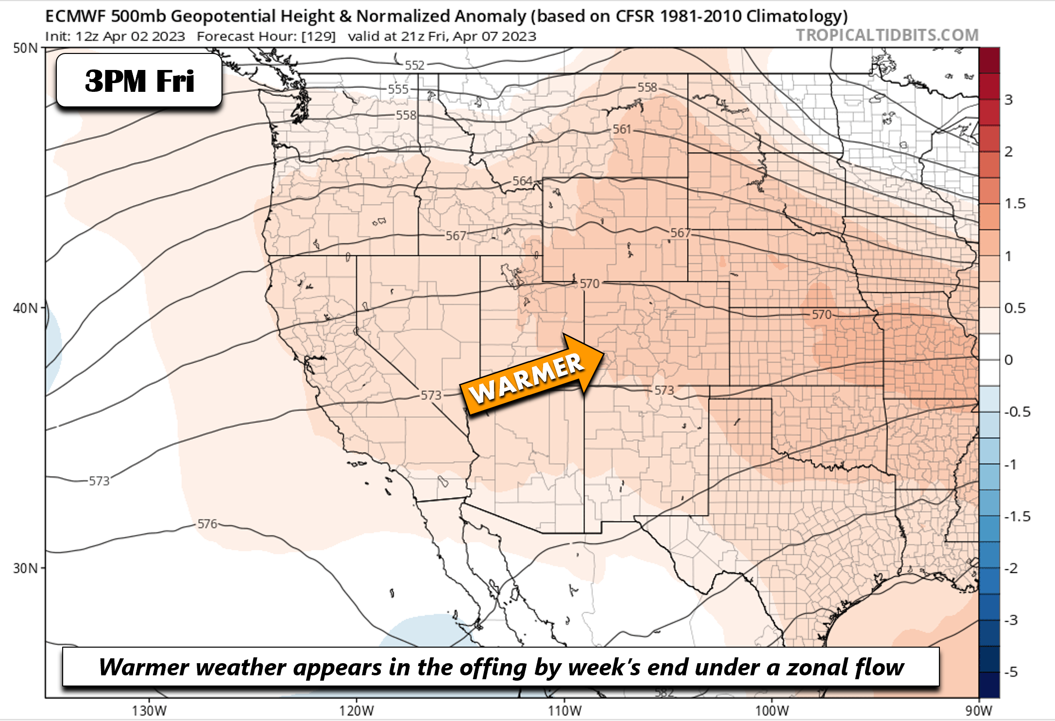
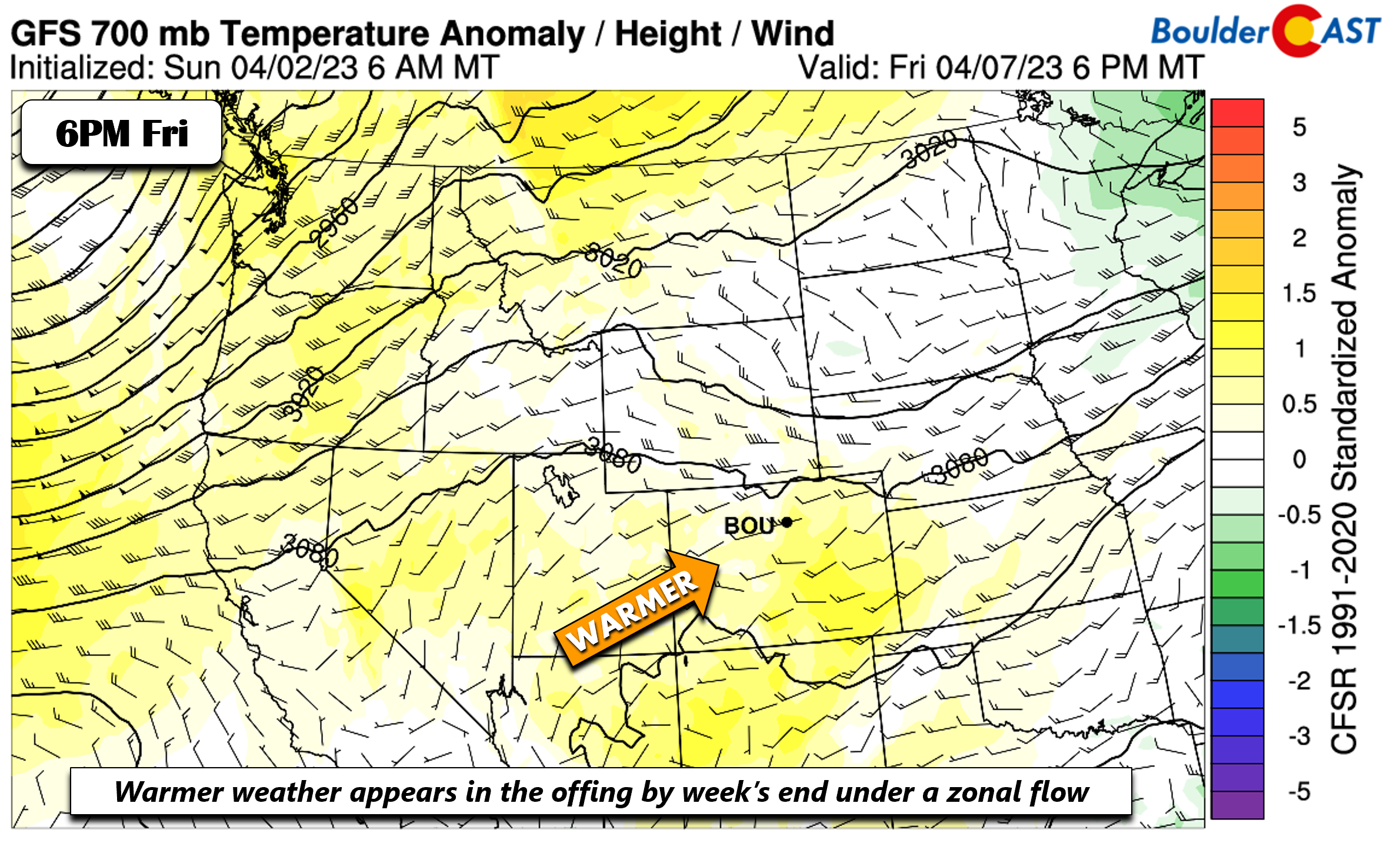
By the end of the work week, the atmosphere looks to give us a break. The ECMWF/GFS indicate that a zonal flow will develop over the central Rockies — one which will favor a drier and warmer pattern for our region.
After highs still chilly in the lower 50s on Thursday, warmth will really begin to return towards the end of the week with 60s favored to return for Friday and the upcoming weekend. If the week’s snowfall is greater than anticipated, it is possible highs will be cooler as a result of new snow cover (but that seems unlikely at this point).
Early next week a highly amplified ridge is expected to develop across the West bringing well above normal temperatures and dry weather to portions of the West Coast and Intermountain West. We will likely have many days in a row of dry weather with temperatures pushing to their warmest values yet in 2023 — well into the 70s if not 80 degrees.
Forecast Specifics:
Monday: Warm and breezy with a slight increase in clouds through the day. Fire danger will be high along and south of Interstate 70 where gusts up to 35 MPH are possible. Highs mostly in the 60s for the Denver Metro to the low to middle 50s in the Foothills.
Tuesday: Cold, cloudy and blustery with scattered snow showers possible from morning into the evening. Snow amounts of a trace to 3 inches are possible, highest in and near the Foothills. Temperatures much cooler in the low to middle 30s for the Plains and upper 20s in the Foothills.
Wednesday: Partly to mostly cloudy with a chance of light snow late in the day and evening. Highs in the upper 30s for the Plains and upper 20s to near 30 in the Foothills. Less than 1″ of accumulation is expected.
Thursday: Sunny and not as cold. Highs near 50 degrees on the Plains and upper 30s in the Foothills.
Friday: Mostly sunny and seasonally mild with highs in the 60s for the Plains and 50s in the Foothills.
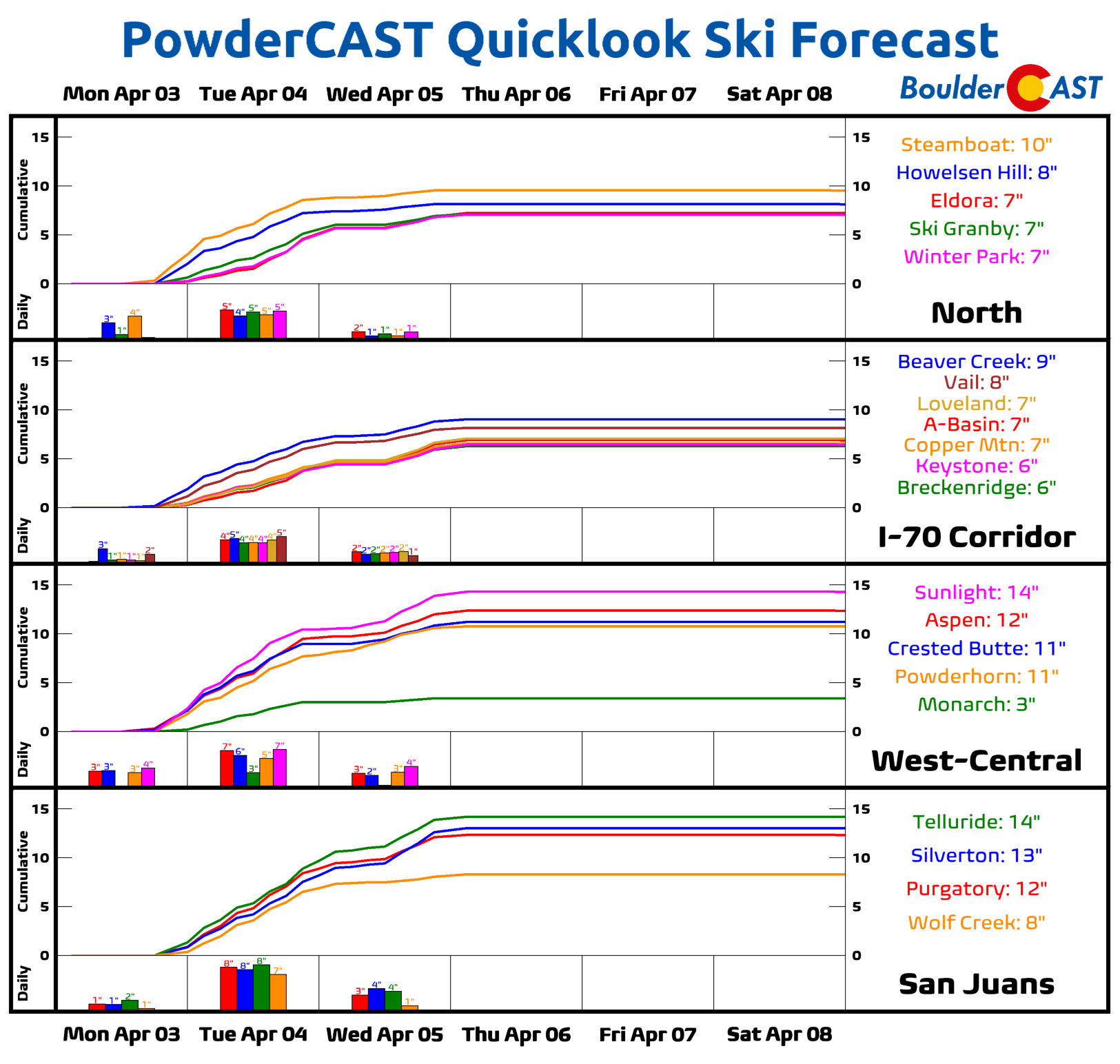
PowderCAST: Periods of heavy snow will be felt late Monday night into Tuesday and Wednesday into early Thursday. Several inches of snow will be likely by week’s end — mainly 6-12″ in the San Juans and 5-10″ elsewhere across central and northern Colorado ranges. Drier weather ensues Thursday and Friday.
DISCLAIMER: This weekly outlook forecast is created Monday morning and covers the entire upcoming week. Accuracy will decrease as the week progresses as this post is NOT updated. To receive daily updated forecasts from our team, among many other perks, subscribe to BoulderCAST Premium.
Go Premium, get all the perks.
Daily Forecast Updates
Get our daily forecast discussion every morning delivered to your inbox.
All Our Model Data
Access to all our Colorado-centric high-resolution weather model graphics. Seriously — every one!
Ski & Hiking Forecasts
6-day forecasts for all the Colorado ski resorts, plus more than 120 hiking trails, including every 14er.
Smoke Forecasts
Wildfire smoke concentration predictions up to 72 hours into the future.
Exclusive Content
Weekend outlooks every Thursday, bonus storm updates, historical data and much more!
No Advertisements
Enjoy ad-free viewing on the entire site.
Spread the word, share the BoulderCAST forecast!


You must be logged in to post a comment.