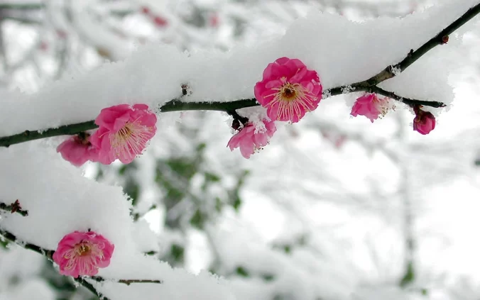
After another glorious springlike Monday across the Front Range, much colder and gloomier weather will arrive early Tuesday as our next storm system enters the picture. While we will sadly be missing out on the feet of snow and blizzard conditions hitting Wyoming, there are some snowflakes in the forecast. Let’s take a look at the timing of the snow, the most likely snowfall amounts, and the potential travel impacts as winter weather returns to the area.
W
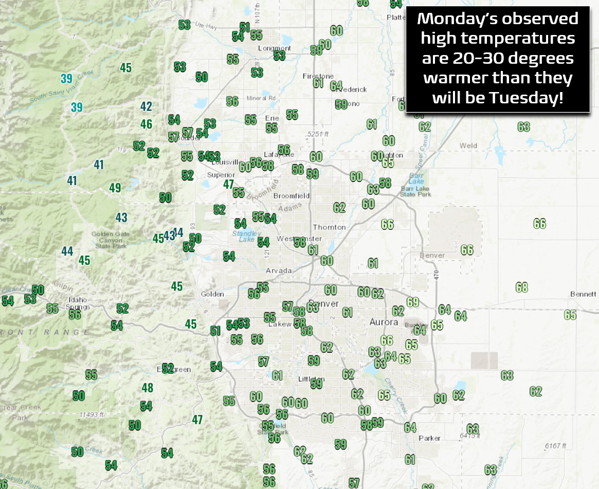
e’ve got just a very quick update following our weekly outlook discussion from earlier this morning. After highs in the 50s and 60s this afternoon, tomorrow will be more than 20 degrees colder across the entire Front Range, and in some cases 30 degrees!
A massive winter storm is currently gearing up for a path of destruction across the nation with impacts spreading from Mexico to Canada and eastward to the Great Lakes.
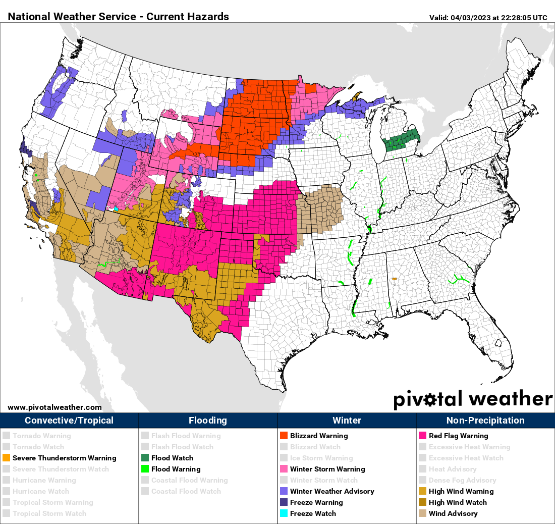
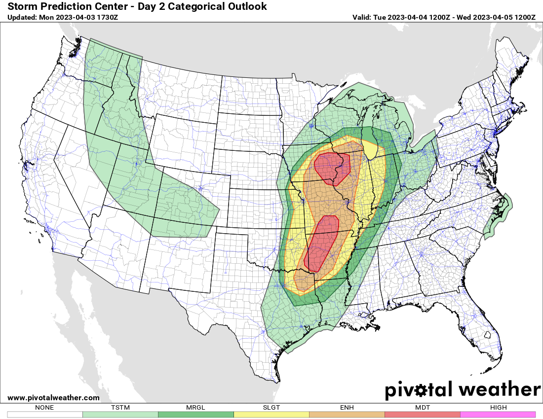
A developing low pressure system across far northeast Colorado and Nebraska with produce feet of snow and widespread blizzard conditions across the High Plains of Wyoming and the Dakotas over the next 48 hours. While heavy snow will be falling to the north, the warm sector of this system will spawn another round of devastating tornadoes from Wisconsin to Texas on Tuesday.

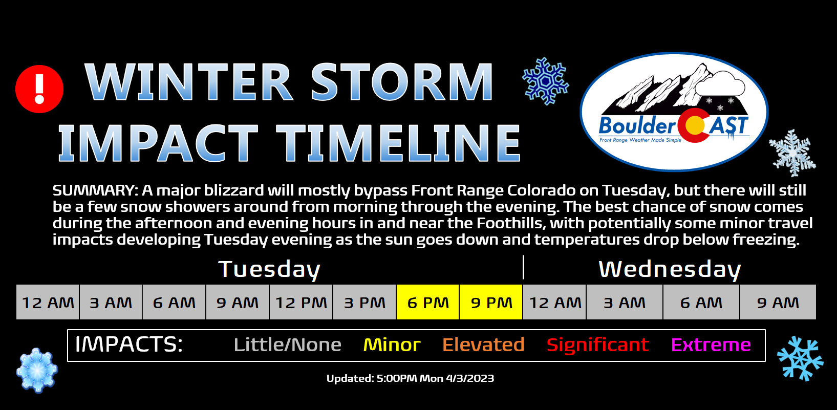
As has been the case much of the last six weeks, this powerful system will unfortunately track too far north, largely bypassing the Denver Metro area with little to show for it east of the Continental Divide. There will still be a chance of snow on Tuesday for us but it won’t amount to much. Snow showers could pop-up anytime from morning through the evening, with the best chance coming Tuesday late afternoon into the evening as daytime heating adds some fuel to the fire and combines with a brief shot of upslope winds. It is this evening timeframe on Tuesday when our area stands the best chance to see some snowfall stick on the grassy surfaces as the sun lowers in the sky and temperatures drop near and just below freezing. Popcorn convective snow showers could put down a quick inch or two in some locations during this timeframe.
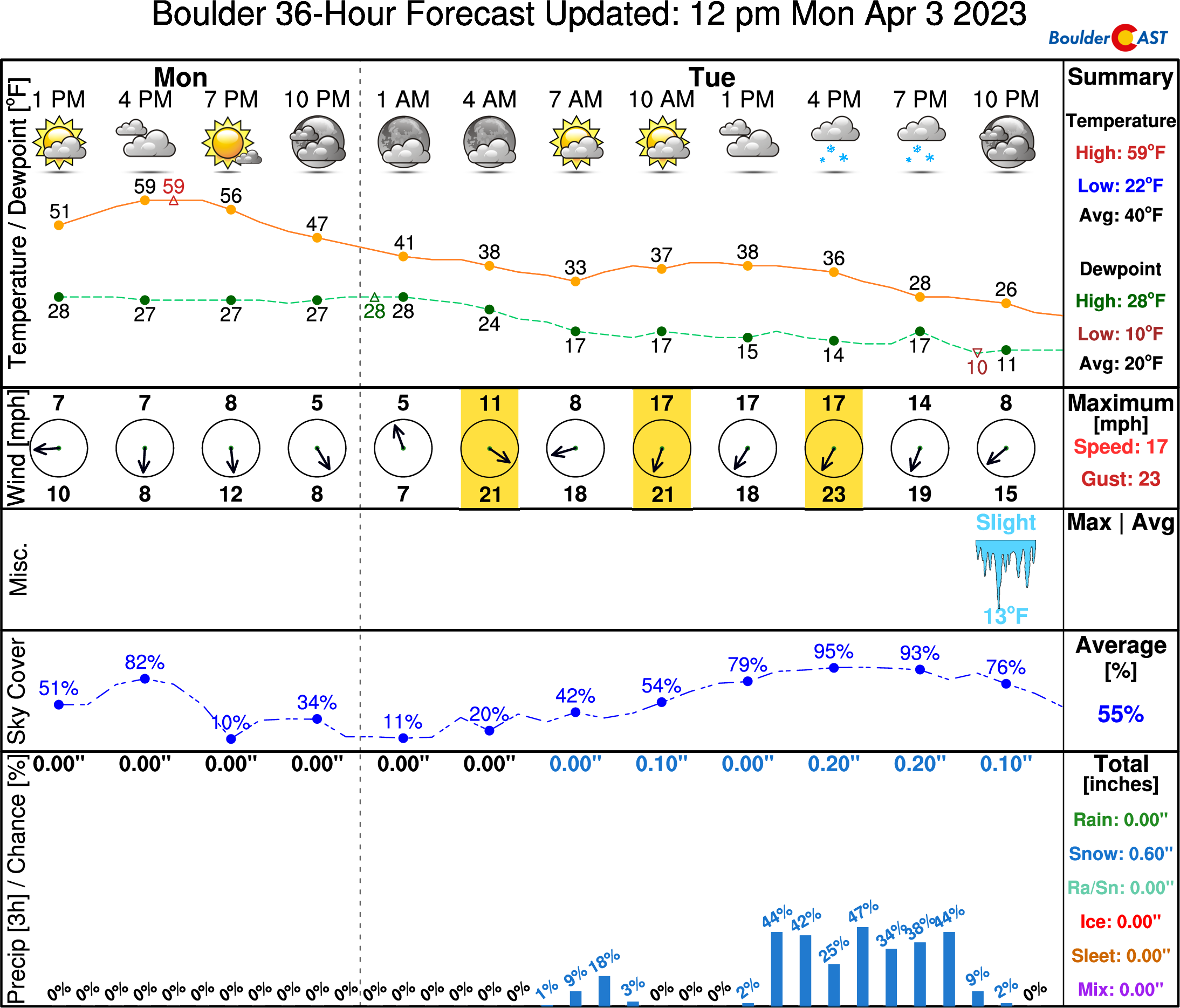
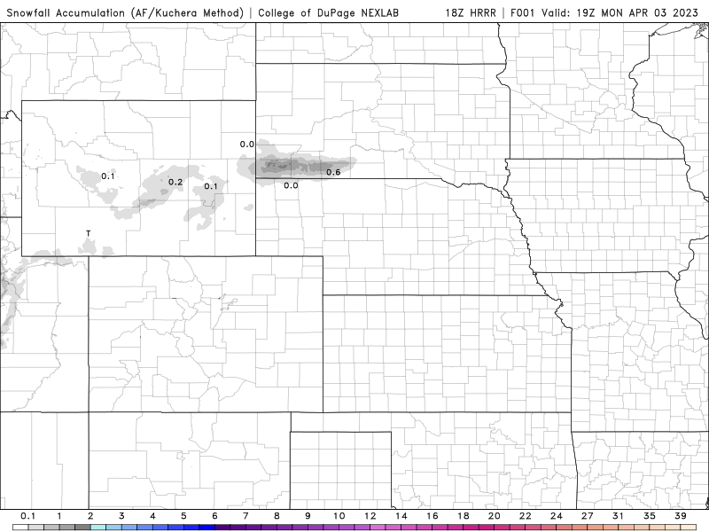
Our snowfall forecast map for all snowflakes falling Tuesday morning through the late evening is shown below. The focus for most of the accumulation will be in and near the Foothills west and southwest of Denver, and in the Mountains of course. Most of us will see just a trace to 3″ of snow, but as mentioned, some luckier spots that land a convective cell or two could see slightly higher totals.

Roadways should mostly remain just wet Tuesday and Tuesday night across the Boulder-Denver area, but with some slushy accumulation on the roads possible in the Foothills where it will be colder. We generally expect little to no travel issues with this system given the warm road temperatures, but we will highlight the evening hours on Tuesday as that timeframe could see spotty minor impacts.
Be sure to read our weekly outlook for a discussion of the weather to follow this system the rest of the week and the weekend ahead. Enjoy the return of the cold and snow!
Get BoulderCAST updates delivered to your inbox:
Enjoy our content? Give it a share!


You must be logged in to post a comment.