A brief period of snow lasting only about five hours made for a messy commute Thursday morning! We discuss the event, review storm totals and check-in on seasonal snow amounts for Boulder and Denver so far this winter. We’re also tracking our next wintry event scheduled for Monday.
Our forecast promising a “sneaky” batch of snow delivered early Thursday morning. The snow arrived like a LION around 7:00 AM in Boulder and wrapped up before the lunch-hour.
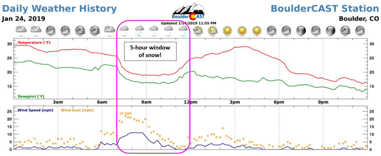
Weather summary for Thursday at BoulderCAST Station. Fun fact: The high temperature was 30 degrees at 12:00 AM and the low was 16 degrees at 11:59 PM.
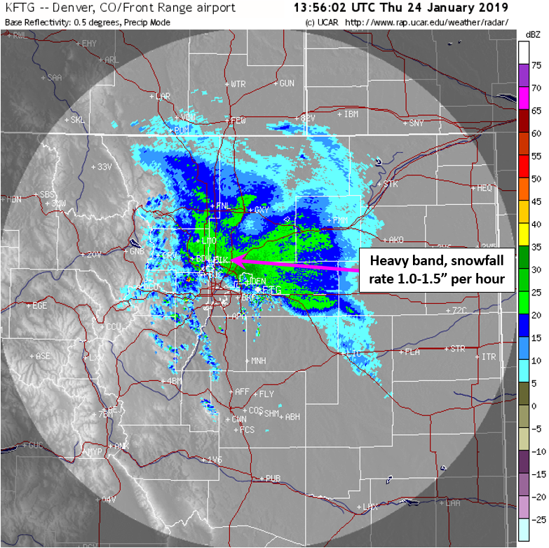
The atmosphere aligned in such a way that snowfall was only possible east of the Mountains for a few brief hours Thursday morning. The leading edge of the intense northeasterly upslope spawned a heavier snow band, clearly visible in the radar image below from 7:00 AM. You can see the full radar loop from the entire storm HERE.
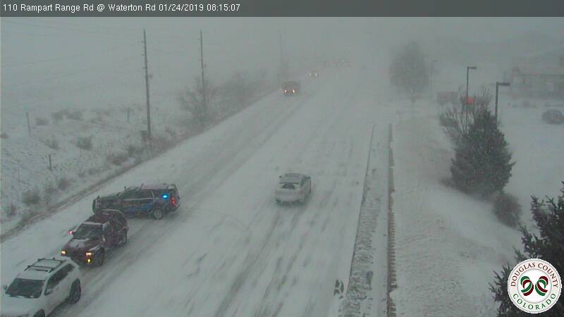
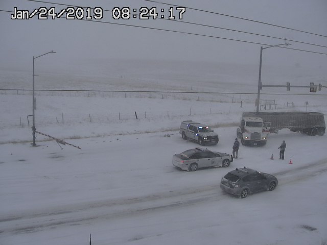
Winds were gusty within this band as northeasterly flow surged into the Metro area. At BoulderCAST Station, we reported gusts between 20 and 30 mph. The snow was very dry and fluffy, so these wind speeds were plenty to produce blowing and drifting snow, adding to the travel disaster that was the morning rush hour. Scenes like those below were all-to-common Thursday morning.
As quickly as the snow began it ended with sunshine taking over almost immediately and roads surfaces melting off quickly. We must say, the evening commute was definitely a lot better!
Shown below is our snowfall forecast map with the storm snow totals overlaid in boxes. Green boxes denote totals that were within 1″ of our forecast ranges. Red boxes were not.
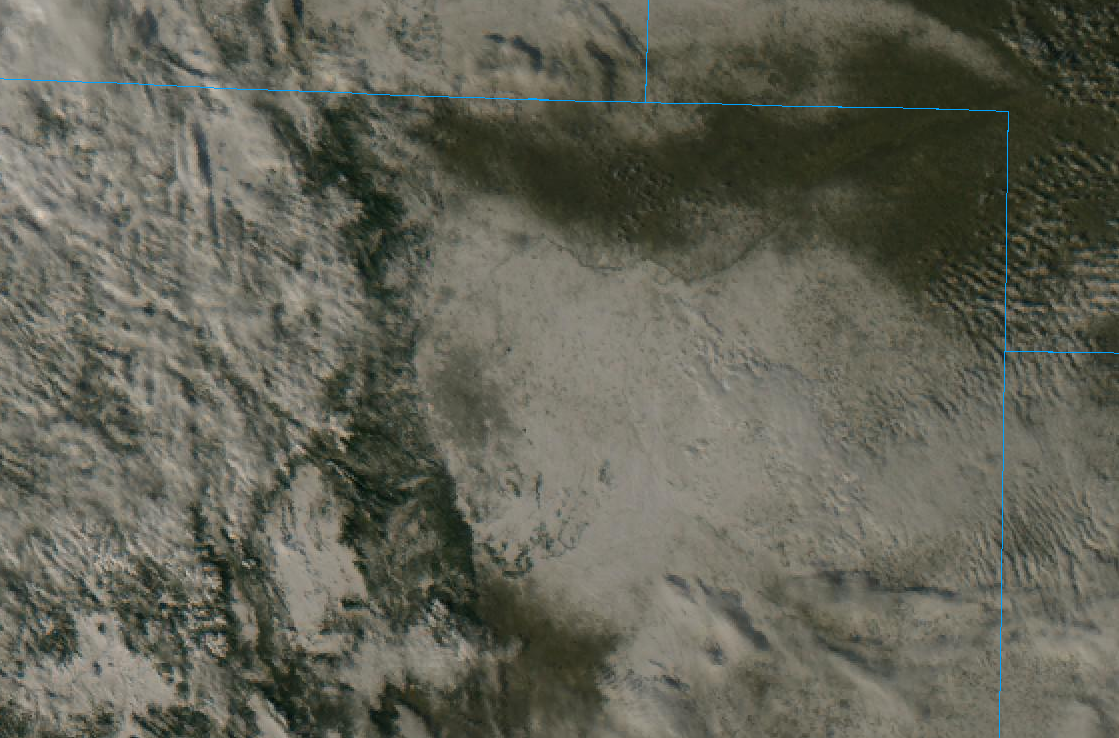
In general, 1 to 4″ of snow fell pretty much everywhere in the Metro area. Melted liquid equivalents were between 0.1 and 0.3″. While not overly substantial, it’s not bad for just a few hours! Clear skies Thursday afternoon allowed GOES-East to see the fresh blanket of snow across much of eastern Colorado:
We’re happy with the way our forecast turned out for the Front Range. While it was unfortunate that it took until the day before for the models to come into agreement, when they finally did, they sang in perfect harmony. This was surprising for a storm that had such fragile components.
JANUARY 24, 2019 OFFICIAL SNOW TOTALS
Boulder: 2.9″ (1 – 4″ forecast)
Denver: 1.0″ (1 – 4″ forecast)
This snow event further widened the already substantial gap in 2018-2019 winter snow totals between Boulder and Denver.
| Seasonal Snow Totals (Updated Jan 25 2019) |
|---|
| Boulder | Denver |
|---|---|
| 42.8" | 12.1" |
Boulder is exactly at normal for the end of January. The measly 12″ in Denver is less than half of where we should be.
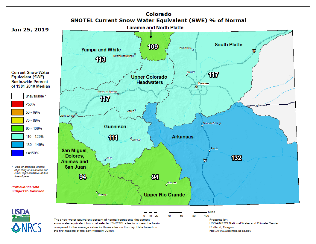
This latest storm also produced good snow in the Mountains, with Winter Park, Vail, Steamboat and Eldora all picking up at least 6 inches of fresh powder. Snowpack is in good shape STATEWIDE right now, something we haven’t been able to say for a few YEARS now…
Our next potential wintry system moves into Colorado late Sunday and early Monday. Models continue to show the prospect for light snow for us Monday morning into the afternoon. The GFS model has been trending drier, while the Euro continues to produce 2 to 5″ for the Metro area. Nothing about this system looks substantial at this point, so accumulation should ultimately be on the light side. We will of course be tracking this storm in the coming days and put out an update when we are more confident, likely Sunday morning.
Enjoy the weekend….Sunday in particular will be pleasant!
Share this post:
.





You must be logged in to post a comment.