Another year, another CU Boulder graduation with terrible weather. They seem to go hand-in-hand, dont they? We discuss totals from this week’s snow event and take a look at brighter weekend weather ahead.
I
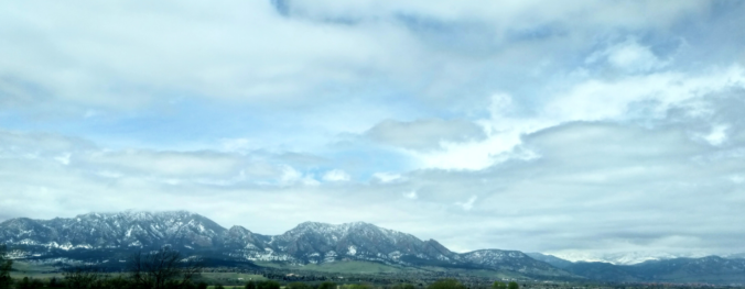
t should be no surprise that we’re still talking snow during the month of May. Boulder has reported it 9 out of the last 10 years , and 17 out of the last 20. However, with so many trees “springing” back to life this time of year and flowers in full-bloom, snow in May just never seems normal!
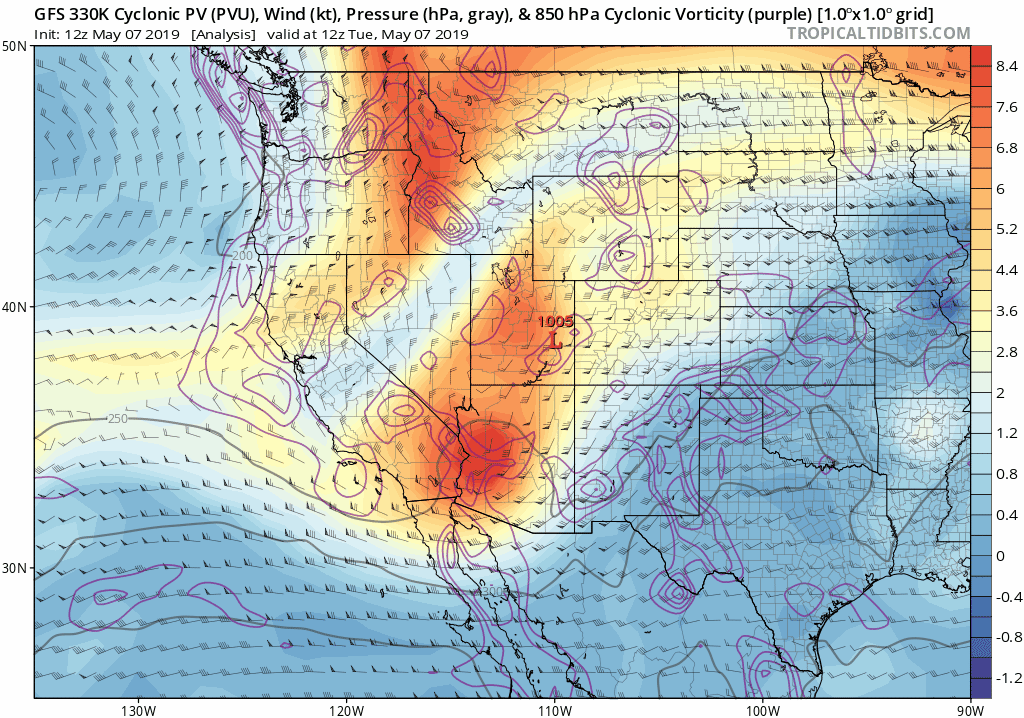
This week’s snow event was spurred on once again by the interaction of two storm systems; one cold, and one warmer with plenty of moisture. Unlike those before, however, this week’s pattern was rather stagnant and involved two slow-moving disturbances passing across Colorado back-to-back, instead of completing a solidifying merger. This led to a period a prolonged upslope-fueled gloomy weather beginning Tuesday afternoon and continuing into Friday morning, a lengthy stretch of weather that we in Colorado are not accustomed to! You can see both systems move across our area in sequence in the animation below.
The main cold front moved into northeast Colorado Wednesday before sunrise, quickly bringing fog to most of the Front Range. Light rain commenced in Boulder Wednesday morning, began to mix with snow just after dark Wednesday evening, with light snow then continuing to make like a snow-globe until Thursday evening. All-in-all, there was roughly 36 hours of constant light precipitation in Boulder, though areas further east did see sporadic lulls in the action.
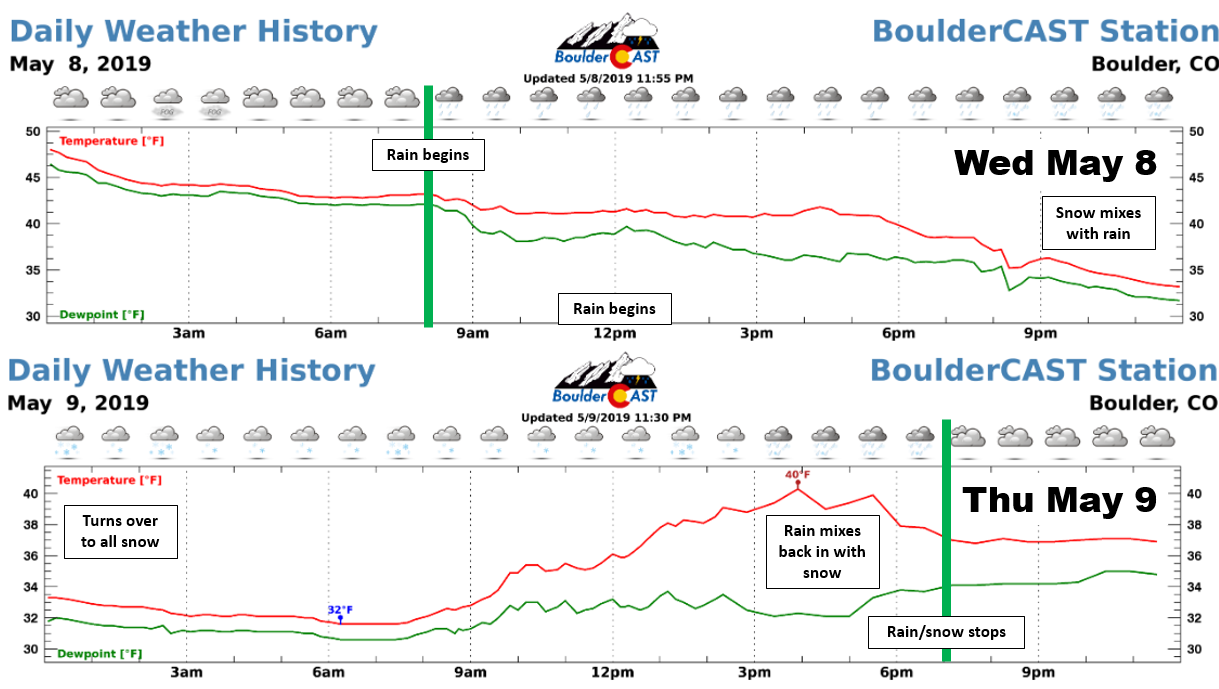
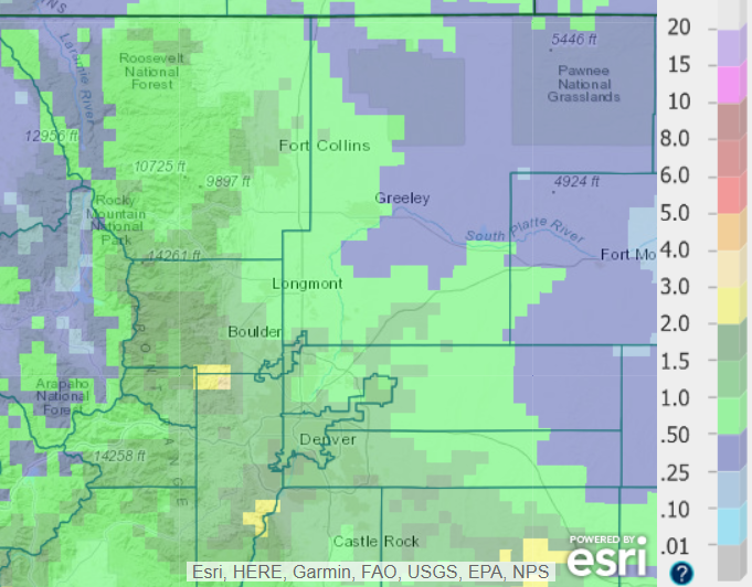
Temperatures throughout the snow event Wednesday night and early Thursday dropped to as low as 31 or 32 degrees across the Metro area, just cold enough for snow to accumulate on the grass and cars, but never on roadways or sidewalks. The highest snow totals across the Plains were in the western suburbs of Denver. 2 to 3″ were reported from Lyons, through Boulder and Golden into Lakewood. Elsewhere, generally a dusting to 1″ is all that fell. The most impressive snow totals, up to 12″, came out of western Boulder Country in areas above 7000 feet elevation.
Shown below is our snowfall forecast map which we issued Wednesday morning with storm totals overlaid in boxes. Green ones indicate that our forecast verified to within one inch of the observed snowfall. Red did not.
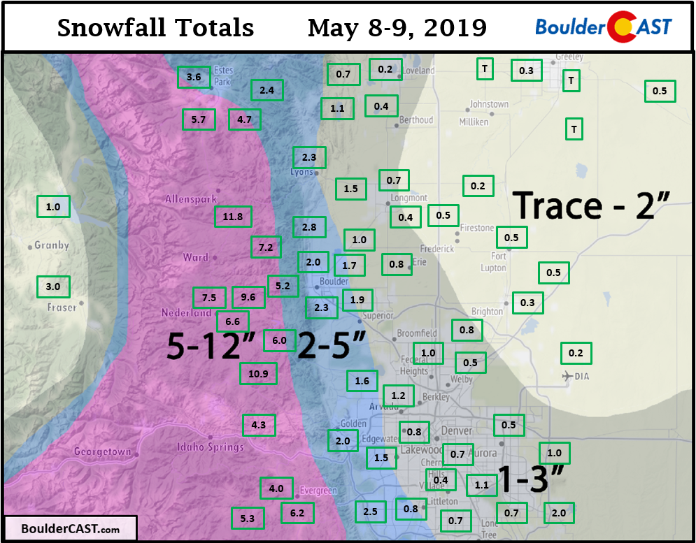
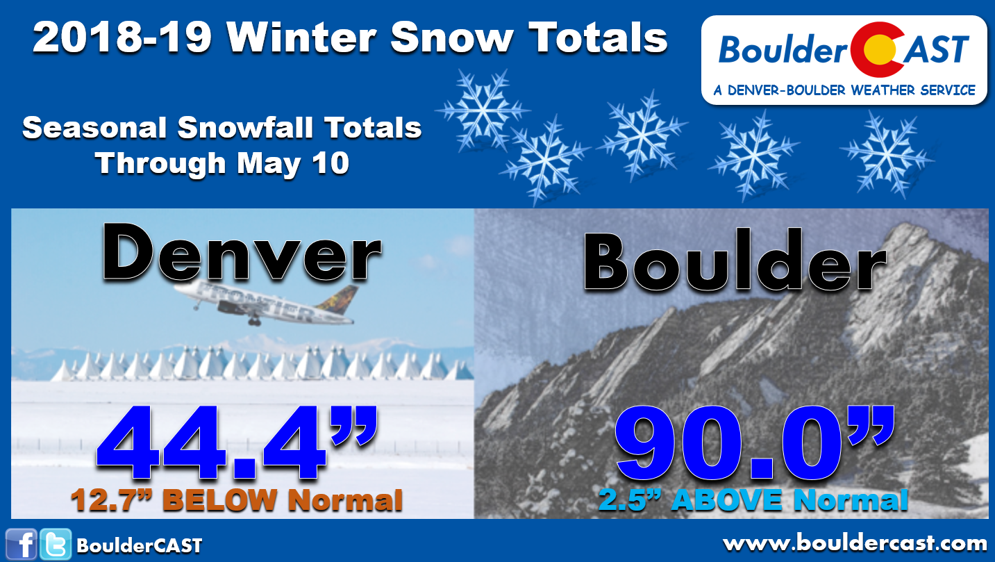
Officially, Boulder reported 2.3″ of snow from the storm. This technically set a new snowfall record for May 9th since this was the very first time snow has ever been documented in Boulder on this date! This brings Boulder to exactly 90.0″ of snow for the 2018-19 season, which is a hint above normal.
Further east, Denver scrapped together only 0.2″ from the storm, and now sits at 44.4″ for the season….another disappointing effort at more than a foot below normal.
In addition to snow amounts, precipitation totals this week in some cases were equally as impressive, with 0.5″ up to 2.0″ of liquid common across the Metro area. This was the result of spotty thunderstorms Monday and Tuesday, then widespread light rain and snow Wednesday and Thursday focused near the Foothills.
Regional Precipitation Totals Since Monday (Rain + Melted Snow):
- Boulder – 1.40″
- Fort Collins – 0.99″
- Denver International Airport – 0.93″
- Denver Stapleton Airport – 0.83″
- Loveland – 0.64″
After nearly one-hundred consecutive hours of fog, clouds, rain and snow, the sun finally peaked out a little this afternoon. Witnessing its triumphant return definitely felt more climatic than it should have….
A warming and drying trend will take us into the weekend with temperatures getting back to normal into the 60’s to lower 70’s. Watch for a few isolated thunderstorms late in the day Saturday, followed by dry and mostly sunny conditions Sunday.
Share this post:
.


You must be logged in to post a comment.