



Page 235 of 586


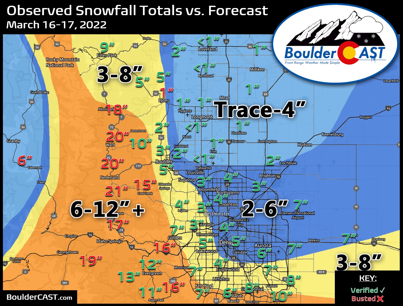


Nothing is ever easy in Front Range weather! The incoming spring, or shall we say winter, storm remains a very challenging forecast as models struggle to resolve where the heaviest precipitation will fall Wednesday into Thursday, the precise timing on when rain will change to snow, and exactly where temperatures will bottom out at overnight. All of these factors are coming together to make for a complicated blend of moderate to heavy rain and soupy snow this evening into Thursday. Most models would have us believe a deluge of precipitation is about to unleash on the Denver area, but there are some red flags. We discuss the latest on this evolving storm which is sure to create quite the mess for everyone over the next 36 hours.


Another Wednesday, another winter storm is going to hit the Front Range! A Pacific trough will impact the area Wednesday into Thursday bringing a return of the white stuff to the Boulder-Denver Metro. Unlike the last handful of snowstorms, this one will have just enough cold air to turn rain over to snow across the entire area. Snowfall amounts remain somewhat uncertain, but most of us should expect at least a couple inches of slushy snow by midday Thursday, with much more in the higher terrain. Let’s take a look at our first “warm” winter storm of the season!
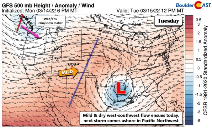
After a mild and gorgeous weekend, the week ahead continues on the same note, at least to start! Colder temperatures and a good threat for rain/snow arrives late Wednesday into Thursday. Uncertainty remains on where snowfall will be greatest, but likely favors the higher elevations of the Front Range due to the marginal temperatures. Sunshine and warmth return for the upcoming weekend.

Live View of Boulder

Current Conditions

Live Radar

Latest Smoke Forecast

Recent Premium Posts

BoulderCAST Daily – Fri 10/09/26 | Mild and Quiet Weather Through the Weekend
🔥 Record October heat: Highs may approach record highs today in the middle …
This Weekend in Colorado Weather: 80s Continue With a Big Western Storm Brewing, But Colorado’s Role Next Week Remains Unclear
🌤️ Summer Preview Continues: Warm and dry weather hangs on through the weekend …
BoulderCAST Daily – Wed 10/07/26 | Colorado Remains Stuck in a Remarkably Warm October Pattern
🔥 Record October heat: Boulder hit a record 89° on Tuesday, Denver tied …
3-Day Forecast

Trending Content



© 2026 Front Range Weather, LLC
You must be logged in to post a comment.