



Page 202 of 586
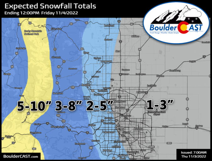

After a stunning weather-Wednesday, winter conditions are on the horizon again for Thursday as a big storm system moves into Colorado from the west. This one will bring much colder temperatures Thursday and widespread light to moderate snow to the area Thursday evening. Confidence is high that that most everyone will finally get their first accumulating snowfall of the season with this notably colder situation. We discuss the latest timing on the change-over to snow and provide our snowfall forecast map.
Premium Storm Update (11/3/22 7:00AM): Overnight model runs confirm the situation — the accumulating snow for all this evening remains on-track! We provide a brief update on the timing of the snow, how it will impact the evening commute, and discuss a few changes we’re making to our snowfall forecast amounts this morning. READ HERE
October 2022 Graphical Weather Review: Not as bone-dry as last October, but still dry & warm overall
October 2022 was yet another warm and dry month for the Front Range as drought expanded across the state and our precipitation deficit for 2022 grew further. Denver and Boulder both saw later than normal first snowfalls and first freezes. There were no major heatwaves or cold snaps to speak of during the month either. Here’s a quick and colorful graphical recap of our weather during October and how it relates to climatology.

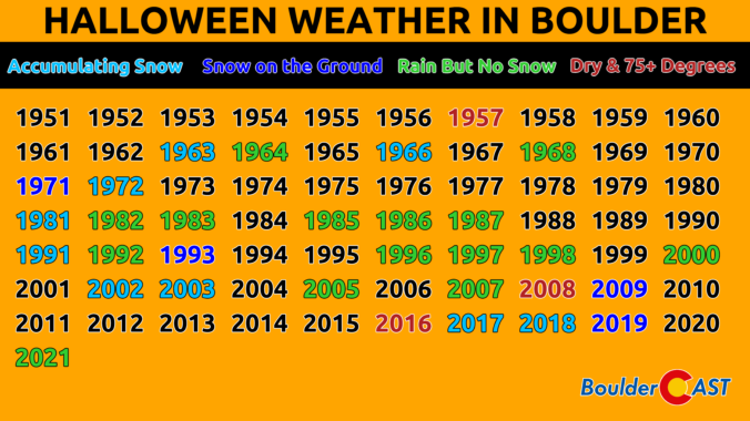
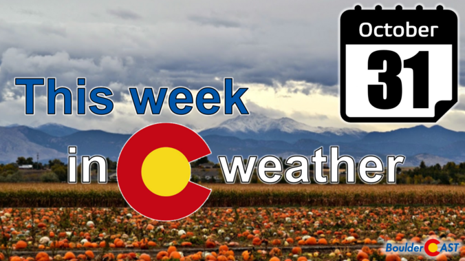
Warm temperatures will be the story through midweek in the 60s to near 70 degrees with a ridge of high pressure slowly sliding eastward, including picture-perfect conditions for Halloween evening festivities. However, the pattern shifts much colder and potentially snowy late Thursday into Friday. There remains considerable model uncertainty right now but there are definitely good chances for snow later in the week. Stay tuned and read on for more details.

Live View of Boulder

Current Conditions

Live Radar

Latest Smoke Forecast

Recent Premium Posts

BoulderCAST Daily – Wed 10/07/26 | Colorado Remains Stuck in a Remarkably Warm October Pattern
🔥 Record October heat: Boulder hit a record 89° on Tuesday, Denver tied …
BoulderCAST Daily – Tue 10/06/26 | October Heatwave Keeps Its Grip on the Front Range All Week Long
🔥 Record October heat — Boulder hit 89°F yesterday (just shy of the …
BoulderCAST Daily – Sun 10/04/26 | The Persistent 80s and Continuation of Summer-Like Temperatures
🌡️August-like temperatures: Temperatures hover in the 80s throughout the upcoming week, prolonging the …
3-Day Forecast

Trending Content



© 2026 Front Range Weather, LLC