



Page 196 of 586
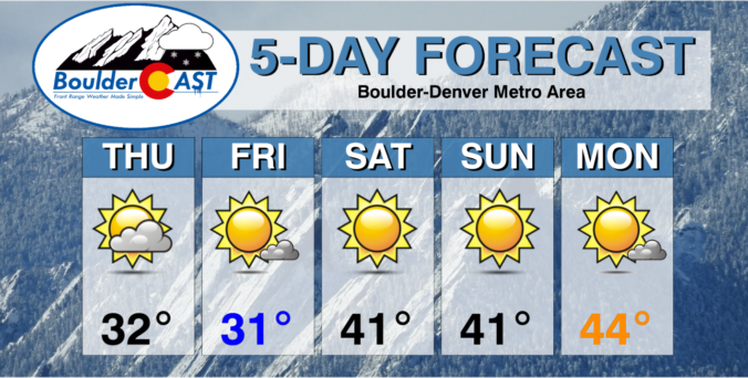

Many of you were likely underwhelmed by the snowfall event this week which was inevitable. Despite the media hype for this storm, the most likely scenario, at least from a pattern recognition standpoint, ultimately did unfold across the Denver area with most locations seeing little to no snowfall as the heavier bands stayed just to the east. Let’s take a look at the snow totals across the Front Range!
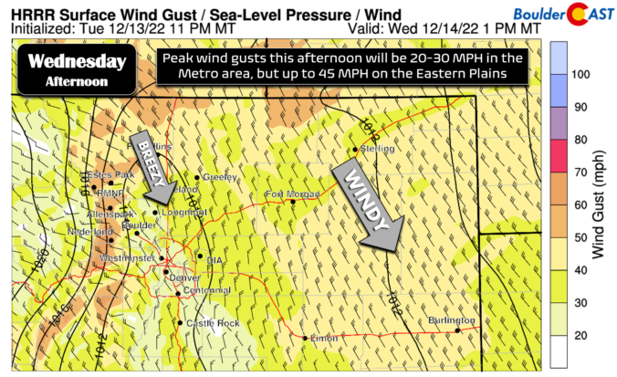
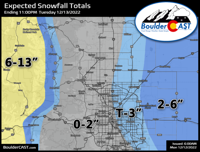

A strong and slow-moving winter storm takes aim on Colorado late Monday night and through Tuesday. The system will bring snowfall, gusty winds, and colder temperatures to the Front Range. The greatest impacts will be felt east of the Denver Metro where blizzard conditions will exist over northeast Colorado. After a mild day to start our week on Monday, below normal temperatures in the 30s will persist through the rest of the week, with perhaps an intrusion of Arctic air in the extended outlook. Read on for the latest on potential snowfall amounts and a look at just how cold it will get this week.

Live View of Boulder

Current Conditions

Live Radar

Latest Smoke Forecast

Recent Premium Posts

BoulderCAST Daily – Wed 10/07/26 | Colorado Remains Stuck in a Remarkably Warm October Pattern
🔥 Record October heat: Boulder hit a record 89° on Tuesday, Denver tied …
BoulderCAST Daily – Tue 10/06/26 | October Heatwave Keeps Its Grip on the Front Range All Week Long
🔥 Record October heat — Boulder hit 89°F yesterday (just shy of the …
BoulderCAST Daily – Sun 10/04/26 | The Persistent 80s and Continuation of Summer-Like Temperatures
🌡️August-like temperatures: Temperatures hover in the 80s throughout the upcoming week, prolonging the …
3-Day Forecast

Trending Content



© 2026 Front Range Weather, LLC