
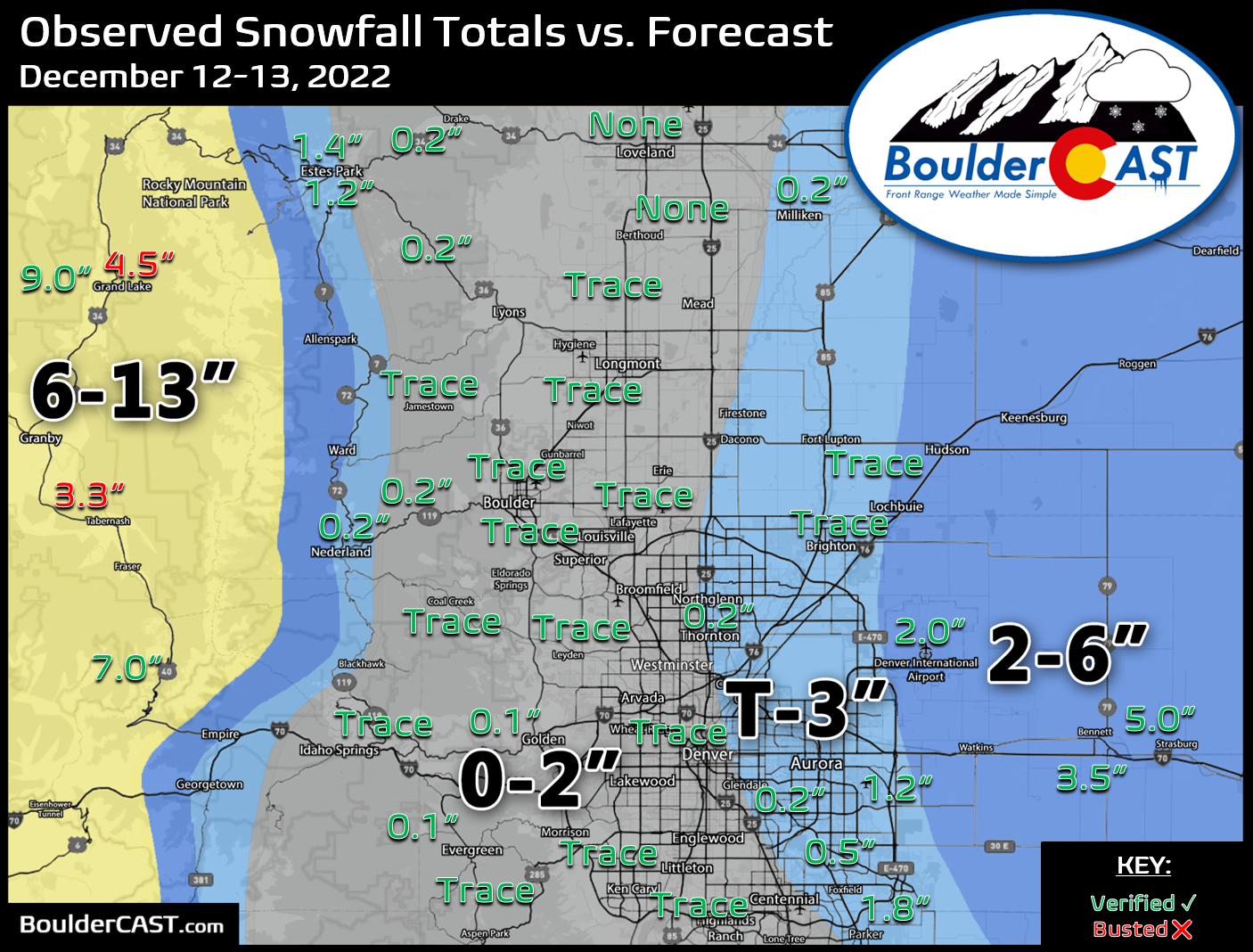
Many of you were likely underwhelmed by the snowfall event this week which was inevitable. Despite the media hype for this storm, the most likely scenario, at least from a pattern recognition standpoint, ultimately did unfold across the Denver area with most locations seeing little to no snowfall as the heavier bands stayed just to the east. Let’s take a look at the snow totals across the Front Range!
Shown below is our snowfall forecast map issued Monday morning with actual storm totals overlaid. Green values indicate that our forecast verified to within one inch of the observed snowfall total. Red numbers did not. Overall, we had excellent forecast verification across the region, albeit on the lowest end of the range in most cases. Denver officially reported 2.0″ of snow at DIA, while Boulder saw just a trace.


You must be logged in to post a comment.